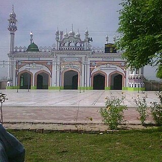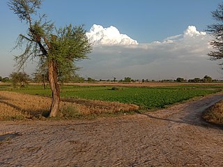
Okara, is the capital city of Okara District in the Punjab province of Pakistan. The name Okara is derived from Okaan, which is the name of a type of tree. It is the 23rd largest city of Pakistan by population. The city is located southwest of the city of Lahore and Faisalabad is 100 km bypassing away Ravi River. It is known for its agriculture-based economy and cotton mills. The nearest major city to Okara is Sahiwal, which was formerly known as Montgomery. Kasur is also located in the east of the city. Pakistan military dairy farms, known for their cheese, are situated in Okara. Pul Dhool near Abdulla Sugar Mill is a town in the Okara district. Pul Dhool is on Hujra Chunian road. From Hujra Shah Muqeem 9KM and from Chunian 17KM.These farms were established before the creation of Pakistan in 1947.

{{Infobox settlement | official_name = Okara District | name = | native_name = ضِلع اوكاڑا | native_name_lang = | settlement_type = District | image_skyline = | imagesize = | image_alt = | image_caption = | image_map = Pakistan - Punjab - Okara.svg | mapsize = 200px | map_alt = | map_caption = Location of Okara in Punjab. | coordinates = 30.801380°N 73.448334°E | subdivision_type = Country | subdivision_name = Pakistan | subdivision_type1 = Province | subdivision_name1 = Punjab | subdivision_type2 = | subdivision_name2 = | founder = | seat_type = Headquarters | seat = Okara | government_footnotes = | leader_party = | unit_pref = Metric | area_footnotes = | area_total_km2 = 4377 | population_as_of = 2017 | population_total =3,39,139 | population_density_km2 = auto | timezone1
= PST

Sheikhan City is situated in District Chiniot in Punjab province of Pakistan.

Pakpattan District, , is a district of Punjab province in Pakistan, Pakpattan is the district capital. According to the 1998 census of Pakistan, it had a population of 1,286,680 of which 14% were urban. It has since risen to 1,563,000.
Salarwala is located in Faisalabad District, Punjab, Pakistan. It is a town situated on the Faisalabad to Lahore railway section. It is one of the oldest railway stations before the independence of Pakistan in 1947. Many people have used it as a starting point for a railway journey to all of South Asia. It is 60 miles from Lahore and 20 miles from Faisalabad.

Sabour is a Union Council of Gujrat District, in the Punjab province of Pakistan.
Potha Sharif is a village and union council of Murree Tehsil in the Rawalpindi District of Punjab, Pakistan. It is located in the north-east of the tehsil at 33°57'0N 73°30'0E, and is bounded to the north by Phagwari, to the south by Sehr Bagla, to the west by Rawat and to the east by Kashmir. The Potha hill has great and attractive view. The upper part of UC known as DANNA has exclusive land price and many outcasts from cities buy plots and built homes to enjoy the summer season. The village contains the mazar of the Sufi saint Hazarat Dada Malik Suraj Abbasi forefather of Potha Shareef peoples. He had seven sons and their descendants are currently present in Potha Shareef. People visit the mazar from different areas of the country to offer tribute.

Yazman, is a city and capital of Yazman Tehsil of Bahawalpur District, in southern Punjab, Pakistan. It is located at an altitude of 115 metres.
Khohar is a village of district Gujrat, Pakistan. The population of Khohar is mostly Muslim. There are almost 20 mosques in Khohar of which three are Jamia Mosques {Mosque where offering of the Jummah (Friday) Prayer is done}. Khohar is almost 17 kilometres south of the town of Sara i Alamgir. Upper Jhelum Canal flows to its east while the River Jhelum borders it to the west. Khohar is divided into various "Mohalla" and "Dhoke", e.g. Dhoke Baba Hafiz Jee, Dhoke Shamali, Dhoke Baba Hussain Shah, Mohllah Maki Masjid, Mohallah Malkana, etc. Khohar is divided into two main parts: Khohar Khurad and Khohar Kalan.
Youngpur Urdu: ینگ پور is large village 22 km away from Okara city on Faisalabad road. It has a total population of over 6000. It is a part of Okara District, Pakistan.

Chak No 100 ML is a village situated in Union Council 98 ML, Karor Lal Esan Tehsil, Layyah District, Punjab, Pakistan.

Chak No. 4/G.D. is a village in Okara District near Renala Khurd in Pakistan. It is located in a fertile area just under 13 kilometers north of the city across the Lower Bari Doab canal. It is the main village on the Chuchak Road and is also a union council center.
Sabzazar is a neighbourhood and union council located in Allama Iqbal town Tehsil of Lahore, Punjab, Pakistan. Sabzazar is divided into two subdivisions, phase 1 & phase 2. It is surrounded by areas like Allama Iqbal Town, Lalazaar Garden, and Awan Town.
Behak Mekan is a small town located in the Sargodha District ضلع سرگودھا of the Punjab province, Pakistan, that was formed when the area was part of the British Empire. The town is placed 16.5 kilometres (10.3 mi) away from the city of Sargodha and 10 kilometres (6.2 mi) away from Dhreema. Due to the town's ecological site, the British Royal Air Force (RAF) built an airstrip near "godhay wala" that become of great significance to the Pakistan Air Force after the Pakistan Movement independence of Pakistan.

Shergarh, is an historic town, union council and major administrative subdivision of Depalpur Tehsil, Okara District, Punjab, Pakistan.

Bhura Hayal is a fairly large village in Tehsil Kahuta with a population of about 15,000 +. It is located about 8 Kilometers from Chowk Pindori on Thoa Khalsa- Matore Road.
Uggu Chak (Urdu: اُگو چک is a populated village of Gujranwala District, Punjab, Pakistan. Uggu Chak is one of the biggest UC's of the Gujranwala City with strong political background and highly populated area. Situated on the Hafiz Abad Gujranwala Road, 13 Km west of the city of Gujranwala. It is having canal on one side of the village main road bisects the village in two parts. It has many hamlets like Sheikhanwala, Hondlanwala, Sajjadaywala and Pakka Khuh. Its surrounding villages and towns are Papnakha, Hardupur, Sahanki, Maan, Piru Kot and Qila Didar Singh.

Chak Paras or Chack Paras is a village in Samba district in Jammu and Kashmir, near the India-Pakistan border. Chak Paras is situated 3 km from Ramgarh.

Kaluwal is a small village in Renala Khurd, Okara District, Punjab, Pakistan. It is located 22 kilometres (14 mi) from Renala Khurd, 38 kilometres (24 mi) away from Okara District.

Badoki Saikhwan is a small village Of Tehsil Nowshera Virkan, District Gujranwala, Punjab, Pakistan. It is very historical village, having remnants of Mughal Empire as well as Sikh Empire It is located at 32°8' N 74°1' E, west of Gujranwala, the district capital. Its population was estimated to be 2500 in December 2020. It lies near the Gujranwala-Hafizabad road, 35 km west of the Gujranwala.


