
Himachal Pradesh is a state in the northern part of India. Situated in the Western Himalayas, it is one of the thirteen mountain states and is characterised by an extreme landscape featuring several peaks and extensive river systems. Himachal Pradesh is the northernmost state of India and shares borders with the union territories of Jammu and Kashmir and Ladakh to the north, and the states of Punjab to the west, Haryana to the southwest, Uttarakhand to the southeast and a very narrow border with Uttar Pradesh to the south. The state also shares an international border to the east with the Tibet Autonomous Region in China. Himachal Pradesh is also known as Dev Bhoomi or Dev Bhumi, meaning 'Land of Gods' and Veer Bhoomi which means 'Land of the Brave'.

Shimla is the capital and the largest city of the northern Indian state of Himachal Pradesh. In 1864, Shimla was declared as the summer capital of British India. After independence, the city became the capital of East Punjab and was later made the capital city of Himachal Pradesh. It is the principal commercial, cultural and educational centre of the state.

The Chenab River is a major river that flows in India and Pakistan, and is one of the 5 major rivers of the Punjab region. It is formed by the union of two headwaters, Chandra and Bhaga, which rise in the upper Himalayas in the Lahaul region of Himachal Pradesh, India. The Chenab flows through the Jammu region of Jammu and Kashmir, India, into the plains of Punjab, Pakistan, before ultimately flowing into the Indus River. The Battle of Chenab was fought between Sikhs and Afghans on the bank of the river.

The Pir Panjal Range is a range of mountains in the Lower Himalayan region located in the Western Himalayas of northern Indian subcontinent. It runs southeast to northwest between the Beas and Neelam/Kishanganga rivers, in the Indian state of Himachal Pradesh and Indian-administered union territory of Jammu and Kashmir, with its northwestern end extending into territory administered by Pakistan. The Himalayas show a gradual elevation towards the Dhauladhar and Pir Panjal ranges. Pir Panjal is the largest and westernmost range of the Lesser Himalayas. Near the bank of the Sutlej River, it dissociates itself from the main Himalayan range and forms a divide between the Beas and Ravi rivers on one side and the Chenab on the other. Further west, the Pir Panjal range forms the southwestern boundary of the Kashmir Valley, separating it from the hills of Jammu region, forming a divide between the Jhelum and Chenab rivers.

Shimla district is one of the twelve districts of the state of Himachal Pradesh in northern India. Its headquarters is the state capital of Shimla. Neighbouring districts are Mandi and Kullu in the north, Kinnaur in the east, Uttarakhand in the southeast, Solan to the southwest and Sirmaur in the south. The elevation of the district ranges from 987 metres (3,238 ft) to 4,500 metres (14,764 ft).

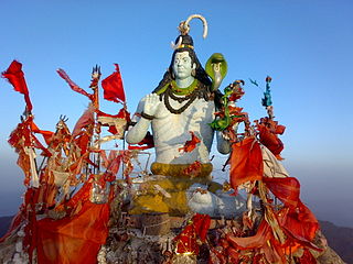
Chaupal is a town and nagar panchayat in the Shimla district of the Indian state of Himachal Pradesh.
Churdhar Sanctuary is located in the Sirmaur district of the Indian state of Himachal Pradesh. The total covered area of this sanctuary is 56.16 square kilometers, as notified on November 15, 1985. The fauna includes Himalayan black bear, Barking deer, Musk deer, Langur and Leopards. The work of administration at Churdhar is taken care by Chureshwar Sewa Samiti.
Gopalpur (Hindi/Bengali/Oriya) or Gopalapuram (Telugu/Tamil/Malayalam) may refer to:
Dharampur or Dharmpur may refer to:
Fatehpur, Fatepur, or Phattepur may refer to any of a number of places:
A Chaupal, or chopal, is a community building or space in the rural areas of North India and Pakistan. It is the hub of community life in villages, especially for male inhabitants. In smaller villages, a chaupal can be a simple raised platform that is shaded by a large tree, typically a neem, banyan or pipal fig tree. In larger villages, the chaupal may be an elaborate structure that also doubles as a community guesthouse.

Pathankot district is the northernmost district of the Indian state of Punjab. Pathankot is the district headquarters. The district was formed on July 27, 2011. It borders Pakistan.
Bamta is a panchayat in Chopal in the district of Shimla, Himachal Pradesh, India.

Jahu is a village panchayat in Bhoranj tehsil, of the Hamirpur district, Himachal Pradesh, India. Jahu is on a trijunction of Hamirpur, Bilaspur and Mandi districts.

Legislative Assembly elections were held in Himachal Pradesh on 12 November 2022 to elect 68 members of the Himachal Pradesh Legislative Assembly. The votes were counted and the results were declared on 8 December 2022.
This page is based on this
Wikipedia article Text is available under the
CC BY-SA 4.0 license; additional terms may apply.
Images, videos and audio are available under their respective licenses.