Chopawamsic (disambiguation)

Last updated

Chopawamsic refers to several placenames in Northern Virginia, United States.

Northern Virginia Region in Virginia, United States

Northern Virginia, locally referred to as NOVA or NoVA, comprises several counties and independent cities in the Commonwealth of Virginia in the United States. It is a widespread region radiating westward from Washington, D.C. With an estimated 3,119,182 residents in 2017, it is the most populous region of Virginia and the Washington metropolitan area.

United States federal republic in North America

The United States of America (USA), commonly known as the United States or America, is a country composed of 50 states, a federal district, five major self-governing territories, and various possessions. At 3.8 million square miles, the United States is the world's third or fourth largest country by total area and is slightly smaller than the entire continent of Europe's 3.9 million square miles. With a population of over 327 million people, the U.S. is the third most populous country. The capital is Washington, D.C., and the largest city by population is New York City. Forty-eight states and the capital's federal district are contiguous in North America between Canada and Mexico. The State of Alaska is in the northwest corner of North America, bordered by Canada to the east and across the Bering Strait from Russia to the west. The State of Hawaii is an archipelago in the mid-Pacific Ocean. The U.S. territories are scattered about the Pacific Ocean and the Caribbean Sea, stretching across nine official time zones. The extremely diverse geography, climate, and wildlife of the United States make it one of the world's 17 megadiverse countries.

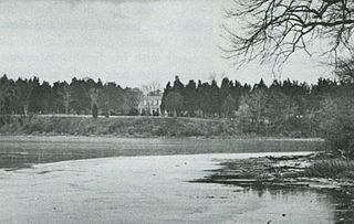
Chopawamsic was an 18th-century plantation on Chopawamsic Creek in Stafford County, Virginia. Chopawamsic was a seat of the Mason family.

Island Any piece of sub-continental land that is surrounded by water

An island or isle is any piece of sub-continental land that is surrounded by water. Very small islands such as emergent land features on atolls can be called islets, skerries, cays or keys. An island in a river or a lake island may be called an eyot or ait, and a small island off the coast may be called a holm. A grouping of geographically or geologically related islands is called an archipelago, such as the Philippines.

Potomac River river in the mid-Atlantic United States

The Potomac River is located within the Mid-Atlantic region of the United States and flows from the Potomac Highlands into the Chesapeake Bay. The river is approximately 405 miles (652 km) long, with a drainage area of about 14,700 square miles (38,000 km2). In terms of area, this makes the Potomac River the fourth largest river along the Atlantic coast of the United States and the 21st largest in the United States. Over 5 million people live within the Potomac watershed.

Related Research Articles

Point of Rocks, Maryland Census-designated place in Maryland, United States

Point of Rocks is an unincorporated community and census-designated place (CDP) in Frederick County, Maryland, United States. As of the 2010 census it had a population of 1,466. It is named for the striking rock formation on the adjacent Catoctin Mountain, which was formed by the Potomac River cutting through the ridge in a water gap, a typical formation in the Appalachian Mountains. The formation is not visible from the town and can only be seen from boats on the river, or from the southern bank of the river in Virginia.

Battle of Cockpit Point battle

The Battle of Cockpit Point, the Battle of Freestone Point, or the Battle of Shipping Point, took place on January 3, 1862, in Prince William County, Virginia, as part of the blockade of the Potomac River during the American Civil War.

Wicomico River (Potomac River tributary) river in the United States of America, tributary of the Potomac River

The Wicomico River is a 13.0-mile-long (20.9 km) tributary of the lower tidal portion of the Potomac River located in the U.S. state of Maryland south of Washington, DC. The river empties into the Potomac at Cobb Island and St. Margaret's Island. Its watershed area is 77 square miles (200 km2), with 2% impervious surface in 1994. in Charles, St. Mary's, and southern Prince George's counties. The lower section of the river forms part of the boundary between Charles and St. Mary's counties. The Wicomico River was designated a Scenic River under the Maryland Scenic River Act in 1968, and there are Scenic River Commissions for it in both Charles and St. Mary's counties.

River Creek is a planned community in Loudoun County, Virginia, located 30 miles west of Washington, D.C. and north of Leesburg at the confluence of the Potomac River and Goose Creek. It is recognized as the first gated country club community in the Washington, D.C. metropolitan area. River Creek is a joint venture project of The Tower Companies, Montgomery Development, and ClubCorp USA, Inc. River Creek welcomed its first residents in 1997.

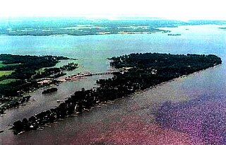
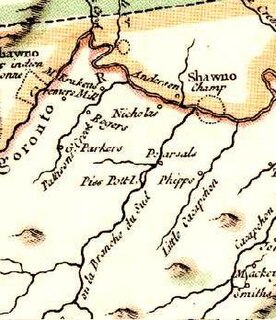
Piss Pot Island

Piss Pot Island is an island on the South Branch Potomac River west of Romney in Hampshire County, West Virginia. Piss Pot Island received its unflattering name before 1755, the year it was included on Joshua Fry's and Peter Jefferson's Carte de la Virginie et du Maryland. Uncommon for islands of its size and geologic nature, Piss Pot Island has remained approximately the same size since the eighteenth century. The island is forested primarily with American sycamores and silver maples. It continues to be popular with fishermen and canoers on the South Branch Potomac River. Mill Creek empties into the South Branch to its western shore and Wergman Run enters the river to its northeast.

Popes Creek (Virginia)

Coordinates: 38°11′29″N 76°54′16″W

Chopawamsic Creek

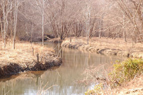
Chopawamsic Creek is a 6.8-mile-long (10.9 km) tributary of the Potomac River in Prince William and Stafford counties, Virginia. Chopawamsic Creek is formed by the confluence of the North and South Branches of Chopawamsic Creek and empties into the Potomac River south of Quantico at the Marine Corps Base Quantico's Air Station. Breckenridge Reservoir lies at the stream's confluence with the North and South Branches. Along with its North Branch, Chopawamsic Creek forms part of the boundary between Prince William and Stafford counties. The North Branch flows through part of the Chopawamsic Backcountry Area in Prince William Forest Park.

Evitts Creek (North Branch Potomac River tributary)

Evitts Creek is a tributary stream of the North Branch Potomac River in the U.S. states of Pennsylvania and Maryland. The confluence of Evitts Creek and the North Branch Potomac River is located 2 miles (3 km) east of Cumberland, Maryland.

Little Hunting Creek

Little Hunting Creek is a 3.6-mile-long (5.8 km) primarily tidal tributary of the Potomac River located in Fairfax County, Virginia, not to be confused with Hunting Creek farther north. A stone-arch bridge, completed in 1931, carries traffic on the George Washington Memorial Parkway across the narrow mouth of the creek, located 96.6 miles (155.5 km) upriver from the mouth of the Potomac. The Washington family built its Mount Vernon plantation on the Potomac River along both banks of Little Hunting Creek during colonial times. The creek is bordered by residential communities in addition to the Mount Vernon property. It is a popular location for recreational fishing, and much of the wildlife characteristic of the tidal Potomac wetlands can be spotted there.

Marine Corps Air Facility Quantico airport

Marine Corps Air Facility Quantico is a United States Marine Corps airfield located within Marine Corps Base Quantico, Virginia. It was commissioned in 1919 and is currently home to HMX-1, the squadron that flies the President of the United States. The airfield is also known as Turner Field, after Colonel Thomas C. Turner, a veteran Marine aviator and the second director of Marine Corps Aviation, who lost his life in Haiti in 1931. On August 12, 2010, a new Quantico air facility to accommodate maintenance and storage of HMX-1 helicopters was dedicated in honor of Marine One founding commander Col. Virgil D. Olson (1919–2012).

George Mason II (1660—1716) was an early American planter and statesman. Mason was the grandfather of George Mason IV, a Founding Father of the United States.

Accokeek was a 17th-century plantation on Accokeek Creek in Stafford County, Virginia, United States. Accokeek was the first seat of the prominent Mason political family in Virginia.

Accokeek Creek is a tidal tributary of Potomac Creek, itself a tributary of the Potomac River, in Stafford County, Virginia, United States. From it headwaters to its mouth, Accokeek Creek is 15.4 miles (24.8 km) in total length.

George Mason III was an early American planter, businessman, and statesman. Mason was the father of George Mason IV, a Founding Father of the United States.