Prince William Forest Park | |
---|---|
Nearest city | Dumfries, Virginia |
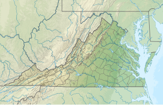
Coordinates | 38°35′07″N77°22′47″W / 38.58528°N 77.37972°W |
Area | 16,084 acres (65.09 km2) |
Established | November 14, 1936 |
Visitors | 379,535 [1] (in 2011) |
Governing body | National Park Service |
Website | Prince William Forest Park |
Prince William Forest Park is a National Park Service (NPS) site in the U.S. state of Virginia within Prince William County (and very partially Stafford County), located adjacent to the Marine Corps Base Quantico near the town of Dumfries. Established as Chopawamsic Recreational Demonstration Area in 1936, the park is the largest protected natural area in the Washington, D.C. metropolitan region at over 13,000 acres (5,300 ha). [2]
The park serves as the largest example of Eastern Piedmont forest in the National Park System. The park also protects the Quantico Creek watershed. It is a sanctuary for numerous native plant and animal species.
The park was developed by Works Progress Administration workers after the Great Depression. Landscaping and structures were designed by National Park Service architects. Four camp areas are listed individually on the National Register of Historic Places: [3]
The park also includes the Cabin Branch Pyrite Mine Historic District, listed on the National Register of Historic Places in 2002. [3] The park itself was designed as the Prince William Forest Park Historic District in 2012. [4]
The land on which Prince William Forest Park now resides was once used by Native Americans of the Archaic period. The Native Americans would use the area for hunting, gathering, and camping. Many artifacts from the archaic people have been found throughout the park. [5]
The park was erected where once the town of Batestown stood. It was an enclave for freed slaves named for Mary Bates, the matriarch of the community. [6] [7]
Between 1933 and 1937, the Federal Government began implementing a Resettlement Administration program to form Chopawamsic Recreational Demonstration Area, [2] where rural farmers were supposed to relocate for more fertile land. The RA bought 79 pieces of property in both Hickory Ridge and Batestown and condemned another 48, to form a new recreation area. However, the RA often made no effort to actually resettle the displaced residents.
The area residents resisted the relocation efforts, sometimes retreating into the park boundaries to escape detection. This continued until the beginning of World War II, where the park was taken over by the Office of Strategic Services as a spy training ground, since a camp was needed within driving distance of the capital that could focus on special operations. Trainees practiced dismantling booby traps, performing message drops, psychological warfare, shortwave radio, and basic and advanced ciphers. [8]
The park was surrounded by barbed wire and fences, and patrolled by dogs and armed guards. All remaining forty-four holdouts were evicted, some carried away screaming. [9]
At the end of the war, the displaced residents hoped their land would be restored, but to date these families have received no compensation. Instead, the property was turned over to the National Park Service and renamed Prince William Forest Park. [7]
A variety of recreational opportunities are available, which include:
The park’s cultural resources are also varied. They include:
Prince William Forest Park is most notably home to mammalian species such as white-tailed deer, black bear, beaver, and coyote. [11] Deer in particular can be seen almost anywhere in the park. A variety of bird species, such as the hooded warbler, the wood thrush, and the red-shouldered hawk, can also be found. [12] Reptiles such as eastern black rat snakes have been seen in and around logs and brush areas, and eastern box turtles can often be found, especially after a light rain. There are a number of amphibians that inhabit the park, such as the American toad, green frog, and Cope's gray tree frog, as well as salamanders such as the marbled salamander and the eastern red-backed salamander. Various skinks can be seen around sunny areas of the trails as well. [13]
Prince William County lies beside the Potomac River in the U.S. state of Virginia. At the 2020 census, the population was 482,204, making it Virginia's second most populous county. The county seat is the independent city of Manassas.
Marine Corps Base Quantico is a United States Marine Corps installation located near Triangle, Virginia, covering nearly 55,148 acres of southern Prince William County, Virginia, northern Stafford County, and southeastern Fauquier County. Used primarily for training purposes, MCB Quantico is known as the "Crossroads of the Marine Corps".
Quantico Creek is a 13.7-mile-long (22.0 km) partially tidal tributary of the Potomac River in eastern Prince William County, Virginia. Quantico Creek rises southeast of Independent Hill, flows through Prince William Forest Park and Dumfries and empties into the Potomac at Possum Point.
Joplin is an unincorporated community and former town in Prince William County, Virginia. The town was located on land taken to form Chopawamsic Recreational Demonstration Area and is now part of Prince William Forest Park, a National Park Service property located adjacent to Marine Corps Base Quantico. The remains of the town, now just a collection of homes, lies on a stretch of Va. 619, Joplin Road, about 3 miles west of Dumfries.
Hickory Ridge is an extinct unincorporated town in Prince William County, Virginia. The town was located on land that is now part of Prince William Forest Park, a National Park Service property located adjacent to Marine Corps Base Quantico. The town was established shortly after the opening of the now defunct Cabin Branch Pyrite Mine in 1889 and was home to many of the mine employees.
Batestown is an extinct unincorporated community in Prince William County, Virginia. The town was located along the farthest terminus of Batestown Road in what is now a western neighborhood of Dumfries along the banks of Quantico Creek. It was an enclave for freed slaves named for Mary Bates, the matriarch of the community.
The Greenwood gold mine operated in Prince William County, Virginia, United States, near the town of Independent Hill for a few years before closing in 1885. It was one of two known gold mines in Prince William County, the other being the Crawford placer prospect on Neabsco Creek, near I-95, though small amounts of gold were occasionally found at the Cabin Branch Pyrite Mine in nearby Dumfries.
Breckenridge Reservoir is a small reservoir on Chopawamsic Creek in Prince William and Stafford counties, Virginia. The reservoir's western shore is the Marine Corps Base Quantico and the eastern shore is a part of Prince William Forest Park, which is a unit of the National Park Service. The reservoir is open to fishing along with a Virginia fishing license and Marine Corps Base Quantico permit. Primitive campsites and a hiking trail are on the Prince William Forest Park side of the reservoir. Reservoir storage volume is approximately 22,500,000 cubic feet with a surface area of about 1,820,000 square feet.
Chopawamsic Creek is a 6.8-mile-long (10.9 km) tributary of the Potomac River in Prince William and Stafford counties, Virginia. Chopawamsic Creek is formed by the confluence of the North and South Branches of Chopawamsic Creek and empties into the Potomac River south of Quantico at the Marine Corps Base Quantico's Air Station. Breckenridge Reservoir lies at the stream's confluence with the North and South Branches. Along with its North Branch, Chopawamsic Creek forms part of the boundary between Prince William and Stafford counties. The North Branch flows through part of the Chopawamsic Backcountry Area in Prince William Forest Park.
Laurel Hill State Park is a 3,935-acre (1,592 ha) Pennsylvania state park in Jefferson and Middlecreek Townships, Somerset County, Pennsylvania in the United States. Laurel Hill Lake is a 63-acre (25 ha) man-made lake with a dam that was constructed during the Great Depression by the young men of CCC camps NP-5-PA and SP-15-PA. Laurel Hill State Park is 8 miles (13 km) from Interstate 76 just off Pennsylvania Route 31 near Bakersville and on Pennsylvania Route 653 near Trent.
The Recreational Demonstration Area program was a National Park Service program during the 1930s and early 1940s that built forty-six public parks in twenty-four states on 397,000 acres (1,606.6 km2), chiefly near urban areas in the United States. The NPS used labor from a variety of Great Depression federal relief programs, chiefly the Civilian Conservation Corps and Works Progress Administration, to build recreational demonstration areas. By the end of World War II, the recreational demonstration areas had all either become National Park Service units or been given to their states for use as state parks.
Cunningham Falls State Park is a public recreation area located west of Thurmont, Maryland, in the United States. The state park is the home of Cunningham Falls, the largest cascading waterfall in Maryland, a 43-acre (17 ha) man-made lake, and the remains of a historic iron furnace. The park is one of several protected areas occupying 50-mile-long Catoctin Mountain; it is bordered on its north by Catoctin Mountain Park and on its south by Frederick Municipal Forest.
State Route 619 in Prince William County, Virginia is a secondary state highway. SR 619 provides a cross-county connector as well as a major artery for commuters. SR 619 is known by four names: Linton Hall Road, Bristow Road, Joplin Road, and Fuller Heights Road. There are also two short concurrencies: one with SR 234 Old in Independent Hill, and one with Fuller Military Road on the border of Marine Corps Base Quantico.
Cherry Hill is a census-designated place (CDP) in Prince William County, Virginia, United States. The population was 16,000 according to the 2010 Census. As of the 2020 census, it was estimated to be 23,683. The CDP is made up of the Cherry Hill peninsula, to the northeast of the town of Dumfries.
Architects of the National Park Service are the architects and landscape architects who were employed by the National Park Service (NPS) starting in 1918 to design buildings, structures, roads, trails and other features in the United States National Parks. Many of their works are listed on the National Register of Historic Places, and a number have also been designated as National Historic Landmarks.
The Goodwill Historic District, Chopawamsic RDA Camp 1 near Triangle, Virginia dates from 1934. It has also been known as Prince William Forest Park, as Camp Lichtman, and as Boys' Camp. It was listed as a historic district on the National Register of Historic Places on June 12, 1989. The listing included eight contributing buildings, one contributing structure and one contributing site on 13 acres (5.3 ha).
The Mawavi Historic District, Chopawamsic RDA Camp 2 near Triangle, Virginia, United States, dates from 1942. It was listed on the National Register of Historic Places in 1989.
The Orenda/SP-26 Historic District, Chopawamsic RDA Camp 3, near Triangle, Virginia dates from 1934. It was a Recreational Demonstration Area camp that includes work designed by the National Park Service and built by the Civilian Conservation Corps. Building styles within the district include NPS rustic architecture.
The Pleasant Historic District, Chopawamsic RDA Camp 4 near Triangle, Virginia dates from 1934. It was listed on the National Register of Historic Places in 1989. It includes NPS rustic architecture and is within what is now Prince William Forest Park. The listing included 36 contributing buildings and three contributing structures on 132 acres (53 ha).
Cabin Branch Pyrite Mine Historic District is a national historic district located at Prince William Forest Park, Triangle, Prince William County, Virginia. It encompasses 4 contributing sites and 42 contributing structures associated with the Cabin Branch pyrite mine. The pyrite mine opened in 1889, and remained in operation until 1919 or 1920. The property includes a number of capped mine shafts, and the remains of a commissary building and an old mill; and mine structures, including crusher house, mill, mechanical and support buildings, numerous rail lines.