List of national parks of the United States

Last updated

1938 poster promoting Yellowstone National Park, the first national park in the world RNS Yellowstone 13399u.jpg
1938 poster promoting Yellowstone National Park, the first national park in the world
List of national parks of the United States
Interactive map (incomplete) of the National Parks of the United States.

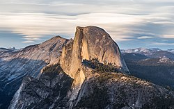
The United States has 63 national parks, which are congressionally designated protected areas operated by the National Park Service, an agency of the Department of the Interior. [1] National parks are designated for their natural beauty, unique geological features, diverse ecosystems, and recreational opportunities, typically "because of some outstanding scenic feature or natural phenomena." [2] While legislatively all units of the National Park System are considered equal with the same mission, national parks are generally larger and more of a destination, and hunting and extractive activities are prohibited. [3] National monuments, on the other hand, are also frequently protected for their historical or archaeological significance. Eight national parks (including six in Alaska) are paired with a national preserve, areas with different levels of protection that are administered together but considered separate units and whose areas are not included in the figures below. The 429 units of the National Park System can be broadly referred to as national parks, but most have other formal designations. [4]

Contents

A bill creating the first national park, Yellowstone, was signed into law by President Ulysses S. Grant in 1872, followed by Mackinac National Park in 1875 (decommissioned in 1895), and then Rock Creek Park (later merged into National Capital Parks), Sequoia and Yosemite in 1890. The Organic Act of 1916 created the National Park Service "to conserve the scenery and the natural and historic objects and wildlife therein, and to provide for the enjoyment of the same in such manner and by such means as will leave them unimpaired for the enjoyment of future generations." [5] Many current national parks had been previously protected as national monuments by the president under the Antiquities Act or as other designations created by Congress before being redesignated by Congress; the newest national park is New River Gorge, previously a National River, and the most recent entirely new park is National Park of American Samoa. A few former national parks are no longer designated as such, or have been disbanded. Fourteen national parks are designated UNESCO World Heritage Sites (WHS), [6] and 21 national parks are named UNESCO Biosphere Reserves (BR), [7] with eight national parks in both programs.

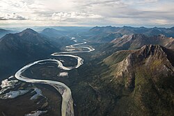
Thirty states have national parks, as do the territories of American Samoa and the U.S. Virgin Islands. The state with the most national parks is California with nine, followed by Alaska with eight, Utah with five, and Colorado with four. The largest national park is Wrangell–St. Elias in Alaska: at over 8 million acres (32,375 km2), it is larger than each of the nine smallest states. The next three largest parks are also in Alaska. The smallest park is Gateway Arch National Park, Missouri, at 192.83 acres (0.7804 km2). The total area protected by national parks is approximately 52.4 million acres (212,000 km2), for an average of 833 thousand acres (3,370 km2) but a median of only 220 thousand acres (890 km2). [8]

The national parks set a visitation record in 2021, with more than 92 million visitors. [9] Great Smoky Mountains National Park in North Carolina and Tennessee has been the most-visited park since 1944, [10] and had almost 13 million visitors in 2022. [11] In contrast, only about 9,500 people visited the remote Gates of the Arctic National Park and Preserve in Alaska in 2022. [11]

National parks

Legend
* Green UNESCO designated World Heritage Sites (WHS)
 Blue UNESCO designated Biosphere Reserves (BR)
 Purple parks designated in both UNESCO programs
List of U.S. national parks
NameImageLocationDate established as park [12] Area (2023) [8] Recreation visitors (2022) [11] Description
Acadia Bass Harbor Head Light Station 2016.jpg Maine
44°21′N68°13′W / 44.35°N 68.21°W / 44.35; -68.21 (Acadia)
February 26, 191949,071.40 acres (198.6 km2)3,970,260Covering most of Mount Desert Island and other coastal islands, Acadia features the tallest mountain on the Atlantic coast of the United States, granite peaks, ocean shoreline, woodlands, and lakes. There are freshwater, estuary, forest, and intertidal habitats. [13] [14]
American Samoa Ofu Beach American Samoa US National Park Service.jpg American Samoa
14°15′S170°41′W / 14.25°S 170.68°W / -14.25; -170.68 (National Park of American Samoa)
October 31, 19888,256.67 acres (33.4 km2)12,135The southernmost national park is on three Samoan islands in the South Pacific. It protects coral reefs, rainforests, volcanic mountains, and white beaches. The area is also home to flying foxes, brown boobies, sea turtles, and 900 species of fish. [15]
Arches USA Arches NP Delicate Arch(1).jpg Utah
38°41′N109°34′W / 38.68°N 109.57°W / 38.68; -109.57 (Arches)
November 12, 197176,678.98 acres (310.3 km2)1,460,652This site features more than 2,000 natural sandstone arches, with some of the most popular arches in the park being Delicate Arch, Landscape Arch and Double Arch. [16] Millions of years of erosion have created these structures in a desert climate where the arid ground has life-sustaining biological soil crusts and potholes that serve as natural water-collecting basins. Other geologic formations include stone pinnacles, fins, and balancing rocks. [17]
Badlands Golden Glow Canyon.jpg South Dakota
43°45′N102°30′W / 43.75°N 102.50°W / 43.75; -102.50 (Badlands)
November 10, 1978242,755.94 acres (982.4 km2)1,006,809The Badlands are a collection of buttes, pinnacles, spires, and mixed-grass prairies within the drainage basin of the White River, in southwestern South Dakota. They contain the largest known assemblage of late Eocene and Oligocene mammal fossils. [18] Wildlife includes bison, bighorn sheep, black-footed ferrets, and prairie dogs. [19]
Big Bend On the Border (39960085292).jpg Texas
29°15′N103°15′W / 29.25°N 103.25°W / 29.25; -103.25 (Big Bend)
June 12, 1944801,163.21 acres (3,242.2 km2)514,107Named for the prominent bend in the Rio Grande along the U.S.–Mexico border, this park encompasses a large and remote part of the Chihuahuan Desert. Its main attraction is backcountry recreation in the arid Chisos Mountains and in canyons along the river. A wide variety of Cretaceous and Tertiary fossils as well as cultural artifacts of Native Americans also exist within its borders. [20] (BR) [21]
Biscayne Biscayne NP snorkeling.jpg Florida
25°39′N80°05′W / 25.65°N 80.08°W / 25.65; -80.08 (Biscayne)
June 28, 1980172,971.11 acres (700.0 km2)701,023The central part of Biscayne Bay, this mostly underwater park at the north end of the Florida Keys has four interrelated marine ecosystems: mangrove forest, the Bay, the Keys, and coral reefs. Threatened animals include the West Indian manatee, American crocodile, various sea turtles, and the peregrine falcon. [22]
Black Canyon of the Gunnison Black canyon gunnison Colorado.jpg Colorado
38°34′N107°43′W / 38.57°N 107.72°W / 38.57; -107.72 (Black Canyon of the Gunnison)
October 21, 199930,779.83 acres (124.6 km2)297,257The park protects a quarter of the Gunnison River, which slices sheer canyon walls from dark Precambrian-era rock. The canyon features some of the steepest cliffs and oldest rock in North America, and is a popular site for river rafting and rock climbing. The deep, narrow canyon is composed of gneiss and schist, which appears black when in shadow. [23]
Bryce Canyon Inspiration Point Bryce Canyon November 2018 panorama.jpg Utah
37°34′N112°11′W / 37.57°N 112.18°W / 37.57; -112.18 (Bryce Canyon)
February 25, 192835,835.08 acres (145.0 km2)2,354,660Bryce Canyon is a geological amphitheater on southern Utah's Paunsaugunt Plateau with hundreds of tall, multicolored sandstone hoodoos formed by erosion. The region was originally settled by Native Americans and later by Mormon pioneers. [24]
Canyonlands Canyonlands National Park...Needles area (6294480744).jpg Utah
38°12′N109°56′W / 38.2°N 109.93°W / 38.2; -109.93 (Canyonlands)
September 12, 1964337,597.83 acres (1,366.2 km2)779,147This landscape was eroded into a maze of canyons, buttes, and mesas by the combined efforts of the Colorado River, Green River, and their tributaries, which divide the park into three districts. The park contains thousands of rock pinnacles and arches, as well as artifacts from Ancient Pueblo peoples. [25]
Capitol Reef Cassidy Arch, Capitol Reef National Park.JPG Utah
38°12′N111°10′W / 38.20°N 111.17°W / 38.20; -111.17 (Capitol Reef)
December 18, 1971241,904.50 acres (979.0 km2)1,227,608The park's Waterpocket Fold is a 100-mile (160 km) monocline that exhibits the earth's diverse geologic layers. Other natural features include monoliths, eroded buttes, and sandstone domes, including one shaped like the United States Capitol. [26]
Carlsbad Caverns * Carlsbad Caverns.jpg New Mexico
32°10′N104°26′W / 32.17°N 104.44°W / 32.17; -104.44 (Carlsbad Caverns)
May 14, 193046,766.45 acres (189.3 km2)390,932Carlsbad Caverns has 117 caves, the longest of which is over 120 miles (190 km) long. The Big Room is almost 4,000 feet (1,200 m) long, and the caves are home to over 400,000 Mexican free-tailed bats and sixteen other species. Above ground are the Chihuahuan Desert and Rattlesnake Springs. [27] (WHS) [28]
Channel Islands Santa Cruz Island CA DSC 4323 ad.JPG California
34°01′N119°25′W / 34.01°N 119.42°W / 34.01; -119.42 (Channel Islands)
March 5, 1980249,561.00 acres (1,009.9 km2)323,245Five of the eight Channel Islands are protected, with half of the park's area underwater. The islands have a unique Mediterranean ecosystem originally settled by the Chumash people. They are home to over 2,000 species of land plants and animals, 145 endemic to them, including the island fox. Ferry services offer transportation to the islands from the mainland. [29] (BR) [30]
Congaree Bald cypress and creek (7166139814).jpg South Carolina
33°47′N80°47′W / 33.78°N 80.78°W / 33.78; -80.78 (Congaree)
November 10, 200326,692.60 acres (108.0 km2)204,522On the Congaree River, this park is the largest portion of old-growth floodplain forest left in North America. Some of the trees are the tallest in the eastern United States. An elevated walkway called the Boardwalk Loop guides visitors through the swamp. [31] (BR) [32]
Crater Lake Crater Lake winter pano2.jpg Oregon
42°56′N122°06′W / 42.94°N 122.1°W / 42.94; -122.1 (Crater Lake)
May 22, 1902183,224.05 acres (741.5 km2)527,259 Crater Lake lies in the caldera of an ancient volcano called Mount Mazama that collapsed 7,700 years ago. The lake is the deepest in the United States and is noted for its vivid blue color and water clarity. Wizard Island and the Phantom Ship are more recent volcanic formations within the caldera. As the lake has no inlets or outlets, it is replenished only by precipitation. [33]
Cuyahoga Valley Cuyahoga Valley National Park 20.jpg Ohio
41°14′N81°33′W / 41.24°N 81.55°W / 41.24; -81.55 (Cuyahoga Valley)
October 11, 200032,571.89 acres (131.8 km2)2,913,312This park along the Cuyahoga River has waterfalls, hills, trails, and exhibits on early rural living. The Ohio and Erie Canal Towpath Trail follows the Ohio and Erie Canal, where mules towed canal boats. The park has numerous historic homes, bridges, and structures, [34] and also offers a scenic train ride. [35]
Death Valley Isolated Desert.jpg California, Nevada
36°14′N116°49′W / 36.24°N 116.82°W / 36.24; -116.82 (Death Valley)
October 31, 19943,408,395.63 acres (13,793.3 km2)1,128,862 Death Valley is the hottest, lowest, and driest place in the United States, with daytime temperatures that have exceeded 130 °F (54 °C). The park protects Badwater Basin and its vast salt flats at the lowest elevation in North America, −282 ft (−86 m), [36] This geologic graben also protects numerous canyons, badlands, sand dunes, mountain ranges, historic mines, springs, and more than 1,000 species of plants that grow. [37] (BR) [38]
Denali Wonder Lake and Denali.jpg Alaska
63°20′N150°30′W / 63.33°N 150.50°W / 63.33; -150.50 (Denali)
February 26, 19174,740,911.16 acres (19,185.8 km2)427,562Centered on Denali, the tallest and most prominent mountain in North America, the park is serviced by a single road leading to Wonder Lake, most of which can only be accessed via scheduled tour buses. Denali and other peaks of the Alaska Range are covered with long glaciers and boreal forest. Wildlife includes grizzly bears, Dall sheep, moose, caribou, and wolves. [39] (BR) [40]
Dry Tortugas Fort-Jefferson Dry-Tortugas.jpg Florida
24°38′N82°52′W / 24.63°N 82.87°W / 24.63; -82.87 (Dry Tortugas)
October 26, 199264,701.22 acres (261.8 km2)78,488The islands of the Dry Tortugas, at the westernmost end of the Florida Keys, are the site of Fort Jefferson, a Civil War-era fort that is the largest masonry structure in the Western Hemisphere. The park is home to undisturbed coral reefs and shipwrecks, and is only accessible by plane or boat. [41] (BR) [42]
Everglades Pinelands Sunrise (1) NPSPhoto, Sarah Zenner (9255147763).jpg Florida
25°19′N80°56′W / 25.32°N 80.93°W / 25.32; -80.93 (Everglades)
May 30, 19341,508,938.57 acres (6,106.5 km2)1,155,193The Everglades are the largest tropical wilderness in the United States. This mangrove and tropical rainforest ecosystem and marine estuary is home to 36 protected species, including the Florida panther, American crocodile, and West Indian manatee. Some areas have been drained and developed; restoration projects aim to restore the ecology. [43] (WHS) [44] (BR) [42]
Gates of the Arctic Remote river in Gates of the Arctic (16524035298).jpg Alaska
67°47′N153°18′W / 67.78°N 153.30°W / 67.78; -153.30 (Gates of the Arctic)
December 2, 19807,523,897.45 acres (30,448.1 km2)9,457The country's northernmost park protects an expanse of pure wilderness in Alaska's Brooks Range and has no park facilities. The land is home to Alaska Natives who have relied on the land and caribou for 11,000 years. [45]
Gateway Arch St Louis night expblend.jpg Missouri
38°38′N90°11′W / 38.63°N 90.19°W / 38.63; -90.19 (Gateway Arch)
February 22, 2018 [46] 192.83 acres (0.8 km2)1,618,774The Gateway Arch is a 630-foot (192 m) (both high and wide) catenary arch built in the 1960s to commemorate the Lewis and Clark Expedition, initiated by Thomas Jefferson, and the subsequent westward expansion of the country. The nearby Old Courthouse, across a greenway to the west of the arch, was the original site of the landmark Dred Scott case about slavery. An underground museum describes the arch's construction and the country's westward expansion. [47]
Glacier Mountain Goat at Hidden Lake.jpg Montana
48°48′N114°00′W / 48.80°N 114.00°W / 48.80; -114.00 (Glacier)
May 11, 19101,013,126.39 acres (4,100.0 km2)2,908,458The U.S. half of Waterton-Glacier International Peace Park, this park includes 26 rapidly receding glaciers and 130 named lakes surrounded by Rocky Mountain peaks. Historic hotels and the landmark Going-to-the-Sun Road accommodate visitors. [48] The local mountains, formed by an overthrust, expose Paleozoic fossils including trilobites, mollusks, giant ferns and dinosaurs. The park is also home to Triple Divide Peak, which forms the boundary between the watersheds of the Atlantic, Pacific, and Arctic Oceans. [49] (WHS) [50] (BR) [51]
Glacier Bay Glacier Bay National Park, July 28, 2012.jpg Alaska
58°30′N137°00′W / 58.50°N 137.00°W / 58.50; -137.00 (Glacier Bay)
December 2, 19803,223,383.43 acres (13,044.6 km2)545,758Glacier Bay contains tidewater glaciers, mountains, fjords, and a temperate rainforest, and is home to large populations of grizzly bears, mountain goats, whales, seals, and eagles. When discovered in 1794 by George Vancouver, the entire bay was covered by ice, but the glaciers have since receded more than 65 miles (105 km). [52] (WHS) [53] (BR) [54]
Grand Canyon * USA 09847 Grand Canyon Luca Galuzzi 2007.jpg Arizona
36°04′N112°08′W / 36.06°N 112.14°W / 36.06; -112.14 (Grand Canyon)
February 26, 19191,201,647.03 acres (4,862.9 km2)4,732,101The Grand Canyon, carved by the mighty Colorado River, is 277 miles (446 km) long, up to 1 mile (1.6 km) deep, and up to 15 miles (24 km) wide. Millions of years of erosion have resulted in a massive three-tiered canyon, exposing the multicolored layers of the Colorado Plateau in mesas and canyon walls, visible from trails that descend into the canyon from the north and south rims. [55] (WHS) [56]
Grand Teton Cathedral Group GTNP1.jpg Wyoming
43°44′N110°48′W / 43.73°N 110.80°W / 43.73; -110.80 (Grand Teton)
February 26, 1929310,044.36 acres (1,254.7 km2)2,806,223 Grand Teton is the tallest mountain in the scenic Teton Range. The park's historic Jackson Hole and reflective piedmont lakes teem with endemic wildlife, with a backdrop of craggy mountains that rise abruptly from the sage-covered valley below. [57] (BR) [7]
Great Basin Upper Lehman Creek.jpg Nevada
38°59′N114°18′W / 38.98°N 114.30°W / 38.98; -114.30 (Great Basin)
October 27, 198677,180.00 acres (312.3 km2)142,115Based around Nevada's second tallest mountain, Wheeler Peak, Great Basin National Park protects 5,000-year-old bristlecone pines, a rock glacier, and the limestone Lehman Caves. Due to its remote location, the park is home to some of the country's darkest night skies. Wildlife includes the Townsend's big-eared bat, pronghorn, and Bonneville cutthroat trout. [58]
Great Sand Dunes Sun and Shadow Patterns on Dunes (28471118064).jpg Colorado
37°44′N105°31′W / 37.73°N 105.51°W / 37.73; -105.51 (Great Sand Dunes)
September 24, 2004107,345.73 acres (434.4 km2)493,428The tallest sand dunes in North America, up to 750 feet (230 m) tall, were formed by deposits of the ancient Rio Grande in the San Luis Valley. Abutting a variety of grasslands, shrublands, and wetlands, the park also features alpine lakes, six 13,000-foot mountains, and old-growth forests. [59]
Great Smoky Mountains Foothills Parkway, November 2018--Joye Ardyn Durham (31031302587).jpg North Carolina, Tennessee
35°41′N83°32′W / 35.68°N 83.53°W / 35.68; -83.53 (Great Smoky Mountains)
June 15, 1934522,426.88 acres (2,114.2 km2)12,937,633The Great Smoky Mountains, part of the Appalachian Mountains, span a wide range of elevations, making them home to over 400 vertebrate species, 100 tree species, and 5,000 plant species. Hiking is the park's main attraction, with over 800 miles (1,300 km) of trails, including 70 miles (110 km) of the Appalachian Trail. Other activities include fishing, horseback riding, and touring nearly 80 historic structures. [60] (WHS) [61] (BR) [62]
Guadalupe Mountains El Capitan from US Route 62 DSC 5495 ed ad.jpg Texas
31°55′N104°52′W / 31.92°N 104.87°W / 31.92; -104.87 (Guadalupe Mountains)
September 30, 197286,367.10 acres (349.5 km2)219,987This park contains Guadalupe Peak, the highest point in Texas, as well as the scenic McKittrick Canyon filled with bigtooth maples, a corner of the arid Chihuahuan Desert, and a fossilized coral reef from the Permian era. [63]
Haleakalā Haleakala National Park 02.jpg Hawaii
20°43′N156°10′W / 20.72°N 156.17°W / 20.72; -156.17 (Haleakalā)
July 1, 196133,488.98 acres (135.5 km2)1,087,616The Haleakalā volcano on Maui features a very large crater with numerous cinder cones, a grove of non-native trees, the Kipahulu section's scenic pools of freshwater fish, and the endemic Hawaiian goose. The park protects the greatest number of endangered species within a U.S. national park. [64] (BR) [65]
Hawaiʻi Volcanoes Sulfur dioxide emissions from the Halemaumau vent 04-08-1 1.jpg Hawaii
19°23′N155°12′W / 19.38°N 155.20°W / 19.38; -155.20 (Hawaiʻi Volcanoes)
August 1, 1916344,812.18 acres (1,395.4 km2)1,580,961This park on the Big Island protects the Kīlauea and Mauna Loa volcanoes, two of the world's most active geological features. Diverse ecosystems range from tropical forests at sea level to barren lava beds at more than 13,000 feet (4,000 m). [66] (WHS) [67] (BR) [65]
Hot Springs Hots Springs National Park aerial.jpg Arkansas
34°31′N93°03′W / 34.51°N 93.05°W / 34.51; -93.05 (Hot Springs)
March 4, 19215,554.15 acres (22.5 km2)2,646,133Hot Springs was originally established by Congress as a federal reserve on April 20, 1832, making it the oldest area managed by the National Park Service. Natural thermal springs flow out of the Ouachita Mountains, providing opportunities for relaxation in a historic setting. Bathhouse Row preserves examples of 19th-century architecture. [68] Hot Springs is the first national park within a city and was the smallest national park until 2018. [69]
Indiana Dunes 2010-11-26 3060x2040 portage indiana dunes.jpg Indiana
41°39′12″N87°03′09″W / 41.6533°N 87.0524°W / 41.6533; -87.0524 (Indiana Dunes)
February 15, 201915,349.08 acres (62.1 km2)2,834,180Previously designated a national lakeshore, parts of this 20-mile (32 km) stretch of the southern shore of Lake Michigan have sandy beaches and tall dunes. The park includes grassy prairies, peat bogs, and marsh wetlands home to over 2,000 species. [70]
Isle Royale IsleRoyalePlane.jpg Michigan
48°06′N88°33′W / 48.10°N 88.55°W / 48.10; -88.55 (Isle Royale)
April 3, 1940571,790.30 acres (2,314.0 km2)25,454The largest island in Lake Superior is a place of isolation and wilderness. Along with its many shipwrecks, waterways, and hiking trails, the park also includes over 400 smaller islands within 4.5 miles (7.2 km) of its shores. There are only 20 mammal species on the island, though the relationship between its wolf and moose populations is especially unique. [71] (BR) [72]
Joshua Tree Joshua Tree - Rock formation in Real Hidden Valley 1.jpg California
33°47′N115°54′W / 33.79°N 115.90°W / 33.79; -115.90 (Joshua Tree)
October 31, 1994795,155.85 acres (3,217.9 km2)3,058,294Covering large areas of the Colorado and Mojave Deserts and the Little San Bernardino Mountains, this desert landscape is populated by vast stands of Joshua trees. Large changes in elevation reveal various contrasting environments including bleached sand dunes, dry lakes, rugged mountains, and maze-like clusters of monzogranite monoliths. [73] (BR) [38]
Katmai Grizzly mama bear with spring cubs. Naknek Lake, Katmai National Park, Alaska.jpg Alaska
58°30′N155°00′W / 58.50°N 155.00°W / 58.50; -155.00 (Katmai)
December 2, 19803,674,529.33 acres (14,870.3 km2)33,908This park on the Alaska Peninsula protects the Valley of Ten Thousand Smokes, an ash flow formed by the 1912 eruption of Novarupta, and the stratovolcano Mount Katmai. Over 2,000 grizzly bears come here each year to catch spawning salmon. Other wildlife includes caribou, wolves, moose, and wolverines. [74]
Kenai Fjords Kenai Fjords National Park ENBLA20.jpg Alaska
59°55′N149°39′W / 59.92°N 149.65°W / 59.92; -149.65 (Kenai Fjords)
December 2, 1980669,650.05 acres (2,710.0 km2)389,943Near Seward on the Kenai Peninsula, this park protects the Harding Icefield and at least 38 glaciers and fjords stemming from it. The only area accessible to the public by road is the rapidly shrinking Exit Glacier. Boat and kayak tours offer views of tidewater glaciers, whales, sea lions, and marine birds. [75]
Kings Canyon Copper Creek Trail.jpg California
36°48′N118°33′W / 36.80°N 118.55°W / 36.80; -118.55 (Kings Canyon)
March 4, 1940461,901.20 acres (1,869.2 km2)640,986Home to several giant sequoia groves and the General Grant Tree, the world's second largest measured tree, this park also features part of the Kings River, sculptor of the dramatic granite canyon that is its namesake, and the San Joaquin River, as well as Boyden Cave. [76] Although Kings Canyon National Park was designated as such in 1940, it subsumed General Grant National Park, which had been established on October 1, 1890, as the United States' fourth national park. [77] [78] [79] (BR) [80]
Kobuk Valley Wetlands along the Kobuk River (8029770162).jpg Alaska
67°33′N159°17′W / 67.55°N 159.28°W / 67.55; -159.28 (Kobuk Valley)
December 2, 19801,750,716.16 acres (7,084.9 km2)16,925Kobuk Valley protects 61 miles (98 km) of the Kobuk River and three regions of sand dunes. Created by glaciers, the Great Kobuk, Little Kobuk, and Hunt River Sand Dunes can reach 100 feet (30 m) high and 100 °F (38 °C), and they are the largest dunes in the Arctic. Twice a year, half a million caribou migrate through the dunes and across river bluffs that expose well-preserved ice age fossils. [81]
Lake Clark Lake Clark Place Name Project images. Credit Dev Charm Khalsa NPS. (36bde271-64b3-447a-b18a-9421e5e07284).jpg Alaska
60°58′N153°25′W / 60.97°N 153.42°W / 60.97; -153.42 (Lake Clark)
December 2, 19802,619,816.49 acres (10,602.0 km2)18,187The region around Lake Clark features four active volcanoes, including Mount Redoubt, as well as an abundance of rivers, glaciers, and waterfalls. Temperate rainforests, a tundra plateau, and three mountain ranges complete the landscape. [82]
Lassen Volcanic Lake Helen, Lassen Volcanic National Park, in June 2020.jpg California
40°29′N121°31′W / 40.49°N 121.51°W / 40.49; -121.51 (Lassen Volcanic)
August 9, 1916106,589.02 acres (431.4 km2)446,291 Lassen Peak, the largest lava dome volcano in the world, is joined by all three other types of volcanoes in this park: shield, cinder cone, and composite. Though Lassen itself last erupted in 1915, most of the rest of the park is continuously active. Numerous hydrothermal features, including fumaroles, boiling pools, and bubbling mud pots, are heated by molten rock from beneath the peak. [83]
Mammoth Cave Mammoth Cave National Park 007.jpg Kentucky
37°11′N86°06′W / 37.18°N 86.10°W / 37.18; -86.10 (Mammoth Cave)
July 1, 194172,472.87 acres (293.3 km2)663,147With more than 400 miles (640 km) of passageways explored, Mammoth Cave is the world's longest known cave system. Subterranean wildlife includes eight bat species, Kentucky cave shrimp, Northern cavefish, and cave salamanders. Above ground, the park provides recreation on the Green River, 70 miles of hiking trails, and plenty of sinkholes and springs. [84] (WHS) [85] (BR) [86]
Mesa Verde * Mesa Verde National Park Cliff Palace 2006 09 12.jpg Colorado
37°11′N108°29′W / 37.18°N 108.49°W / 37.18; -108.49 (Mesa Verde)
June 29, 190652,485.17 acres (212.4 km2)499,790This area constitutes over 4,000 archaeological sites of the Ancestral Puebloan people, who lived here and elsewhere in the Four Corners region for at least 700 years. Cliff dwellings built in the 12th and 13th centuries include Cliff Palace, which has 150 rooms and 23 kivas, and the Balcony House, with its many passages and tunnels. [87] (WHS) [88]
Mount Rainier Tatoosh Range WA MRNP1.jpg Washington
46°51′N121°45′W / 46.85°N 121.75°W / 46.85; -121.75 (Mount Rainier)
March 2, 1899236,381.64 acres (956.6 km2)1,622,395 Mount Rainier, an active stratovolcano, is the most prominent peak in the Cascades and is covered by 26 named glaciers including Carbon Glacier and Emmons Glacier, the longest and largest in the contiguous United States respectively. The mountain is popular for climbing, and more than half of the park is covered by subalpine and alpine forests and meadows seasonally in bloom with wildflowers. Paradise on the south slope is among the snowiest places on Earth. [89] The Longmire visitor center is the start of the Wonderland Trail, which encircles the mountain. [90]
New River Gorge New River Gorge Bridge.jpg West Virginia
38°04′N81°05′W / 38.07°N 81.08°W / 38.07; -81.08 (New River Gorge)
December 27, 20207,021 acres (28.4 km2) [91] 1,593,523The New River Gorge is the deepest river gorge east of the Mississippi River. The park primarily covers the lower gorge area around the New River Gorge Bridge, which features some of the country's best whitewater rafting. Smaller noncontiguous sections showcase the ghost town of Thurmond, the scenic Grandview vista, and Sandstone Falls. The other 65,165 acres (263.71 km2) of the redesignated national river is now a national preserve, spanning 53 mi (85 km) of the New River. [92] [93]
North Cascades Cascade Pass.jpg Washington
48°42′N121°12′W / 48.70°N 121.20°W / 48.70; -121.20 (North Cascades)
October 2, 1968504,780.94 acres (2,042.8 km2)30,154The highly glaciated mountains of the North Cascades Range exhibit a spectacular and complex geologic history. Between the river valleys and high peaks there are eight diverse life zones with 75 mammal and 1,600 vascular plant species. Popular hiking and climbing areas of the Stephen Mather Wilderness include Cascade Pass, Mount Shuksan, Mount Triumph, and Eldorado Peak. Ross Lake and Lake Chelan National Recreation Areas adjoin the two segments of the park and are all administered together. [94]
Olympic Acer macrophyllum in Hoh ValleyB.jpg Washington
47°58′N123°30′W / 47.97°N 123.50°W / 47.97; -123.50 (Olympic)
June 29, 1938922,649.41 acres (3,733.8 km2)2,432,972This park on the Olympic Peninsula includes a wide range of ecosystems from Pacific shoreline to temperate rainforests to the glaciated alpine peaks of the Olympic Mountains, the tallest of which is Mount Olympus. The Hoh and Quinault Rainforests are the wettest areas in the contiguous United States, with the Hoh receiving an average of almost 12 ft (3.7 m) of rain every year. [95] [96] (WHS) [97] (BR) [98]
Petrified Forest The PEFO Tepees.jpg Arizona
35°04′N109°47′W / 35.07°N 109.78°W / 35.07; -109.78 (Petrified Forest)
December 9, 1962221,390.21 acres (895.9 km2)505,209This portion of the Chinle Formation has a large concentration of 225-million-year-old petrified wood. The surrounding Painted Desert features eroded cliffs of red-hued volcanic rock called bentonite. Dinosaur fossils and over 350 Native American sites are also protected in this park. [99]
Pinnacles Pinnacles National Park.jpg California
36°29′N121°10′W / 36.48°N 121.16°W / 36.48; -121.16 (Pinnacles)
January 10, 201326,685.73 acres (108.0 km2)275,023Named for the eroded leftovers of a portion of an extinct volcano, the park's massive black and gold monoliths of andesite and rhyolite are a popular destination for rock climbers. Hikers have access to trails crossing the Coast Range wilderness. The park is one of the few locations where the endangered California condor can be seen in the wild. Pinnacles also supports a dense population of prairie falcons and more than 13 species of bat that populate its talus caves. [100]
Redwood * Redwood National Park, fog in the forest.jpg California
41°18′N124°00′W / 41.30°N 124.00°W / 41.30; -124.00 (Redwood)
October 2, 1968138,999.37 acres (562.5 km2)458,400This park and the co-managed state parks protect almost half of all remaining coastal redwoods, the tallest trees on earth. There are three large river systems in this very seismically active area, and 37 miles (60 km) of protected coastline reveal tide pools and seastacks. The prairie, estuary, coast, river, and forest ecosystems contain a wide variety of animal and plant species. [101] (WHS) [102]
Rocky Mountain Bierstadt Lake, Rocky Mountain National Park, USA.jpg Colorado
40°24′N105°35′W / 40.40°N 105.58°W / 40.40; -105.58 (Rocky Mountain)
January 26, 1915265,847.74 acres (1,075.8 km2)4,300,424Bisected north to south by the Continental Divide, this portion of the Rockies has ecosystems varying from over 150 riparian lakes to montane and subalpine forests to treeless alpine tundra. Wildlife including elk, moose, mule deer, bighorn sheep, black bears, and cougars inhabit its igneous mountains and glacial valleys. Longs Peak, a classic Colorado fourteener, and the scenic Bear Lake are popular destinations, as well as the historic Trail Ridge Road, which reaches an elevation of more than 12,000 feet (3,700 m). [103] (BR) [104]
Saguaro Saguaronationalparl17102008.jpg Arizona
32°15′N110°30′W / 32.25°N 110.50°W / 32.25; -110.50 (Saguaro)
October 14, 199492,876.75 acres (375.9 km2)908,194Split into the separate Rincon Mountain and Tucson Mountain districts, this park is evidence that the dry Sonoran Desert is still home to a great variety of life spanning six biotic communities. Beyond the namesake giant saguaro cacti, there are barrel cacti, chollas, and prickly pears, as well as lesser long-nosed bats, spotted owls, and javelinas. [105]
Sequoia Giant sequoias in Sequoia National Park 2013.jpg California
36°26′N118°41′W / 36.43°N 118.68°W / 36.43; -118.68 (Sequoia)
September 25, 1890404,062.63 acres (1,635.2 km2)1,153,198This park protects the Giant Forest, which boasts some of the world's largest trees, the General Sherman being the largest measured tree in the park. Other features include over 240 caves, a long segment of the Sierra Nevada including the tallest mountain in the contiguous United States, and Moro Rock, a large granite dome. [106] (BR) [80]
Shenandoah Early Fall at Dark Hollow Falls (22028259442).jpg Virginia
38°32′N78°21′W / 38.53°N 78.35°W / 38.53; -78.35 (Shenandoah)
December 26, 1935200,445.92 acres (811.2 km2)1,449,300Shenandoah's Blue Ridge Mountains are covered by hardwood forests that teem with a wide variety of wildlife. The Skyline Drive and Appalachian Trail run the entire length of this narrow park, along with more than 500 miles (800 km) of hiking trails passing scenic overlooks and cataracts of the Shenandoah River. [107]
Theodore Roosevelt View of Theodore Roosevelt National Park.jpg North Dakota
46°58′N103°27′W / 46.97°N 103.45°W / 46.97; -103.45 (Theodore Roosevelt)
November 10, 197870,446.89 acres (285.1 km2)668,679This region that enticed and influenced President Theodore Roosevelt consists of a park of three units in the northern badlands. Besides Roosevelt's historic cabin, there are numerous scenic drives and backcountry hiking opportunities. Wildlife includes American bison, pronghorn, bighorn sheep, and wild horses. [108]
Virgin Islands St John Trunk Bay 1.jpg U.S. Virgin Islands
18°20′N64°44′W / 18.33°N 64.73°W / 18.33; -64.73 (Virgin Islands)
August 2, 195615,052.33 acres (60.9 km2)196,752This island park on Saint John preserves pristine beaches surrounded by mangrove forests, seagrass beds, and coral reefs. It also has Taíno archaeological sites and the ruins of sugar plantations from Columbus's time. [109]
Voyageurs Voyageurs National Park.jpg Minnesota
48°30′N92°53′W / 48.50°N 92.88°W / 48.50; -92.88 (Voyageurs)
April 8, 1975218,222.35 acres (883.1 km2)221,434This park protecting four lakes near the Canada–US border is a site for canoeing, kayaking, and fishing. The park also preserves a history populated by Ojibwe Native Americans, French fur traders called voyageurs, and gold miners. Formed by glaciers, the region features tall bluffs, rock gardens, islands, bays, and several historic buildings. [110]
White Sands White Sands New Mexico USA.jpg New Mexico
32°47′N106°10′W / 32.78°N 106.17°W / 32.78; -106.17 (White Sands)
December 20, 2019 [111] 146,344.31 acres (592.2 km2)705,127Located in the mountain-ringed Tularosa Basin, White Sands consists of the southern part of a 275-square-mile (710 km2) field of white sand dunes composed of gypsum crystals—the world's largest gypsum dunefield. The park is completely within the White Sands Missile Range and is subject to closure when tests are conducted. [112]
Wind Cave Wind Cave lower.jpg South Dakota
43°34′N103°29′W / 43.57°N 103.48°W / 43.57; -103.48 (Wind Cave)
January 9, 190333,970.84 acres (137.5 km2)607,418Wind Cave is distinctive for its calcite fin formations called boxwork, a unique formation rarely found elsewhere, and needle-like growths called frostwork. It is one of the longest caves in the world and creates a wind as air pressure changes. Above ground is a mixed-grass prairie with animals such as bison, black-footed ferrets, and prairie dogs and ponderosa pine forests home to cougars and elk. [113] The cave is culturally significant to the Lakota people as a creation site. [114]
Wrangell–St. Elias * Rain in the Wrangell Mountains.jpg Alaska
61°00′N142°00′W / 61.00°N 142.00°W / 61.00; -142.00 (Wrangell – St. Elias)
December 2, 19808,323,146.48 acres (33,682.6 km2)65,236The largest national park in the system protects the convergence of the Alaska, Chugach, Wrangell, and Saint Elias Ranges, which include many of the continent's tallest mountains and volcanoes, including the 18,008-foot Mount Saint Elias. More than a quarter of the park is covered with glaciers, including the tidewater Hubbard Glacier, piedmont Malaspina Glacier, and valley Nabesna Glacier. [115] (WHS) [53]
Yellowstone Grand Prismatic Spring 2013.jpg Wyoming, Montana, Idaho
44°36′N110°30′W / 44.60°N 110.50°W / 44.60; -110.50 (Yellowstone)
March 1, 18722,219,790.71 acres (8,983.2 km2)3,290,242Situated on the Yellowstone Caldera, the park has an expansive network of geothermal areas including boiling mud pots, vividly colored hot springs such as Grand Prismatic Spring, and regularly erupting geysers, the best-known being Old Faithful. The yellow-hued Grand Canyon of the Yellowstone River contains several high waterfalls, and four mountain ranges traverse the park. More than 60 mammal species including timber wolves, grizzly bears, black bears, lynxes, bison, and elk make this park one of the best wildlife viewing spots in the country. [116] (WHS) [117] (BR) [118]
Yosemite * Half Dome from Glacier Point, Yosemite NP - Diliff.jpg California
37°50′N119°30′W / 37.83°N 119.50°W / 37.83; -119.50 (Yosemite)
October 1, 1890761,747.50 acres (3,082.7 km2)3,667,550Yosemite features sheer granite cliffs, exceptionally tall waterfalls, and old-growth forests at a unique intersection of geology and hydrology. Half Dome and El Capitan rise from the park's centerpiece, the glacier-carved Yosemite Valley, and from its vertical walls drop Yosemite Falls, one of North America's tallest waterfalls at 2,425 feet (739 m) high. Three giant sequoia groves, along with a pristine wilderness in the heart of the Sierra Nevada, are home to a wide variety of rare plant and animal species. [119] (WHS) [120]
Zion Angels Landing.jpg Utah
37°18′N113°03′W / 37.30°N 113.05°W / 37.30; -113.05 (Zion)
November 19, 1919147,242.66 acres (595.9 km2)4,692,417Located at the junction of the Colorado Plateau, Great Basin, and Mojave Desert, this park contains sandstone features such as mesas, rock towers, and canyons, including the Virgin River Narrows. The various sandstone formations and the forks of the Virgin River create a wilderness divided into four ecosystems: desert, riparian, woodland, and coniferous forest. [121]

Parks by state or territory

The following table includes the 30 states and two territories that have national parks. Exclusive parks refer to parks entirely within one state or territory. Shared parks refer to parks in multiple states.

Territories are set in italics.

StateTotal parksExclusive parksShared parks
California 981
Alaska 88
Utah 55
Colorado 44
Arizona 33
Florida 33
Washington 33
Hawaii 22
New Mexico 22
South Dakota 22
Texas 22
Montana 211
Nevada 211
Wyoming 211
American Samoa 11
Arkansas 11
Indiana 11
Kentucky 11
Maine 11
Michigan 11
Minnesota 11
Missouri 11
North Dakota 11
Ohio 11
Oregon 11
South Carolina 11
U.S. Virgin Islands 11
Virginia 11
West Virginia 11
Idaho 11
North Carolina 11
Tennessee 11

See also

Related Research Articles

<span class="mw-page-title-main">Yosemite National Park</span> National park in California, United States

Yosemite National Park is a national park in California. It is bordered on the southeast by Sierra National Forest and on the northwest by Stanislaus National Forest. The park is managed by the National Park Service and covers 759,620 acres in four counties – centered in Tuolumne and Mariposa, extending north and east to Mono and south to Madera. Designated a World Heritage Site in 1984, Yosemite is internationally recognized for its granite cliffs, waterfalls, clear streams, giant sequoia groves, lakes, mountains, meadows, glaciers, and biological diversity. Almost 95 percent of the park is designated wilderness. Yosemite is one of the largest and least fragmented habitat blocks in the Sierra Nevada.

<span class="mw-page-title-main">Kings Canyon National Park</span> National park in California, United States

Kings Canyon National Park is an American national park in the southern Sierra Nevada, in Fresno and Tulare Counties, California. Originally established in 1890 as General Grant National Park, the park was greatly expanded and renamed on March 4, 1940. The park's namesake, Kings Canyon, is a rugged glacier-carved valley more than a mile (1,600 m) deep. Other natural features include multiple 14,000-foot (4,300 m) peaks, high mountain meadows, swift-flowing rivers, and some of the world's largest stands of giant sequoia trees. Kings Canyon is north of and contiguous with Sequoia National Park, and both parks are jointly administered by the National Park Service as the Sequoia and Kings Canyon National Parks.

<span class="mw-page-title-main">Sequoia National Park</span> National park in the Sierra Nevada mountains, California, U.S.

Sequoia National Park is an American national park in the southern Sierra Nevada east of Visalia, California. The park was established on September 25, 1890, and today protects 404,064 acres of forested mountainous terrain. Encompassing a vertical relief of nearly 13,000 feet (4,000 m), the park contains the highest point in the contiguous United States, Mount Whitney, at 14,505 feet (4,421 m) above sea level. The park is south of, and contiguous with, Kings Canyon National Park; both parks are administered by the National Park Service together as Sequoia and Kings Canyon National Parks. UNESCO designated the areas as Sequoia-Kings Canyon Biosphere Reserve in 1976.

<span class="mw-page-title-main">Transboundary protected area</span>

A transboundary protected area (TBPA) is an ecological protected area that spans boundaries of more than one country or sub-national entity. Such areas are also known as transfrontier conservation areas (TFCAs) or peace parks.

<span class="mw-page-title-main">Waterton Lakes National Park</span> National park in Alberta, Canada

Waterton Lakes National Park is in the southwest corner of Alberta, Canada. The national park borders Glacier National Park in Montana, United States. Waterton was the fourth Canadian national park, formed in 1895 as Kootenay Lakes Forest Reserve. It is named after Waterton Lake, in turn after the Victorian naturalist and conservationist Charles Waterton. Its range is between the Rocky Mountains and prairies. This park contains 505 km2 (195 sq mi) of rugged mountains and wilderness.

<span class="mw-page-title-main">Waterton-Glacier International Peace Park</span> International park

The Waterton-Glacier International Peace Park is the union of Waterton Lakes National Park in Canada and Glacier National Park in the United States. Both parks are declared Biosphere Reserves by UNESCO and their union as a World Heritage Site.

<span class="mw-page-title-main">Santa Monica Mountains National Recreation Area</span> Protected area in Southern California, US

The Santa Monica Mountains National Recreation Area is a United States national recreation area containing many individual parks and open space preserves, located primarily in the Santa Monica Mountains of Southern California. The SMMNRA is in the greater Los Angeles region, with two thirds of the parklands in northwest Los Angeles County, and the remaining third, including a Simi Hills extension, in southeastern Ventura County.

<span class="mw-page-title-main">Golden Gate Biosphere Network</span>

The Golden Gate Biosphere Network is a voluntary coalition of federal, state, and local government agencies, nonprofit organizations, universities, and private partners within the Golden Gate Biosphere region. The Network works towards protecting the biosphere region's biodiversity and conserving its natural resources to maintain the quality of life for people within the region. The Network has been part of the UNESCO Man and Biosphere Programme since 1988 and is part of the US Biosphere Network and EuroMAB. It is recognized by UNESCO due to the significant biodiversity of the region, as well as the Network's efforts to demonstrate and promote a balanced relationship between humans and the biosphere.

<span class="mw-page-title-main">Protected areas of Poland</span>

Protected areas of Poland include the following categories, as defined by the Act on Protection of Nature of 16 April 2004, by the Polish Parliament:

Under UNESCO’s Man and the Biosphere Programme, there are 308 biosphere reserves recognized as part of the World Network of Biosphere Reserves in Europe and North America. These are distributed across 41 countries in the region.

<span class="mw-page-title-main">Sequoia and Kings Canyon National Parks</span> Adjacent national parks in California

The Sequoia and Kings Canyon National Parks is the consolidated management structure for Sequoia National Park and Kings Canyon National Park in California. The two parks have been jointly administered since 1943. They have a combined size of 1,353 square miles (3,500 km2). It was designated the UNESCO Sequoia-Kings Canyon Biosphere Reserve in 1976.

Biosphere reserves are areas comprising terrestrial, marine and coastal ecosystems. The biosphere reserve title is handed over by UNESCO. Each reserve promotes solutions reconciling the conservation of biodiversity with its sustainable use. Biosphere reserves are 'Science for Sustainability support sites' – special places for testing interdisciplinary approaches to understanding and managing changes and interactions between social and ecological systems, including conflict prevention and management of biodiversity. Biosphere reserves are nominated by national governments and remain under the sovereign jurisdiction of the states where they are located. Their status is internationally recognized.

<span class="mw-page-title-main">California Coast Ranges Biosphere Reserve</span>

The California Coast Ranges Biosphere Reserve was a UNESCO Biosphere reserve located along the California Coast Ranges of northern California and the San Francisco Bay area until June 2017. This biosphere reserve includes a highly diverse complex of evergreen sclerophyllous woodland, coastal, estuary and marine ecosystems.

<span class="mw-page-title-main">National parks in California</span> National parks in California

There are nine national parks located in the state of California managed by the National Park Service. National parks protect significant scenic areas and nature reserves, provide educational programs, community service opportunities, and are an important part of conservation efforts in the United States. There are several other locations inside of California managed by the National Park Service, but carry other designations such as National Monuments. Many of the national parks in California are also part of national forests and National Wildlife Refuges, and contain Native American Heritage Sites and National Monuments.

References

  1. "National Park System (U.S. National Park Service)". March 15, 2018.
  2. Yard, Robert Sterling (1931). "Difference Between a National Park and a National Monument". The National Parks Portfolio.
  3. Sachs, Andrea (August 24, 2016). "What does the National Park Service consider a national park?". The Washington Post.
  4. "Lower, Rocío (October 17, 2016). "How many national parks are there?". nationalparks.org. National Park Foundation. Archived from the original on February 22, 2017. Retrieved February 24, 2017. The National Park System encompasses 417 national parks in the United States.... Within the system, 59 sites include 'National Park' as part of their proper name
  5. "NPS Organic Act Overview". nature.nps.gov. National Park Service. January 17, 2007. Archived from the original on February 6, 2017. Retrieved February 26, 2017.
  6. "World Heritage List - United States of America". whc.unesco.org. UNESCO World Heritage Centre. Archived from the original on February 25, 2017. Retrieved February 25, 2017.
  7. 1 2 "UNESCO » Biosphere Reserves » United States of America". unesco.org. UNESCO. November 2015. Archived from the original on February 22, 2017. Retrieved February 22, 2017.
  8. 1 2 "National Park Service Acreage Reports". nps.gov. National Park Service. March 31, 2023. Retrieved May 15, 2023. "Gross Area Acres" data retrieved from "Listing of Acreage" sheet.
  9. "Annual Visitation by Park Type or Region for: 2021 By Park Type". Irma.NPS.gov. Retrieved July 9, 2023.
  10. "National Parks Hosted 237 Million Visitors in 2020 - Office of Communications (U.S. National Park Service)". www.nps.gov. Retrieved February 26, 2021.
  11. 1 2 3 "Annual Park Ranking Report for Recreation Visits in: 2022". NPS Stats. National Park Service, U.S. Department of the Interior. Retrieved May 15, 2023.
  12. "National Park System Areas Listed in Chronological Order of Date Authorized under DOI" (PDF). National Park Service. June 27, 2005. Archived from the original on March 11, 2012. Retrieved January 18, 2010.{{cite web}}: CS1 maint: unfit URL (link)
  13. "Acadia National Park". National Park Service. Retrieved March 23, 2010.
  14. "Acadia National Park Places To Go". National Park Service. Retrieved January 28, 2014.
  15. "National Park of American Samoa". National Park Service. Retrieved March 23, 2010.
  16. "Arches National Park - Arches Rock Stars". National Park Service. Retrieved February 25, 2017.
  17. "Arches National Park". National Park Service. Retrieved March 23, 2010.
  18. "Badlands National Park - Fossils". National Park Service. Retrieved February 25, 2017.
  19. "Badlands National Park". National Park Service. Retrieved March 23, 2010.
  20. "Big Bend National Park". National Park Service. December 8, 2009.
  21. "Big Bend Biosphere Reserve and National Park". unesco.org. UNESCO. Archived from the original on February 24, 2017. Retrieved February 24, 2017.
  22. "Biscayne National Park". National Park Service. Retrieved March 23, 2010.
  23. "Black Canyon of the Gunnison National Park". National Park Service. Retrieved March 23, 2010.
  24. "Bryce Canyon National Park". National Park Service. Retrieved March 23, 2010.
  25. "Canyonlands National Park". National Park Service. Retrieved March 23, 2010.
  26. "Capitol Reef National Park". National Park Service. Retrieved March 23, 2010.
  27. "Carlsbad Caverns National Park". National Park Service. Retrieved March 23, 2010.
  28. "World Heritage List - Carlsbad Caverns National Park". unesco.org. UNESCO. Archived from the original on February 24, 2017. Retrieved February 24, 2017.
  29. "Channel Islands National Park". National Park Service. Retrieved March 23, 2010.
  30. "Channel Islands Biosphere Reserve". unesco.org. UNESCO. Archived from the original on February 24, 2017. Retrieved February 24, 2017.
  31. "Congaree National Park". National Park Service. Retrieved March 23, 2010.
  32. "South Atlantic Coastal Plain Biosphere Reserve". unesco.org. UNESCO. Archived from the original on February 24, 2017. Retrieved February 24, 2017.
  33. "Crater Lake National Park". National Park Service. Retrieved March 23, 2010.
  34. "Cuyahoga Valley National Park". National Park Service. Retrieved March 23, 2010.
  35. "Cuyahoga Valley National Park Scenic Railroad". National Park Service. Retrieved November 4, 2012.
  36. "Must See Highlights: Badwater Basin". National Park Service. Retrieved March 4, 2018.
  37. "Death Valley National Park". National Park Service. Retrieved March 23, 2010.
  38. 1 2 "Mojave and Colorado Deserts Biosphere Reserve". unesco.org. UNESCO. Archived from the original on February 24, 2017. Retrieved February 24, 2017.
  39. "Denali National Park". National Park Service. Retrieved March 23, 2010.
  40. "Denali Biosphere Reserve and National Park". unesco.org. UNESCO. Archived from the original on February 24, 2017. Retrieved February 24, 2017.
  41. "Dry Tortugas National Park". National Park Service. Retrieved March 23, 2010.
  42. 1 2 "Everglades & Dry Tortugas Biosphere Reserve". unesco.org. UNESCO. Archived from the original on February 24, 2017. Retrieved February 24, 2017.
  43. "Everglades National Park". National Park Service. Retrieved March 23, 2010.
  44. "World Heritage List - Everglades National Park". unesco.org. UNESCO. Archived from the original on February 24, 2017. Retrieved February 24, 2017.
  45. "Gates of the Arctic National Park". National Park Service. Retrieved March 23, 2010.
  46. "President Donald J. Trump Signs S. 1438 into Law". whitehouse.gov . February 22, 2018. Archived from the original on January 20, 2021. Retrieved November 19, 2018 via National Archives.
  47. "Gateway Arch National Park". National Park Service. Retrieved February 23, 2018.
  48. "Glacier National Park". National Park Service. Retrieved March 23, 2010.
  49. "Glacier National Park - Fossils". National Park Service. Retrieved February 25, 2017.
  50. "World Heritage List - Waterton Glacier International Peace Park". unesco.org. UNESCO. Archived from the original on February 24, 2017. Retrieved February 24, 2017.
  51. "Glacier Biosphere Reserve and National Park". unesco.org. UNESCO. Archived from the original on February 24, 2017. Retrieved February 24, 2017.
  52. "Glacier Bay National Park". National Park Service. Retrieved March 23, 2010.
  53. 1 2 "World Heritage List - Kluane / Wrangell-St. Elias / Glacier Bay / Tatshenshini-Alsek". unesco.org. UNESCO. Archived from the original on February 24, 2017. Retrieved February 24, 2017.
  54. "Glacier Bay and Admiralty Island Biosphere Reserve". unesco.org. UNESCO. Archived from the original on February 24, 2017. Retrieved February 24, 2017.
  55. "Grand Canyon National Park". National Park Service. Retrieved March 23, 2010.
  56. "World Heritage List - Grand Canyon National Park". unesco.org. UNESCO. Archived from the original on February 24, 2017. Retrieved February 24, 2017.
  57. "Grand Teton National Park". National Park Service. Retrieved March 23, 2010.
  58. "Great Basin National Park". National Park Service. Retrieved March 23, 2010.
  59. "Great Sand Dunes National Park". National Park Service. Retrieved March 23, 2010.
  60. "Great Smoky Mountains National Park". National Park Service. Retrieved March 23, 2010.
  61. "World Heritage List - Great Smoky Mountains National Park". unesco.org. UNESCO. Archived from the original on February 24, 2017. Retrieved February 24, 2017.
  62. "Southern Appalachian Biosphere Reserve". unesco.org. UNESCO. Archived from the original on February 24, 2017. Retrieved February 24, 2017.
  63. "Guadalupe Mountains National Park". National Park Service. Retrieved March 23, 2010.
  64. "Haleakala National Park". National Park Service. Retrieved March 23, 2010.
  65. 1 2 "Hawaiian Islands Biosphere Reserve". unesco.org. UNESCO. Archived from the original on February 24, 2017. Retrieved February 24, 2017.
  66. "Hawaii Volcanoes National Park". National Park Service. Retrieved March 23, 2010.
  67. "World Heritage List - Hawaii Volcanoes National Park". unesco.org. UNESCO. Archived from the original on February 24, 2017. Retrieved February 24, 2017.
  68. "Hot Springs National Park". National Park Service. Retrieved March 23, 2010.
  69. "President Donald J. Trump Signs S. 1438 into Law". whitehouse.gov via National Archives.
  70. "Indiana Dunes National Park". National Park Service. Retrieved February 16, 2019.
  71. "Isle Royale National Park". National Park Service. Retrieved March 23, 2010.
  72. "Isle Royale Biosphere Reserve and National Park". unesco.org. UNESCO. Archived from the original on February 24, 2017. Retrieved February 24, 2017.
  73. "Joshua Tree National Park". National Park Service. Retrieved March 23, 2010.
  74. "Katmai National Park". National Park Service. Retrieved March 23, 2010.
  75. "Kenai Fjords National Park". National Park Service. Retrieved March 23, 2010.
  76. "Kings Canyon National Park". National Park Service. Retrieved March 23, 2010.
  77. "Kings Canyon National Park". National Park Service. Retrieved July 13, 2018.
  78. "Sequoia and Kings Canyon National Parks: Final General Management Plan and Comprehensive River Management Plan/Environmental Impact Statement". U.S. National Park Service. 2006. p. 35. Retrieved July 13, 2018.
  79. Dilsaver, Lary M.; Tweed, William C. (1990). "Expansion of Sequoia and Creation of General Grant". Challenge of the Big Trees. U.S. National Park Service. Retrieved July 13, 2018.
  80. 1 2 "Sequoia and Kings Canyon Biosphere Reserve and National Parks". unesco.org. UNESCO. Archived from the original on February 24, 2017. Retrieved February 24, 2017.
  81. "Kobuk Valley National Park". National Park Service. Retrieved March 23, 2010.
  82. "Lake Clark National Park". National Park Service. Retrieved March 23, 2010.
  83. "Lassen Volcanic National Park". National Park Service. Retrieved March 23, 2010.
  84. "Mammoth Cave National Park". National Park Service. Retrieved March 23, 2010.
  85. "World Heritage List - Mammoth Cave National Park". unesco.org. UNESCO. Archived from the original on February 24, 2017. Retrieved February 24, 2017.
  86. "Mammoth Cave Area Biosphere Reserve and National Park". unesco.org. UNESCO. Archived from the original on February 24, 2017. Retrieved February 24, 2017.
  87. "Mesa Verde National Park". National Park Service. Retrieved March 23, 2010.
  88. "World Heritage List - Mesa Verde National Park". unesco.org. UNESCO. Archived from the original on February 24, 2017. Retrieved February 24, 2017.
  89. "Mount Rainier National Park – Frequently Asked Questions". National Park Service. Retrieved February 28, 2017.
  90. "Mount Rainier National Park". National Park Service. Retrieved March 23, 2010.
  91. "New River Gorge: America's newest national park is one of West Virginia's hidden gems". The Washington Post. Retrieved August 10, 2022.
  92. "New River Gorge National Park and Preserve". National Park Service. Retrieved December 27, 2020.
  93. Averill, Graham (December 22, 2020). "West Virginia's New River Gorge Will Be Our 63rd National Park". Outside Online. Retrieved December 28, 2020.
  94. "North Cascades National Park". National Park Service. Retrieved March 23, 2010.
  95. "Olympic National Park-Weather and Climate" (PDF). National Park Service. Retrieved February 28, 2017.
  96. "Olympic National Park". National Park Service. Retrieved March 23, 2010.
  97. "World Heritage List - Olympic National Park". unesco.org. UNESCO. Archived from the original on February 24, 2017. Retrieved February 24, 2017.
  98. "Olympic Biosphere Reserve and National Park". unesco.org. UNESCO. Archived from the original on February 24, 2017. Retrieved February 24, 2017.
  99. "Petrified Forest National Park". National Park Service. Retrieved March 23, 2010.
  100. "Pinnacles National Park". National Park Service. January 11, 2013. Retrieved January 12, 2013.
  101. "Redwood National Park". National Park Service. Retrieved March 23, 2010.
  102. "World Heritage List - Redwood National and State Parks". unesco.org. UNESCO. Archived from the original on February 24, 2017. Retrieved February 24, 2017.
  103. "Rocky Mountain National Park". National Park Service. Retrieved March 23, 2010.
  104. "Rocky Mountain Biosphere Reserve and National Park". unesco.org. UNESCO. Archived from the original on February 24, 2017. Retrieved February 24, 2017.
  105. "Saguaro National Park". National Park Service. Retrieved March 23, 2010.
  106. "Sequoia National Park". National Park Service. Retrieved March 23, 2010.
  107. "Shenandoah National Park". National Park Service. Retrieved March 23, 2010.
  108. "Theodore Roosevelt National Park". National Park Service. Retrieved March 23, 2010.
  109. "Virgin Islands National Park". National Park Service. Retrieved March 23, 2010.
  110. "Voyageurs National Park". National Park Service. Retrieved March 23, 2010.
  111. "H.R.2500 - 116th Congress (2019-2020): National Defense Authorization Act for Fiscal Year 2020". www.congress.gov. Retrieved December 21, 2019. Subtitle E--White Sands National Park and White Sands Missile Range, SEC. 2851...approximately 2,826 acres of land identified as "To NPS, lands inside current boundary" [plus] approximately 5,766 acres of land identified as "To NPS, new additions" [minus] approximately 3,737 acres of land identified as "To DOA".
  112. "White Sands National Park". National Park Service. December 26, 2019. Retrieved December 27, 2019.
  113. "Wind Cave National Park". National Park Service. Retrieved March 23, 2010.
  114. "Wind Cave's Early Days". National Park Service. Retrieved February 28, 2017.
  115. "Wrangell – St. Elias National Park". National Park Service. Retrieved March 23, 2010.
  116. "Yellowstone National Park". National Park Service. Retrieved March 23, 2010.
  117. "World Heritage List - Yellowstone National Park". unesco.org. UNESCO. Archived from the original on February 24, 2017. Retrieved February 24, 2017.
  118. "Yellowstone Biosphere Reserve and National Park". unesco.org. UNESCO. Archived from the original on February 24, 2017. Retrieved February 24, 2017.
  119. "Yosemite National Park". National Park Service. Retrieved March 23, 2010.
  120. "World Heritage List - Yosemite National Park". unesco.org. UNESCO. Archived from the original on February 24, 2017. Retrieved February 24, 2017.
  121. "Zion National Park". National Park Service. Retrieved March 23, 2010.