National Natural Landmark

Last updated

The Trona Pinnacles with National Natural Landmark sign 01-2007-TronaPinnacles-withsignage.jpg
The Trona Pinnacles with National Natural Landmark sign
Shiprock National Natural Landmark Shiprock.snodgrass3.jpg
Shiprock National Natural Landmark
Wissahickon Valley plaque in Philadelphia near Valley Green Inn Wissahickon NHL.jpg
Wissahickon Valley plaque in Philadelphia near Valley Green Inn

The National Natural Landmarks (NNL) Program recognizes and encourages the conservation of outstanding examples of the natural history of the United States. [1] It is the only national natural areas program that identifies and recognizes the best examples of biological and geological features in both public and private ownership. The program was established on May 18, 1962, by United States Secretary of the Interior Stewart Udall.

Contents

The program aims to encourage and support voluntary preservation of sites that illustrate the geological and ecological history of the United States. It also hopes to strengthen the public's appreciation of the country's natural heritage. As of January 2021, 602 sites have been added to the National Registry of Natural Landmarks. [2] The registry includes nationally significant geological and ecological features in 48 states, American Samoa, Guam, Puerto Rico, and the U.S. Virgin Islands.

The National Park Service administers the NNL Program and if requested, assists NNL owners and managers with the conservation of these important sites. Land acquisition by the federal government is not a goal of this program. National Natural Landmarks are nationally significant sites owned by a variety of land stewards, and their participation in this federal program is voluntary.

The legislative authority for the National Natural Landmarks Program stems from the Historic Sites Act of August 21, 1935 (49 Stat. 666, 16 U.S.C. 641); the program is governed by federal regulations. [3] The NNL Program does not have the protection features of Section 106 of the National Historic Preservation Act of 1966. Thus, designation of a National Natural Landmark presently constitutes only an agreement with the owner to preserve, as far as possible, the significant natural values of the site or area. Administration and preservation of National Natural Landmarks is solely the owner's responsibility. Either party may terminate the agreement after they notify the other.

Designation

The NNL designation is made by the Secretary of the Interior after in-depth scientific study of a potential site. All new designations must have owner concurrence. The selection process is rigorous: to be considered for NNL status, a site must be one of the best examples of a natural region's characteristic biotic or geologic features. Since establishment of the NNL program, a multi-step process has been used to designate a site for NNL status. Since 1970, the following steps have constituted the process.

  1. A natural area inventory of a natural region is completed to identify the most promising sites.
  2. After landowners are notified that the site is being considered for NNL status, a detailed onsite evaluation is conducted by scientists other than those who conducted the inventory. [note 1]
  3. The evaluation report is peer-reviewed by other experts to assure its soundness.
  4. The report is reviewed further by National Park Service staff.
  5. The site is reviewed by the Secretary of the Interior's National Park Advisory Board to determine that the site qualifies as an NNL.
  6. The findings are provided to the Secretary of the Interior who approves or declines.
  7. Landowners are notified a third time informing them that the site has been designated an NNL.

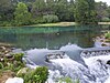
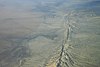
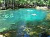
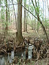
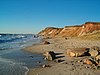
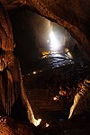
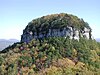
Prospective sites for NNL designation are terrestrial and aquatic ecosystems; geological features, exposures, and landforms that record active geological processes or portions of earth history; and fossil evidence of biological evolution. Each major natural history "theme" can be further subdivided into various sub-themes. For example, sub-themes suggested in 1972 for the overall theme "Lakes and ponds" included large deep lakes, large shallow lakes, lakes of complex shape, crater lakes, kettle lake and potholes, oxbow lakes, dune lakes, sphagnum-bog lakes, lakes fed by thermal streams, tundra lakes and ponds, swamps and marshy areas, sinkhole lakes, unusually productive lakes, and lakes of high productivity and high clarity.

Ownership

The NNL program does not require designated properties to be owned by public entities. Lands under almost all forms of ownership or administration have been designated—federal, state, local, municipal, and private. Federal lands with NNLs include those administered by the National Park Service, U.S. Forest Service, Bureau of Land Management, Bureau of Reclamation, Fish and Wildlife Service, Air Force, Marine Corps, Army Corps of Engineers, Navy, and others.

Some NNL have been designated on lands held by Native Americans or tribes. NNLs also have been designated on state lands that cover a variety of types and management, such as forest, park, game refuge, recreation area, and preserve. Private lands with NNLs include those owned by universities, museums, scientific societies, conservation organizations, land trusts, commercial interests, and private individuals. Approximately 52% of NNLs are administered by public agencies, more than 30% are entirely privately owned, and the remaining 18% are owned or administered by a mixture of public agencies and private owners.

Access

Participation in the NNL Program carries no requirements regarding public access. The NNL registry includes many sites of national significance that are open for public tours, but others are not. Since many NNLs are located on federal and state property, permission to visit is often unnecessary. Some private properties may be open to public visitation or just require permission from the site manager. On the other hand, some NNL private landowners desire no visitors whatsoever and might even prosecute trespassers. The reasons for this viewpoint vary: potential property damage or liability, fragile or dangerous resources, and desire for solitude or no publicity.

Property status

NNL designation is an agreement between the property owner and the federal government. NNL designation does not change ownership of the property nor induce any encumbrances on the property. NNL status does not transfer with changes in ownership.

Participation in the NNL Program involves a voluntary commitment on the part of the landowner(s) to retain the integrity of their NNL property as it was when designated. If "major" habitat or landscape destruction is planned, participation in the NNL Program by a landowner would be disingenuous and meaningless.

The federal action of designation imposes no new land use restrictions that were not in effect before the designation. It is conceivable that state or local governments of their own volition could initiate regulations or zoning that might apply to an NNL. However, as of 2005 no examples of such a situation have been identified. Some states require planners to ascertain the location of NNLs.
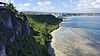
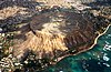
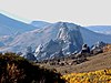
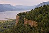
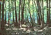
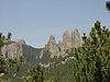
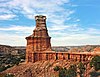
List of landmarks

Listed by state or territory in alphabetical order. As of January 2021, there were 602 listings. [2]

State or territoryNumber of landmarksNumber, non-duplicatedEarliest declaredLatest declaredImage
1 Alabama 77October 1971November 1987 Bottle Creek.jpg
2 Alaska 161619671976 Aniakchak-caldera alaska.jpg
3 American Samoa 7719721972 Fagatogo Dock.jpg
4 Arizona 101019652011 Barringer Crater aerial photo by USGS.jpg
5 Arkansas 5519721976 Mammoth spring (47).JPG
6 California 37371964January 2021 Kluft-photo-Carrizo-Plain-Nov-2007-Img 0327.jpg
7 Colorado 1615 [note 2] 1964January 2021 2006-07-16 Summit Lake Park Colorado.jpg
8 Connecticut 87 [note 3] April 1968November 1973 Dinosaur State Park (Rocky Hill, CT) - prints.JPG
9 Delaware 0
10 Florida 1818March 1964May 1987 Manatee Springs State Park Florida springs05.jpg
11 Georgia 11111966April 2013 OkefenokeeCanalDiggersTrail.wmg.jpg
12 Guam 4419721972 Puntan Dos Amantes (Two Lovers Point) in Guam in June 2017.jpg
13 Hawaii 77June 1971December 1972 Diamond-Head-Hawaii-Nov-2001.jpg
14 Idaho 111119681980 City of rocks view NPS.jpg
15 Illinois 181819651987 Illinois Beach State Park Lakefront.jpg
16 Indiana 3029 [note 4] 19651986 Marengo Cave formations.JPG
17 Iowa 7719651987 Iowa loesshills.jpg
18 Kansas 5519681980 Rockcityks.JPG
19 Kentucky 76 [note 4] 19662009 Daniel Boone National Forest Tater Knob.jpg
20 Louisiana 0
21 Maine 141419661984 Katahdin.jpg
22 Maryland 65 [note 5] 19641980 BattleCreekCypressSwamp3.JPG
23 Massachusetts 1110 [note 3] October 1971November 1987 Gay Head cliffs MV.JPG
24 Michigan 1212 [4] 19671984 Porcupine Mountains.jpg
25 Minnesota 87 [note 6] 19651980 Lake Itasca Mississippi Source.jpg
26 Mississippi 5519651976 Petrified Forest.jpg
27 Missouri 1616June 1971May 1986 Marvel Cave.JPG
28 Montana 101019661980 Orillas fosiles del lago Missoula.jpg
29 Nebraska 5519642006 Sand Hills Nebraska.jpg
30 Nevada 6619681973 Valley of Fire Nevada11.jpg
31 New Hampshire 111119711987 2007 11Nov 10 Mount Monadnock Summit Rocky Plateau.jpg
32 New Jersey 1110 [note 7] October 1965June 1983 Great Falls (Passaic River).jpg
33 New Mexico 121219691982 Shiprock.snodgrass3.jpg
34 New York 2826 [note 7] [note 8] March 1964July 2014 Round Lake (2) - Fayetteville NY.jpg
35 North Carolina 131319671983 Pilot Mtn Knob 2.JPG
36 North Dakota 4419601975
37 Northern Mariana Islands 0
38 Ohio 232319651980 Cedar Bog Ohio Trail.JPG
39 Oklahoma 33December 1974June 1983
40 Oregon 11111966June 2016 Vistahouse.jpg
41 Pennsylvania 2727March 1964January 2009 Hawk Mountain Sanctuary, PA - North Lookout.jpg
42 Puerto Rico 5519751980 Cabo Rojo limestone cliffs.jpg
43 Rhode Island 11May 1974May 1974 Ell Pond-Rhode Island kettle hole.jpeg
44 South Carolina 66May 1974May 1986 SC Congaree Swamp River.jpg
45 South Dakota 1312 [note 6] 19651980 The Needles in Custer State Park, South Dakota.jpg
46 Tennessee 131319661974 Black-mountain-slopes-east-tn1.jpg
47 Texas 202019652009 Palodurolighthouse.jpg
48 Utah 44October 19651977 Cleveland Lloyd Dinosaur Quarry entrance.jpg
49 Vermont 1211 [note 8] 19672009 Mount mansfield 20040926.jpg
50 Virgin Islands 7719801980 Salt-River-Bay-1.jpg
51 Virginia 101019651987 Photo of the Week - Great Dismal Swamp National Wildlife Refuge (VA) (4578425529).jpg
52 Washington 181819652011 3-Devils-grade-Moses-Coulee-Cattle-Feed-Lot-PB110016.JPG
53 Washington D.C. 0
54 West Virginia 1615 [note 5] 19642021 GermanyValley.wmg.jpg
55 Wisconsin 18181964May 2012 WyalusingStateParkWisconsinRiverIntoMississippiRiver.jpg
56 Wyoming 65 [note 2] October 1965December 1984 Como Bluff.jpg

See also

Notes

  1. This step was dropped after 1979 but was reinstituted in 1999.
  2. 1 2 Sand Creek shared between Colorado and Wyoming
  3. 1 2 Bartholomew's Cobble shared between Connecticut and Massachusetts
  4. 1 2 Ohio Coral Reef shared between Indiana and Kentucky
  5. 1 2 Cranesville Swamp Nature Sanctuary shared between Maryland and West Virginia
  6. 1 2 Ancient River Warren Channel shared between Minnesota and South Dakota
  7. 1 2 Palisades of the Hudson shared between New Jersey and New York
  8. 1 2 Chazy Fossil Reef shared between Vermont and New York

Related Research Articles

The National Register of Historic Places (NRHP) is the United States federal government's official list of districts, sites, buildings, structures, and objects deemed worthy of preservation for their historical significance or "great artistic value". A property listed in the National Register, or located within a National Register Historic District, may qualify for tax incentives derived from the total value of expenses incurred in preserving the property.

<span class="mw-page-title-main">National Historic Landmark</span> Designation by the US government

A National Historic Landmark (NHL) is a building, district, object, site, or structure that is officially recognized by the United States government for its outstanding historical significance. Only some 2,500, or roughly three percent, of over 90,000 places listed on the country's National Register of Historic Places are recognized as National Historic Landmarks.

<span class="mw-page-title-main">Protected areas of the United States</span> Legally protected land, eg national parks

The protected areas of the United States are managed by an array of different federal, state, tribal and local level authorities and receive widely varying levels of protection. Some areas are managed as wilderness, while others are operated with acceptable commercial exploitation. As of 2022, the 42,826 protected areas covered 1,235,486 km2 (477,024 sq mi), or 13 percent of the land area of the United States. This is also one-tenth of the protected land area of the world. The U.S. also had a total of 871 National Marine Protected Areas, covering an additional 1,240,000 sq mi (3,200,000 km2), or 26 percent of the total marine area of the United States.

The Forest Legacy Program was established in the 1990 United States farm bill to protect environmentally important forest lands that are threatened by conversion to nonforest uses. It provides federal funding for conservation easements and fee simple purchases.

The Historic Preservation Fund (HPF) provides financial support for historic preservation projects throughout the United States. The fund is administered by the National Park Service (NPS), pursuant to the National Historic Preservation Act of 1966 (NHPA). The fund provides state historic preservation agencies with matching funds to implement the act.

Lake Agassiz Peatlands Natural Area is a 25,411-acre (10,283 ha) National Natural Landmark located in Koochiching County, Minnesota. Designated in November 1965 under the Historic Sites Act, its ownership and oversight are provided by the National Park Service of the United States. This designation from the United States Secretary of the Interior, gives it recognition as an outstanding example of the nation's natural history. The designation describes it as

An example of the extensive peatlands occupying the bed of ancient glacial Lake Agassiz, illustrating the process of peat accumulation over about 11,000 years. The area contains Myrtle Lake Bog, which developed contrary to the usual successional process of lake filling, and is an excellent example of both raised and string bogs.

References

  1. "National Natural Landmarks Program". National Park Service. Retrieved June 7, 2021.
  2. 1 2 "High Plateaus, Smelly Caverns, and Coastal Dunes, Meet the Nation's Newest Natural Landmarks". National Park Service. Retrieved April 18, 2021.
  3. "National Natural Landmarks Program; Final Rule 36 CFR 62," Federal Register Vol. 64, No. 91, Wednesday, May 12, 1999, pp. 25708-25723.
  4. Roscommon Red Pines, Department of Natural Resources.