List of National Natural Landmarks in Missouri

Last updated

Map all coordinates using: OpenStreetMap  
Download coordinates as: KML

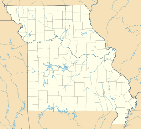
From List of National Natural Landmarks, these are the National Natural Landmarks in Missouri. There are 16 in total.

NameImageDateLocationCountyOwnershipDescription
1 Big Oak Tree State Park Big Oak Tree State Park Boardwalk.JPG May 1986 East Prairie 36°39′18″N89°19′42″W / 36.655°N 89.32833°W / 36.655; -89.32833 (Big Oak Tree State Park) Mississippi stateA rare untouched wet-mesic bottomland hardwood forest in the Mississippi Alluvial Plain, it is the home of several state and national champion trees
2 Carroll Cave 1977 Camden privateContains a dendritic system of subsurface karst streams and tributaries.
3 Cupola Pond 1974 Ripley federalOne of the most ancient sinkhole ponds in the Ozark plateaus. Located in Mark Twain National Forest.
4 Golden Prairie BS pale purple conflower at sunrise 6 Golden Prairie 6-2011.JPG 1975 Golden City 37°21′45″N94°09′01″W / 37.36261°N 94.15019°W / 37.36261; -94.15019 (Golden Prairie) Barton privateAn unplowed remnant of the tall grass prairie ecosystem.
5 Grand Gulf State Park Grand Gulf cave 1-02Aug07.jpg June 1971 Thayer 36°31′27″N91°32′38″W / 36.52427°N 91.54389°W / 36.52427; -91.54389 (Grand Gulf State Park) Oregon stateAn excellent example of karst topography, this canyon is a collapsed dolomite cave with a 200 feet (61 m) natural bridge. Water in this canyon emerges 9 miles (14 km) away in Mammoth Spring, Arkansas.
6 Greer Spring Greer Spring-Oct2013-067.jpg 1980 36°47′12″N91°20′51″W / 36.786667°N 91.3475°W / 36.786667; -91.3475 (Greer Spring) Oregon privateSpring in the Ozarks that discharges into a high quality, cascading stream.
7 Maple Woods Natural Area 1980 Clay stateContains a nearly virgin sugar maple and mockernut hickory forest.
8 Maramec Spring Maramec Iron Works furnace a.jpg October 1971 St. James 37°57′19″N91°32′11″W / 37.95526°N 91.53632°W / 37.95526; -91.53632 (Maramec Spring) Phelps privateA natural spring, the fifth largest in the state. It has a notable trout park and a historic iron works in a privately owned park.
9 Mark Twain and Cameron Caves JesseJamesHideout.jpg 1972 39°41′19″N91°19′54″W / 39.68864°N 91.33153°W / 39.68864; -91.33153 (Mark Twain Cave) Marion privateExceptionally good examples of the maze type of cavern development.
10 Marvel Cave Marvel Cave.JPG 1972 36°40′03″N93°20′23″W / 36.6675°N 93.3397°W / 36.6675; -93.3397 (Marvel Cave) Stone privateIncludes one of the greatest dripstone units of all the Ozark caves.
11 Onondaga Cave State Park Onondaga Cave lily pad room by stannate.jpg 1980 38°03′39″N91°13′38″W / 38.060833°N 91.227222°W / 38.060833; -91.227222 (Onondaga Cave State Park) Crawford stateContains an unusually large and varied number of speleothems.
12 Pickle Springs 1975 Ste. Genevieve stateContains one of the finest Pleistocene relict habitats in Missouri.
13 Taberville Prairie Conservation Area Taberville Prairie Conservation Area.jpg 1975 St. Clair stateOne of the largest remaining virgin tall grass prairies.
14 Tucker Prairie 1975 Callaway privateA virgin tall grass prairie occurring within the transition zone between the oak-hickory forest and typical tall grass prairie.
15 Tumbling Creek Cave 1980 Taney privateContains the most diverse fauna known for any cave west of the Mississippi River.
16 Wegener Woods 1975 Warren privateAn essentially virgin oak-hickory-dominated forest in a condition of gradual change to a sugar maple-dominated forest.

Related Research Articles

<span class="mw-page-title-main">Mammoth Spring</span> Spring in Arkansas

Mammoth Spring is a large, first magnitude karst spring that arises in the Ozark Plateau within the state of Arkansas. It is the largest spring in Arkansas and the third-largest spring within the Ozark Plateau region behind Big Spring and Greer Spring. Mammoth Spring is the seventh-largest natural spring in the world.

<span class="mw-page-title-main">Sam's Point Preserve</span>

Sam's Point Preserve, or Sam's Point Dwarf Pine Ridge Preserve, is a 4,600-acre (19 km2) preserve in Ulster County on the highest point of the Shawangunk Ridge in New York, on the Wawarsing, New York-Shawangunk town line. It is owned and managed by the New York State Office of Parks, Recreation and Historic Preservation after having previously been managed by The Nature Conservancy. Its unique environment features dwarf pitch pine trees along the ridgetop. Located within the park is Lake Maratanza, the highest lake on the ridge, and the Ellenville Fault Ice Caves.

<span class="mw-page-title-main">Cathedral Caverns State Park</span> State park in Alabama, United States

Cathedral Caverns State Park is a public recreation area and natural history preserve located in Kennamer Cove, Alabama, approximately 5 miles (8.0 km) northeast of Grant and 7 miles (11 km) southeast of Woodville in Marshall County. The park, first known as Bats Cave, was developed as a tourist attraction in the 1950s. Cathedral Caverns was declared a National Natural Landmark in 1972 and opened as a state park in 2000.

<span class="mw-page-title-main">Pictograph Cave (Billings, Montana)</span> United States historic place

Pictograph Cave is an area of three caves located 5 miles (8.0 km) south of Billings, Montana, United States, preserved and protected in the 23-acre (9.3 ha) Pictograph Cave State Park.

<span class="mw-page-title-main">Mississippi Palisades State Park</span> State park in Illinois, USA

Mississippi Palisades State Park is a National Natural Landmark located in Carroll County, Illinois, just north of the town of Savanna. It is a partially conserved section of the Mississippi Palisades. The area contains many caves and large cliffs along the Mississippi River at the mouth of the Apple River in the Driftless Area of far northwestern Illinois.

Cold Water Spring State Preserve is a 60-acre (240,000 m2) parcel state preserve protecting a spring that issues from Cold Water Cave, an extensive cave system in Winneshiek County, Iowa and Fillmore County, Minnesota. The spring is a tributary of the Upper Iowa River.

<span class="mw-page-title-main">Big Bone Cave</span>

(Big) Bone Cave is a cave located in Van Buren County, Tennessee, in the community of Bone Cave that is named after it. It is notable both for its history and current recreational use. It is listed on the National Register of Historic Places and a designated National Natural Landmark. It is a 400-acre (161.9 ha) State Natural Area managed by Rock Island State Park. It is named for the discovery of the bones of a giant ground sloth in 1811. The cave was operated as a saltpeter mine, notably during the War of 1812 and the American Civil War. A variety of natural remains and human artifacts have been well preserved in the dry atmosphere of the cave. The cave is the 10th longest mapped cave in Tennessee.

<span class="mw-page-title-main">Cave-in-Rock State Park</span> State park in Illinois, United States

Cave-In-Rock State Park is an Illinois state park, on 204 acres (0.83 km2), in the town of Cave-in-Rock, Hardin County, Illinois in the United States. The state park contains the historic Cave-In-Rock, a landmark of the Ohio River. It is maintained by the Illinois Department of Natural Resources (IDNR).

Shawnee Cave is located in Spring Mill State Park in the state of Indiana. Access to the cave is controlled by the Indiana Department of Natural Resources.

<span class="mw-page-title-main">Longhorn Cavern State Park</span> State park in Texas, United States

Longhorn Cavern State Park is a state park located in Burnet County, Texas, United States. The Texas Parks and Wildlife Department is administrator of the facility. The land for Longhorn Cavern State Park was acquired between 1932 and 1937 from private owners. It was dedicated as a state park in 1932 and in 1938 was opened to the public. In 1971, the cavern was dedicated as a National Natural Landmark. The park's administration building was listed as a Recorded Texas Historic Landmark in 1989.

<span class="mw-page-title-main">Onondaga Cave State Park</span> State park in Missouri, United States

Onondaga Cave State Park is a Missouri state park located on the Meramec River approximately 5 miles (8.0 km) southeast of the village of Leasburg. The park was established in 1982. Park activities include cave tours, camping, fishing, hiking, picnicking, and swimming.

<span class="mw-page-title-main">Grand Gulf State Park (Missouri)</span> State park in Missouri, United States

Grand Gulf State Park is a state-operated, privately owned and publicly accessible, geologic preserve near Thayer, Missouri, United States, encompassing a forked canyon that is the remnant of an ancient collapsed dolomite cave system. The land that is now the park was acquired by conservationist Leo Drey (1917–2015) before becoming part of the Missouri state parks system. The 322-acre (130 ha) state park has been operated by the Missouri Department of Natural Resources under a lease agreement with the L-A-D Foundation since 1984. Grand Gulf was declared a National Natural Landmark in 1971 as an excellent example of karst topography and underground stream piracy. A 60-acre (24 ha) portion of the park was designated by the state as the Grand Gulf Natural Area in 1986.

The Lost River is a river that rises in Vernon Township, Washington County, Indiana, and discharges into the East Fork of the White River in Lost River Township, Martin County, Indiana. The river's unusual hydrology has led to two of its features being named as National Natural Landmarks.

<span class="mw-page-title-main">Graham Cave</span> United States historic place

Graham Cave is a Native American archeological site near Mineola, Missouri in Montgomery County in the hills above the Loutre River. It is located in the 356 acre Graham Cave State Park. The entrance of the sandstone cave forms a broad arch 120 feet (37 m) wide and 16 feet (5 m) high. Extending about 100 feet (30 m) into the hillside, the cave protects an historically important Pre-Columbian archaeological site from the ancient Dalton and Archaic period dating back to as early as 10,000 years ago.

<span class="mw-page-title-main">Cedars of Lebanon State Park</span> State park in Tennessee, United States

Cedars of Lebanon State Park is a state park in Wilson County, Tennessee, in the southeastern United States. It consists of 900 acres (364 ha) situated amidst the 9,420-acre (3,810 ha) Cedars of Lebanon State Forest. The park and forest are approximately 10 miles (16 km) south of Lebanon, Tennessee.