List of National Natural Landmarks in Wisconsin

Last updated

Baraboo Range BarabooRangeFall2010WIS33.jpg
Baraboo Range

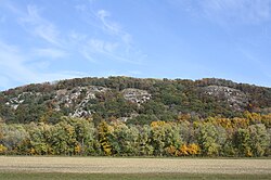
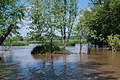
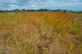
The National Natural Landmarks (NNLs) in Wisconsin include 18 of the almost 600 such landmarks in the United States. [1] They cover areas of geological, biological and historical importance, and include dune and swales, swamps, bogs, and virgin forests. [1] Several of the sites provide habitat for rare or endangered plant and animal species. The Driftless Area in southwest Wisconsin is known for its rare species, especially in the Baraboo Range. [1] Owners include private individuals, Native American tribes, and several county, state and federal agencies. [1] These landmarks were designed between 1967 and 1987. [1] They vary in size between 44 and 53,531 acres (18 and 21,663 hectares). [1]

Contents

The National Natural Landmarks Program is administered by the National Park Service, a branch of the Department of the Interior. The National Park Service determines which properties meet NNL criteria and, after notifying the owners, makes nomination recommendations. The Secretary of the Interior reviews nominations and, based on a set of predetermined criteria, makes a decision on NNL designation or a determination of eligibility for designation. Both public and privately owned properties can be designated as NNLs. Owners may object to the nomination of the property as a NNL. [2] This designation provides indirect, partial protection of the historic integrity of the properties via tax incentives, grants, monitoring of threats, and other means. [3]

National Natural Landmarks

NameImageDateLocationCountySize (acres)OwnershipDescription
Abraham's Woods
Abraham's Woods.jpg
1973 42°40′58″N89°29′2″W / 42.68278°N 89.48389°W / 42.68278; -89.48389 (Abraham's Woods) Green 44stateA remnant of regional climax maple-basswood forest.
Avoca River-Bottom Prairie
Avoca River-Bottom Prairie.jpg
1980 43°12′3″N90°18′17″W / 43.20083°N 90.30472°W / 43.20083; -90.30472 (Avoca River-Bottom Prairie) Iowa 762stateThe largest intact prairie in Wisconsin.
Baraboo Range
BarabooRangeFall2010WIS33.jpg
1980 43°25′30″N89°39′20″W / 43.42500°N 89.65556°W / 43.42500; -89.65556 (Baraboo Range) Columbia / Sauk 53,531state, privateAn example of an exhumed mountain range.
Bose Lake Hemlock Hardwoods
Bose Lake Hemlock Hardwoods NPS.jpg
1980 45°55′56″N88°58′19″W / 45.93222°N 88.97194°W / 45.93222; -88.97194 (Bose Lake Hemlock Hardwoods) Forest 62federalThe best virgin stand of hemlock in Wisconsin. Part of Chequamegon-Nicolet National Forest.
Cave of the Mounds
CaveoftheMounds.jpg
1987 43°1′5″N89°48′58″W / 43.01806°N 89.81611°W / 43.01806; -89.81611 (Cave of the Mounds) Dane 63privateCave richly decorated with cave formations of most known varieties.
Cedarburg Bog
Ced-Bog lake June2013.jpg
1973 43°23′14″N88°0′27″W / 43.38722°N 88.00750°W / 43.38722; -88.00750 (Cedarburg Bog) Ozaukee 2817state, privateThe largest and most outstanding bog in southeastern Wisconsin.
Chippewa River Bottoms
1973 Buffalo 8086federal, stateThe largest single stand of bottomland hardwood forest along the once widespread post-glacial forest.
Chiwaukee Prairie
Chiwaukee Prairie.jpg
1973 42°33′18″N88°49′0″W / 42.55500°N 88.81667°W / 42.55500; -88.81667 (Chiwaukee Prairie) Kenosha 485state, privateThe best remaining wet prairie in Wisconsin along the shore of Lake Michigan.
Finnerud Forest Scientific Area
Finnerud Forest Scientific Area NPS.jpg
1973 45°51′29″N89°44′53″W / 45.85806°N 89.74806°W / 45.85806; -89.74806 (Finnerud Forest Scientific Area) Oneida 117stateAn excellent representative of the northern coniferous forest complex.
Flambeau River Hemlock-Harwood Forest
Flambeau River State Forest.jpg
1973 45°44′54″N90°45′51″W / 45.74833°N 90.76417°W / 45.74833; -90.76417 (Flambeau River Hemlock-Harwood Forest) Price / Sawyer 391stateThe best and largest remnant of old-growth conifer-hardwood forest in Wisconsin.
Kakagon Sloughs
Kakagon Sloughs.jpg
1973 46°39′44″N90°44′28″W / 46.66222°N 90.74111°W / 46.66222; -90.74111 (Kakagon Sloughs) Ashland 2932 Bad River Tribe, PrivateOne of the finest marsh complexes on the upper Great Lakes.
Kickapoo River Natural Area
1975 43°53′53″N90°27′27″W / 43.89806°N 90.45750°W / 43.89806; -90.45750 (Kickapoo River Natural Area) Vernon 5841federal, stateThe largest undisturbed concentration of exposed seeping sandstone in Wisconsin. Flora and river meanderings typical of the Driftless Area
Moquah Barrens Research Natural Area
Moquah Barrens Research Natural Area NNL.jpg
1980 46°37′35″N91°15′0″W / 46.62639°N 91.25000°W / 46.62639; -91.25000 (Moquah Barrens) Bayfield 632federal
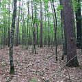
Representative of the jack pine-scrub oak barrens (savannas) of the glacial outwash area. Found in the Chequamegon National Forest of northwestern Wisconsin.
Point Beach Ridges
Point Beach Ridges.jpg
1980 44°12′49″N87°30′55″W / 44.21361°N 87.51528°W / 44.21361; -87.51528 (Point Beach Ridges) Manitowoc 151stateAlternating ridges and swales formed by previous water levels of Lake Michigan.
The Ridges Sanctuary
TheRidgesBaileysHarbor.jpg
1967 45°4′22″N87°7′7″W / 45.07278°N 87.11861°W / 45.07278; -87.11861 (The Ridges Sanctuary) Door 2281federal, stateA series of sand ridges and swales with associated boreal forest and bog vegetation.
Spruce Lake Bog
Spruce Lake Bog at a Creek Entrance.jpg
1967 43°40′14″N88°12′4″W / 43.67056°N 88.20111°W / 43.67056; -88.20111 (Spruce Lake Bog) Fond du Lac 162state, privateA superb, unspoiled example of a northern bog.
Summerton Bog
Summerton Bog.jpg
1973 43°45′3″N89°31′23″W / 43.75083°N 89.52306°W / 43.75083; -89.52306 (Summerton Bog) Marquette 266privateAn undisturbed and floristically diverse area providing habitat for many rare plant and animal species.
Wyalusing Hardwood Forest
WyalusingStateParkWisconsinRiverIntoMississippiRiver.jpg
1973 42°58′47″N91°6′31″W / 42.97972°N 91.10861°W / 42.97972; -91.10861 (Wyalusing Hardwood Forest) Grant 214stateContains several rare plant species and abundant wildlife, including some endangered species.
Source: [1]

See also

References

  1. 1 2 3 4 5 6 7 "Wisconsin". National Park Service. June 28, 2012. Retrieved June 1, 2014.
  2. "36 CFR Part 62: National Natural Landmarks Program, Final Rule" (PDF). Federal Register. May 12, 1999. Archived from the original (PDF) on October 15, 2011. Retrieved March 1, 2014.
  3. "Frequently Asked Questions". National Park Service. Retrieved March 1, 2014.