Kenosha County | |
---|---|
Coordinates: 42°34′22″N87°50′23″W / 42.5728°N 87.83981°W | |
Country | United States |
State | Wisconsin |
Founded | January 30, 1850 |
Seat | Kenosha |
Largest city | Kenosha |
Area | |
• Total | 754 sq mi (1,950 km2) |
• Land | 272 sq mi (700 km2) |
• Water | 482 sq mi (1,250 km2) 64% |
Population (2020) | |
• Total | 169,151 |
• Density | 224.3/sq mi (86.6/km2) |
Time zone | UTC−6 (Central) |
• Summer (DST) | UTC−5 (CDT) |
Congressional district | 1st |
Website | www |
Kenosha County is located in the southeastern corner of the U.S. state of Wisconsin. The population was 169,151 as of the 2020 census, making it the eighth most populous county in Wisconsin. [1] [2] The county shares the same name as its county seat, the city of Kenosha, [3] the fourth largest city in Wisconsin. [1] Kenosha County is part of the Chicago metropolitan area, the fourth most-populous metropolitan area in North America. Kenosha County is situated on the southwestern shore of Lake Michigan.
The county has a direct rail link to Chicago via Metra's Union Pacific / North Line. Since 2000, the county saw a population increase of 12.6%, higher than the overall Wisconsin growth of 6.0%. [4] According to Business Insider, Kenosha County is an exurb and benefits as part of the Chicago metropolitan area. [5] In 2022, Kenosha County was ranked 16th out of 72 Wisconsin counties for tourism revenue, at $424 million in 2022; a 13.6% increase over 2021. Kenosha County's previous record level was in 2019 at $391 million. [6]
The Potowatomi inhabited the area that would become Kenosha County for centuries prior to the acquisition of the area in 1833. The city of Kenosha was founded in 1835, and Kenosha County was formed from Racine County on January 30, 1850. [7] Its location led to development and factories being built in the 19th century. Manufacturing continued to be a key component of the economy into the 20th century. [8]
According to the U.S. Census Bureau, the county has a total area of 754 square miles (1,950 km2), of which 272 square miles (700 km2) is land and 482 square miles (1,250 km2) (64%) is water. [9] Although the county contains area from Lake Michigan, it is the fourth-smallest county in Wisconsin by land area. [10]
Kenosha Regional Airport (KENW) serves the county and surrounding communities.
Census | Pop. | Note | %± |
---|---|---|---|
1850 | 10,734 | — | |
1860 | 13,900 | 29.5% | |
1870 | 13,147 | −5.4% | |
1880 | 13,550 | 3.1% | |
1890 | 15,581 | 15.0% | |
1900 | 21,707 | 39.3% | |
1910 | 32,929 | 51.7% | |
1920 | 51,284 | 55.7% | |
1930 | 63,277 | 23.4% | |
1940 | 63,505 | 0.4% | |
1950 | 75,238 | 18.5% | |
1960 | 100,615 | 33.7% | |
1970 | 117,917 | 17.2% | |
1980 | 123,137 | 4.4% | |
1990 | 128,181 | 4.1% | |
2000 | 149,577 | 16.7% | |
2010 | 166,426 | 11.3% | |
2020 | 169,151 | 1.6% | |
2023 (est.) | 167,488 | [11] | −1.0% |
U.S. Decennial Census [12] 1790–1960 [13] 1900–1990 [14] 1990–2000 [15] 2010–2020 [16] 2020 census [2] |
As of the census [17] of 2000, there were 149,577 people, 56,057 households, and 38,455 families residing in the county. The population density was 548 people per square mile (212 people/km2). There were 59,989 housing units at an average density of 220 units per square mile (85 units/km2). The racial makeup of the county was 88.38% White, 5.08% Black or African American, 0.38% Native American, 0.92% Asian, 0.04% Pacific Islander, 3.29% from other races, and 1.91% from two or more races. 7.19% of the population were Hispanic or Latino of any race. 28.8% were of German, 10.4% Italian, 7.9% Irish, 7.6% Polish and 7.5% English ancestry.
There were 56,057 households, out of which 34.80% had children under the age of 18 living with them, 52.70% were married couples living together, 11.50% had a female householder with no husband present, and 31.40% were non-families. 25.50% of all households were made up of individuals, and 9.10% had someone living alone who was 65 years of age or older. The average household size was 2.60 and the average family size was 3.13.
In the county, the population was spread out, with 27.10% under the age of 18, 9.40% from 18 to 24, 31.30% from 25 to 44, 20.70% from 45 to 64, and 11.50% who were 65 years of age or older. The median age was 35 years. For every 100 females, there were 98.30 males. For every 100 females age 18 and over, there were 95.30 males.
In 2017, there were 1,873 births, giving a general fertility rate of 55.7 births per 1000 women aged 15–44, the 13th lowest rate out of all 72 Wisconsin counties. [18]
The county legislature is known as the Board of Supervisors. It consists of 23 members, each elected from single-member districts. The county executive is elected in a spring countywide, nonpartisan vote. The county executive is Samantha Kerkman. [19] The district attorney, treasurer, clerk, and register of deeds are elected in fall countywide, partisan elections held in presidential years, while the sheriff and clerk of circuit court are elected in fall countywide, partisan elections held in gubernatorial years.
In presidential elections, Kenosha County has voted Democratic for most of the past century. In 2016, Donald Trump became the first Republican presidential candidate to win the county since President Nixon in 1972. Trump won it again in 2020, this time with an outright majority of the vote, marking the first consecutive victories for the GOP in Kenosha County since 1928.
Year | Republican | Democratic | Third party | |||
---|---|---|---|---|---|---|
No. | % | No. | % | No. | % | |
2020 | 44,972 | 50.68% | 42,193 | 47.55% | 1,573 | 1.77% |
2016 | 36,037 | 47.23% | 35,799 | 46.92% | 4,468 | 5.86% |
2012 | 34,977 | 43.24% | 44,867 | 55.46% | 1,053 | 1.30% |
2008 | 31,609 | 40.12% | 45,836 | 58.18% | 1,344 | 1.71% |
2004 | 35,587 | 46.56% | 40,107 | 52.48% | 734 | 0.96% |
2000 | 28,891 | 45.35% | 32,429 | 50.90% | 2,389 | 3.75% |
1996 | 18,296 | 34.06% | 27,964 | 52.06% | 7,457 | 13.88% |
1992 | 19,854 | 32.11% | 27,341 | 44.21% | 14,642 | 23.68% |
1988 | 21,661 | 41.55% | 30,089 | 57.72% | 379 | 0.73% |
1984 | 26,118 | 46.89% | 29,233 | 52.49% | 344 | 0.62% |
1980 | 24,481 | 43.82% | 26,738 | 47.86% | 4,644 | 8.31% |
1976 | 22,349 | 43.61% | 27,585 | 53.82% | 1,316 | 2.57% |
1972 | 24,041 | 53.93% | 19,441 | 43.61% | 1,094 | 2.45% |
1968 | 17,089 | 40.57% | 21,427 | 50.86% | 3,610 | 8.57% |
1964 | 14,764 | 32.55% | 30,522 | 67.29% | 70 | 0.15% |
1960 | 19,969 | 46.43% | 22,956 | 53.37% | 86 | 0.20% |
1956 | 21,367 | 55.08% | 17,094 | 44.06% | 335 | 0.86% |
1952 | 18,917 | 48.72% | 19,768 | 50.91% | 142 | 0.37% |
1948 | 12,780 | 39.80% | 17,987 | 56.02% | 1,342 | 4.18% |
1944 | 12,436 | 39.96% | 18,325 | 58.88% | 360 | 1.16% |
1940 | 12,182 | 40.91% | 17,174 | 57.68% | 421 | 1.41% |
1936 | 7,268 | 26.68% | 18,137 | 66.57% | 1,840 | 6.75% |
1932 | 7,307 | 30.57% | 14,373 | 60.13% | 2,223 | 9.30% |
1928 | 11,330 | 50.66% | 10,638 | 47.57% | 395 | 1.77% |
1924 | 10,341 | 55.45% | 1,517 | 8.13% | 6,791 | 36.41% |
1920 | 9,791 | 77.81% | 1,724 | 13.70% | 1,069 | 8.49% |
1916 | 3,537 | 50.99% | 2,813 | 40.55% | 587 | 8.46% |
1912 | 1,671 | 27.21% | 2,216 | 36.09% | 2,254 | 36.70% |
1908 | 3,409 | 54.50% | 2,006 | 32.07% | 840 | 13.43% |
1904 | 3,293 | 60.86% | 1,592 | 29.42% | 526 | 9.72% |
1900 | 3,078 | 58.37% | 2,101 | 39.84% | 94 | 1.78% |
1896 | 2,827 | 60.54% | 1,732 | 37.09% | 111 | 2.38% |
1892 | 1,628 | 44.71% | 1,928 | 52.95% | 85 | 2.33% |
Washburn County is a county in the U.S. state of Wisconsin. It is named after Governor Cadwallader C. Washburn. As of the 2020 census, the population was 16,623. Its county seat is Shell Lake. The county was created in 1883.
Walworth County is a county located in the U.S. state of Wisconsin. As of the 2020 census, the population was 106,478. Its county seat is Elkhorn. The county was created in 1836 from Wisconsin Territory and organized in 1839. It is named for Reuben H. Walworth. Walworth County comprises the Whitewater-Elkhorn, WI Micropolitan Statistical Area and is included in the Milwaukee-Racine-Waukesha, WI Combined Statistical Area. Lake Geneva, the University of Wisconsin-Whitewater, and Alpine Valley Resort, and Music Theatre are located in Walworth County.
Vilas County is a county in the state of Wisconsin, United States. As of the 2020 census, the population was 23,047. Its county seat is Eagle River. The county partly overlaps the reservation of the Lac du Flambeau Band of Lake Superior Chippewa.
Sheboygan County is a county in the U.S. state of Wisconsin. It is named after the Sheboygan River. As of the 2020 census, the population was 118,034. Its county seat is Sheboygan. The county was created in 1836 and organized in 1846. At the time, it was located in the Wisconsin Territory. Sheboygan County comprises the Sheboygan, WI Metropolitan Statistical Area. Part of the Holyland region is located in northwestern Sheboygan County.
Sawyer County is a county in the U.S. state of Wisconsin. As of the 2020 census, its population was 18,074. Its county seat is Hayward. The county partly overlaps with the reservation of the Lac Courte Oreilles Band of Lake Superior Chippewa Indians.
Racine County is a county in southeastern Wisconsin. As of the 2020 census, its population was 197,727, making it Wisconsin's fifth-most populous county. Its county seat is Racine. The county was founded in 1836, then a part of the Wisconsin Territory. Racine County comprises the Racine metropolitan statistical area. This area is part of the Milwaukee-Racine-Waukesha combined statistical area. According to the U.S. Census Bureau, the county has an area of 792 square miles (2,050 km2), of which 333 square miles (860 km2) is land and 460 square miles (1,200 km2) (58%) is water. The county's unemployment rate was 5.6% in June 2021.
Pepin County is a county in the U.S. state of Wisconsin. As of the 2020 census, the population was 7,318, making it the fourth-least populous county in Wisconsin; it is also the smallest county in Wisconsin by area. Its county seat is Durand.
Oneida County is a county in the state of Wisconsin, United States. At the 2020 census, the population was 37,845. Its county seat is Rhinelander.
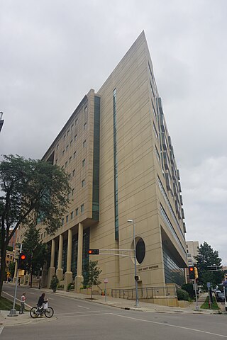
Milwaukee County is a county located in the U.S. state of Wisconsin. At the 2020 census, the population was 939,489, down from 947,735 in 2010. It is both the most populous and most densely populated county in Wisconsin, and the 45th most populous county nationwide; Milwaukee, its eponymous county seat, is also the most populous city in the state. The county was created in 1834 as part of Michigan Territory and organized the following year.
Menominee County is a county in the U.S. state of Wisconsin. As of the 2020 census, the population was 4,255, making it the least populous county in Wisconsin. Its county seat is in the community of Keshena.
Marathon County is a county located in the U.S. state of Wisconsin. As of the 2020 census, the population was 138,013. Its county seat is Wausau. It was founded in 1850, created from a portion of Portage County. At that time the county stretched to the northern border with the upper Michigan peninsula. It is named after the battlefield at Marathon, Greece.
Iowa County is a county in the U.S. state of Wisconsin. As of the 2020 census, the population was 23,709. Its county seat and largest city is Dodgeville. When created, it was part of the Michigan Territory. Iowa County is part of the Madison, Wisconsin, Metropolitan Statistical Area.
Green Lake County is a county located in the U.S. state of Wisconsin. As of the 2020 census, the population was 19,018. Its county seat is Green Lake. In 2020, the center of population of Wisconsin was located in Green Lake County, near the city of Markesan.
Fond du Lac County is a county in the U.S. state of Wisconsin. As of the 2020 census, the population was 104,154. Its county seat is Fond du Lac. The county was created in the Wisconsin Territory in 1836 and later organized in 1844. Fond du Lac is French for "bottom of the lake", given so because of the county's location at the southern shore of Lake Winnebago. Fond du Lac County comprises the Fond du Lac, Wisconsin Metropolitan Statistical Area. The Holyland region is in northeastern Fond du Lac County.
Florence County is a county located in the U.S. state of Wisconsin. As of the 2020 census, the population was 4,558, making it the second-least populous county in Wisconsin after Menominee County. Its county seat is Florence.
Dodge County is a county located in the U.S. state of Wisconsin. As of the 2020 census, the population was 89,396. Its county seat is Juneau. The county was created from the Wisconsin Territory in 1836 and organized in 1844.
Dane County is a county in the U.S. state of Wisconsin. As of the 2020 census, the population was 561,504, making it the second-most populous county in Wisconsin after Milwaukee County. The county seat is Madison, which is also the state capital. Dane County is the central county of the Madison metropolitan area, as well as the Madison–Janesville–Beloit combined statistical area.
Columbia County is a county located in the U.S. state of Wisconsin. As of the 2020 census, the population was 58,490. Its county seat and largest city is Portage. The county was created in 1846 as part of Wisconsin Territory.
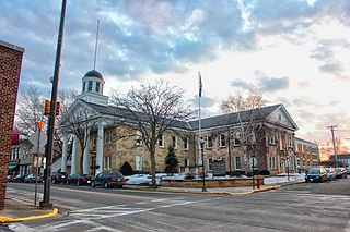
Barron County is a county located in the U.S. state of Wisconsin. As of the 2020 census, the population was 46,711. Its county seat is Barron. The county was created in 1859 and organized in 1874.
Lake Catherine is an unincorporated community and census-designated place (CDP) in Lake County, Illinois, United States. Per the 2020 census, the population was 1,279.