Somers (town), Wisconsin

Last updated

Somers, Wisconsin
WIMap-doton-Somers.png
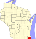
Location of Somers, Wisconsin
Coordinates: 42°36′07″N87°53′42″W / 42.60194°N 87.89500°W / 42.60194; -87.89500
Country Flag of the United States.svg  United States
State Flag of Wisconsin.svg  Wisconsin
County Kenosha
Elevation
[1]
669 ft (204 m)
Time zone UTC-6 (Central (CST))
  Summer (DST) UTC-5 (CDT)
Area code 262
FIPS code 55-059-74650
GNIS feature ID1584173 [1]

Somers is a town in Kenosha County, Wisconsin, United States. Prior to 2015, the town encompassed all of the village of Somers along with its current area. When the village was incorporated in 2015, the western part of the original town remained as part of the town; however, it was later incorporated into the village as well. The present town largely consists of land along or within the boundaries of Kenosha, and it is slated to become part of Kenosha by 2035. [2] [3] [4]

As of the 2020 census, the town of Somers had a population of 992, [5] compared to a population of 9,597 at the 2010 census, [6] prior to incorporation of the village of Somers.

Related Research Articles

<span class="mw-page-title-main">Racine County, Wisconsin</span> County in Wisconsin, United States

Racine County is a county in southeastern Wisconsin. As of the 2020 census, its population was 197,727, making it Wisconsin's fifth-most populous county. Its county seat is Racine. The county was founded in 1836, then a part of the Wisconsin Territory. Racine County comprises the Racine metropolitan statistical area. This area is part of the Milwaukee-Racine-Waukesha combined statistical area. According to the U.S. Census Bureau, the county has an area of 792 square miles (2,050 km2), of which 333 square miles (860 km2) is land and 460 square miles (1,200 km2) (58%) is water. The county's unemployment rate was 5.6% in June 2021.

<span class="mw-page-title-main">Kenosha County, Wisconsin</span> County in Wisconsin, United States

Kenosha County is located in the southeastern corner of the U.S. state of Wisconsin. The population was 169,151 as of the 2020 census, making it the eighth most populous county in Wisconsin. The county shares the same name as its county seat, the city of Kenosha, the fourth largest city in Wisconsin. Kenosha County is part of the Chicago metropolitan area, the fourth most-populous metropolitan area in North America. Kenosha County is situated on the southwestern shore of Lake Michigan.

<span class="mw-page-title-main">East Hills, New York</span> Village in New York, United States

East Hills is a village in Nassau County, on the North Shore of Long Island, in New York, United States. It is considered part of the Greater Roslyn area, which is anchored by the Incorporated Village of Roslyn. The population was 7,284 at the time of the 2020 census.

<span class="mw-page-title-main">Islandia, New York</span> Village in New York, United States

Islandia is a village in the northern part of the Town of Islip in Suffolk County, on Long Island, in New York, United States. The population was 3,335 at the 2010 census.

<span class="mw-page-title-main">Bristol (town), Kenosha County, Wisconsin</span> Former Town in Wisconsin, United States

The Town of Bristol is a former town in Kenosha County, Wisconsin, United States. The population was 4,538 at the 2000 census—before a portion of the town was incorporated as the Village of Bristol. The remainder of the Town of Bristol was annexed by the Villages of Bristol and Pleasant Prairie effective July 4, 2010, and the town ceased to exist.

<span class="mw-page-title-main">Camp Lake, Wisconsin</span> Former CDP in Wisconsin, United States

Camp Lake is a neighborhood and former census-designated place in the village of Salem Lakes, Kenosha County, Wisconsin, United States. The population of Camp Lake was 3,665 at the 2010 census. Upon incorporation of the village of Salem Lakes in 2017, the census statistical boundaries for the neighborhood ceased to exist.

<span class="mw-page-title-main">Pleasant Prairie, Wisconsin</span> Village in Wisconsin, United States

Pleasant Prairie is a village in the U.S. state of Wisconsin. Located in Kenosha County along the southwestern shoreline of Lake Michigan, Pleasant Prairie was home to 21,250 people at the 2020 census. The village is positioned directly south of the city of Kenosha and directly north of the Illinois border.

<span class="mw-page-title-main">Somers, Wisconsin</span> Village in Wisconsin, United States

Somers is a village in Kenosha County, Wisconsin, United States. The population was 8,402 at the 2020 census. Somers has a post office with ZIP code 53171. The former unincorporated communities of Berryville, Central Park, and Kellogg's Corners are located in the village.

<span class="mw-page-title-main">Caledonia, Wisconsin</span> Village in Wisconsin, United States

Caledonia is a village in Racine County, Wisconsin, United States. The population was 25,361 at the 2020 census. The residential community of Franksville is located within the village. Franksville is a former census-designated place. The residential neighborhood of Husher is also located within the village. The lakeside community of Tabor is also in the village.

<span class="mw-page-title-main">Mount Pleasant, Wisconsin</span> Village in Wisconsin, United States

Mount Pleasant is a village in Racine County, Wisconsin, United States. It is located approximately 30 miles south of Milwaukee and 60 mi (97 km) north of Chicago. As of the 2020 census, the village's population was 27,732.

<span class="mw-page-title-main">Sturtevant, Wisconsin</span> Village in Wisconsin, United States

Sturtevant is a village in Racine County, Wisconsin, United States. The population was 6,919 at the 2020 census.

<span class="mw-page-title-main">Town of Madison, Wisconsin</span> Town in Wisconsin, United States

The Town of Madison was located in Dane County, Wisconsin, United States. The town ceased to exist on October 31, 2022. The majority of the town's territory was situated along the Madison Beltline Highway, comprising several neighborhoods situated between the south side of the city of Madison, and the north side of the city of Fitchburg. The town also had territory on the north side of Madison near the border with Maple Bluff, as well as a few lots on the west side of Madison near Whitney Way. The Dane County Expo Center and Alliant Energy Center was situated within the Town of Madison. Despite its status as an unincorporated community, the Town of Madison provided a variety of services to its residents which typically would only be found in incorporated cities and villages, including trash and recycling services, police, fire and emergency medical services; sewer and water utilities; and three public parks.

A census-designated place (CDP) is a concentration of population defined by the United States Census Bureau for statistical purposes only.

A township in some states of the United States is a small geographic area.

<span class="mw-page-title-main">Duck, North Carolina</span> Town in North Carolina, United States

Duck is a town in Dare County, North Carolina, United States. As of the 2020 census, the population was 746. During the peak vacation season, starting after Memorial Day, the population increases to over 20,000. Duck is the northernmost incorporated town in Dare County and the Outer Banks' newest town, incorporated on May 1, 2002. Duck offers visitors outdoor recreational activities, summer events and concerts, watersports, fine dining, shopping, art galleries, and a nationally known jazz festival, as well as the 11-acre (4.5 ha) Town Park and soundside boardwalk.

<span class="mw-page-title-main">Lake Hallie, Wisconsin</span> Village in Wisconsin, United States

Lake Hallie is a village in Chippewa County, Wisconsin, United States. It was incorporated from part of the Town of Hallie on February 18, 2003. The 2010 census put the village's population at 6,448.

Magnet Cove is a census-designated place (CDP) and former town in Hot Spring County, Arkansas, United States. It is located in the Ouachita Mountains southeast of Hot Springs, on Arkansas Highway 51 north of U.S. Highway 270. As of the 2020 census, the town of Magnet Cove had a population of 692.

The United States Census Bureau defines a place as a concentration of population which has a name, is locally recognized, and is not part of any other place. A place typically has a residential nucleus and a closely spaced street pattern, and it frequently includes commercial property and other urban land uses. A place may be an incorporated place or it may be a census-designated place (CDP). Incorporated places are defined by the laws of the states in which they are contained. The Census Bureau delineates CDPs. A small settlement in the open countryside or the densely settled fringe of a large city may not be a place as defined by the Census Bureau. As of the census, 26% of the people in the United States lived outside of places.

<span class="mw-page-title-main">Bristol (village), Wisconsin</span> Village in Wisconsin, United States

Bristol is a village in Kenosha County, Wisconsin, United States. It was incorporated in 2009 from portions of the Town of Bristol. The population was 5,192 at the 2020 census, more than double the 2010 census population of 2,584. The former unincorporated communities of Bissell, Cypress, Pikeville, and Woodworth are located in the village.

<span class="mw-page-title-main">Harrison (village), Wisconsin</span> Village in Wisconsin, United States

Harrison is a village in Calumet and Outagamie Counties, Wisconsin, United States. The village was created on March 8, 2013, from unincorporated areas of the Town of Harrison and a portion of the Town of Buchanan: the right of way along County Trunk Highway KK in Outagamie County. The village is located in what was the northwestern part of the town of Harrison and borders Appleton and Menasha. It has a population of 11,532 and an area of 4.7 square miles (12 km2).

References

  1. 1 2 "Town of Somers". Geographic Names Information System . United States Geological Survey, United States Department of the Interior.
  2. Proposed Village Incorporation (PDF) (Map). Town of Somers. February 23, 2015. Retrieved June 25, 2017.
  3. Somers Town & Village Boundaries (PDF) (Map). Village and Town of Somers. Retrieved June 25, 2017.
  4. "Somers looks to become whole again". Kenosha News . April 21, 2015. Retrieved June 25, 2017.
  5. "U.S. Census website". United States Census Bureau . Retrieved December 26, 2022.
  6. "Geographic Identifiers: 2010 Census Summary File 1 (G001), Somers town, Kenosha County, Wisconsin". American FactFinder. U.S. Census Bureau. Archived from the original on February 13, 2020. Retrieved August 5, 2019.