Powers Lake, Wisconsin

Last updated

Powers Lake, Wisconsin
Lakeville or Nippersink
WIMap-doton-Powers Lake.png
Location of Powers Lake, Wisconsin
Coordinates: 42°32′20″N88°17′53″W / 42.53889°N 88.29806°W / 42.53889; -88.29806
Country United States
State Wisconsin
County Kenosha
Towns Randall, Wheatland
Area
  Total3.074 sq mi (7.96 km2)
  Land2.217 sq mi (5.74 km2)
  Water0.857 sq mi (2.22 km2)
Elevation
[1]
869 ft (265 m)
Population
 (2020)
  Total1,401
  Density728.5/sq mi (281.3/km2)
Time zone UTC-6 (Central Standard Time)
  Summer (DST) UTC-5 (CDT)
ZIP Code
53159 [2]
Area code 262
FIPS code 55-64825 [3]
GNIS feature ID1571858 [1]
Website districtofpowerslake.com

Powers Lake is a census-designated place (CDP) in the towns of Randall and Wheatland, in Kenosha County in the U.S. state of Wisconsin. As of the 2020 census, the CDP had a population of 1,401. Part of the Powers Lake CDP was in Walworth County, but on December 20, 2011, it became part of the village of Bloomfield. [4]

Contents

History

Originally called Lakeville and then Nippersink, Powers Lake was named after James B. Powers, one of its early settlers, convivial neighbor, and one of our first postmasters. The farming community appreciated our fertile Wisconsin soil and access to a water supply. [5] Recreational activities garnered interest around the lakes in the 1880’s, but it was in the 1890’s that fishermen and others, primarily from Chicago, enjoyed long visits in the area and eventually developed the North Shore of Powers Lake. Ice companies also ‘mined’ the south shores of Powers Lake and the north shore of Benedict Lake in the 1890’s, eventually establishing five ice houses on Powers Lake. [5]

Geography

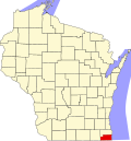
Powers Lake is located at 42°32'20" North, 88°17'53" West (42.538813, -88.298027). [6]

According to the United States Census Bureau, the CDP has a total area of 3.1 square miles (8.0 km2), of which, 2.2 square miles (5.7 km2) of it is land and 0.9 square miles (2.2 km2) of it is water. The total area is 27.88% water.

Demographics

Historical population
CensusPop.Note
2000 1,500
2010 1,6157.7%
2020 1,401−13.3%
U.S. Decennial Census [7]

As of the census [3] of 2000, there were 1,500 people, 544 households, and 405 families residing in the CDP. The population density was 783.6 inhabitants per square mile (302.5/km2). There were 855 housing units at an average density of 446.6 per square mile (172.4/km2). The racial makeup of the CDP was 97.53% White, 0.33% African American, 0.13% Native American, 0.27% Asian, 0.00% Pacific Islander, 0.07% from other races, and 1.67% from two or more races. 2.13% of the population were Hispanic or Latino of any race.

There were 544 households, out of which 38.2% had children under the age of 18 living with them, 59.6% were married couples living together, 10.8% had a female householder with no husband present, and 25.4% were non-families. 20.0% of all households were made up of individuals, and 7.7% had someone living alone who was 65 years of age or older. The average household size was 2.73 and the average family size was 3.15.

In the CDP, the population was spread out, with 28.5% under the age of 18, 6.6% from 18 to 24, 32.3% from 25 to 44, 21.2% from 45 to 64, and 11.5% who were 65 years of age or older. The median age was 36 years. For every 100 females, there were 98.4 males. For every 100 females age 18 and over, there were 92.6 males.

The median income for a household in the CDP was $53,403, and the median income for a family was $53,264. Males had a median income of $42,000 versus $26,736 for females. The per capita income for the CDP was $22,766. 7.4% of the population and 6.6% of families were below the poverty line. 3.0% of those under the age of 18 and 9.7% of those 65 and older were living below the poverty line.

Organizations

Powers Lake has many groups and organizations, including the Powers Lake Yacht Club, which has been sailing on these waters for many years.

Related Research Articles

<span class="mw-page-title-main">Lake Almanor West, California</span> Census-designated place in California, United States

Lake Almanor West is a census-designated place (CDP) in Plumas County, California, United States. The population was 270 at the 2010 census, down from 329 at the 2000 census.

<span class="mw-page-title-main">Channel Lake, Illinois</span> Census-designated place in Illinois, United States

Channel Lake is an unincorporated community and census-designated place (CDP) in Antioch Township, Lake County, Illinois, United States. Per the 2020 census, the population was 1,581.

Forest Lake is an unincorporated community and census-designated place (CDP) in Ela Township of Lake County, Illinois, United States. It is about 35 miles (56 km) northwest of downtown Chicago. Per the 2020 census, the population was 1,784. The community was founded in 1935 as a vacation community for Chicago residents.

Fox Lake Hills is an unincorporated community and census-designated place (CDP) in Lake Villa Township, Lake County, Illinois, United States. Per the 2020 census, the population was 2,684.

Lake Catherine is an unincorporated community and census-designated place (CDP) in Lake County, Illinois, United States. Per the 2020 census, the population was 1,279.

Venetian Village is a census-designated place (CDP) in Lake County, Illinois, United States. Per the 2020 census, the population was 2,761.

<span class="mw-page-title-main">Lakewood Shores, Illinois</span> Census-designated place in Illinois, United States

Lakewood Shores is a census-designated place (CDP) in Will County, Illinois, United States. The population was 665 at the 2020 census.

<span class="mw-page-title-main">Bass Lake, Indiana</span> Census-designated place in Indiana, United States

Bass Lake is a census-designated place (CDP) in California and North Bend Townships, Starke County, in the U.S. state of Indiana. The population was 1,195 at the 2010 census.

<span class="mw-page-title-main">Lake Shore, Maryland</span> Census-designated place in Maryland, United States

Lake Shore is a census-designated place and unincorporated community in Anne Arundel County, Maryland, United States, located east of Pasadena. The population of Lake Shore was 19,477 at the 2010 census.

<span class="mw-page-title-main">Hubbell, Michigan</span> Census-designated place & unincorporated community in Michigan, United States

Hubbell is an unincorporated community and census-designated place (CDP) in Houghton County in the U.S. state of Michigan. As of the 2010 census, the CDP population was 946, down from 1,105 at the 2000 census. The community is partially within Torch Lake Township and partially within Osceola Township.

<span class="mw-page-title-main">Michigamme, Michigan</span> Census-designated place & unincorporated community in Michigan, United States

Michigamme is an unincorporated community in Marquette County in the U.S. state of Michigan. It is located within Michigamme Township on the north shores of Lake Michigamme. For statistical purposes, the United States Census Bureau has defined Michigamme as a census-designated place (CDP). The CDP had a population of 255 at the 2020 census.

<span class="mw-page-title-main">Lakeside, Montana</span> Unincorporated community in Montana, United States

Lakeside is an unincorporated area and census-designated place (CDP) in Flathead County, Montana, United States. The population was 2,705 at the 2020 census, up from 2,669 in 2010.

<span class="mw-page-title-main">Lake Erie Beach, New York</span> Census-designated place in New York, United States

Lake Erie Beach is a hamlet and census-designated place (CDP) in the town of Evans, Erie County, New York, United States. The population was 3,872 at the 2010 census. It is part of the Buffalo–Niagara Falls Metropolitan Statistical Area.

<span class="mw-page-title-main">Lake Shore, Utah</span> CDP in Utah, United States

Lake Shore is a census-designated place (CDP) in Utah County, Utah, United States. It is part of the Provo–Orem Metropolitan Statistical Area. The population was 817 at the 2010 census.

<span class="mw-page-title-main">Lake Wissota, Wisconsin</span> CDP in Wisconsin, United States

Lake Wissota is a census-designated place (CDP) in the town of Lafayette in Chippewa County in the U.S. state of Wisconsin. The population was 2,738 at the 2010 census. The CDP, known locally as Lake Wissota Village, is located along the southern shores of Lake Wissota.

<span class="mw-page-title-main">Lake Koshkonong, Wisconsin</span> Census-designated place in Wisconsin, United States

Lake Koshkonong is a census-designated place (CDP) in the towns of Koshkonong and Sumner, Jefferson County, Wisconsin, United States. The population was 1,239 at the 2020 census. Lake Koshkonong is in the area.

<span class="mw-page-title-main">Lake Ripley, Wisconsin</span> Census-designated place in Wisconsin, United States

Lake Ripley is a census-designated place (CDP), in the town of Oakland, Jefferson County, Wisconsin, United States. The population was 1,911 at the 2020 census.

<span class="mw-page-title-main">Browns Lake, Wisconsin</span> CDP in Wisconsin, United States

Browns Lake is a census-designated place (CDP) in Racine County, Wisconsin around a lake of the same name. The population was 1,879 at the 2020 census. It is politically a part of the town of Burlington, along with Bohners Lake.

<span class="mw-page-title-main">Delavan Lake, Wisconsin</span> CDP in Wisconsin, United States

Delavan Lake is a census-designated place (CDP) in the towns of Delavan and Walworth, Walworth County, Wisconsin, United States. The population was 2,803 at the 2020 census. It is located near the shore of Delavan Lake.

<span class="mw-page-title-main">Potter Lake, Wisconsin</span> CDP in Wisconsin, United States

Potter Lake is a census-designated place (CDP) in the town of East Troy, Walworth County, Wisconsin, United States. The population was 1,117 at the 2020 census.

References

  1. 1 2 "US Board on Geographic Names". United States Geological Survey. October 25, 2007. Retrieved January 31, 2008.
  2. "ZIP Codes for City of Powers Lake, WI".
  3. 1 2 "U.S. Census website". United States Census Bureau . Retrieved January 31, 2008.
  4. "Boundary Changes". Geographic Changes. Population Division, United States Census Bureau. January 1, 2012. Retrieved February 26, 2013.
  5. 1 2 "Lake History & Facts | District of Powers Lake". districtofpowerslake.com. Retrieved February 24, 2023.
  6. "US Gazetteer files: 2010, 2000, and 1990". United States Census Bureau. February 12, 2011. Retrieved April 23, 2011.
  7. "Census of Population and Housing". Census.gov. Retrieved January 1, 2023.