Camp Lake, Wisconsin

Last updated
Camp Lake, Wisconsin
WIMap-doton-Camp Lake.png
Location of Camp Lake, Wisconsin
Coordinates: 42°31′33″N88°8′21″W / 42.52583°N 88.13917°W / 42.52583; -88.13917 Coordinates: 42°31′33″N88°8′21″W / 42.52583°N 88.13917°W / 42.52583; -88.13917
Country United States
State Wisconsin
County Kenosha
Village Salem Lakes
Area
  Total5.4 sq mi (14.1 km2)
  Land4.5 sq mi (11.6 km2)
  Water0.9 sq mi (2.4 km2)
Elevation
[1]
751 ft (229 m)
Population
 (2010)
  Total3,665
  Density670/sq mi (260/km2)
Time zone UTC-6 (Central (CST))
  Summer (DST) UTC-5 (CDT)
ZIP Code
53109
Area code 262
FIPS code 55-12400 [2]
GNIS feature ID1562628 [1]

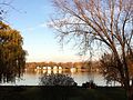
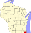
Camp Lake is a neighborhood and former census-designated place in the village of Salem Lakes, Kenosha County, Wisconsin, United States. The population of Camp Lake was 3,665 at the 2010 census. [3] Upon incorporation of the village of Salem Lakes in 2017, the census statistical boundaries for the neighborhood ceased to exist.

Contents

History

Camp Lake was named after a lake noted on the first township surveys. [4] When the Wisconsin Central/Soo railroad came through the area, there was a depot stop created as Camp Lake. Prior to that, James McVey had a hotel called the Camp Lake Hotel and Gardens. The earliest visitors to Camp Lake were children and their mothers from Chicago. The Camp still operates and continues to offer community services. Camp Lake has had a post office since the 1910 era.

Center Lake and Camp Lake were noted on the earliest maps as two separate lakes with an isthmus. Navigators cannot traverse the isthmus. The high level of this isthmus made this the choice area for the Wisconsin Central/Soo Railroad to cross between the lakes and escape the low-lying areas to the south of Camp Lake.

In the 1920s, Camp Lake Oaks subdivision was the location of one of the nation's early radio stations, WCLO, for "Camp Lake Oaks". Camp Lake Oaks was a subdivision built on property owned at one time by the Knickerbocker Ice Company on the northeast corner of Camp Lake south of the Soo rail line. Charles Whitmore used the radio station to advertise his "new" subdivision and offer the community music and news on the air waves. The building where the station was located is now a private residence. The station is still on the air in Janesville, Wisconsin.

Many of the early (1840–50) buildings in this hamlet still exist, although they are not being used for their original purposes. Hotels are now apartments, grocery stores are now restaurants, and residences are now businesses.

Geography

Camp Lake is located at 42°31′33″N88°8′21″W / 42.52583°N 88.13917°W / 42.52583; -88.13917 (42.525918, -88.139247). [5] According to the United States Census Bureau, the CDP has a total area of 5.4 square miles (14.1 km2), of which, 4.5 square miles (11.7 km2) of it is land and 0.9 square miles (2.4 km2) of it (17.28%) is water. (Camp Lake and Center Lake)

Image

Demographics

Historical population
CensusPop.
2000 3,255
2010 3,66512.6%
U.S. Decennial Census [6]

As of the census [2] of 2000, there were 3,255 people, 1,149 households, and 875 families residing in the CDP. The population density was 724.0 inhabitants per square mile (279.5/km2). There were 1,310 housing units at an average density of 291.4 per square mile (112.5/km2). The racial makeup of the CDP was 97.45% White, 0.37% African American, 0.31% Native American, 0.28% Asian, 1.04% from other races, and 0.55% from two or more races. Hispanic or Latino of any race were 2.83% of the population.

There were 1,149 households, out of which 43.5% had children under the age of 18 living with them, 62.4% were married couples living together, 9.6% had a female householder with no husband present, and 23.8% were non-families. 19.1% of all households were made up of individuals, and 4.8% had someone living alone who was 65 years of age or older. The average household size was 2.83 and the average family size was 3.25.

In the CDP, the population was spread out, with 30.9% under the age of 18, 6.3% from 18 to 24, 36.1% from 25 to 44, 19.2% from 45 to 64, and 7.5% who were 65 years of age or older. The median age was 34 years. For every 100 females, there were 102.2 males. For every 100 females age 18 and over, there were 98.9 males.

The median income for a household in the CDP was $42,986, and the median income for a family was $48,523. Males had a median income of $39,515 versus $26,544 for females. The per capita income for the CDP was $17,863. About 8.0% of families and 9.8% of the population were below the poverty line, including 11.3% of those under age 18 and 8.7% of those age 65 or over.

Related Research Articles

<span class="mw-page-title-main">Channel Lake, Illinois</span> Census-designated place in Illinois, United States

Channel Lake is an unincorporated community and census-designated place (CDP) in Antioch Township, Lake County, Illinois, United States. Per the 2020 census, the population was 1,581.

Forest Lake is an unincorporated community and census-designated place (CDP) in Ela Township of Lake County, Illinois, United States. It is about 35 miles (56 km) northwest of downtown Chicago. Per the 2020 census, the population was 1,784. The community was founded in 1935 as a vacation community for Chicago residents.

Lake Catherine is an unincorporated community and census-designated place (CDP) in Lake County, Illinois, United States. Per the 2020 census, the population was 1,279.

<span class="mw-page-title-main">Lake Ridge, Virginia</span> Census-designated place in Virginia, United States

Lake Ridge is a census-designated place (CDP) in Prince William County, Virginia, United States. It is an annex of Woodbridge, Virginia. The population was 41,058 at the 2010 census, an increase of 35% from 2000.

<span class="mw-page-title-main">Lake Koshkonong, Wisconsin</span> Census-designated place in Wisconsin, United States

Lake Koshkonong is a census-designated place (CDP) in the towns of Koshkonong and Sumner, Jefferson County, Wisconsin, United States. The population was 1,239 at the 2020 census. Lake Koshkonong is in the area.

<span class="mw-page-title-main">Lake Ripley, Wisconsin</span> Census-designated place in Wisconsin, United States

Lake Ripley is a census-designated place (CDP), in the town of Oakland, Jefferson County, Wisconsin, United States. The population was 1,779 at the 2010 census.

Rome is a census-designated place (CDP) in the town of Sullivan, Jefferson County, Wisconsin, along the Bark River. The population was 689 at the 2010 census.

<span class="mw-page-title-main">Lake Shangrila, Wisconsin</span> Former CDP in Wisconsin, United States

Lake Shangrila was a census-designated place (CDP) in the town of Salem, Kenosha County, Wisconsin, United States. The population was 861 at the 2010 census. The core area of the CDP was annexed into the village of Bristol on March 15, 2011, at the same time that the CDP was deleted.

<span class="mw-page-title-main">Salem Lakes, Wisconsin</span> Village in Wisconsin, United States

Salem Lakes, formerly the town of Salem and the village of Silver Lake, is a village in Kenosha County, Wisconsin, United States. The village was created by a municipal merger on February 14, 2017. The population was 14,601 at the 2020 census. The communities of Benet Lake, Camp Lake, Fox River, Lake Shangrila, Liberty Corners, Salem, Salem Oaks, Silver Lake, Trevor, Voltz Lake, and Wilmot are wholly or partially located in the village.

<span class="mw-page-title-main">Bohners Lake, Wisconsin</span> CDP in Wisconsin, United States

Bohners Lake is a census-designated place (CDP) in Racine County, Wisconsin, United States. Its first syllable is pronounced as in "bone". The population of the CDP was 2,374 at the 2020 census. It is politically part of the Town of Burlington, together with Browns Lake, Wisconsin. There has been discussion of incorporating Bohners Lake as a village to prevent annexation by the City of Burlington. It was named for Antony Bohner, a French immigrant who established a resort on the lake of the same name.

<span class="mw-page-title-main">Browns Lake, Wisconsin</span> CDP in Wisconsin, United States

Browns Lake is a census-designated place (CDP) in Racine County, Wisconsin around a lake of the same name. The population was 1,879 at the 2020 census. It is politically a part of the town of Burlington, along with Bohners Lake.

<span class="mw-page-title-main">Eagle Lake, Wisconsin</span> CDP in Wisconsin, United States

Eagle Lake is a census-designated place (CDP) in the town of Dover, Racine County, Wisconsin, United States. The population was 1,251 at the 2020 census.

<span class="mw-page-title-main">Wind Lake, Wisconsin</span> CDP in Wisconsin, United States

Wind Lake is a census-designated place (CDP) in Racine County, Wisconsin, United States. The population was 5,355 at the 2020 census. Wind Lake is in the town of Norway.

<span class="mw-page-title-main">Como, Wisconsin</span> CDP in Wisconsin, United States

Como is a census-designated place (CDP), in the town of Geneva, Walworth County, Wisconsin, United States. The population was 2,356 at the 2020 census.

<span class="mw-page-title-main">Delavan Lake, Wisconsin</span> CDP in Wisconsin, United States

Delavan Lake is a census-designated place (CDP) in the towns of Delavan and Walworth, Walworth County, Wisconsin, United States. The population was 2,649 at the 2010 census. It is located near the shore of Delavan Lake.

<span class="mw-page-title-main">Pell Lake, Wisconsin</span> Former CDP in Wisconsin, United States

Pell Lake is a neighborhood and former census-designated place (CDP) in Walworth County, Wisconsin, United States. The population was 3,722 at the 2010 census. On December 20, 2011, Pell Lake became part of the newly incorporated village of Bloomfield.

<span class="mw-page-title-main">Potter Lake, Wisconsin</span> CDP in Wisconsin, United States

Potter Lake is a census-designated place (CDP) in the town of East Troy, Walworth County, Wisconsin, United States. The population was 1,117 at the 2020 census.

<span class="mw-page-title-main">Lac La Belle, Wisconsin</span> Village in Wisconsin, United States

Lac La Belle is a village located mostly in Waukesha County in the U.S. state of Wisconsin. The population was 290 at the 2010 census. Of this, 289 were in Waukesha County, and one person was in Jefferson County. The village is located mostly within the town of Oconomowoc in Waukesha County. On March 28, 2002, the village annexed a portion of land in the town of Ixonia in Jefferson County.

<span class="mw-page-title-main">Powers Lake, Wisconsin</span> Census-designated place in Wisconsin, United States

Powers Lake is a census-designated place (CDP) in the towns of Randall and Wheatland, in Kenosha County in the U.S. state of Wisconsin. As of the 2020 census, the CDP had a population of 1,401. Part of the Powers Lake CDP was in Walworth County, but on December 20, 2011, it became part of the village of Bloomfield.

<span class="mw-page-title-main">Hebron (CDP), Wisconsin</span> Census-designated place in Wisconsin, United States

Hebron is a census-designated place (CDP) in the town of Hebron, Jefferson County, Wisconsin, United States. The population was 224 at the 2010 census. It is located on the Bark River.

References

  1. 1 2 "US Board on Geographic Names". United States Geological Survey. 2007-10-25. Retrieved 2008-01-31.
  2. 1 2 "U.S. Census website". United States Census Bureau . Retrieved 2008-01-31.
  3. "U.S. Census website". U.S. Census Bureau . Retrieved 29 March 2011.
  4. http://www.rootsweb.ancestry.com/~wikenosh/placenames.htm [ user-generated source ]
  5. "US Gazetteer files: 2010, 2000, and 1990". United States Census Bureau. 2011-02-12. Retrieved 2011-04-23.
  6. "Census of Population and Housing". Census.gov. Retrieved June 4, 2016.