Klondike, Wisconsin | |
|---|---|
 Klondike  Klondike | |
| Coordinates: 42°35′24″N88°07′10″W / 42.59000°N 88.11944°W | |
| Country | United States |
| State | Wisconsin |
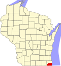
| County | Kenosha |
| Town | Brighton |
| Elevation | 833 ft (254 m) |
| Time zone | UTC-6 (Central (CST)) |
| • Summer (DST) | UTC-5 (CDT) |
| Area code | 262 |
| GNIS feature ID | 1567552 [1] |
Klondike is an unincorporated residential and agricultural community in the town of Brighton, in Kenosha County, Wisconsin, United States. [1]