List of counties in Wisconsin

Last updated

Counties of Wisconsin
Wisconsin-counties-map.gif
Location State of Wisconsin
Number72
Populations4,197 (Menominee) – 918,661 (Milwaukee)
Areas231.98 square miles (600.8 km2) (Pepin) – 1,544.91 square miles (4,001.3 km2) (Marathon)
Government
Subdivisions
  • cities, villages, towns

There are 72 counties in the U.S. State of Wisconsin. The land that eventually became Wisconsin was transferred from British to American control with the 1783 signing of the Treaty of Paris. [1] It was an unorganized part of the Northwest Territory until 1802 when all of the land from St. Louis north to the Canadian border was organized as St. Clair County. [1] When Illinois was admitted to the union in 1818, Wisconsin became part of the Territory of Michigan and divided into two counties: Brown County in the northeast along Lake Michigan and Crawford County in the southwest along the Mississippi River. [1] Iowa County was formed in 1829 from the Crawford County land south of the Wisconsin River. [1] Brown County's southern portion was used to form Milwaukee County in 1834. [1] The state of Wisconsin was created from Wisconsin Territory on May 29, 1848, with 28 counties.

Contents

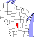
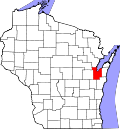
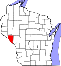
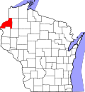
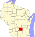
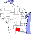
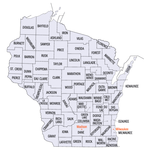
The most populous county in the state is Milwaukee County at 918,661 people at the 2022 Census estimate. [2] The county with the least population is Menominee County with 4,197 residents; the Menominee Indian Reservation is co-extensive with the county. [2] Pepin County is the smallest in area, with 231.98 square miles (600.8 km2); Marathon is the largest, having 1,544.91 square miles (4,001.3 km2). [2]

The Federal Information Processing Standard (FIPS) code, which is used by the United States government to uniquely identify states and counties, is provided with each entry. [3] Wisconsin's code is 55, which when combined with any county code would be written as 55XXX. The FIPS code for each county links to census data for that county. [4]

Governance

Each county has a county seat, often a populous or centrally located community, where the county's governmental offices are located. Some of the services provided by the county include: law enforcement, circuit courts, social services, vital records and deed registration, road maintenance, and snow removal. County officials include sheriffs, district attorneys, clerks, treasurers, coroners, surveyors, registers of deeds, and clerks of circuit court; these officers are elected for four-year terms. In most counties, elected coroners have been replaced by appointed medical examiners. State law permits counties to appoint a registered land surveyor in place of electing a surveyor.

Counties in Wisconsin are governed by county boards, headed by a chairperson. Counties with a population of 500,000 or more must also have a county executive. Smaller counties may have either a county executive or a county administrator. [5] As of 2011, 13 counties had elected county executives: Brown, Chippewa, Dane, Fond du Lac, Kenosha, Manitowoc, Milwaukee, Outagamie, Portage, Racine, Sawyer, Waukesha, and Winnebago. 23 had an appointed county administrator, 34 had an appointed administrative coordinator, and 2 had neither an executive nor an administrator. Waukesha County had both an executive and an administrator. [6]

List of counties

County
FIPS code [4] County seat [7] Est. [8] Formed from [9] Etymology [9] Population [2] Area [2] Map
AdamsCounty 001 Friendship 1848 Portage County John Quincy Adams (1767–1848), President of the United States (1825–29)21,226645.65 sq mi
(1,672 km2)
Map of Wisconsin highlighting Adams County.svg
AshlandCounty 003 Ashland 1860La Pointe County Ashland, Henry Clay's estate in Kentucky 16,0391,045.04 sq mi
(2,707 km2)
Map of Wisconsin highlighting Ashland County.svg
BarronCounty 005 Barron 1859 Polk County Henry D. Barron, state senator and circuit court judge.46,843862.71 sq mi
(2,234 km2)
Map of Wisconsin highlighting Barron County.svg
BayfieldCounty 007 Washburn 1845 St. Croix County Henry Bayfield, Royal naval officer and first to survey Great Lakes area16,6081,477.86 sq mi
(3,828 km2)
Map of Wisconsin highlighting Bayfield County.svg
BrownCounty 009 Green Bay 1818 unorganized territory Major General Jacob Brown (1775–1828), commanding general of the United States Army during the War of 1812 270,036529.71 sq mi
(1,372 km2)
Map of Wisconsin highlighting Brown County.svg
BuffaloCounty 011 Alma 1853 Trempealeau County The Buffalo River, which flows through the county.13,391671.64 sq mi
(1,740 km2)
Map of Wisconsin highlighting Buffalo County.svg
BurnettCounty 013 Siren 1856 Polk County Thomas P. Burnett, state legislator 17,036821.85 sq mi
(2,129 km2)
Map of Wisconsin highlighting Burnett County.svg
CalumetCounty 015 Chilton 1836Brown County, WisconsinThe French word for a Menominee Ceremonial pipe.52,718318.24 sq mi
(824 km2)
Map of Wisconsin highlighting Calumet County.svg
ChippewaCounty 017 Chippewa Falls 1845 Crawford County Chippewa Indians66,8071,008.37 sq mi
(2,612 km2)
Map of Wisconsin highlighting Chippewa County.svg
ClarkCounty 019 Neillsville 1853 Crawford County George Rogers Clark (1752–1812), Revolutionary War general 34,6911,209.82 sq mi
(3,133 km2)
Map of Wisconsin highlighting Clark County.svg
ColumbiaCounty 021 Portage 1846 Portage County Christopher Columbus (1451–1506), navigator and explorer58,193765.53 sq mi
(1,983 km2)
Map of Wisconsin highlighting Columbia County.svg
CrawfordCounty 023 Prairie du Chien 1818unorganized territory William Harris Crawford (1772–1834), United States Senator from Georgia (1807–13) and Secretary of the Treasury (1816–25)16,007570.66 sq mi
(1,478 km2)
Map of Wisconsin highlighting Crawford County.svg
DaneCounty 025 Madison 1836Crawford, Iowa, and Milwaukee Countes Nathan Dane (1752–1835), delegate to the First Continental Congress (1785–88)568,2031,197.24 sq mi
(3,101 km2)
Map of Wisconsin highlighting Dane County.svg
DodgeCounty 027 Juneau 1836Brown and Milwaukee Counties Henry Dodge (1782–1867), Territorial Governor of Wisconsin (1845–48)88,282875.63 sq mi
(2,268 km2)
Map of Wisconsin highlighting Dodge County.svg
DoorCounty 029 Sturgeon Bay 1851 Brown County A dangerous water passage near Door Peninsula known as Porte des Morts or "door of the dead" in French 30,526481.98 sq mi
(1,248 km2)
Map of Wisconsin highlighting Door County.svg
DouglasCounty 031 Superior 1854La Pointe County Stephen Douglas (1813–61), United States Senator from Illinois (1847–61)44,1441,304.14 sq mi
(3,378 km2)
Map of Wisconsin highlighting Douglas County.svg
DunnCounty 033 Menomonie 1854 Chippewa County Charles Dunn, state senator and chief justice of Wisconsin Territory 45,651850.11 sq mi
(2,202 km2)
Map of Wisconsin highlighting Dunn County.svg
Eau ClaireCounty 035 Eau Claire 1856 Chippewa County City of Eau Claire French for "clear water"106,837637.98 sq mi
(1,652 km2)
Map of Wisconsin highlighting Eau Claire County.svg
FlorenceCounty 037 Florence 1881Marinette and Oconto CountiesFlorence Hulst, the first white woman to settle in the area4,688488.20 sq mi
(1,264 km2)
Map of Wisconsin highlighting Florence County.svg
Fond du LacCounty 039 Fond du Lac 1836Brown CountyFrench for "bottom of the lake"103,836719.55 sq mi
(1,864 km2)
Map of Wisconsin highlighting Fond du Lac County.svg
ForestCounty 041 Crandon 1885Langlade and Oconto CountiesForest which covered the area when it was settled9,3811,014.07 sq mi
(2,626 km2)
Map of Wisconsin highlighting Forest County.svg
GrantCounty 043 Lancaster 1837Iowa CountyProbably a trader named Grant who made contact with area natives in 1810 but about whom little else is known51,2761,146.85 sq mi
(2,970 km2)
Map of Wisconsin highlighting Grant County.svg
GreenCounty 045 Monroe 1837Iowa County and unorganized territory Nathanael Greene (1742–86), quartermaster general during the American Revolutionary War 36,816583.96 sq mi
(1,512 km2)
Map of Wisconsin highlighting Green County.svg
Green LakeCounty 047 Green Lake 1858Marquette County Green Lake located within the county19,220349.44 sq mi
(905 km2)
Map of Wisconsin highlighting Green Lake County.svg
IowaCounty 049 Dodgeville 1829Crawford County Iowa tribe of Indians 23,865762.58 sq mi
(1,975 km2)
Map of Wisconsin highlighting Iowa County.svg
IronCounty 051 Hurley 1893Ashland and Oneida CountiesLocal iron deposits6,224758.17 sq mi
(1,964 km2)
Map of Wisconsin highlighting Iron County.svg
JacksonCounty 053 Black River Falls 1853La Crosse County Andrew Jackson (1767–1845), President of the United States (1829–37)20,836987.72 sq mi
(2,558 km2)
Map of Wisconsin highlighting Jackson County.svg
JeffersonCounty 055 Jefferson 1836Milwaukee County Thomas Jefferson (1743–1826), President of the United States (1801–09)85,784556.47 sq mi
(1,441 km2)
Map of Wisconsin highlighting Jefferson County.svg
JuneauCounty 057 Mauston 1856Adams County Solomon Juneau (1793–1856), founder of what would become Milwaukee 26,866766.93 sq mi
(1,986 km2)
Map of Wisconsin highlighting Juneau County.svg
KenoshaCounty 059 Kenosha 1850Racine County Indian word meaning "place of the pike"167,817271.99 sq mi
(704 km2)
Map of Wisconsin highlighting Kenosha County.svg
KewauneeCounty 061 Kewaunee 1852Door CountyEither a Potawatomi word meaning "river of the lost" or an Ojibwe word meaning "prairie hen" "wild duck" or "to go around"20,623342.52 sq mi
(887 km2)
Map of Wisconsin highlighting Kewaunee County.svg
La CrosseCounty 063 La Crosse 1851Crawford County Indian game of lacrosse 120,294451.69 sq mi
(1,170 km2)
Map of Wisconsin highlighting La Crosse County.svg
LafayetteCounty 065 Darlington 1846Iowa County Gilbert du Motier marquis de La Fayette (1757–1834), a French general in the American Revolutionary War 16,877633.59 sq mi
(1,641 km2)
Map of Wisconsin highlighting Lafayette County.svg
LangladeCounty 067 Antigo 1879Oconto County Charles de Langlade (1729 – c.1800), American Revolutionary War veteran and United States Indian Agent in Green Bay19,559870.64 sq mi
(2,255 km2)
Map of Wisconsin highlighting Langlade County.svg
LincolnCounty 069 Merrill 1874 Marathon County Abraham Lincoln (1809–65), President of the United States (1861–65)28,376878.97 sq mi
(2,277 km2)
Map of Wisconsin highlighting Lincoln County.svg
ManitowocCounty 071 Manitowoc 1836Brown CountyMunedoo-owk, an Ojibwe word meaning "the place of the good spirit"81,172589.08 sq mi
(1,526 km2)
Map of Wisconsin highlighting Manitowoc County.svg
MarathonCounty 073 Wausau 1850 Portage County Marathon, Greece 137,9581,544.98 sq mi
(4,001 km2)
Map of Wisconsin highlighting Marathon County.svg
MarinetteCounty 075 Marinette 1879Oconto CountyMarie Antoinette Chevalier, Indian wife of an early fur trapper41,9881,399.35 sq mi
(3,624 km2)
Map of Wisconsin highlighting Marinette County.svg
MarquetteCounty 077 Montello 1836Brown County Jacques Marquette (1637–75), missionary and explorer15,779455.60 sq mi
(1,180 km2)
Map of Wisconsin highlighting Marquette County.svg
MenomineeCounty 078 Keshena 1959 Menominee Indian Reservation, Shawano, and Oconto Counties Menominee Indians4,197357.61 sq mi
(926 km2)
Map of Wisconsin highlighting Menominee County.svg
MilwaukeeCounty 079 Milwaukee 1834Brown CountyMahnawaukee-Seepe, an Indian word meaning "gathering place by the river"918,661241.40 sq mi
(625 km2)
Map of Wisconsin highlighting Milwaukee County.svg
MonroeCounty 081 Sparta 1854La Crosse County James Monroe (1758–1831), President of the United States (1817–25)46,109900.78 sq mi
(2,333 km2)
Map of Wisconsin highlighting Monroe County.svg
OcontoCounty 083 Oconto 1851Brown CountyAn Indian settlement and the Oconto River, whose name means "plentiful with fish"39,633997.99 sq mi
(2,585 km2)
Map of Wisconsin highlighting Oconto County.svg
OneidaCounty 085 Rhinelander 1885Lincoln County Oneida Indians38,2121,112.97 sq mi
(2,883 km2)
Map of Wisconsin highlighting Oneida County.svg
OutagamieCounty 087 Appleton 1851Brown County Outagamie Indians192,127637.52 sq mi
(1,651 km2)
Map of Wisconsin highlighting Outagamie County.svg
OzaukeeCounty 089 Port Washington 1853Washington CountyThe Ojibwe word for the Sauk nation93,009233.08 sq mi
(604 km2)
Map of Wisconsin highlighting Ozaukee County.svg
PepinCounty 091 Durand 1858 Dunn County Pierre and Jean Pepin du Chardonnets, explorers7,410231.98 sq mi
(601 km2)
Map of Wisconsin highlighting Pepin County.svg
PierceCounty 093 Ellsworth 1853Saint Croix County Franklin Pierce (1804–69), President of the United States (1853–57)42,532573.75 sq mi
(1,486 km2)
Map of Wisconsin highlighting Pierce County.svg
PolkCounty 095 Balsam Lake 1853Saint Croix County James Polk (1795–1849), President of the United States (1845–49)45,709913.96 sq mi
(2,367 km2)
Map of Wisconsin highlighting Polk County.svg
PortageCounty 097 Stevens Point 1836Brown, Crawford, Iowa, and Milwaukee Counties Passage between the Fox and Wisconsin Rivers70,718800.68 sq mi
(2,074 km2)
Map of Wisconsin highlighting Portage County.svg
PriceCounty 099 Phillips 1879Chippewa and Lincoln Counties William T. Price (1824–86), Representative from Wisconsin (1883–86)14,1791,254.38 sq mi
(3,249 km2)
Map of Wisconsin highlighting Price County.svg
RacineCounty 101 Racine 1836Milwaukee CountyRacine, the French word for "root", after the Root River, which flows through the county195,846332.5 sq mi
(861 km2)
Map of Wisconsin highlighting Racine County.svg
RichlandCounty 103 Richland Center 1842 Iowa County The rich soil of the area17,090586.15 sq mi
(1,518 km2)
Map of Wisconsin highlighting Richland County.svg
RockCounty 105 Janesville 1836Milwaukee County Rock River, which flows through the county164,060718.14 sq mi
(1,860 km2)
Map of Wisconsin highlighting Rock County.svg
RuskCounty 107 Ladysmith 1901Chippewa County Jeremiah McLain Rusk (1830–93), Governor of Wisconsin (1882–89)14,186913.59 sq mi
(2,366 km2)
Map of Wisconsin highlighting Rusk County.svg
SaukCounty 111 Baraboo 1840Crawford, Dane and Portage Counties Sauk Indians65,777830.9 sq mi
(2,152 km2)
Map of Wisconsin highlighting Sauk County.svg
SawyerCounty 113 Hayward 1883Ashland and Chippewa Counties Philetus Sawyer (1816–1900), Representative (1865–75) and Senator (1881–93) from Wisconsin18,5591,257.31 sq mi
(3,256 km2)
Map of Wisconsin highlighting Sawyer County.svg
ShawanoCounty 115 Shawano 1853 Oconto County An Ojibwe word meaning "southern"40,886893.06 sq mi
(2,313 km2)
Map of Wisconsin highlighting Shawano County.svg
SheboyganCounty 117 Sheboygan 1836Brown CountyShawb-wa-way-kun, an Indian word meaning "great noise underground"117,841511.27 sq mi
(1,324 km2)
Map of Wisconsin highlighting Sheboygan County.svg
St. CroixCounty 109 Hudson 1840Crawford County, and unorganized territoryAn early French explorer named St. Croix, about whom little is known96,017722.33 sq mi
(1,871 km2)
Map of Wisconsin highlighting Saint Croix County.svg
TaylorCounty 119 Medford 1875Clark, Lincoln, Marathon and Chippewa Counties William Robert Taylor (1820–1909), Governor of Wisconsin 1874–7619,975974.88 sq mi
(2,525 km2)
Map of Wisconsin highlighting Taylor County.svg
TrempealeauCounty 121 Whitehall 1854Crawford and La Crosse CountiesTrempealeau Mountain (from the French for "mountain with its foot in the water"), a bluff located in a bend of the Trempealeau River, [10] which flows through the county30,899732.97 sq mi
(1,898 km2)
Map of Wisconsin highlighting Trempealeau County.svg
VernonCounty 123 Viroqua 1851Richland and Crawford Counties Mount Vernon, home of George Washington 31,060791.58 sq mi
(2,050 km2)
Map of Wisconsin highlighting Vernon County.svg
VilasCounty 125 Eagle River 1893Oneida County William Vilas (1840–1908), officer in the Civil War United States Postmaster General (1885–88) United States Secretary of the Interior (1888–89) and Senator from Wisconsin (1891–97)23,763856.60 sq mi
(2,219 km2)
Map of Wisconsin highlighting Vilas County.svg
WalworthCounty 127 Elkhorn 1836Milwaukee County Reuben Hyde Walworth (1788–1867), jurist from New York 105,380555.13 sq mi
(1,438 km2)
Map of Wisconsin highlighting Walworth County.svg
WashburnCounty 129 Shell Lake 1883Burnett County Cadwallader Washburn (1818–82), Governor (1872–74) and Representative from Wisconsin (1867–71)16,911797.11 sq mi
(2,065 km2)
Map of Wisconsin highlighting Washburn County.svg
WashingtonCounty 131 West Bend 1836Brown and Milwaukee Counties George Washington (1732–99), American Revolutionary War leader (1775–83) and first President of the United States (1789–97)137,688430.70 sq mi
(1,116 km2)
Map of Wisconsin highlighting Washington County.svg
WaukeshaCounty 133 Waukesha 1846Milwaukee CountyWaugooshance, a Pottawatomi word meaning "little foxes"410,434549.57 sq mi
(1,423 km2)
Map of Wisconsin highlighting Waukesha County.svg
WaupacaCounty 135 Waupaca 1851Brown and Winnebago Countieswau-pa-ka-ho-nak, a Menominee word meaning "white sand bottom" or "brave young hero"51,488747.71 sq mi
(1,937 km2)
Map of Wisconsin highlighting Waupaca County.svg
WausharaCounty 137 Wautoma 1851Marquette CountyAn Indian word meaning "good earth"24,999626.15 sq mi
(1,622 km2)
Map of Wisconsin highlighting Waushara County.svg
WinnebagoCounty 139 Oshkosh 1840Brown, Calumet, and Fond du Lac Counties Winnebago Indians 170,718434.49 sq mi
(1,125 km2)
Map of Wisconsin highlighting Winnebago County.svg
WoodCounty 141 Wisconsin Rapids 1856 Portage County Joseph Wood (1809–90), state legislator (1856–58)73,993793.12 sq mi
(2,054 km2)
Map of Wisconsin highlighting Wood County.svg

Renamed counties

Five counties in Wisconsin have been renamed, but otherwise kept their same borders. [11]

Proposed counties

Two proposed counties were ultimately not established.

See also

Related Research Articles

<span class="mw-page-title-main">Wisconsin</span> U.S. state

Wisconsin is a state in the upper Midwestern United States. Wisconsin is the 25th-largest state by total area and the 20th-most populous. It is bordered by Minnesota to the west, Iowa to the southwest, Illinois to the south, Lake Michigan to the east, Michigan to the northeast, and Lake Superior to the north.

<span class="mw-page-title-main">La Crosse County, Wisconsin</span> County in Wisconsin, United States

La Crosse County is a county located in the U.S. state of Wisconsin. At the 2020 census, the population was 120,784. Its county seat is La Crosse. La Crosse County is included in the La Crosse-Onalaska, WI-MN Metropolitan Statistical Area with a population of 139,627 and is the most populous county on Wisconsin's western border.

<span class="mw-page-title-main">Patrick Lucey</span> American politician (1918–2014)

Patrick Joseph Lucey was an American politician. A member of the Democratic Party, he served as the 38th Governor of Wisconsin from 1971 to 1977. He was also independent presidential candidate John B. Anderson's running mate in the 1980 presidential election.

The history of Wisconsin encompasses the story not only of the people who have lived in Wisconsin since it became a state of the U.S., but also that of the Native American tribes who made their homeland in Wisconsin, the French and British colonists who were the first Europeans to live there, and the American settlers who lived in Wisconsin when it was a territory.

<span class="mw-page-title-main">United States District Court for the Eastern District of Wisconsin</span> United States federal trial court of limited jurisdiction

The United States District Court for the Eastern District of Wisconsin is a federal trial court of limited jurisdiction. The court is under the auspices of the United States Court of Appeals for the Seventh Circuit, although patent claims and claims against the federal government under the Tucker Act are appealed to the United States Court of Appeals for the Federal Circuit. The Eastern District was established on June 30, 1870.

The administrative divisions of Wisconsin include counties, cities, villages and towns. In Wisconsin, all of these are units of general-purpose local government. There are also a number of special-purpose districts formed to handle regional concerns, such as school districts.

<span class="mw-page-title-main">Attorney General of Wisconsin</span> Chief law officer of the state of Wisconsin

The attorney general of Wisconsin is a constitutional officer in the executive branch of the government of the U.S. state of Wisconsin. Forty-five individuals have held the office of attorney general since statehood. The incumbent is Josh Kaul, a Democrat.

<span class="mw-page-title-main">Herman Ekern</span> 20th century American politician

Herman Louis Ekern was an American attorney and progressive Republican politician who served as the 28th lieutenant governor of Wisconsin, the 25th attorney general of Wisconsin, and the 42nd speaker of the Wisconsin State Assembly. He was also one of the founders of Lutheran Brotherhood.

<span class="mw-page-title-main">Geography of Wisconsin</span> Physical features of the state in the Midwestern United States

Wisconsin, a state in the Midwestern United States, has a vast and diverse geography famous for its landforms created by glaciers during the Wisconsin glaciation 17,000 years ago. The state can be generally divided into five geographic regions—Lake Superior Lowland, Northern Highland, Central Plain, Eastern Ridges & Lowlands, and Western Upland. The southwestern part of the state, which was not covered by glaciers during the most recent ice age, is known as the Driftless Area. The Wisconsin glaciation formed the Wisconsin Dells, Devil's Lake, and the Baraboo Range. A number of areas are protected in the state, including Devil's Lake State Park, the Apostle Islands National Lakeshore, and the Chequamegon–Nicolet National Forest.

<span class="mw-page-title-main">Jeff Stone (Wisconsin politician)</span> American politician

Jeff Stone is an American businessman and former politician. A Republican, he was a member of the Wisconsin State Assembly from 1998 through 2013.

<span class="mw-page-title-main">Chris Larson</span> 21st century American politician, Wisconsin Senator

Christopher J. Larson is an American Democratic politician and a member of the Wisconsin Senate, representing southeast Milwaukee County since 2011. He was Senate Minority Leader from 2013 through 2014, and currently serves as Senate Democratic Caucus Chair.

<span class="mw-page-title-main">2012 United States presidential election in Wisconsin</span>

The 2012 United States presidential election in Wisconsin took place on November 6, 2012, as part of the 2012 United States presidential election in which all 50 states plus the District of Columbia participated. Wisconsin voters chose 10 electors to represent them in the Electoral College via a popular vote pitting incumbent Democratic President Barack Obama and his running mate, Vice President Joe Biden, against Republican challenger and former Massachusetts Governor Mitt Romney and his running mate, Congressman Paul Ryan.

<span class="mw-page-title-main">Antigo Public Library and Deleglise Cabin</span> Historic buildings in Wisconsin, United States

The Antigo Public Library and Deleglise Cabin comprise a historic site in Antigo, Wisconsin. The library building is a Carnegie library built in 1904. In 1997, the Antigo Public Library left the building; it is now a museum and the headquarters of the Langlade County Historical Society. The Deleglise Cabin, the first home in Antigo, was constructed by George Eckart in 1878 on the Springbrook and inhabited by Francis A. Deleglise. The cabin was moved near the library in 1916. Both buildings were added to the National Register of Historic Places on December 18, 1978.

<span class="mw-page-title-main">Regions of Wisconsin</span>

There are a variety of schema for dividing Wisconsin into regions.

A recall election in the state of Wisconsin is a procedure by which voters can remove an elected official from office through a direct vote before his or her term has ended.

References

  1. 1 2 3 4 5 Curtiss-Wedge, Franklyn (1919). History of Buffalo and Pepin Counties, Wisconsin, Volume 1. Higginson Book Company. pp. 3–4. Archived from the original on 2023-09-22. Retrieved 2020-10-26.
  2. 1 2 3 4 5 "Wisconsin QuickFacts". U.S. Census Bureau. Archived from the original on 2021-11-19. Retrieved 2023-04-03. (2022 Census estimates)
  3. "FIPS Publish 6-4". National Institute of Standards and Technology. Archived from the original on 2013-09-29. Retrieved 2008-02-11.
  4. 1 2 "EPA County FIPS Code Listing". US Environmental Protection Agency. Archived from the original on 2013-10-07. Retrieved 2008-02-11.
  5. Wisconsin Legislative Reference Bureau. State of Wisconsin 2011–2012 Blue Book Archived 2017-12-28 at the Wayback Machine . Madison: Joint Committee on Legislative Organization, 2011, p. 736.
  6. Wisconsin Legislative Reference Bureau. State of Wisconsin 2011–2012 Blue Book Archived 2017-12-28 at the Wayback Machine . Madison: Joint Committee on Legislative Organization, 2011, p. 732.
  7. "NACo – Find a county". National Association of Counties. Archived from the original on 2011-05-31. Retrieved 2008-02-11.
  8. Wisconsin Legislative Reference Bureau. State of Wisconsin 2011–2012 Blue Book Archived 2017-12-28 at the Wayback Machine . Madison: Joint Committee on Legislative Organization, 2011, p. 731.
  9. 1 2 3 Carver, Jonathon (1910). Proceedings of the State Historical Society of Wisconsin at its Fifty-Seventh Annual Meeting (1st ed.). Madison WI: Democrat Printing Company. (WV County Founding Dates and Etymology). Other editions available at ISBN   1130567257 and Google Books Archived 2023-04-04 at the Wayback Machine
  10. Elkins, Winston (1985). Trempealeau and the Mississippi River Dam. Trempealeau County, WI: Trempealeau County Historical Society.
  11. "Interactive Map of Wisconsin County Formation History". mapgeeks.org. Archived from the original on 2018-03-28. Retrieved 2014-09-15.
  12. History of Vernon County, Wisconsin. Viroqua, WI: Union Publishing. 1884. p.  132. (Bad Ax County). Other editions available: ISBN   1178120341 and Google Books
  13. "Dictionary of Wisconsin History". Wisconsin Historical Society. Archived from the original on 2008-08-24. Retrieved 2013-02-27.
  14. Gannett, Henry (1905). The Origin of Certain Place Names in the United States. Govt. Print. Off. pp.  135.
  15. Rusk County Museum Archived 2013-10-22 at the Wayback Machine
  16. "Wisconsin Historical Society-La Pointe County, Wisconsin (obsolete)". Archived from the original on 2014-05-08. Retrieved 2013-03-04.
  17. 'History of Langlade County, Wisconsin from U.S. Government Survey to Present Time, With Biographical Sketches,' Robert Dessueran, Bernier Bros Publishing Co., Antigo, Wisconsin: 1922, History of Langlade County, Chapter V: Organization of Langlade County, pg. 12
  18. Wisconsin (1850). "Acts and Resolves Passed by the Legislature of Wisconsin". Archived from the original on 2023-09-22. Retrieved 2021-06-25.
  19. Clark, Anita (1997-09-28). "New county only solution to poor service, some say". The Journal Times. Archived from the original on 2016-11-05. Retrieved 2017-01-09.
  20. Kirkby, Sean (2012-03-04). "Professor advocates creating a new state county". Badger Herald. The Badger Herald. Archived from the original on 2020-06-28. Retrieved 2012-03-04.