Ellsworth, Wisconsin

Last updated

Village of Ellsworth
Downtown Ellsworth.jpg
Downtown Ellsworth
Pierce County Wisconsin Incorporated and Unincorporated areas Ellsworth Highlighted.svg
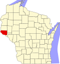
Location of Ellsworth
in Pierce County, Wisconsin
USA Wisconsin location map.svg
Red pog.svg
Ellsworth
Location within the state of Wisconsin
Usa edcp location map.svg
Red pog.svg
Ellsworth
Location within the United States
North America laea location map.svg
Red pog.svg
Ellsworth
Ellsworth (North America)
Coordinates: 44°43′57″N92°28′48″W / 44.73250°N 92.48000°W / 44.73250; -92.48000
Country Flag of the United States.svg  United States
State Flag of Wisconsin.svg  Wisconsin
County Pierce
Government
  Village Board PresidentBecky Beissel
Area
[1]
  Total3.80 sq mi (9.84 km2)
  Land3.80 sq mi (9.83 km2)
  Water0.00 sq mi (0.00 km2)
Elevation
1,226 ft (315 m)
Population
 (2020) [2]
  Total3,348
  Density881.7/sq mi (340.4/km2)
Time zone UTC-6 (CST)
  Summer (DST) UTC-5 (CDT)
Zipcode
54011, 54010
Area code(s) 715 & 534
FIPS code 55-23525 [3]
GNIS feature ID1564550 [4]
Website www.villageofellsworth.org

Ellsworth is a village in and the county seat of Pierce County, Wisconsin, United States. The population was 3,348 at the 2020 census. [2] The village is adjacent to the Town of Ellsworth and now incorporates the formerly separate district known as East Ellsworth. The municipality of Ellsworth and its surroundings are slowly becoming incorporated into the Twin Cities Metro Area.[ citation needed ]

Contents

History

Welcome sign to Ellsworth Ellsworth Wisconsin, The Cheese Curd Capital Welcomes You.jpg
Welcome sign to Ellsworth

Settlement in the area that now comprises the village of Ellsworth began with the arrival of several families in 1857. The village was officially platted in 1862, then incorporated in 1887. [5] The village was initially called Perry, in honor of the War of 1812 hero, Oliver Hazard Perry, but was renamed in 1866 in honor of Col. Elmer E. Ellsworth, the first Union officer to die in the Civil War. [6] A close friend of Pres. Abraham Lincoln, Ellsworth died while removing a highly visible Confederate flag from the roof of a hotel overlooking the Potomac River in Alexandria, Virginia. The incident received national attention, and at least one other town, Ellsworth, Michigan, was named in his honor. [7]

Downtown Ellsworth's location atop a steep hill is the result of an 1861 dispute between Pierce County's two major towns, Prescott and River Falls, over which should be county seat. The compromise reached was to draw lines on a map connecting the corners of the county, northwest to southeast and northeast to southwest. The intersection of these lines at a densely forested site at the top of a ridge determined the placement of the new town. A log building was hastily erected to serve as a courthouse, then replaced by a wood-frame structure about two years later. [8] The current Pierce County Courthouse, built 1905, was designed by the noted St. Paul firm of Buechner & Orth. The structure exhibits characteristics of both the neoclassical and Beaux-Arts styles, topped by a large dome above a five-story hexagonal rotunda. [9]

Geography

According to the United States Census Bureau, the village has a total area of 3.75 square miles (9.71 km2), all of it land. [10]

Ellsworth is located at 44°43′57″N92°28′48″W / 44.73250°N 92.48000°W / 44.73250; -92.48000 (44.73261, -92.480177). [11]

Ellsworth is along U.S. Highways 10 and 63, and Wisconsin Highways 65 and 72.

Climate

Climate data for Ellsworth, Wisconsin (1991–2020 normals, extremes 1908–1909, 1944–present)
MonthJanFebMarAprMayJunJulAugSepOctNovDecYear
Record high °F (°C)53
(12)
64
(18)
80
(27)
88
(31)
94
(34)
98
(37)
105
(41)
99
(37)
96
(36)
90
(32)
77
(25)
63
(17)
105
(41)
Mean daily maximum °F (°C)21.3
(−5.9)
26.6
(−3.0)
39.2
(4.0)
54.2
(12.3)
66.4
(19.1)
75.6
(24.2)
79.5
(26.4)
77.5
(25.3)
70.6
(21.4)
57.0
(13.9)
40.4
(4.7)
26.6
(−3.0)
52.9
(11.6)
Daily mean °F (°C)11.9
(−11.2)
16.4
(−8.7)
28.9
(−1.7)
42.5
(5.8)
54.8
(12.7)
64.5
(18.1)
68.4
(20.2)
66.2
(19.0)
58.9
(14.9)
45.8
(7.7)
31.1
(−0.5)
18.3
(−7.6)
42.3
(5.7)
Mean daily minimum °F (°C)2.4
(−16.4)
6.1
(−14.4)
18.6
(−7.4)
30.8
(−0.7)
43.1
(6.2)
53.4
(11.9)
57.3
(14.1)
55.0
(12.8)
47.3
(8.5)
34.6
(1.4)
21.8
(−5.7)
10.0
(−12.2)
31.7
(−0.2)
Record low °F (°C)−37
(−38)
−37
(−38)
−29
(−34)
1
(−17)
19
(−7)
31
(−1)
38
(3)
35
(2)
22
(−6)
8
(−13)
−15
(−26)
−40
(−40)
−40
(−40)
Average precipitation inches (mm)1.01
(26)
1.00
(25)
1.99
(51)
2.99
(76)
4.51
(115)
5.25
(133)
4.11
(104)
5.04
(128)
3.87
(98)
2.84
(72)
1.97
(50)
1.36
(35)
35.94
(913)
Average precipitation days (≥ 0.01 in)7.45.77.510.212.812.910.29.79.69.77.37.7110.7
Source: NOAA [12] [13]

Demographics

Historical population
CensusPop.Note
1880 432
1890 67055.1%
1900 1,05257.0%
1910 1,005−4.5%
1920 1,0433.8%
1930 1,1247.8%
1940 1,34019.2%
1950 1,47510.1%
1960 1,70115.3%
1970 1,98316.6%
1980 2,1438.1%
1990 2,70626.3%
2000 2,9097.5%
2010 3,28412.9%
2020 3,3481.9%
U.S. Decennial Census [14] 2020 [2]

2020 census

As of the census of 2020, [2] the population was 3,348. The population density was 881.7 inhabitants per square mile (340.4/km2). There were 1,467 housing units at an average density of 386.4 per square mile (149.2/km2). The racial makeup of the village was 93.2% White, 0.7% Black or African American, 0.4% Native American, 0.1% Asian, 1.1% from other races, and 4.5% from two or more races. Ethnically, the population was 3.0% Hispanic or Latino of any race.

2010 census

As of the census [15] of 2010, there were 3,284 people, 1,331 households, and 827 families residing in the village. The population density was 875.7 inhabitants per square mile (338.1/km2). There were 1,434 housing units at an average density of 382.4 per square mile (147.6/km2). The racial makeup of the village was 96.6% White, 0.3% African American, 0.3% Native American, 0.4% Asian, 0.8% from other races, and 1.6% from two or more races. Hispanic or Latino of any race were 1.5% of the population.

There were 1,331 households, of which 34.5% had children under the age of 18 living with them, 44.9% were married couples living together, 12.1% had a female householder with no husband present, 5.1% had a male householder with no wife present, and 37.9% were non-families. 31.6% of all households were made up of individuals, and 13.2% had someone living alone who was 65 years of age or older. The average household size was 2.39 and the average family size was 2.98.

The median age in the village was 35.7 years. 26.2% of residents were under the age of 18; 7.9% were between the ages of 18 and 24; 27.8% were from 25 to 44; 23.7% were from 45 to 64; and 14.5% were 65 years of age or older. The gender makeup of the village was 49.0% male and 51.0% female.

2000 income statistics

As of 2000 the median income for a household in the village was $42,604, and the median income for a family was $51,286. Males had a median income of $36,069 versus $25,000 for females. The per capita income for the village was $18,661. About 2.6% of families and 5.4% of the population were below the poverty line, including 4.4% of those under age 18 and 7.9% of those age 65 or over.

East Ellsworth

Pierce County courthouse Pierce County Courthouse.jpg
Pierce County courthouse

The steep grades approaching Ellsworth's hilltop location proved an insurmountable challenge to railroad construction. When the Chicago, St. Paul, Minneapolis and Omaha Railway ("Omaha Road") surveyed a branch line to the locale in 1885, it bypassed the village and constructed a depot about one mile away at the foot of the grade. [16] The businesses that grew up by the station coalesced into the independent village of East Ellsworth. Although they are now administered as one municipal entity, Ellsworth and East Ellsworth retain separate ZIP codes. [17] The Isabelle River runs through East Ellsworth.

Economy

Cheese Curd Festival

Ellsworth is known as the cheese curd capital of Wisconsin, due to the cheese curds produced by its namesake creamery. The last weekend in June is reserved for a town festival which celebrates the cheese curd. [18]

Notable people

Related Research Articles

<span class="mw-page-title-main">Pierce County, Wisconsin</span> County in Wisconsin, United States

Pierce County is a county in the U.S. state of Wisconsin. As of the 2020 census, the population was 42,212. Its county seat is Ellsworth.

<span class="mw-page-title-main">Ellsworth, Illinois</span> Village in Illinois, United States

Ellsworth is a village in Dawson Township, McLean County, Illinois, United States. The population was 184 at the 2020 census. It is part of the Bloomington–Normal Metropolitan Statistical Area.

<span class="mw-page-title-main">Pierce, Nebraska</span> City in Nebraska, United States

Pierce is a city in and county seat of Pierce County, Nebraska, United States. The population was 1,767 at the 2010 census.

<span class="mw-page-title-main">Somerset, Ohio</span> Village in Ohio, United States

Somerset is a village in Perry County, Ohio, United States. The population was 1,481 at the 2020 census. It is located 9.5 miles (15.3 km) north of the county seat New Lexington and has a dedicated historical district. Saint Joseph Church, the oldest Catholic church in Ohio, is located just outside Somerset on State Route 383.

<span class="mw-page-title-main">Pearisburg, Virginia</span> Town in Virginia, United States

Pearisburg is a town in Giles County, Virginia, and the county seat. The population was 2,909 at the time of the 2020 census. Pearisburg is part of the Blacksburg–Christiansburg Metropolitan Statistical Area.

<span class="mw-page-title-main">Elmwood, Wisconsin</span> Village in Wisconsin, United States

Elmwood is a village in Pierce County, Wisconsin, along the Eau Galle River. The population was 817 at the 2010 census.

<span class="mw-page-title-main">Prescott, Wisconsin</span> City in Wisconsin, United States

Prescott is a city in Pierce County, Wisconsin at the confluence of the St. Croix River and Mississippi River. The population was 4,258 at the 2010 census, making it the second-largest city in the county after River Falls, and the largest entirely within Pierce County.

<span class="mw-page-title-main">Salem, Pierce County, Wisconsin</span> Town in Wisconsin, United States

Salem is a town in Pierce County, Wisconsin, United States. The population was 475 at the 2020 census. The unincorporated community of Ono is also located partially in the town.

<span class="mw-page-title-main">Trimbelle, Wisconsin</span> Town in Wisconsin, United States

Trimbelle is a town in Pierce County, Wisconsin, United States. The population was 1,511 at the 2000 census. The unincorporated communities of Beldenville and Ottman Corners are located in the town. The unincorporated community of Moeville is also located partially in the town.

<span class="mw-page-title-main">Woodville, Wisconsin</span> Village in Wisconsin, United States

Woodville is a village in St. Croix County, Wisconsin, United States. The population was 1,344 at the 2010 census.

<span class="mw-page-title-main">Whitehall, Wisconsin</span> City in Wisconsin, United States

Whitehall is a city in Trempealeau County, Wisconsin, United States, along the Trempealeau River. The population was 1,645 at the 2020 census. It is the county seat of Trempealeau County.

<span class="mw-page-title-main">Montfort, Wisconsin</span> Village in Wisconsin, United States

Montfort is a village in Grant and Iowa Counties in the U.S. state of Wisconsin. The population was 718 at the 2010 census. Of this, 622 were in Grant County, and 96 were in Iowa County.

<span class="mw-page-title-main">Pulaski, Wisconsin</span> Village in Wisconsin, United States

Pulaski is a village in Brown, Oconto, and Shawano counties in the U.S. state of Wisconsin. The population was 3,539 at the 2010 census. Of this, 3,321 were in Brown County, 218 in Shawano County, and none in Oconto County.

<span class="mw-page-title-main">Spring Valley, Wisconsin</span> Village in Wisconsin, United States

Spring Valley is a village in Pierce and St. Croix counties in Wisconsin, United States. The population was 1,401 at the 2020 census. Of those, 1,390 were in Pierce County and 11 in St. Croix County. The village is mostly within the Town of Spring Lake in Pierce County. Small parts also lie in the Town of Gilman, also in Pierce County, and the Town of Cady in St. Croix County.

<span class="mw-page-title-main">Nelson, Wisconsin</span> Village in Wisconsin, United States

Nelson is a village in Buffalo County in the U.S. state of Wisconsin. The population was 374 at the 2010 census. The village is surrounded by the Town of Nelson.

<span class="mw-page-title-main">Colby, Wisconsin</span> City in Wisconsin, United States

Colby is a city in Clark and Marathon counties in the U.S. state of Wisconsin. It is part of the Wausau, Wisconsin Metropolitan Statistical Area. The population was 1,852 at the 2010 census. Of this, 1,354 were in Clark County, and 498 were in Marathon County. The city is bordered by the Town of Colby, the Town of Hull, and the City of Abbotsford. Colby cheese was first created in Colby.

The Town of Arena is a town located in Iowa County, Wisconsin, United States. The population was 1,444 at the 2000 census. The Village of Arena is located within the town. The unincorporated communities of Coon Rock, and Helena are also located within the town.

<span class="mw-page-title-main">Gratiot, Wisconsin</span> Village in Wisconsin, United States

Gratiot is a village in Lafayette County, Wisconsin, United States. The population was 236 at the 2010 census. The village is surrounded by the Town of Gratiot.

Ellsworth is a town in Pierce County, Wisconsin, United States. The population was 1,064 at the 2000 census. The Village of Ellsworth is located within the town. The unincorporated community of Lawton is also located partially in the town.

<span class="mw-page-title-main">River Falls, Wisconsin</span> City in Wisconsin, United States

River Falls is a city in Pierce and St. Croix counties in the U.S. state of Wisconsin. It is located mostly within the town of River Falls, and adjacent to the town of Kinnickinnic in St. Croix County. River Falls is the most populous city in Pierce County. The population was 16,182 at the 2020 census, with 12,546 residing in Pierce County and 3,636 in St. Croix County. It is part of the Minneapolis-St. Paul metropolitan area and located approximately 30 miles (48 km) east of the center of that region.

References

  1. "2019 U.S. Gazetteer Files". United States Census Bureau. Retrieved August 7, 2020.
  2. 1 2 3 4 "2020 Decennial Census: Ellsworth village, Wisconsin". data.census.gov. U.S. Census Bureau. Retrieved July 7, 2022.
  3. "ANSI and FIPS codes". Census.gov. US Census Bureau. Retrieved July 7, 2022.
  4. "US Board on Geographic Names". United States Geological Survey. October 25, 2007. Retrieved January 31, 2008.
  5. "History of Ellsworth, Wisconsin".
  6. Chicago and North Western Railway Company (1908). A History of the Origin of the Place Names Connected with the Chicago & North Western and Chicago, St. Paul, Minneapolis & Omaha Railways. p. 175.
  7. "Elmer E. Ellsworth" https://en.wikipedia.org/wiki/Elmer_E._Ellsworth
  8. Seyforth, H.G. "Pierce County courthouse was built 55 years ago." (Pamphlet retrieved at Ellsworth, Wisconsin, Public Library, November 24, 2015)
  9. National Register of Historic Places Thematic Nomination: "Courthouses of Wisconsin." State Historical Society of Wisconsin, 1981. https://catalog.archives.gov/id/106779302
  10. "US Gazetteer files 2010". United States Census Bureau. Archived from the original on January 25, 2012. Retrieved November 18, 2012.
  11. "US Gazetteer files: 2010, 2000, and 1990". United States Census Bureau. February 12, 2011. Retrieved April 23, 2011.
  12. "NOWData - NOAA Online Weather Data". National Oceanic and Atmospheric Administration. Retrieved March 28, 2024.
  13. "Summary of Monthly Normals 1991-2020". National Oceanic and Atmospheric Administration. Retrieved March 28, 2024.
  14. "Census of Population and Housing". Census.gov. Retrieved June 4, 2015.
  15. "U.S. Census website". United States Census Bureau . Retrieved November 18, 2012.
  16. Miller, Stan. Omaha Road: The Chicago, St. Paul, Minneapolis & Omaha. Mukilteo, Washington, Hundman Publishing Inc. 2004.
  17. "Towns and Cities of Pierce County". www.rootsweb.ancestry.com.
  18. "Cheese Curd Festival - Ellsworth Area Chamber of Commerce, WI". www.ellsworthchamber.com.