
Pierce County is a county in the U.S. state of Wisconsin. As of the 2020 census, the population was 42,212. Its county seat is Ellsworth.

Turtle River is a town in Beltrami County, Minnesota, United States. The population was 77 at the 2010 census. The elevation is 1,332 ft (406m). It is approximately 17 miles northeast of Bemidji, where most community services are available. Turtle River consists of two stores, a restaurant, a gas station, and a church.

Allouez is a village in Brown County in the U.S. state of Wisconsin. The population was 14,156 at the 2020 census. It is part of the Green Bay Metropolitan Statistical Area.

Fountain City is a small city bordering the Mississippi River in Buffalo County, Wisconsin, United States.

Cadott is a village in Chippewa County in the U.S. state of Wisconsin. The population was 1,437 at the 2010 census.

Pardeeville is a village in Columbia County, Wisconsin, United States. The population was 2,115 at the 2010 census. It is part of the Madison Metropolitan Statistical Area.

Merrillan is a village in Jackson County, Wisconsin, United States. The population was 542 at the 2010 census.
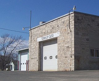
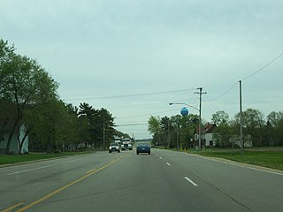
Cato is a town in Manitowoc County, Wisconsin, United States. The population was 1,616 at the 2000 census. A Manitowoc County park is located in the town; it is called "Cato Falls" for a waterfall on the Manitowoc River.

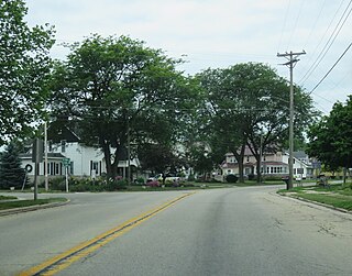
Maribel is a village in Manitowoc County, Wisconsin, United States. The population was 336 at the 2020 census.
Park Falls is a city in Price County, Wisconsin, United States. The population was 2,410 at the 2020 census, down from 2,462 at 2010. Located in the woods of north central Wisconsin, primarily the Chequamegon National Forest, Park Falls is a small community divided by the North Fork of the Flambeau River, a popular destination for fishing, canoeing and whitewater rafting.
New Richmond is a city in St. Croix County, Wisconsin, United States. Its population was 10,079 as of the 2020 census. New Richmond is within the Minneapolis-Saint Paul metropolitan area.

Biron is a village in Wood County, Wisconsin, United States. The population was 839 at the 2010 census. It is the site of ND Paper's Biron Mill.

Nekoosa is a city in Wood County, Wisconsin, United States. Its name derives from the Ho-Chunk word, "Nįįkuusra", "Nakrusa", or "Nįkusara" which translates to "running water". The population was 2,580 at the 2010 census.

Abbotsford is a city in Clark and Marathon counties in the U.S. state of Wisconsin. The population was 2,275 at the 2020 census. Of this, 1,665 were in Clark County, and 610 were in Marathon County. Abbotsford is nicknamed "Wisconsin's First City" due to its alphabetical place on a list of Wisconsin cities.

Wrightstown is a village in Brown and Outagamie counties in the U.S. state of Wisconsin. The population was 3,179 at the 2020 census. The village is surrounded mostly by the westernmost part of the Town of Wrightstown in Brown County. On February 28, 2002, the village annexed a portion of land within the adjacent Town of Kaukauna in Outagamie County.

Ripon is a city in Fond du Lac County, Wisconsin, United States. The population was 7,863 at the 2020 census. The city is surrounded by the Town of Ripon.

Green Lake is a city in and county seat of Green Lake County, Wisconsin, United States. The city had a population of 1,001 in the 2020 census. It is located on the north side of Green Lake. The Town of Green Lake is located on the south side of Big Green Lake, opposite the city.
Princeton is a city in western part of Green Lake County, Wisconsin, United States. The population was 1,214 at the 2010 census. The city is located within the Town of Princeton. The Fox River flows through the city, dividing the city into an east half and west half.
Arena is a village in Iowa County, Wisconsin, United States. The population was 834 at the 2010 census. The village is located within the Town of Arena. It is part of the Madison Metropolitan Statistical Area.
Gillett is a city in Oconto County, Wisconsin, United States. The population was 1,386 at the 2010 census. It is part of the Green Bay Metropolitan Statistical Area. The city is adjacent to the Town of Gillett.


