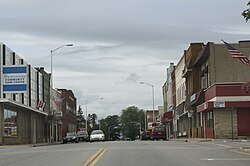
Merrill, Wisconsin

Last updated

City of Merrill
Merrill Wisconsin Downtown2 West Westside WIS64.jpg
Looking west at the western downtown
Nickname: 
City of Parks
Lincoln County Wisconsin Incorporated and Unincorporated areas Merrill Highlighted.svg
Location of Merrill in Lincoln County, Wisconsin.
USA Wisconsin relief location map.svg
Red pog.svg
Merrill
Location within Wisconsin
Usa edcp relief location map.png
Red pog.svg
Merrill
Merrill (the United States)
Coordinates: 45°10′57″N89°41′44″W / 45.18250°N 89.69556°W / 45.18250; -89.69556
Country United States
State Wisconsin
County Lincoln County
Name Adopted1881
First Mayor and City Council1883
Government
   Mayor Steve Hass [1]
Area
[2]
  Total8.08 sq mi (20.94 km2)
  Land7.50 sq mi (19.44 km2)
  Water0.58 sq mi (1.50 km2)  7.30%
Elevation
1,316 ft (401 m)
Population
 (2020) [3]
  Total9,347
  Estimate 
(2022) [4]
9,122
  Density1,245.6/sq mi (480.9/km2)
Demonym Merrillite
Time zone UTC-6 (CST)
  Summer (DST) UTC-5 (CDT)
ZIP code
54452
Area code(s) 715 & 534
FIPS code 55-51250
Website www.ci.merrill.wi.us

Merrill is a city in and the county seat of Lincoln County, Wisconsin, United States. It is located to the south of and adjacent to the Town of Merrill. The population was 9,347, according to the 2020 census. [3] Merrill is part of the United States Census Bureau's Merrill MSA, which includes all of Lincoln County. Together with the Wausau MSA, which includes all of Marathon County, it forms the Wausau-Merrill CSA.

Contents

History

Merrill was first inhabited by the Chippewa Native Americans. The first European settlement there was a logging town named Jenny Bull Falls. By 1843, a trading post was constructed near the town; John Faely was the first settler. Within four years a dam, started by Andrew Warren, was constructed over the Wisconsin River. Warren then established the first mill powered by the dam, and other saw mills in the area. In 1870, T. B. Scott succeeded Warren, and the mill soon became increasingly successful. In 1899 the mill burned down. During that time the name of the community was changed to Merrill, [5] in honor of Sherburn S. Merrill (1818–1885), the general manager of the Chicago, Milwaukee, St. Paul, and Pacific Railroad. [6]

In 1881, the Wisconsin Telephone Company began operation, with 20 phones in service. In 1883, the first City Council met and T. B. Scott was named the first mayor. By 1885, the population had risen to 7,000, approximately 3,000 less than Merrill's population today. [5] The railroad and passenger depot was a hub of social activity through the lumber industry's boom years and after. It later became a community youth center, but has since been razed. By 1900, the timber industry was in decline and the community was compelled to diversify its economy. In 1892, the Weinbrenner Shoe Company was established with Merrill headquarters. [7] In July 1912, the Wisconsin River and several of its tributaries flooded from Rothschild to Merrill, destroying several dams (active and abandoned), as well as causing hundreds of thousands of dollars in damage in Merrill.

Geography

Merrill is located at 45°10′57″N89°41′44″W / 45.18250°N 89.69556°W / 45.18250; -89.69556 (45.182569, -89.69559), [8] along the Wisconsin River at its confluence with the Prairie River.

According to the United States Census Bureau, the city has a total area of 8.08 square miles (20.93 km2), of which, 7.5 square miles (19.42 km2) is land and 0.58 square miles (1.50 km2) is water. [9]

Merrill is located west of US Route 51 on State Highway 64 (Main Street).

Council Grounds State Park is due west of the city.

Demographics

Historical population
CensusPop.Note
1880 882
1890 6,809672.0%
1900 8,53725.4%
1910 8,6891.8%
1920 8,068−7.1%
1930 8,4584.8%
1940 8,7113.0%
1950 8,9512.8%
1960 9,4515.6%
1970 9,5020.5%
1980 9,5780.8%
1990 9,8602.9%
2000 10,1462.9%
2010 9,661−4.8%
2020 9,347−3.3%
2022 (est.)9,122 [4] −2.4%
U.S. Decennial Census [10]

2020 census

As of the census of 2020, [3] the population was 9,347. The population density was 1,245.6 inhabitants per square mile (480.9/km2). There were 4,503 housing units at an average density of 600.1 per square mile (231.7/km2). The racial makeup of the city was 93.1% White, 0.7% Native American, 0.7% Black or African American, 0.4% Asian, 1.0% from other races, and 4.1% from two or more races. Ethnically, the population was 2.6% Hispanic or Latino of any race.

2010 census

As of the census [11] of 2010, there were 9,661 people, 4,175 households, and 2,516 families residing in the city. The population density was 1,334.4 inhabitants per square mile (515.2/km2). There were 4,619 housing units at an average density of 638.0 per square mile (246.3/km2). The racial makeup of the city was 96.3% White, 0.5% African American, 0.4% Native American, 0.6% Asian, 0.8% from other races, and 1.2% from two or more races. Hispanic or Latino of any race were 2.0% of the population.

There were 4,175 households, of which 29.4% had children under the age of 18 living with them, 43.0% were married couples living together, 12.4% had a female householder with no husband present, 4.9% had a male householder with no wife present, and 39.7% were non-families. 35.0% of all households were made up of individuals, and 17.4% had someone living alone who was 65 years of age or older. The average household size was 2.25 and the average family size was 2.88.

The median age in the city was 40.4 years. 23.9% of residents were under the age of 18; 7.2% were between the ages of 18 and 24; 24.9% were from 25 to 44; 24.5% were from 45 to 64; and 19.4% were 65 years of age or older. The gender makeup of the city was 47.6% male and 52.4% female.

2000 census

As of the census [12] of 2000, there were 10,146 people, 4,183 households, and 2,631 families residing in the city. The population density was 1,441.7 people per square mile (556.4/km2). There were 4,397 housing units at an average density of 624.8 per square mile (241.1/km2). The racial makeup of the city was 97.77% White, 0.20% Black or African American, 0.54% Native American, 0.42% Asian, 0.04% Pacific Islander, 0.36% from other races, and 0.66% from two or more races. 1.03% of the population were Hispanic or Latino of any race.

There were 4,183 households, out of which 31.0% had children under the age of 18 living with them, 47.2% were married couples living together, 11.9% had a female householder with no husband present, and 37.1% were non-families. 32.3% of all households were made up of individuals, and 17.6% had someone living alone who was 65 years of age or older. The average household size was 2.34 and the average family size was 2.96.

In the city, the population was spread out, with 25.3% under the age of 18, 8.5% from 18 to 24, 27.5% from 25 to 44, 19.1% from 45 to 64, and 19.7% who were 65 years of age or older. The median age was 37 years. For every 100 females, there were 89.8 males. For every 100 females age 18 and over, there were 84.4 males.

The median income for a household in the city was $33,098, and the median income for a family was $45,860. Males had a median income of $30,789 versus $21,372 for females. The per capita income for the city was $17,429. About 5.7% of families and 9.5% of the population were below the poverty line, including 10.7% of those under age 18 and 15.0% of those age 65 or over.

Government

Lincoln County Courthouse LincolnCountyCourthouse.JPG
Lincoln County Courthouse

The Lincoln County Courthouse, begun in 1903, was completed at a cost of $119,882. Its central rotunda is 32 feet in diameter; second floor offices lead off its balcony. A 48-inch bell and one-ton clock were mounted on the roof tower. [13] It was added to the National Register of Historic Places on April 19, 1978.

Education

Merrill is served by the Merrill Area Public School District. Northcentral Technical College's Public Safety Training center was built in Merrill in 2005.

Public schools

City hall Merrill Wisconsin City Hall 2011 Present.jpg
City hall

Private schools

Transportation

Highways

US 51.svg
U.S. 51 Northbound US 51 travels to Woodruff, Wisconsin. Southbound, US 51 routes to Wausau, Wisconsin.
WIS 17.svg
WIS 17 travels north to Rhinelander, Wisconsin.
WIS 64.svg
WIS 64 travels east to Antigo, Wisconsin and west to Medford, Wisconsin.
WIS 107.svg
WIS 107 travels north to Tomahawk, Wisconsin and south to Mosinee, Wisconsin.

From 1889 to 1921 a streetcar line was operated by the Merrill Railway & Lighting Co., which also operated one of the earliest trolleybus lines in the United States in 1913.

Local transit

The City of Merrill operates an on-demand bus system within the city limits, known as the Merrill Transit System (formerly Merrill-Go-Round). As of 2019, the fee is $2.00 general and $1.00 for the elderly and disabled. [14]

The community supports a private Blue Jay Taxi service. The service is in part supported by the Merrill/Tomahawk Tavern League through its SafeRide Home program providing over 1,200 free ride vouchers annually, and is locally funded by the annual Lobsterfest event. [15] The program unique to Wisconsin and is considered an effective means by other states to eliminate drunk driving. [16]

Airport

Merrill is served by the Merrill Municipal Airport (KRRL). Located one mile northwest of the city's center, the airport handles approximately 18,600 operations per year, with roughly 96% general aviation and 4% air taxi. The airport has a 5,100-foot asphalt runway with approved GPS approaches (Runway 7-25) and a 2,997-foot asphalt crosswind runway (Runway 16-34). [17]

Parks and recreation

Parks

Community parks:

  • Lion's Park
  • Stange Park
  • Merrill Area Recreation Complex (MARC) [18]
  • Dog Park [19]

Neighborhood parks:

  • Streeter Square
  • Ott's Park [20]
  • Riverside Park
  • Stange Kitchenette
  • Normal Park

Special use:

  • Athletic Park
  • Gebert Park
  • Memorial Forest Wildlife Area

State:

  • Council Grounds State Park [21]

Other:

  • Camp New Wood County Park
  • Cenotaph Memorial Park
  • Jack Pines Park
  • Tug Lake Recreation Area [22]

Recreation

  • Merrill Enrichment Center
  • MARC/Smith Center [23]
  • Merrill Soccer
  • Merrill City Band [24]
  • Merrill Tennis
  • River Bend Trail [25]
  • Merrill City Softball
  • Merrill Fast Pitch

Historic places

Notable people

Images

Related Research Articles

<span class="mw-page-title-main">Lincoln County, Wisconsin</span> County in Wisconsin, United States

Lincoln County is a county located in the U.S. state of Wisconsin. As of the 2020 census, the population was 28,415. Its county seat is Merrill. The county was created in 1875 and named after President Abraham Lincoln.

<span class="mw-page-title-main">Taylors Falls, Minnesota</span> City in Minnesota, United States

Taylors Falls is a city in Chisago County, Minnesota, United States, located at the junction of U.S. Highway 8 and Minnesota State Highway 95. The population was 1,055 at the 2020 census.

<span class="mw-page-title-main">Bradley, Wisconsin</span> Town in Wisconsin, United States

Bradley is a town in Lincoln County, Wisconsin, United States. The population was 2,408 at the 2010 census, down from 2,573 at the 2000 census. The unincorporated communities of Bradley, Gilbert, Heafford Junction, and West Kraft are located in the town.

<span class="mw-page-title-main">Corning, Wisconsin</span> Town in Wisconsin, United States

Corning is a town in Lincoln County, Wisconsin, United States. The population was 883 at the 2010 census, up from 826 at the 2000 census.

<span class="mw-page-title-main">King, Lincoln County, Wisconsin</span> Town in Wisconsin, United States

King is a town in Lincoln County, Wisconsin, United States. The population was 855 at the 2010 census.

<span class="mw-page-title-main">Pine River, Wisconsin</span> Town in Wisconsin, United States

Pine River is a town in Lincoln County, Wisconsin. The population was 1,869 at the time of the 2010 census.

<span class="mw-page-title-main">Rock Falls, Wisconsin</span> Town in Wisconsin, United States

Rock Falls is a town in Lincoln County, Wisconsin, United States. The population was 618 at the 2010 census.

<span class="mw-page-title-main">Russell, Lincoln County, Wisconsin</span> Town in Wisconsin, United States

Russell is a town in Lincoln County, Wisconsin, United States. The population was 677 at the 2010 census. The unincorporated communities of Gleason and Dudley are located in the town. The unincorporated community of Bloomville is also located partially in the town.

<span class="mw-page-title-main">Schley, Wisconsin</span> Town in Wisconsin, United States

Schley is a town in Lincoln County, Wisconsin, United States. The population was 934 at the 2010 census. The unincorporated communities of Doering and Dutch Corners are located in the town. The unincorporated community of Bloomville is also located partially in the town.

<span class="mw-page-title-main">Scott, Lincoln County, Wisconsin</span> Town in Wisconsin, United States

Scott is a town in Lincoln County, Wisconsin, United States. The population was 1,432 at the 2010 census, up from 1,287 at the 2000 census.

<span class="mw-page-title-main">Frederic, Wisconsin</span> Village in Wisconsin, United States

Frederic is a village in Polk County, Wisconsin, United States. The population was 1,137 at the 2010 census. It was established as a village in 1901.

<span class="mw-page-title-main">Park Falls, Wisconsin</span> City in Wisconsin, United States

Park Falls is a city in Price County, Wisconsin, United States. The population was 2,462 at the 2010 census. Located in the woods of north central Wisconsin, primarily the Chequamegon National Forest, Park Falls is a small community divided by the North Fork of the Flambeau River, a popular destination for fishing, canoeing and whitewater rafting.

<span class="mw-page-title-main">Merrill (town), Wisconsin</span> Town in Wisconsin, United States

Merrill is a town in Lincoln County, Wisconsin, United States. The population was 2,980 at the 2010 census. The city of Merrill is located to the south of and adjacent to the town. The city has incorporated a portion of land that had been part of the town. The unincorporated community of Otis is also located in the town.

<span class="mw-page-title-main">St. Croix Falls, Wisconsin</span> City in Wisconsin, United States

St. Croix Falls is a city in Polk County, Wisconsin, United States. The population was 2,208 at the 2020 census. The city is located within the Town of St. Croix Falls.

<span class="mw-page-title-main">Medford, Wisconsin</span> City in Wisconsin, United States

Medford is a city in Taylor County, in north-central Wisconsin, United States. The population was 4,349 at the 2020 census. The city is located mostly within the boundaries of the Town of Medford. It is the county seat of Taylor County.

<span class="mw-page-title-main">Hillsboro, Wisconsin</span> City in Wisconsin, United States

Hillsboro is a city in Vernon County, Wisconsin, United States. The population was 1,397 at the 2020 Census. The city is located within the Town of Hillsboro. Hillsboro is known as the Czech Capital of Wisconsin.

<span class="mw-page-title-main">Neenah, Wisconsin</span> Human settlement in Wisconsin, USA, since 1835

Neenah is a city in Winnebago County, Wisconsin, in the north central United States. It is situated on the banks of Lake Winnebago, Little Lake Butte des Morts, and the Fox River, approximately forty miles (64 km) southwest of Green Bay. Neenah's population was 27,319 at the 2020 census.

<span class="mw-page-title-main">Omro, Wisconsin</span> City in Wisconsin, United States

Omro is a city in Winnebago County, Wisconsin, United States. The population was 3,517 at the 2010 census. The city is located along the Fox River, approximately 10 miles west of Oshkosh, Wisconsin.

<span class="mw-page-title-main">Arcadia, Wisconsin</span> City in Wisconsin, United States

Arcadia is a city in Trempealeau County, Wisconsin, United States, along the Trempealeau River. The population was 3,737 at the 2020 census. Arcadia is a Latino-majority city and the largest city in Trempealeau county.

<span class="mw-page-title-main">Black River Falls, Wisconsin</span> City in Wisconsin, United States

Black River Falls is a city in and the county seat of Jackson County, Wisconsin, United States. The population was 3,523 at the 2020 census. It is home to the administrative center of the Ho-Chunk Nation.

References

  1. "Elected Officials". City of Merrill, Wisconsin. Retrieved June 9, 2022.
  2. "2019 U.S. Gazetteer Files". United States Census Bureau. Retrieved August 7, 2020.
  3. 1 2 3 "2020 Decennial Census: Merrill city, Wisconsin". data.census.gov. U.S. Census Bureau. Retrieved July 27, 2022.
  4. 1 2 "QuickFacts Merrill city, Wisconsin". United States Census Bureau. Retrieved May 31, 2023.
  5. 1 2 "Merrill History". Archived from the original on December 20, 2009. Retrieved December 6, 2011.
  6. "About Us". City of Merrill. Retrieved January 26, 2018.
  7. "THOROGOOD WORK BOOTS | Safety and Non-Safety | AMERICAN MADE - UNION MADE | Lifetime Union Member Discounts | FREE SHIPPING & EXCHANGES". www.theunionbootpro.com. Retrieved July 13, 2020.
  8. "US Gazetteer files: 2010, 2000, and 1990". United States Census Bureau. February 12, 2011. Retrieved April 23, 2011.
  9. "2020 Gazetteer Files". census.gov. U.S. Census Bureau. Retrieved July 27, 2022.
  10. "Census of Population and Housing". Census.gov. Retrieved June 4, 2015.
  11. "U.S. Census website". United States Census Bureau . Retrieved November 18, 2012.
  12. "U.S. Census website". United States Census Bureau . Retrieved January 31, 2008.
  13. Wisconsin courthouses Archived 2012-08-06 at the Wayback Machine .
  14. "Transit".
  15. "SafeRide program: Over three decades of success". December 21, 2018.
  16. "Tavern League | SafeRide Program".
  17. "AirNav: Airport Information".
  18. "Home". Merrill Youth Hockey Association.
  19. "Dog Park › City of Merrill Parks and Rec".
  20. "Ott's › City of Merrill Parks and Rec". www.merrillparkandrec.com. Archived from the original on April 25, 2016.
  21. "Council Grounds State Park | Wisconsin DNR". dnr.wisconsin.gov.
  22. "Welcome to Merrill!". www.ci.merrill.wi.us.
  23. "Merrill Area Recreation Complex › City of Merrill Parks and Rec".
  24. "Merrill City Band | Founded in 1911".
  25. "River Bend Trail". River Bend Trail.
  26. "Wisconsin (U.S. National Park Service)".