Marathon County, Wisconsin

Last updated

Marathon County
Marathon County Courthouse, Wisconsin.jpg
Marathon County Courthouse in Wausau
Map of Wisconsin highlighting Marathon County.svg
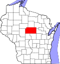
Location within the U.S. state of Wisconsin
Wisconsin in United States.svg
Wisconsin's location within the U.S.
Coordinates: 44°54′N89°46′W / 44.9°N 89.76°W / 44.9; -89.76
CountryFlag of the United States.svg United States
StateFlag of Wisconsin.svg  Wisconsin
Founded1850
Named for Marathon, Greece
Seat Wausau
Largest cityWausau
Area
  Total1,576 sq mi (4,080 km2)
  Land1,545 sq mi (4,000 km2)
  Water31 sq mi (80 km2)  2.0%%
Population
 (2020) [1]
  Total138,013
  Density89.3/sq mi (34.5/km2)
Time zone UTC−6 (Central)
  Summer (DST) UTC−5 (CDT)
Congressional district 7th
Website www.co.marathon.wi.us
Wisconsin 1866 US land Office Wisconsin 1866 US land Office.jpg
Wisconsin 1866 US land Office
Marathon County Fairgrounds MarathonCountyFairgrounds.jpg
Marathon County Fairgrounds

Marathon County is a county located in the U.S. state of Wisconsin. As of the 2020 census, the population was 138,013. [1] Marathon County's seat is Wausau. [2] It was founded in 1850, [2] created from a portion of Portage County. At that time the county stretched to the northern border with the upper Michigan peninsula. It is named after the battlefield at Marathon, Greece. [3]

Contents

Marathon County comprises the Wausau, WI Metropolitan Statistical Area and is included in the Wausau-Stevens Point-Wisconsin Rapids, WI Combined Statistical Area.

Geography

According to the U.S. Census Bureau, the county has a total area of 1,576 square miles (4,080 km2), of which 1,545 square miles (4,000 km2) is land and 31 square miles (80 km2) (2.0%) is water. [4] It is the largest county in Wisconsin by land area and fourth-largest by total area.

Marker located at the 45x90 point near Rietbrock Sign for the Western Hemisphere's 45X90 point.jpg
Marker located at the 45×90 point near Rietbrock

The Marathon County Park Commission has posted a geographical marker [5] that identifies the spot (45°N, 90°W) of the exact center of the northern half of the Western Hemisphere, meaning that it is a quarter of the way around the world from the Prime Meridian and halfway from the Equator to the North Pole.

Major highways

Railroads

Buses

Airports

Adjacent counties

Natural wildlife refuges

Demographics

Historical population
CensusPop.Note
1850 508
1860 2,892469.3%
1870 5,885103.5%
1880 17,121190.9%
1890 30,36977.4%
1900 43,25642.4%
1910 55,05427.3%
1920 65,25918.5%
1930 70,6298.2%
1940 75,9157.5%
1950 80,3375.8%
1960 88,87410.6%
1970 97,4579.7%
1980 111,27014.2%
1990 115,4003.7%
2000 125,8349.0%
2010 134,0636.5%
2020 138,0132.9%
U.S. Decennial Census [6]
1790–1960 [7] 1900–1990 [8]
1990–2000 [9] 2010 [10] 2020 [1]

2020 census

As of the census of 2020, [1] the population was 138,013. The population density was 89.3 inhabitants per square mile (34.5/km2). There were 59,828 housing units at an average density of 38.7 per square mile (14.9/km2). The racial makeup of the county was 86.9% White, 6.2% Asian, 0.9% Black or African American, 0.5% Native American, 1.3% from other races, and 4.3% from two or more races. Ethnically, the population was 3.2% Hispanic or Latino of any race.

2000 Census Age Pyramid for Marathon County USA Marathon County, Wisconsin age pyramid.svg
2000 Census Age Pyramid for Marathon County

2000 census

As of the census [11] of 2000, there were 125,834 people, 47,702 households, and 33,868 families residing in the county. The population density was 81 people per square mile (31/km2). There were 50,360 housing units at an average density of 33 per square mile (13/km2). The racial makeup of the county was 93.84% White, 0.28% Black or African American, 0.35% Native American, 4.54% Asian, 0.02% Pacific Islander, 0.26% from other races, and 0.72% from two or more races. 0.78% of the population were Hispanic or Latino of any race. 52.6% were of German and 13.6% Polish ancestry. 92.9% spoke English, 3.4% Hmong, 1.1% German and 1.1% Spanish as their first language.

There were 47,702 households, out of which 34.00% had children under the age of 18 living with them, 59.90% were married couples living together, 7.40% had a female householder with no husband present, and 29.00% were non-families. 23.60% of all households were made up of individuals, and 9.50% had someone living alone who was 65 years of age or older. The average household size was 2.60 and the average family size was 3.11.

In the county, the population was spread out, with 26.80% under the age of 18, 8.20% from 18 to 24, 29.50% from 25 to 44, 22.50% from 45 to 64, and 13.00% who were 65 years of age or older. The median age was 36 years. For every 100 females, there were 99.50 males. For every 100 females aged 18 and over, there were 97.40 males.

Libraries

The Marathon County Public Library (MCPL) has its headquarters in downtown Wausau, Wisconsin. Eight branch libraries have been established in the cities of Athens, Edgar, Hatley, Marathon City, Mosinee, Rothschild, Spencer, and Stratford.

Recreation

County parks

  • Amco County Park
  • Big Eau Pleine County Park
  • Big Rapids County Park
  • Bluegill Bay County Park
  • Cherokee County Park
  • Courthouse Square
  • D.C. Everest County Park
  • Dells of the Eau Claire County Park
  • Duane L. Corbin Shooting Range Park
  • Library Park
  • Marathon Park
  • Mission Lake County Park
  • Mountain-Bay State Park Trail
  • Reitbrock Geographical Marker
  • Rib Falls County Park
  • Sunny Vale County Park

Snowmobile trails

There are over 884 miles of groomed snowmobile trails in Marathon County maintained by 29 area snowmobile clubs. [12]

Communities

County sign on Wisconsin Highway 13 Marathon County Wisconsin Sign WIS13.jpg
County sign on Wisconsin Highway 13

Cities

Villages

Towns

Census-designated places

Unincorporated communities

Ghost towns/neighborhoods

Politics

United States presidential election results for Marathon County, Wisconsin [13]
Year Republican Democratic Third party
No.%No.%No.%
2020 44,62458.14%30,80840.14%1,3191.72%
2016 39,01456.12%26,48138.09%4,0235.79%
2012 36,61752.41%32,36346.32%8821.26%
2008 30,34544.66%36,36753.53%1,2281.81%
2004 36,39453.47%30,89945.40%7661.13%
2000 28,88349.48%26,54645.48%2,9455.05%
1996 19,87438.63%24,01246.67%7,56314.70%
1992 20,94836.51%21,48237.44%14,94826.05%
1988 24,48249.44%24,65849.79%3810.77%
1984 27,08055.64%20,12841.36%1,4623.00%
1980 25,86848.34%23,28143.50%4,3658.16%
1976 21,89845.62%24,93451.94%1,1692.44%
1972 21,45451.28%18,50044.22%1,8854.51%
1968 16,90744.40%18,06347.43%3,1118.17%
1964 12,76634.11%24,60365.74%570.15%
1960 21,88054.67%18,14545.33%00.00%
1956 22,58659.36%15,30140.21%1640.43%
1952 20,70258.52%14,54141.11%1300.37%
1948 11,49440.93%15,89856.62%6872.45%
1944 15,78253.54%13,19244.75%5031.71%
1940 15,26451.80%13,72446.57%4811.63%
1936 7,32827.06%17,89866.10%1,8506.83%
1932 6,21025.24%17,74472.13%6472.63%
1928 10,12748.02%10,67550.61%2891.37%
1924 5,57729.22%1,1095.81%12,40264.97%
1920 11,35665.53%2,13312.31%3,84022.16%
1916 5,83857.03%3,67735.92%7227.05%
1912 3,03333.20%4,04344.26%2,05922.54%
1908 5,25850.62%4,72245.46%4083.93%
1904 6,14463.24%3,22533.19%3473.57%
1900 4,71754.32%3,76843.40%1982.28%
1896 3,95849.62%3,82948.00%1902.38%
1892 1,95933.04%3,79163.94%1793.02%

See also

Related Research Articles

<span class="mw-page-title-main">Wood County, Wisconsin</span> County in Wisconsin, United States

Wood County is a county located in the U.S. state of Wisconsin. As of the 2020 census, the population was 74,207. Its county seat is Wisconsin Rapids. The county is named after Joseph Wood, a member of the Wisconsin State Assembly. Wood County comprises the Wisconsin Rapids-Marshfield, WI Micropolitan Statistical Area and is included in the Wausau-Stevens Point-Wisconsin Rapids, WI Combined Statistical Area.

<span class="mw-page-title-main">Vernon County, Wisconsin</span> County in Wisconsin, United States

Vernon County is a county in the U.S. state of Wisconsin. As of the 2020 census, the population was 30,714. Its county seat is Viroqua.

<span class="mw-page-title-main">Taylor County, Wisconsin</span> County in Wisconsin, United States

Taylor County is a county in the U.S. state of Wisconsin. As of the 2020 census, the population was 19,913. Its county seat is Medford.

<span class="mw-page-title-main">Shawano County, Wisconsin</span> County in Wisconsin

Shawano County is a county located in the U.S. state of Wisconsin. As of the 2020 census, the population was 40,881. Its county seat is Shawano.

<span class="mw-page-title-main">Sawyer County, Wisconsin</span> County in Wisconsin, United States

Sawyer County is a county in the U.S. state of Wisconsin. As of the 2020 census, the population was 18,074. Its county seat is Hayward. The county partly overlaps with the reservation of the Lac Courte Oreilles Band of Lake Superior Chippewa Indians.

<span class="mw-page-title-main">Portage County, Wisconsin</span> County in Wisconsin, United States

Portage County is a county in the U.S. state of Wisconsin. As of the 2020 census, the population was 70,377. Its county seat is Stevens Point.

<span class="mw-page-title-main">Menominee County, Wisconsin</span> County in Wisconsin, United States

Menominee County is a county in the U.S. state of Wisconsin. As of the 2020 census, the population was 4,255, making it the least populous county in Wisconsin. Its county seat is in the community of Keshena.

<span class="mw-page-title-main">Lincoln County, Wisconsin</span> County in Wisconsin, United States

Lincoln County is a county located in the U.S. state of Wisconsin. As of the 2020 census, the population was 28,415. Its county seat is Merrill. The county was created in 1875 and named after President Abraham Lincoln.

<span class="mw-page-title-main">Iowa County, Wisconsin</span> County in Wisconsin, United States

Iowa County is a county in the U.S. state of Wisconsin. As of the 2020 census, the population was 23,709. Its county seat and largest city is Dodgeville. When created, it was part of the Michigan Territory. Iowa County is part of the Madison, Wisconsin, Metropolitan Statistical Area.

<span class="mw-page-title-main">Eau Claire County, Wisconsin</span> County in Wisconsin, United States

Eau Claire County is a county located in the U.S. state of Wisconsin. As of the 2020 census, the population was 105,710. Its county seat is Eau Claire. The county took its name from the Eau Claire River.

<span class="mw-page-title-main">Clark County, Wisconsin</span> County in Wisconsin, United States

Clark County is a county in the U.S. state of Wisconsin. As of the 2020 census, the population was 34,659. Its county seat is Neillsville.

<span class="mw-page-title-main">Chippewa County, Wisconsin</span> County in Wisconsin, United States

Chippewa County is a county located in the U.S. state of Wisconsin. It is named for the historic Chippewa people, also known as the Ojibwe, who long controlled this territory. As of the 2020 census, the population was 66,297. Its county seat is Chippewa Falls. The county was founded in 1845 from Crawford County, then in the Wisconsin Territory, and organized in 1853.

<span class="mw-page-title-main">Hatley, Wisconsin</span> Village in Wisconsin, United States

Hatley is a village in Marathon County, Wisconsin, United States. It is part of the Wausau, Wisconsin Metropolitan Statistical Area. The population was 574 at the 2010 census.

<span class="mw-page-title-main">Kronenwetter, Wisconsin</span> Village in Wisconsin, United States

Kronenwetter is a village in Marathon County, Wisconsin, United States. It is the largest village by land area in the state of Wisconsin, as well as in the entire United States, and the third-largest community by population in Marathon County. It is part of the Wausau, Wisconsin Metropolitan Statistical Area. As of the 2020 census, the population of Kronenwetter was 8,353.

<span class="mw-page-title-main">Ringle, Wisconsin</span> Town in Wisconsin, United States

Ringle is a town in Marathon County, Wisconsin, United States. It is part of the Wausau (WI) Metropolitan Statistical Area. The population was 1,711 at the 2010 census. The unincorporated community of Ringle is located in the town.

<span class="mw-page-title-main">Schofield, Wisconsin</span> City in Wisconsin, United States

Schofield is a city in Marathon County, Wisconsin, United States. It is part of the Wausau, Wisconsin Metropolitan Statistical Area. The population was 2,157 at the 2020 census. The city was named for William Scholfield, who came to the area in the 1851 to open a sawmill. The city has since dropped the "L" from its name.

<span class="mw-page-title-main">Elderon, Wisconsin</span> Village in Wisconsin, United States

Elderon is a village in Marathon County, Wisconsin, United States. It is part of the Wausau, Wisconsin Metropolitan Statistical Area. The population was 179 at the 2010 census.

<span class="mw-page-title-main">Wausau, Wisconsin</span> Place in Marathon

Wausau is a city in and the county seat of Marathon County, Wisconsin, United States. The Wisconsin River divides the city into east and west. The city's suburbs include Schofield, Weston, Mosinee, Maine, Rib Mountain, Kronenwetter, and Rothschild.

<span class="mw-page-title-main">Area codes 715 and 534</span> Telephone area codes for northern Wisconsin

Area codes 715 and 534 are telephone area codes in the North American Numbering Plan (NANP) for the U.S. state of Wisconsin. The numbering plan area (NPA) comprises most of the northern part of the state. 715 was one of the original North American area codes created in 1947, while 534 was added in 2010 as an additional code for the same numbering plan area to form an overlay plan.

<span class="mw-page-title-main">Wisconsin Highway 29</span> Highway in Wisconsin

State Trunk Highway 29 is a state highway running east–west across central Wisconsin. It is a major east–west corridor connecting the Twin Cities and the Chippewa Valley with Wausau and Green Bay. A multi-year project to upgrade the corridor to a four-lane freeway or expressway from Elk Mound to Green Bay was completed in 2005. The expansion served to improve safety on the route, which was over capacity as a two-lane road. The remainder of WIS 29 is two-lane surface road or urban multi-lane road.

References

  1. 1 2 3 4 "2020 Decennial Census: Marathon County, Wisconsin". data.census.gov. U.S. Census Bureau. Retrieved July 4, 2022.
  2. 1 2 "Find a County". National Association of Counties. Retrieved June 7, 2011.
  3. "Here's How Iron Got Its Name". The Rhinelander Daily News. June 16, 1932. p. 2. Retrieved August 24, 2014 via Newspapers.com. Open Access logo PLoS transparent.svg
  4. "2010 Census Gazetteer Files". United States Census Bureau. August 22, 2012. Retrieved August 6, 2015.
  5. "Archived copy". Archived from the original on October 12, 2016. Retrieved December 14, 2021.{{cite web}}: CS1 maint: archived copy as title (link)
  6. "U.S. Decennial Census". United States Census Bureau. Retrieved August 6, 2015.
  7. "Historical Census Browser". University of Virginia Library. Retrieved August 6, 2015.
  8. Forstall, Richard L., ed. (March 27, 1995). "Population of Counties by Decennial Census: 1900 to 1990". United States Census Bureau. Retrieved August 6, 2015.
  9. "Census 2000 PHC-T-4. Ranking Tables for Counties: 1990 and 2000" (PDF). United States Census Bureau. April 2, 2001. Archived (PDF) from the original on October 9, 2022. Retrieved August 6, 2015.
  10. "State & County QuickFacts". United States Census Bureau. Archived from the original on June 6, 2011. Retrieved January 22, 2014.
  11. "U.S. Census website". United States Census Bureau . Retrieved May 14, 2011.
  12. "Marathon County Parks, Recreation, Forestry Department". Marathon County, Wisconsin. Retrieved March 12, 2015.
  13. Leip, David. "Dave Leip's Atlas of U.S. Presidential Elections". uselectionatlas.org. Retrieved November 9, 2020.

Coordinates: 44°54′N89°46′W / 44.90°N 89.76°W / 44.90; -89.76