A county seat is an administrative center, seat of government, or capital city of a county or civil parish. The term is used in Canada, China, Romania, Taiwan and the United States. County towns have a similar function in the United Kingdom and Republic of Ireland, and historically in Jamaica.
In the United States, a metropolitan statistical area (MSA) is a geographical region with a relatively high population density at its core and close economic ties throughout the area. Such regions are neither legally incorporated as a city or town would be, nor are they legal administrative divisions like counties or separate entities such as states; because of this, the precise definition of any given metropolitan area can vary with the source. A typical metropolitan area is centered on a single large city that wields substantial influence over the region. However, some metropolitan areas contain more than one large city with no single municipality holding a substantially dominant position. MSAs are defined by the U.S. Office of Management and Budget (OMB) and used by the Census Bureau and other federal government agencies for statistical purposes.

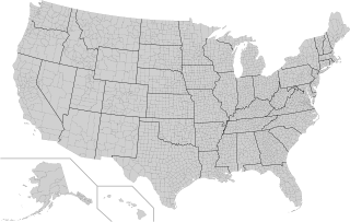
In the United States, an administrative or political subdivision of a state is a county, which is a region having specific boundaries and usually some level of governmental authority. The term "county" is used in 48 U.S. states, while Louisiana and Alaska have functionally equivalent subdivisions called parishes and boroughs respectively.
A census-designated place (CDP) is a concentration of population defined by the United States Census Bureau for statistical purposes only. CDPs have been used in each decennial census since 1980 as the counterparts of incorporated places, such as self-governing cities, towns, and villages, for the purposes of gathering and correlating statistical data. CDPs are populated areas that generally include one officially designated but currently unincorporated small community, for which the CDP is named, plus surrounding inhabited countryside of varying dimensions and, occasionally, other, smaller unincorporated communities as well. CDPs include small rural communities, colonias located along the U.S. border with Mexico, and unincorporated resort and retirement communities and their environs.
A civil township is a widely used unit of local government in the United States that is subordinate to a county. The term town is used in New England, New York, and Wisconsin to refer to the equivalent of the civil township in these states. Specific responsibilities and the degree of autonomy vary based on each state. Civil townships are distinct from survey townships, but in states that have both, the boundaries often coincide and may completely geographically subdivide a county. The U.S. Census Bureau classifies civil townships as minor civil divisions. Currently, there are 20 states with civil townships.
The following is a list of lists of the cities, towns and villages of the United States separated by state, territory or district name.

Kastel-Staadt is a municipality in the Trier-Saarburg district, in Rhineland-Palatinate, Germany.
Saarburg is a Verbandsgemeinde in the district Trier-Saarburg, in Rhineland-Palatinate, Germany. The seat of the Verbandsgemeinde is in Saarburg.

Štěpánov is a village and municipality (obec) in the Olomouc District in the Olomouc Region of the Czech Republic. The municipality is made up of the villages of Štěpánov, Benátky, Březce, Moravská Huzová and Stádlo, and also used to include the village of Liboš, which became independent in 1991.

March Rapids is an unincorporated community located in the town of Eau Pleine, Marathon County, Wisconsin, United States.
Staadt Creek is a stream in the U.S. state of South Dakota.
Saarburg-Kell is a Verbandsgemeinde in the district Trier-Saarburg, in Rhineland-Palatinate, Germany. The seat of the Verbandsgemeinde is in Saarburg. It was formed on 1 January 2019 by the merger of the former Verbandsgemeinden Saarburg and Kell am See.


