Weston, Wisconsin

Last updated

Weston, Wisconsin
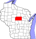
Marathon County Wisconsin Incorporated and Unincorporated areas Weston Highlighted.svg
Location of Weston in Marathon County, Wisconsin.
Coordinates: 44°54′14″N89°34′3″W / 44.90389°N 89.56750°W / 44.90389; -89.56750
Country Flag of the United States.svg  United States
State Flag of Wisconsin.svg  Wisconsin
County Marathon
Area
[1]
  Total21.64 sq mi (56.05 km2)
  Land21.62 sq mi (55.99 km2)
  Water0.02 sq mi (0.06 km2)
Elevation
[2]
1,250 ft (381 m)
Population
 (2020) [3]
  Total15,723
  Estimate 
(2019) [4]
19,142
  Density726.57/sq mi (280.51/km2)
Time zone UTC-6 (Central (CST))
  Summer (DST) UTC-5 (CDT)
Area code(s) 715 & 534
FIPS code 55-86025 [5]
GNIS feature ID1761601 [2]
Website www.westonwisconsin.org

Weston is a village in Marathon County, Wisconsin. It is part of the Wausau Metropolitan Statistical Area. The population was 14,868 at the time of the 2010 census. [6]

Contents

History

Initially part of the Town of Weston, the village was founded on March 11, 1996 as a way to secure its borders from neighboring communities. [7] Two-thirds of the original town were split off to form the new village of the same name. [8]

Geography

According to the United States Census Bureau, the village has a total area of 21.58 square miles (55.89 km2), of which, 21.55 square miles (55.81 km2) of it is land and 0.03 square miles (0.08 km2) is water. [9]

Demographics

Historical population
CensusPop.Note
1970 3,375
1980 8,775160.0%
1990 9,71410.7%
2000 12,07924.3%
2010 14,86823.1%
2020 15,7235.8%
2019 (est.)15,167 [4] 2.0%
U.S. Decennial Census [10]

2020 census

2010 census

As of the census [3] of 2010, there were 14,868 people, 5,772 households, and 3,928 families living in the village. The population density was 689.9 inhabitants per square mile (266.4/km2). There were 6,364 housing units at an average density of 295.3 per square mile (114.0/km2). The racial makeup of the village was 87.7% White, 0.8% African American, 0.4% Native American, 8.7% Asian, 0.8% from other races, and 1.6% from two or more races. Hispanic or Latino of any race were 2.0% of the population.

There were 5,772 households, of which 36.5% had children under the age of 18 living with them, 51.2% were married couples living together, 11.3% had a female householder with no husband present, 5.5% had a male householder with no wife present, and 31.9% were non-families. 25.1% of all households were made up of individuals, and 7.9% had someone living alone who was 65 years of age or older. The average household size was 2.54 and the average family size was 3.06.

The median age in the village was 35.6 years. 27.4% of residents were under the age of 18; 7.8% were between the ages of 18 and 24; 28.4% were from 25 to 44; 24.8% were from 45 to 64; and 11.5% were 65 years of age or older. The gender makeup of the village was 49.5% male and 50.5% female.

2000 census

As of the census of 2000, there were 12,079 people, 4,572 households, and 3,214 families living in the village. The population density was 567.2 people per square mile (219.0/km2). There were 4,806 housing units at an average density of 87.1 persons/km2 (225.7 persons/sq mi). The racial makeup of the village was 93.11% White, 0.30% African American, 0.40% Native American, 4.88% Asian, 0.02% Pacific Islander, 0.32% from other races, and 0.97% from two or more races. 0.70% of the population were Hispanic or Latino of any race.

There were 4,572 households, out of which 38.0% had children under the age of 18 living with them, 56.5% were married couples living together, 9.8% have a woman whose husband does not live with her, and 29.7% were non-families. 22.2% of all households were made up of individuals, and 5.7% had someone living alone who was 65 years of age or older. The average household size was 2.61 and the average family size was 3.10.

In the village, the population was spread out, with 28.4% under the age of 18, 9.4% from 18 to 24, 33.3% from 25 to 44, 19.7% from 45 to 64, and 9.1% who were 65 years of age or older. The median age was 32 years. For every 100 females, there were 98.3 males. For every 100 females age 18 and over, there were 96.4 males.

The median income for a household in the village was $46,063, and the median income for a family was $52,398. Males had a median income of $36,586 versus $25,047 for females. The per capita income for the village was $20,148. 5.1% of the population and 4.2% of families were below the poverty line. Out of the total people living in poverty, 6.4% are under the age of 18 and 5.9% are 65 or older.

Transportation

Airport

The Central Wisconsin Airport (KCWA) serves Weston, the county and surrounding communities with both scheduled commercial jet service and general aviation services.

Education

The village is served by the D.C. Everest School District. Public schools located in Weston are Mountain Bay Elementary, D.C. Everest Middle School, D.C. Everest Junior High, and D.C. Everest Senior High School. [11]

See also

Related Research Articles

<span class="mw-page-title-main">Clay County, West Virginia</span> County in West Virginia, United States

Clay County is a county in the U.S. state of West Virginia. As of the 2020 census, the population was 8,051. Its county seat is Clay. The county was founded in 1858 and named in honor of Henry Clay, famous American statesman, member of the United States Senate from Kentucky and United States Secretary of State in the 19th century.

<span class="mw-page-title-main">Sun Lakes, Arizona</span> CDP in Maricopa County, Arizona

Sun Lakes is an unincorporated community and census-designated place (CDP) in Maricopa County, Arizona, United States. The population was 14,868 at the 2020 census. Sun Lakes is an active adult community comprising five country club communities in three homeowner associations. These include the gated communities of Oakwood and IronWood (IronOaks), the gated and non-gated communities of Palo Verde and Cottonwood, and the non-gated community of Sun Lakes 1. Sun Lakes is a master-planned community developed by Robson Communities.

<span class="mw-page-title-main">East San Gabriel, California</span> Census-designated place in California, United States

East San Gabriel is a census-designated place (CDP) in Los Angeles County, California, United States. The population was 14,874 at the 2010 census, up from 14,512 at the 2000 census.

<span class="mw-page-title-main">Everest, Kansas</span> City in Brown County, Kansas

Everest is a city in Brown County, Kansas, United States. As of the 2020 census, the population of the city was 265.

<span class="mw-page-title-main">Weston, Maine</span> Town in the state of Maine, United States

Weston is a town in Aroostook County, Maine, United States. The population was 245 at the 2020 census.

<span class="mw-page-title-main">Weston, Nebraska</span> Village in Saunder County, Nebraska, United States

Weston is a village in Saunders County, Nebraska, United States. The population was 250 at the 2020 census.

Weston Mills is a hamlet in the towns of Portville and Olean in Cattaraugus County, New York, United States. It is counted as a census-designated place by the U.S. Census Bureau, which recorded a population of 1,472 at the 2010 census.

<span class="mw-page-title-main">New Weston, Ohio</span> Village in Ohio, United States

New Weston is a village in Darke County, Ohio, United States. The population was 124 at the 2020 census.

<span class="mw-page-title-main">Weston, Ohio</span> Village in Ohio, United States

Weston is a village in Wood County, Ohio, United States. The population was 1,455 at the 2020 census. Weston is located just 10 miles west of Bowling Green, Ohio, a university town.

<span class="mw-page-title-main">Weston, Vermont</span> Town in Vermont, United States

Weston is a town in Windsor County, Vermont, United States. The population was 623 at the 2020 census. Home to the Weston Playhouse Theatre Company, it includes the villages of Weston and The Island.

<span class="mw-page-title-main">Weston, West Virginia</span> City in West Virginia, United States

Weston is a city in and the county seat of Lewis County, West Virginia, United States. The population was 3,943 at the 2020 census. It is home to the Museum of American Glass in West Virginia and the Trans-Allegheny Lunatic Asylum.

<span class="mw-page-title-main">Hatley, Wisconsin</span> Village in Wisconsin, United States

Hatley is a village in Marathon County, Wisconsin, United States. It is part of the Wausau, Wisconsin Metropolitan Statistical Area. The population was 574 at the 2010 census.

<span class="mw-page-title-main">Kronenwetter, Wisconsin</span> Village in Wisconsin, United States

Kronenwetter is a village in Marathon County, Wisconsin, United States. It is the largest village by land area in the state of Wisconsin, as well as in the entire United States, and the third-largest community by population in Marathon County. It is part of the Wausau, Wisconsin Metropolitan Statistical Area. As of the 2020 census, the population of Kronenwetter was 8,353.

<span class="mw-page-title-main">Schofield, Wisconsin</span> City in Wisconsin, United States

Schofield is a city in Marathon County, Wisconsin, United States. It is part of the Wausau, Wisconsin Metropolitan Statistical Area. The population was 2,157 at the 2020 census. The city was named for William Scholfield, who came to the area in the 1851 to open a sawmill. The city has since dropped the "L" from its name.

<span class="mw-page-title-main">Glendale, Wisconsin</span> City in Milwaukee County, Wisconsin

Glendale is a city in Milwaukee County, Wisconsin, United States. It is a suburb of the neighboring Milwaukee. The population was 13,357 at the 2020 census.

<span class="mw-page-title-main">Newcastle, Wyoming</span> City in Wyoming, United States

Newcastle is a city in and the county seat of Weston County, Wyoming, United States. The population was 3,374 at the 2020 census.

<span class="mw-page-title-main">Wilson, Ohio</span> Village in Ohio, United States

Wilson is a village in Belmont and Monroe counties in the U.S. state of Ohio. The population was 129 at the 2020 census. It is part of the Wheeling metropolitan area.

<span class="mw-page-title-main">Cazenovia, Wisconsin</span> Village in Wisconsin, United States

Cazenovia is a village in Richland and Sauk Counties in the U.S. state of Wisconsin. The population was 318 at the 2010 census. Of this, 314 were in Richland County, and only 4 were in Sauk County.

<span class="mw-page-title-main">Boonville, New York</span> Town in New York, United States

Boonville is a town in Oneida County, New York, United States. The town is in the northeastern section of the county. The population was 4,555 at the 2010 census. The town includes a village, also called Boonville. The town and village are named after Gerrit Boon, an agent of the Holland Land Company. The current mayor is Judith Dellerba.

The Town of Weston is located in Marathon County, Wisconsin, United States. It is part of the Wausau, Wisconsin Metropolitan Statistical Area. The population was 657 at the 2020 census.

References

  1. "2019 U.S. Gazetteer Files". United States Census Bureau. Retrieved August 7, 2020.
  2. 1 2 "US Board on Geographic Names". United States Geological Survey. October 25, 2007. Retrieved January 31, 2008.
  3. 1 2 "U.S. Census website". United States Census Bureau . Retrieved November 18, 2012.
  4. 1 2 "Population and Housing Unit Estimates". United States Census Bureau. May 24, 2020. Retrieved May 27, 2020.
  5. "U.S. Census website". United States Census Bureau . Retrieved January 31, 2008.
  6. "Profile of General Population and Housing Characteristics: 2010 Demographic Profile Data (DP-1): Weston village, Wisconsin". United States Census Bureau . Retrieved September 10, 2012.
  7. Guild, Daniel (March 2016). "Village of Weston Celebrates 20 Years As An Incorporated Municipality". The Wire. Weston, WI: The Village of Weston. Retrieved July 9, 2018.
  8. "Town of Weston" . Retrieved July 9, 2018.
  9. "US Gazetteer files 2010". United States Census Bureau . Retrieved November 18, 2012.
  10. "Census of Population and Housing". Census.gov. Retrieved June 4, 2015.
  11. "D.C. Everest Area School District / District Home". www.dce.k12.wi.us.