McMillan, Wisconsin | |
|---|---|
 McMillan, Wisconsin  McMillan, Wisconsin | |
| Coordinates: 44°44′32″N90°09′48″W / 44.74222°N 90.16333°W | |
| Country | |
| State | |
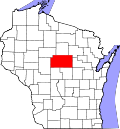
| County | Marathon |
| Elevation | 1,270 ft (390 m) |
| Time zone | UTC-6 (Central (CST)) |
| • Summer (DST) | UTC-5 (CDT) |
| Area codes | 715 and 534 |
| GNIS feature ID | 1844192 [1] |
McMillan is an unincorporated community in the town of McMillan, Marathon County, Wisconsin, United States [1] which was at one time an incorporated village.