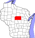
Stratford, Wisconsin | |
---|---|
Coordinates: 44°48′7″N90°4′26″W / 44.80194°N 90.07389°W | |
Country | United States |
State | Wisconsin |
County | Marathon |
Area | |
• Total | 5.34 sq mi (13.83 km2) |
• Land | 5.30 sq mi (13.74 km2) |
• Water | 0.04 sq mi (0.09 km2) |
Elevation | 1,266 ft (386 m) |
Population | |
• Total | 1,578 |
• Estimate (2019) [4] | 1,577 |
• Density | 297.27/sq mi (114.77/km2) |
Time zone | UTC-6 (Central (CST)) |
• Summer (DST) | UTC-5 (CDT) |
Area code(s) | 715 & 534 |
FIPS code | 55-77750 [5] |
GNIS feature ID | 1574972 [2] |
Website | www |
Stratford is a village in Marathon County, Wisconsin, United States. It is part of the Wausau, Wisconsin Metropolitan Statistical Area. The population was 1,578 at the 2010 census. [6]
Stratford was platted in 1891 when the railroad was extended to that point. [7] The village was named after Stratford-upon-Avon, in England. [7]
Stratford is located at 44°48′7″N90°4′26″W / 44.80194°N 90.07389°W (44.801971, -90.073829). [8] According to the United States Census Bureau, the village has a total area of 5.35 square miles (13.86 km2), of which, 5.31 square miles (13.75 km2) of it is land and 0.04 square miles (0.10 km2) is water. [9]
Census | Pop. | Note | %± |
---|---|---|---|
1910 | 763 | — | |
1920 | 1,014 | 32.9% | |
1930 | 960 | −5.3% | |
1940 | 879 | −8.4% | |
1950 | 962 | 9.4% | |
1960 | 1,106 | 15.0% | |
1970 | 1,239 | 12.0% | |
1980 | 1,385 | 11.8% | |
1990 | 1,515 | 9.4% | |
2000 | 1,523 | 0.5% | |
2010 | 1,578 | 3.6% | |
2019 (est.) | 1,577 | [4] | −0.1% |
U.S. Decennial Census [10] |
As of the census [3] of 2010, there were 1,578 people, 666 households, and 433 families living in the village. The population density was 297.2 inhabitants per square mile (114.7/km2). There were 713 housing units at an average density of 134.3 per square mile (51.9/km2). The racial makeup of the village was 98.5% White, 0.2% African American, 0.2% Native American, 0.1% Asian, 0.4% from other races, and 0.6% from two or more races. Hispanic or Latino of any race were 1.6% of the population.
There were 666 households, of which 33.3% had children under the age of 18 living with them, 50.8% were married couples living together, 8.7% had a female householder with no husband present, 5.6% had a male householder with no wife present, and 35.0% were non-families. 31.4% of all households were made up of individuals, and 13.4% had someone living alone who was 65 years of age or older. The average household size was 2.37 and the average family size was 2.97.
The median age in the village was 37.3 years. 26.9% of residents were under the age of 18; 7% were between the ages of 18 and 24; 27.6% were from 25 to 44; 24.5% were from 45 to 64; and 14% were 65 years of age or older. The gender makeup of the village was 49.9% male and 50.1% female.
As of the census [5] of 2000, there were 1,523 people, 603 households, and 413 families living in the village. The population density was 287.6 people per square mile (110.9/km2). There were 648 housing units at an average density of 122.4 per square mile (47.2/km2). The racial makeup of the village was 98.16% White, 0.39% Native American, 1.18% Asian, and 0.26% from two or more races. Hispanic or Latino of any race were 0.98% of the population.
There were 603 households, out of which 34.8% had children under the age of 18 living with them, 57.7% were married couples living together, 7.6% had a female householder with no husband present, and 31.5% were non-families. 25.7% of all households were made up of individuals, and 12.6% had someone living alone who was 65 years of age or older. The average household size was 2.50 and the average family size was 3.06.
In the village, the population was spread out, with 27.1% under the age of 18, 8.5% from 18 to 24, 31.8% from 25 to 44, 19.0% from 45 to 64, and 13.7% who were 65 years of age or older. The median age was 34 years. For every 100 females, there were 97.3 males. For every 100 females age 18 and over, there were 96.3 males.
The median income for a household in the village was $42,569, and the median income for a family was $51,250. Males had a median income of $31,793 versus $23,352 for females. The per capita income for the village was $17,934. About 4.6% of families and 6.0% of the population were below the poverty line, including 9.4% of those under age 18 and 12.2% of those age 65 or over.
The Stratford School District is made up of two separate buildings: Stratford Elementary and Stratford Junior/Senior High.
St. Joseph's Catholic school (K-8) is also located in Stratford.
The Marathon County Public Library has a branch library in Stratford.
Stafford is a town in Genesee County, New York, United States. The population was 2,459 at the 2010 census. The town was named after a town of the same name in England.
Taylor is a village in Jackson County, Wisconsin, United States, along the Trempealeau River. The population was 484 at the 2020 census.
Fenwood is a village in Marathon County, Wisconsin, United States. It is part of the Wausau, Wisconsin Metropolitan Statistical Area. The population was 152 at the 2010 census.
Weyerhaeuser is a village in Rusk County, Wisconsin, United States. The population was 238 at the 2010 census.
Woodville is a village in St. Croix County, Wisconsin, United States. The population was 1,344 at the 2010 census.
Pigeon Falls is a village in Trempealeau County, Wisconsin, United States. The population was 411 at the 2010 census.
Big Falls is a village in Waupaca County, Wisconsin, United States. The population was 61 at the 2010 census.
Ogdensburg is a village in Waupaca County, Wisconsin, United States. The population was 185 at the 2010 census.
Dorchester is a village in Clark and Marathon counties in the U.S. state of Wisconsin, along the 45th parallel. It is part of the Wausau, Wisconsin Metropolitan Statistical Area. The population was 876 at the 2010 census. Of this, 871 were in Clark County, and only 5 were in Marathon County.
Birnamwood is a village in Marathon and Shawano counties in the U.S. state of Wisconsin. It is part of the Wausau, Wisconsin Metropolitan Statistical Area. The population was 818 at the 2010 census. Of this, 802 were in Shawano County, and 16 were in Marathon County. The village is located mostly within the town of Birnamwood in Shawano County; only a small portion extends into the town of Norrie in adjacent Marathon County.
Stockbridge is a village in Calumet County, Wisconsin, United States. The population was 686 at the 2020 census. The village lies within the Town of Stockbridge.
Unity is a village in Clark and Marathon counties in the U.S. state of Wisconsin. It is part of the Wausau, Wisconsin Metropolitan Statistical Area. The population was 343 at the 2010 census. Of this, 204 were in Marathon County, and 139 were in Clark County. The village is located in northeastern town of Unity in Clark County and northwestern town of Brighton in Marathon County.
Lowell is a village in Dodge County, Wisconsin, United States, along the Beaver Dam River. The population was 340 at the 2010 census. The village is located within the Town of Lowell.
Colfax is a village in Dunn County, Wisconsin, United States. The population was 1,158 at the 2010 census. The village is surrounded by the Town of Colfax.
Fairchild is a village in Eau Claire County, Wisconsin, United States. The population was 550 at the 2010 census. The village is located within the Town of Fairchild.
Mount Hope is a village in Grant County, Wisconsin, United States. The population was 225 at the 2010 census. The village is located within the Town of Mount Hope.
Melrose is a village in Jackson County, Wisconsin, United States. The population was 503 at the 2010 census. The village is located within the Town of Melrose.
Necedah is a village in Juneau County, Wisconsin, United States. The population was 916 at the 2020 census. The village is located within the Town of Necedah.
Elderon is a village in Marathon County, Wisconsin, United States. It is part of the Wausau, Wisconsin Metropolitan Statistical Area. The population was 179 at the 2010 census.
Scandinavia is a village in the Town of Scandinavia in Waupaca County, Wisconsin, United States. The population was 328 at the 2010 census.