Birnamwood, Wisconsin

Last updated

Birnamwood, Wisconsin
Birnamwood Wisconsin Downtown North July 2011 US 45.jpg
Looking north at downtown Birnamwood
Shawano County Wisconsin Incorporated and Unincorporated areas Birnamwood Highlighted.svg
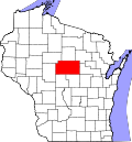
Location of Birnamwood in Shawano County, Wisconsin.
Coordinates: 44°55′52″N89°12′35″W / 44.93111°N 89.20972°W / 44.93111; -89.20972
Country Flag of the United States.svg  United States
State Flag of Wisconsin.svg  Wisconsin
Counties Shawano, Marathon
Area
[1]
  Total2.20 sq mi (5.70 km2)
  Land2.20 sq mi (5.70 km2)
  Water0.00 sq mi (0.00 km2)
Elevation
[2]
1,302 ft (397 m)
Population
 (2010) [3]
  Total818
  Estimate 
(2019) [4]
782
  Density354.97/sq mi (137.08/km2)
Time zone UTC-6 (Central (CST))
  Summer (DST) UTC-5 (CDT)
Area codes 715 & 534
FIPS code 55-07600 [5]
GNIS feature ID1561822 [2]

Birnamwood is a village in Marathon and Shawano counties in the U.S. state of Wisconsin. It is part of the Wausau, Wisconsin Metropolitan Statistical Area. The population was 818 at the 2010 census. [6] Of this, 802 were in Shawano County, and 16 were in Marathon County. The village is located mostly within the town of Birnamwood in Shawano County; only a small portion extends into the town of Norrie in adjacent Marathon County. Until the 1990s, Birnamwood was home to the world's largest fiberglass badger. [7] U.S. Route 45 runs through the village.

Contents

History

The village was named for Birnam Wood, a town in Scotland mentioned in Shakespeare's Macbeth . [8]

Geography

Birnamwood is located at 44°55′52″N89°12′35″W / 44.93111°N 89.20972°W / 44.93111; -89.20972 (44.931199, -89.209643). [9] According to the U.S. Census Bureau, the village has a total area of 2.21 square miles (5.72 km2), all of it land. [10]

Demographics

Historical population
CensusPop.Note
1900 475
1910 67842.7%
1920 651−4.0%
1930 557−14.4%
1940 556−0.2%
1950 5610.9%
1960 5681.2%
1970 63211.3%
1980 6888.9%
1990 6930.7%
2000 79514.7%
2010 8182.9%
2019 (est.)782 [4] −4.4%
U.S. Decennial Census [11]

2010 census

At the 2010 census there were 818 people, 343 households, and 217 families living in the village. The population density was 370.1 inhabitants per square mile (142.9/km2). There were 383 housing units at an average density of 173.3 units per square mile (66.9 units/km2). The racial makeup of the village was 97.2% White, 0.5% African American, 0.7% Native American, 0.6% from other races, and 1.0% from two or more races. Hispanic or Latino of any race were 1.8%. [3]

Of the 343 households 30.3% had children under the age of 18 living with them, 47.5% were married couples living together, 9.9% had a female householder with no husband present, 5.8% had a male householder with no wife present, and 36.7% were non-families. 31.8% of households were one person and 18.4% were one person aged 65 or older. The average household size was 2.28 and the average family size was 2.88.

The median age in the village was 41.5 years. 22.6% of residents were under the age of 18; 8.1% were between the ages of 18 and 24; 23.9% were from 25 to 44; 22.6% were from 45 to 64; and 22.6% were 65 or older. The gender makeup of the village was 50.4% male and 49.6% female.

2000 census

At the 2000 census there were 795 people, 309 households, and 202 families living in the village. The population density was 360.4 people per square mile (139.2 people/km2). There were 328 housing units at an average density of 148.7 units per square mile (57.4 units/km2). The racial makeup of the village was 97.61% White, 0.13% African American, 0.13% Native American, 1.26% Asian, and 0.88% from two or more races. Hispanic or Latino of any race were 0.13%. [5]

Of the 309 households 35.6% had children under the age of 18 living with them, 52.1% were married couples living together, 8.7% had a female householder with no husband present, and 34.6% were non-families. 31.4% of households were one person and 16.8% were one person aged 65 or older. The average household size was 2.48 and the average family size was 3.14.

The age distribution was 29.2% under the age of 18, 6.8% from 18 to 24, 25.8% from 25 to 44, 17.5% from 45 to 64, and 20.8% 65 or older. The median age was 37 years. For every 100 females, there were 89.3 males. For every 100 females age 18 and over, there were 82.2 males.

The median household income was $37,813 and the median family income was $47,574. Males had a median income of $32,500 versus $24,688 for females. The per capita income for the village was $17,740. About 5.0% of families and 7.9% of the population were below the poverty line, including 13.2% of those under age 18 and 2.4% of those age 65 or over.

Notable people

Images

Related Research Articles

<span class="mw-page-title-main">Shawano County, Wisconsin</span> County in Wisconsin

Shawano County is a county located in the U.S. state of Wisconsin. As of the 2020 census, the population was 40,881. Its county seat is Shawano.

<span class="mw-page-title-main">Marathon County, Wisconsin</span> County in Wisconsin, United States

Marathon County is a county located in the U.S. state of Wisconsin. As of the 2020 census, the population was 138,013. Marathon County's seat is Wausau. It was founded in 1850, created from a portion of Portage County. At that time the county stretched to the northern border with the upper Michigan peninsula. It is named after the battlefield at Marathon, Greece.

<span class="mw-page-title-main">Warrensburg, Illinois</span> Village in Illinois, United States

Warrensburg is a village in Macon County, Illinois, United States. Its population was 1,110 at the 2020 census, down from 1,201 in 2010. It is included in the Decatur, Illinois Metropolitan Statistical Area. Warrensburg was established in 1841.

<span class="mw-page-title-main">Huntley, Nebraska</span> Village in Nebraska, United States

Huntley is a village in Harlan County, Nebraska, United States. The population was 44 at the 2010 census.

Birnamwood is a town in Shawano County, Wisconsin, United States. The population was 711 at the 2000 census. The unincorporated community of Shepley is located partially in the town. The Village of Birnamwood is located mostly within the town.

<span class="mw-page-title-main">Bonduel, Wisconsin</span> Village in Wisconsin, United States

Bonduel is a village in Shawano County, Wisconsin, United States. The population was 1,478 at the 2010 census.

<span class="mw-page-title-main">Cecil, Wisconsin</span> Village in Wisconsin, United States

Cecil is a village in Shawano County, Wisconsin, United States. The population was 570 at the 2010 census.

<span class="mw-page-title-main">Eland, Wisconsin</span> Village in Wisconsin, United States

Eland is a village in Shawano County, Wisconsin, in the United States. The population was 202 at the 2010 census.

<span class="mw-page-title-main">Mattoon, Wisconsin</span> Village in Wisconsin, United States

Mattoon is a village in Shawano County, Wisconsin, United States. The population was 438 at the 2010 census.

<span class="mw-page-title-main">Seneca, Shawano County, Wisconsin</span> Town in Wisconsin, United States

Seneca is a town in Shawano County, Wisconsin, in the United States. As of the 2000 census, the town population was 567. The unincorporated community of Tilleda is located within the town.

<span class="mw-page-title-main">Shawano, Wisconsin</span> City in Wisconsin, United States

Shawano is a city in Shawano County, Wisconsin, United States. The population was 9,305 at the 2010 census. It is the county seat of Shawano County.

<span class="mw-page-title-main">Tigerton, Wisconsin</span> Village in Wisconsin, United States

Tigerton is a village in Shawano County, Wisconsin, United States. The population was 741 at the 2010 census.

<span class="mw-page-title-main">Middle Village, Wisconsin</span> CDP in Wisconsin, United States

Middle Village is a census-designated place (CDP), in the towns of Menominee and Red Springs, in Menominee and Shawano counties in the U.S. state of Wisconsin. It does not have any legal status as an incorporated municipality. The population was 290 at the 2020 census.

<span class="mw-page-title-main">Pulaski, Wisconsin</span> Village in Wisconsin, United States

Pulaski is a village in Brown, Oconto, and Shawano counties in the U.S. state of Wisconsin. The population was 3,539 at the 2010 census. Of this, 3,321 were in Brown County, 218 in Shawano County, and none in Oconto County.

<span class="mw-page-title-main">Milladore, Wisconsin</span> Village in Wisconsin, United States

Milladore is a village in Wood County and overlapping into Portage County in the U.S. state of Wisconsin. The population was 276 at the 2010 census. Most of the village is located within the Town of Milladore in Wood County, while only a very small portion of the village lies in Portage County. All of its 2010 census population resided in the Wood County portion of the village.

<span class="mw-page-title-main">Aniwa, Wisconsin</span> Village in Wisconsin, United States

Aniwa is a village in Shawano County, Wisconsin, United States. The population was 260 at the 2010 census. The village is located within the Town of Aniwa. U.S. Route 45 runs north–south through the village.

<span class="mw-page-title-main">Aniwa (town), Wisconsin</span>

Aniwa is a town in Shawano County, Wisconsin, United States. The population was 586 at the 2000 census. The Village of Aniwa is located within the town.

<span class="mw-page-title-main">Wittenberg, Wisconsin</span> Village in Wisconsin, United States

Wittenberg is a village in Shawano County, Wisconsin, United States. The population was 1,081 at the 2010 census. The village is located within the Town of Wittenberg.

<span class="mw-page-title-main">Scandinavia, Wisconsin</span> Village in Wisconsin, United States

Scandinavia is a village in the Town of Scandinavia in Waupaca County, Wisconsin, United States. The population was 328 at the 2010 census.

<span class="mw-page-title-main">Hancock, Wisconsin</span> Village in Wisconsin, United States

Hancock is a village in Waushara County, Wisconsin, United States. The population was 417 at the 2010 census. The village is located within the Town of Hancock.

References

  1. "2019 U.S. Gazetteer Files". United States Census Bureau. Retrieved August 7, 2020.
  2. 1 2 "US Board on Geographic Names". United States Geological Survey. October 25, 2007. Retrieved January 31, 2008.
  3. 1 2 "U.S. Census website". United States Census Bureau . Retrieved November 18, 2012.
  4. 1 2 "Population and Housing Unit Estimates". United States Census Bureau. May 24, 2020. Retrieved May 27, 2020.
  5. 1 2 "U.S. Census website". United States Census Bureau . Retrieved January 31, 2008.
  6. "Profile of General Population and Housing Characteristics: 2010 Demographic Profile Data (DP-1): Birnamwood village, Wisconsin". United States Census Bureau . Retrieved September 7, 2012.
  7. "World's Largest Badger, Birnamwood, Wisconsin".
  8. Chicago and North Western Railway Company (1908). A History of the Origin of the Place Names Connected with the Chicago & North Western and Chicago, St. Paul, Minneapolis & Omaha Railways. p. 44.
  9. "US Gazetteer files: 2010, 2000, and 1990". United States Census Bureau. February 12, 2011. Retrieved April 23, 2011.
  10. "US Gazetteer files 2010". United States Census Bureau. Archived from the original on January 25, 2012. Retrieved November 18, 2012.
  11. "Census of Population and Housing". Census.gov. Retrieved June 4, 2015.
  12. 'Wisconsin Blue Book 1909,' Biographical Sketch of Benjamin A. Cady, pg. 1139-1140
  13. 'Wisconsin Blue Book 1981-1982, Biographical Sketch of Earl William Schmidt, pg. 79