
Wilton is a town in Saratoga County, New York, United States. The population was 17,361 at the 2020 census.
Collins is an unincorporated census-designated place in the town of Rockland, Manitowoc County, Wisconsin, United States, in the east central part of the state. Its zip code is 54207, although its post office is being studied for closure. As of the 2010 census, its population is 164. The Collins Marsh Wildlife Area is located east of the community. Wisconsin Highway 32 ran through the community; the route later became Wisconsin Highway 67 before it became County Highway W. County Highway JJ and the Wisconsin Central Ltd. railroad runs east–west through the community. Collins has an area of 0.496 square miles (1.28 km2), all of it land. The community was named for Sumner J. Collins, who was the general superintendent of the Wisconsin Central Railroad in the 1890s.
Dalton is an unincorporated census-designated place in the town of Kingston located in the southwestern corner of Green Lake County, Wisconsin, United States. It is located on Wisconsin Highway 44. It uses ZIP code 53926. As of the 2010 census, its population was 206. The surrounding countryside is mainly occupied by dairy farmers and an Amish community. Dalton has an area of 0.456 square miles (1.18 km2); 0.449 square miles (1.16 km2) of this is land, and 0.007 square miles (0.018 km2) is water. Dalton was named for John Dalton, who emigrated from Ireland with his family in the early 1850s.

Greenleaf is an unincorporated census-designated place in Brown County, Wisconsin, United States, in the town of Wrightstown.

Tilleda is an unincorporated census-designated place in the town of Seneca in Shawano County, Wisconsin, United States. The community is located on County Highway D. less than one mile north of Wisconsin Highway 29. The community uses the 54978 ZIP code. As of the 2010 census, its population is 91.

Butte des Morts is an unincorporated census-designated place in the town of Winneconne, in Winnebago County, Wisconsin, United States.

Pickerel is an unincorporated community in the northeast corner of Langlade County, Wisconsin, United States. The community is located on Wisconsin Highway 55, in the town of Langlade. Pickerel is 19 miles (31 km) northeast of Antigo, the county seat of Langlade County. Pickerel has a post office with ZIP code 54465. The Pickerel Volunteer Fire Department is located northwest of town on County Road T, and serves the town of Ainsworth, and part of the town of Nashville in Forest County.
Pearson is an unincorporated community in the town of Ainsworth, Langlade County, Wisconsin, United States. Pearson is 5 miles (8 km) west of Pickerel and 17 miles (27 km) north-northeast of Antigo, the county seat of Langlade County. The community is situated on Pickerel Creek near its confluence with the Wolf River. County Highway T runs through Pearson; the closest state highway to the community is Wisconsin State Highway 55 in Pickerel. Pearson had a post office, which closed on May 4, 1996; ZIP code 54462 still serves the community. The Northeast Illinois Council of the Boy Scouts of America runs a summer camp, Ma-Ka-Ja-Wan Scout Reservation, in Pearson. The Pickerel Volunteer Fire Department Station is located east of the community on Johnson Road.

Krakow is an unincorporated community and census-designated place located primarily in Shawano County, Wisconsin, United States, with a small portion in Oconto County. Krakow is located on Wisconsin Highway 32 north of Pulaski, in the towns of Chase, and Angelica. Krakow has a post office with ZIP code 54137. As of the 2010 census, its population is 354. Krakow has a Catholic church and a tavern. In its heyday, Krakow had a grocery store, cheese factory, pickle canning company, movie theaters, and a few taverns, a parochial and a public schools.

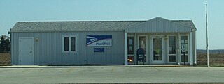
Pickett is an unincorporated community in Winnebago County, Wisconsin, United States. Situated in the southwestern part of the county Pickett is located on Wisconsin Highway 44 between Ripon and Oshkosh, in the town of Utica. Pickett has a post office with ZIP code 54964.

Baileys Harbor is an unincorporated census-designated place in Door County, within the town of Baileys Harbor, Wisconsin, United States. The community is located on Wisconsin Highway 57 northeast of Jacksonport. As of the 2010 census, its population was 257.

Florence is a census-designated place in and the county seat of Florence County, Wisconsin, United States. Florence is located in northern Florence County, in the town of Florence. Florence has a post office with ZIP code 54121. The community was named a census-designated place in 2010. As of the 2010 census, its population was 592.

Burnett is an unincorporated census-designated place located in the town of Burnett, Dodge County, Wisconsin, United States. Burnett is located on Wisconsin Highway 26 5.5 miles (8.9 km) northwest of Horicon. Burnett has a post office with ZIP code 53922. As of the 2010 census, its population is 256.

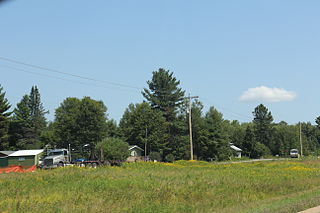
Long Lake is an unincorporated census-designated place in the town of Long Lake, Florence County, Wisconsin, United States. Long Lake is located on the eastern shore of Long Lake along Wisconsin Highway 139, 21 miles (34 km) west-southwest of Florence. As of the 2020 census, its population was 59. The community became a census-designated place in 2010. The community has the 54542 ZIP code.
Lyons is an unincorporated community and census-designated place located in the town of Lyons, in Walworth County, Wisconsin, United States. Lyons is located on Wisconsin Highway 36 4.5 miles (7.2 km) west-southwest of Burlington. Lyons has a post office with ZIP code 53148. It was first named a CDP at the 2020 census, which showed a population of 932.

Mercer is an unincorporated census-designated place located in the town of Mercer, Iron County, Wisconsin, United States. Mercer is located on US Highway 51 20.5 miles (33.0 km) south-southeast of Hurley. Mercer has a post office with ZIP code 54547. As of the 2010 census, its population is 516.

Elcho is an unincorporated community and census-designated place (CDP) in the town of Elcho, Langlade County, Wisconsin, United States. Elcho is located on U.S. Route 45 and Wisconsin Highway 47 16.5 miles (26.6 km) southwest of Crandon. Elcho has a post office with ZIP code 54428. As of the 2010 census, its population was 339.

Fifield is an unincorporated community located in the town of Fifield, Price County, Wisconsin, United States. Fifield is located at the junction of Wisconsin Highway 13 and Wisconsin Highway 70 4 miles (6.4 km) south-southeast of Park Falls. Fifield has a post office with ZIP code 54524.
Freedom is an unincorporated community located in the town of Freedom, Outagamie County, Wisconsin, United States. Freedom is located along Wisconsin Highway 55 7.5 miles (12.1 km) north of Kaukauna. Freedom has a post office, located in Kaukauna, which uses ZIP code 54131.
Brule is an unincorporated, census-designated place; located in the town of Brule, Douglas County, Wisconsin, United States.


