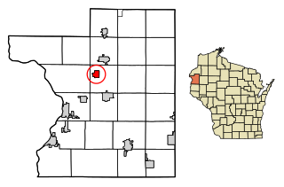
Bowler, Wisconsin | |
---|---|
Coordinates: 44°51′45″N88°58′51″W / 44.86250°N 88.98083°W | |
Country | United States |
State | Wisconsin |
County | Shawano |
Area | |
• Total | 1.04 sq mi (2.69 km2) |
• Land | 1.04 sq mi (2.69 km2) |
• Water | 0.00 sq mi (0.00 km2) |
Elevation | 1,073 ft (327 m) |
Population | |
• Total | 302 |
290 | |
• Density | 279.65/sq mi (107.99/km2) |
Time zone | UTC-6 (Central (CST)) |
• Summer (DST) | UTC-5 (CDT) |
Area code(s) | 715 & 534 |
FIPS code | 55-09025 [5] |
GNIS feature ID | 1562100 [2] |
Bowler is a village in Shawano County, Wisconsin, United States. The population was 302 at the 2010 census.
Bowler was named for Col. J. C. Bowler, who owned a tract of land near the town site. [6]
Bowler is located at 44°51′45″N88°58′51″W / 44.86250°N 88.98083°W (44.862462, -88.980822). [7]
According to the United States Census Bureau, the village has a total area of 1.02 square miles (2.64 km2), all of it land. [8]
The Köppen Climate Classification subtype for this climate is "Dfb" (Warm Summer Continental Climate). [9]
Census | Pop. | Note | %± |
---|---|---|---|
1930 | 318 | — | |
1940 | 315 | −0.9% | |
1950 | 344 | 9.2% | |
1960 | 274 | −20.3% | |
1970 | 272 | −0.7% | |
1980 | 339 | 24.6% | |
1990 | 279 | −17.7% | |
2000 | 343 | 22.9% | |
2010 | 302 | −12.0% | |
2019 (est.) | 290 | [4] | −4.0% |
U.S. Decennial Census [10] |
As of the census [3] of 2010, there were 302 people, 130 households, and 87 families living in the village. The population density was 296.1 inhabitants per square mile (114.3/km2). There were 150 housing units at an average density of 147.1 per square mile (56.8/km2). The racial makeup of the village was 74.5% White, 17.2% Native American, and 8.3% from two or more races. Hispanic or Latino of any race were 3.3% of the population.
There were 130 households, of which 30.8% had children under the age of 18 living with them, 43.8% were married couples living together, 18.5% had a female householder with no husband present, 4.6% had a male householder with no wife present, and 33.1% were non-families. 29.2% of all households were made up of individuals, and 13.9% had someone living alone who was 65 years of age or older. The average household size was 2.32 and the average family size was 2.85.
The median age in the village was 41.7 years. 23.5% of residents were under the age of 18; 7.9% were between the ages of 18 and 24; 23.6% were from 25 to 44; 27.1% were from 45 to 64; and 17.9% were 65 years of age or older. The gender makeup of the village was 47.4% male and 52.6% female.
As of the census [5] of 2000, there were 343 people, 126 households, and 90 families living in the village. The population density was 337.7 people per square mile (129.8/km2). There were 135 housing units at an average density of 132.9 per square mile (51.1/km2). The racial makeup of the village was 78.13% White, 0.87% African American, 16.62% Native American, and 4.37% from two or more races. 0.00% of the population were Hispanic or Latino of any race.
There were 126 households, out of which 42.1% had children under the age of 18 living with them, 49.2% were married couples living together, 18.3% had a female householder with no husband present, and 27.8% were non-families. 24.6% of all households were made up of individuals, and 12.7% had someone living alone who was 65 years of age or older. The average household size was 2.62 and the average family size was 3.11.
In the village, the population was spread out, with 33.2% under the age of 18, 8.7% from 18 to 24, 25.1% from 25 to 44, 20.1% from 45 to 64, and 12.8% who were 65 years of age or older. The median age was 34 years. For every 100 females, there were 80.5 males. For every 100 females age 18 and over, there were 81.7 males.
The median income for a household in the village was $34,167, and the median income for a family was $36,563. Males had a median income of $24,375 versus $20,000 for females. The per capita income for the village was $13,285. 6.6% of the population and 3.4% of families were below the poverty line. Out of the total population, 9.0% of those under the age of 18 and 23.5% of those 65 and older were living below the poverty line.
Stockholm is a village in Pepin County, Wisconsin, United States, founded in 1854 by immigrants from Karlskoga, Sweden, who named it after their country's capital. The population was 78 at the 2020 census. The village is located within the Town of Stockholm.
Fairview Township is a township in Butler County, Pennsylvania, United States. The population was 1,942 at the 2020 census.
Hilbert is a village in Calumet County in the U.S. state of Wisconsin. The population was 1,248 at the 2020 census.
Mount Sterling is a village in Crawford County, Wisconsin, United States. The population was 189 at the 2020 census.
Neosho is a village in Dodge County, Wisconsin, United States. The population was 591 at the 2020 census.
Tennyson is a village in Grant County, Wisconsin, United States, originally called Dutch Hollow. The population was 348 at the 2020 census.
Taylor is a village in Jackson County, Wisconsin, United States, along the Trempealeau River. The population was 484 at the 2020 census.
Fairbanks is a town in Shawano County, Wisconsin, United States. The population was 687 at the 2000 census. The unincorporated community of Split Rock is located in the town.
Pigeon Falls is a village in Trempealeau County, Wisconsin, United States. The population was 411 at the 2010 census.
Big Falls is a village in Waupaca County, Wisconsin, United States. The population was 61 at the 2010 census.
Livingston is a village in Grant and Iowa Counties in the U.S. state of Wisconsin. The population was 637 at the 2020 census. Of this, 657 were in Grant County, and only 12 were in Iowa County.
Unity is a village in Clark and Marathon counties in the U.S. state of Wisconsin. It is part of the Wausau, Wisconsin Metropolitan Statistical Area. The population was 343 at the 2010 census. Of this, 204 were in Marathon County, and 139 were in Clark County. The village is located in northeastern town of Unity in Clark County and northwestern town of Brighton in Marathon County.
Randolph is a village in Columbia and Dodge counties in the U.S. state of Wisconsin. The population was 1,796 at the 2020 census. Of this, 1,338 were in Dodge County, and 458 were in Columbia County. The village is located at the southeast corner of the Town of Randolph in Columbia County, although only a tiny portion of the village lies within the town. Most of the village lies within the Town of Westford in Dodge County. Small portions also lie within the Town of Fox Lake to the north and the Town of Courtland in Columbia County.
Lowell is a village in Dodge County, Wisconsin, United States, along the Beaver Dam River. The population was 309 at the 2020 census. The village is located within the Town of Lowell.
Mount Hope is a village in Grant County, Wisconsin, United States. The population was 215 at the 2020 census. The village is located within the Town of Mount Hope.
Woodman is a village in Grant County in the U.S. state of Wisconsin. The population was 118 at the 2020 census. The village is located within the Town of Woodman.
Melrose is a village in Jackson County, Wisconsin, United States. The population was 503 at the 2010 census. The village is located within the Town of Melrose.
Necedah is a village in Juneau County, Wisconsin, United States. The population was 916 at the 2020 census. The village is located within the Town of Necedah.
Milltown is a village in Polk County, Wisconsin, United States. The population was 917 at the 2010 census. The village is located within the Town of Milltown.
Scandinavia is a village in the Town of Scandinavia in Waupaca County, Wisconsin, United States. The population was 328 at the 2010 census.