Eland, Wisconsin | |
---|---|
Looking west at the Eland sign | |
Location of Eland in Shawano County, Wisconsin. | |
Coordinates: 44°52′13″N89°12′53″W / 44.87028°N 89.21472°W Coordinates: 44°52′13″N89°12′53″W / 44.87028°N 89.21472°W | |
Country | United States |
State | Wisconsin |
County | Shawano |
Area | |
• Total | 2.21 sq mi (5.71 km2) |
• Land | 2.21 sq mi (5.71 km2) |
• Water | 0.00 sq mi (0.00 km2) |
Elevation | 1,234 ft (376 m) |
Population | |
• Total | 202 |
• Estimate (2019) [4] | 197 |
• Density | 89.30/sq mi (34.47/km2) |
Time zone | UTC-6 (Central (CST)) |
• Summer (DST) | UTC-5 (CDT) |
FIPS code | 55-22975 [5] |
GNIS feature ID | 1564486 [2] |
Eland (formerly Eland Junction) [6] is a village in Shawano County, Wisconsin, in the United States. The population was 202 at the 2010 census.
Eland was originally called Eland Junction, and under the latter name was platted by the railroad in 1888. [7] It was named after the eland, a type of African antelope. [7]
Eland is located at 44°52′13″N89°12′53″W / 44.87028°N 89.21472°W (44.870191, -89.214786). [8]
According to the United States Census Bureau, the village has a total area of 2.22 square miles (5.75 km2), all of it land. [9]
Historical population | |||
---|---|---|---|
Census | Pop. | %± | |
1910 | 368 | — | |
1920 | 344 | −6.5% | |
1930 | 319 | −7.3% | |
1940 | 296 | −7.2% | |
1950 | 232 | −21.6% | |
1960 | 213 | −8.2% | |
1970 | 229 | 7.5% | |
1980 | 230 | 0.4% | |
1990 | 247 | 7.4% | |
2000 | 251 | 1.6% | |
2010 | 202 | −19.5% | |
2019 (est.) | 197 | [4] | −2.5% |
U.S. Decennial Census [10] |
As of the census [3] of 2010, there were 202 people, 86 households, and 58 families living in the village. The population density was 91.0 inhabitants per square mile (35.1/km2). There were 93 housing units at an average density of 41.9 per square mile (16.2/km2). The racial makeup of the village was 92.1% White, 4.5% Native American, 2.5% from other races, and 1.0% from two or more races. Hispanic or Latino of any race were 2.5% of the population.
There were 86 households, of which 20.9% had children under the age of 18 living with them, 54.7% were married couples living together, 5.8% had a female householder with no husband present, 7.0% had a male householder with no wife present, and 32.6% were non-families. 25.6% of all households were made up of individuals, and 11.7% had someone living alone who was 65 years of age or older. The average household size was 2.35 and the average family size was 2.79.
The median age in the village was 46.8 years. 16.8% of residents were under the age of 18; 12% were between the ages of 18 and 24; 17.9% were from 25 to 44; 33.7% were from 45 to 64; and 19.8% were 65 years of age or older. The gender makeup of the village was 51.5% male and 48.5% female.
As of the census [5] of 2000, there were 251 people, 93 households, and 66 families living in the village. The population density was 113.0 people per square mile (43.7/km2). There were 96 housing units at an average density of 43.2 per square mile (16.7/km2). The racial makeup of the village was 92.03% White, 5.18% Native American, 1.20% from other races, and 1.59% from two or more races. Hispanic or Latino of any race were 1.20% of the population.
There were 93 households, out of which 37.6% had children under the age of 18 living with them, 53.8% were married couples living together, 9.7% had a female householder with no husband present, and 28.0% were non-families. 23.7% of all households were made up of individuals, and 9.7% had someone living alone who was 65 years of age or older. The average household size was 2.70 and the average family size was 3.18.
In the village, the population was spread out, with 33.1% under the age of 18, 3.6% from 18 to 24, 31.9% from 25 to 44, 18.7% from 45 to 64, and 12.7% who were 65 years of age or older. The median age was 36 years. For every 100 females, there were 105.7 males. For every 100 females age 18 and over, there were 104.9 males.
The median income for a household in the village was $37,917, and the median income for a family was $41,607. Males had a median income of $26,750 versus $23,125 for females. The per capita income for the village was $15,909. About 10.4% of families and 7.9% of the population were below the poverty line, including 2.1% of those under the age of eighteen and 16.7% of those 65 or over.
Sun Lakes is a census-designated place (CDP) in Maricopa County, Arizona, United States. The population was 13,975 at the 2010 census. Sun Lakes is an active adult community comprising five active adult country club communities in three homeowner associations. These include the gated communities of Oakwood and IronWood (IronOaks), and the gated and non-gated communities of Palo Verde and Cottonwood, and the non-gated community of Sun Lakes 1. Sun Lakes is a master-planned community developed by a single builder, Robson Communities. Robson Communities was founded by Ed Robson.
The city of Lexington is the county seat of Oglethorpe County, Georgia, United States. The population was 239 at the 2000 census.
Shellsburg is a city in Benton County, Iowa, United States. The population was 983 at the 2010 census. It is part of the Cedar Rapids Metropolitan Statistical Area.
Mitchell is a city in Mitchell County, Iowa, United States. The population was 138 at the 2010 census.
Whitehall is a town in Jefferson County, Montana, United States. The population was 1,038 at the 2010 census. It is part of the Helena Micropolitan Statistical Area.
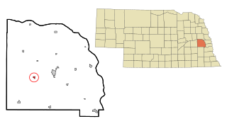
Weston is a village in Saunders County, Nebraska, United States. The population was 324 at the 2010 census.
Uplands Park is a village in St. Louis County, Missouri, United States. The population was 445 at the 2010 census. The village is one of many small majority black communities located in the Natural Bridge corridor of mid-St. Louis County, characterized by small homes on small lots.
Clyde is a village in Wayne County, New York, United States. The population was 2,093 at the 2010 census. It was named after the River Clyde, in Scotland, and the village sits on the Clyde River, a tributary of the Seneca River.
Sibley is a city in Barnes County, North Dakota, United States. The population was 30 at the 2010 census. Sibley was founded in 1959.
Enon is a village in Clark County, Ohio, United States. The population was 2,415 at the 2010 census. It is part of the Springfield, Ohio Metropolitan Statistical Area.
Oacoma is a town in Lyman County, South Dakota, United States. The population was 451 at the 2010 census. Oacoma is located on the west bank of the Missouri River, across from Chamberlain.
Windsor Heights is a village in Brooke County, West Virginia, United States. It is part of the Wheeling, West Virginia Metropolitan Statistical Area. The population was 423 at the 2010 census. Grace Davis was the mayor as of June, 2017.
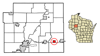
Boyd is a village in Chippewa County, Wisconsin, United States. The population was 552 at the 2010 census.
Blue River is a village in Grant County, Wisconsin, United States. The population was 434 at the 2010 census.
Tennyson is a village in Grant County, Wisconsin, United States, originally called Dutch Hollow. The population was 355 at the 2010 census.
Kellnersville is a village in Manitowoc County, Wisconsin, United States. The population was 332 at the 2010 census.
North Cass is an unorganized territory in Cass County, Minnesota, United States. The population was 348 at the 2000 census. It is part of the Brainerd Micropolitan Statistical Area.
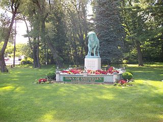
Smithtown is a hamlet and census-designated place (CDP) within the Town of Smithtown in Suffolk County, New York, United States. The population was 26,470 at the 2010 census. The hamlet includes the former Village of The Landing, which was dissolved in 1939.
Unity is a village in Clark and Marathon counties in the U.S. state of Wisconsin. It is part of the Wausau, Wisconsin Metropolitan Statistical Area. The population was 343 at the 2010 census. Of this, 204 were in Marathon County, and 139 were in Clark County. The village is located in northeastern town of Unity in Clark County and northwestern town of Brighton in Marathon County.
Wilton is a village in Monroe County, Wisconsin, United States. The population was 504 at the 2010 census. The village is located partially within the Town of Wilton and partially within the Town of Wellington.