Sport

While frozen, the river is used for ice racing tracks in Tilleda and Caroline. The frozen river is also used for ice fishing.
The Embarrass River is a 62.0-mile-long (99.8 km) [1] tributary of the Wolf River in the U.S. state of Wisconsin. [2]
The Embarrass River has three branches. The South Branch is 35.1 miles (56.5 km) long, [1] originates near Eland and passes by Tigerton. The 50.0-mile-long (80.5 km) [1] Middle Branch originates in southern Langlade County, and the 34.8-mile-long (56.0 km) [1] northern branch passes by Bowler, Tilleda and Leopolis. The Middle and South Branch converge in Caroline, and the river collects its North Branch 4 miles (6 km) east of there, then flows through Pella, where a dam is located. Below Pella, the Embarrass River passes by the village of Embarrass. The Embarrass River eventually flows into the Wolf River in the city of New London. "French voyageurs named this river the Embarrass, French for obstruction, [3] because, while canoeing down the stream, they frequently found their passage blocked by fallen logs." [4]
While frozen, the river is used for ice racing tracks in Tilleda and Caroline. The frozen river is also used for ice fishing.

Shawano County is a county located in the U.S. state of Wisconsin. As of the 2010 census, the population was 41,949. Its county seat is Shawano.
Clarence Township is a civil township located in northeast Calhoun County in the U.S. state of Michigan. It is part of the Battle Creek, Michigan Metropolitan Statistical Area. The population was 1,985 at the 2010 census. The township was originally named Pinkney Township.

Huron Charter Township is a charter township of Wayne County in the U.S. state of Michigan. The population was 15,879 at the 2010 census. Huron Charter Township is named after the Huron River, which flows southeast through the township. It is home to three divisions of the Huron–Clinton Metroparks system: Lower Huron, Oakwoods, and Willow.

Shiocton is a village in Outagamie County, Wisconsin, United States. The population was 921 at the 2010 census. It is wholly surrounded by the Town of Bovina.

New London is a city in Outagamie and Waupaca counties Wisconsin, United States. Founded in 1851, the population was 7,295 at the 2010 census. Of this, 5,685 were in Waupaca County, and 1,640 were in Outagamie County. The city has an annual Saint Patrick's Day Parade, Irish Fest, and week-long festivities, when the city's name is changed to "New Dublin" for the week.
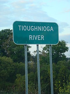
The Tioughnioga River is a 34.2-mile-long (55.0 km) tributary of the Chenango River in central New York in the United States. It drains a dissected plateau area east of the Finger Lakes at the northernmost edge of the watershed of the Susquehanna River.

The Wolf River is a 225 mi (362 km) long tributary of the Fox River in northeastern Wisconsin in the Great Lakes region of the United States. The river is one of the two National Scenic Rivers in Wisconsin, along with the St. Croix River. The scenic portion is 24 miles (39 km) long. The river and its parent the Fox River and associated lakes are known for their sturgeon which spawn every spring upstream on the lower river until blocked by the Shawano Dam. The river flows through mostly undeveloped forestland southerly from central Forest County in the north to Lake Poygan in the south. The lake is part of the Winnebago Pool of lakes fed by both the Fox and Wolf Rivers. The Fox-Wolf basin is usually considered to be a single unified basin and the rivers themselves may be referred to as the Fox-Wolf River system.

The Eau Claire River is a tributary of the Chippewa River in west-central Wisconsin in the United States. It is one of three rivers by this name in Wisconsin. Via the Chippewa River, it is part of the Mississippi River watershed. Its name is the French translation from the Ojibwe Wayaa-gonaatigweyaa-ziibi.
The Manitowoc River is a 35.8-mile-long (57.6 km) river in eastern Wisconsin in the United States. It flows into Lake Michigan at the city of Manitowoc.

The Trempealeau River is an 81.5-mile-long (131.2 km) tributary of the Mississippi River in the Driftless Area of western Wisconsin in the United States.

The Embarras River is a 195-mile-long (314 km) tributary of the Wabash River in southeastern Illinois in the United States. The waters of the Embarras reach the Gulf of Mexico via the Wabash, Ohio, and Mississippi Rivers. The river drains a watershed around 1,566,450 acres (6,339.2 km2) in an agricultural region. The name comes from French explorers, who used the term embarras for river obstacles, blockages, and difficulties relating to logjams and the like.

The Black River is a river in west-central Wisconsin and tributary of the Mississippi River. The river is approximately 190 miles (310 km) long. During the 19th century, pine logs were rafted down the Black, heading for sawmills at La Crosse and points beyond.

Kanab Creek is one of the many tributaries of the Colorado River. It begins in Kane County, Utah, just south of the watershed to the Great Basin and flows 125 miles (201 km) south to the Colorado River.

Wisconsin, a state in the Midwestern United States, has a vast and diverse geography famous for its landforms created by glaciers during the Wisconsin glaciation 17 thousand years ago. The state can be generally divided into five geographic regions—Lake Superior Lowland, Northern Highland, Central Plain, Eastern Ridges & Lowlands, and Western Upland. The southwestern part of the state, which was not covered by glaciers during the most recent ice age, is known as the Driftless Area. The Wisconsin glaciation formed the Wisconsin Dells, Devil's Lake, and the Baraboo Range. A number of areas are protected in the state, including Devil's Lake State Park, the Apostle Islands National Lakeshore, and the Chequamegon–Nicolet National Forest.
The Red River of Wisconsin is a 47.2-mile-long (76.0 km) tributary of the Wolf River. It flows through Gresham and has a dam. Below Gresham, the Red River flows into the Wolf River in northern Shawano County.

The Little Wolf River of Wisconsin is a tributary of the Wolf River.
The Tomorrow/Waupaca River is a river that flows wholly within the U.S. state of Wisconsin. It is called the Tomorrow River where it rises between Polonia and Rosholt in northeast Portage County; it flows through Nelsonville and Amherst. As it exits the village of Amherst, the Tomorrow enters the Town of Amherst, where it joins Bear Creek to become the Waupaca River. It flows into Waupaca County and through the city of Waupaca. There it adjoins the Crystal River and enters Weyauwega before converging with the Wolf River in eastern Waupaca County.

The Satsop River is a stream in the U.S. state of Washington. It has three main tributary forks, the East Fork, West Fork, and Middle Fork Satsop Rivers. The main stem Satsop River is formed by the confluence of the West and East Forks. The Middle Fork is a tributary of the East Fork. The three forks are much longer than the main stem Satsop itself, which flows south from the confluence only a few miles to join the Chehalis River near Satsop, Washington. Other significant tributaries include the Canyon River and Little River, both tributaries of the West Fork Satsop, and Decker Creek, a tributary of the East Fork Satsop River. The Satsop River's major tributaries originate in the Olympic Mountains and its southern foothills, the Satsop Hills, within Grays Harbor and Mason counties. Most of the Satsop River's watershed consists of heavily wooded hill lands. The upper tributaries extend into Olympic National Forest, approaching but not quite reaching Olympic National Park.
Paac Ciinak is a census-designated place (CDP) in Shawano County, Wisconsin, United States. As of the 2020 census, it had a population of 83. On older federal topographic maps, the community is shown as Potch-Chee-Nunk or Potch Che Nunk.
Coordinates: 44°23′32″N88°44′11″W / 44.39222°N 88.73639°W