Elderon, Wisconsin

Last updated
Elderon, Wisconsin
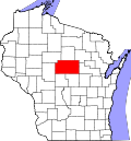
Marathon County Wisconsin Incorporated and Unincorporated areas Elderon Highlighted.svg
Location of Elderon in Marathon County, Wisconsin.
Coordinates: 44°48′40″N89°16′16″W / 44.81111°N 89.27111°W / 44.81111; -89.27111 Coordinates: 44°48′40″N89°16′16″W / 44.81111°N 89.27111°W / 44.81111; -89.27111
Country Flag of the United States.svg  United States
State Flag of Wisconsin.svg  Wisconsin
County Marathon
Area
[1]
  Total1.13 sq mi (2.93 km2)
  Land1.12 sq mi (2.91 km2)
  Water0.01 sq mi (0.02 km2)
Elevation
[2]
1,253 ft (382 m)
Population
 (2010) [3]
  Total179
  Estimate 
(2019) [4]
214
  Density190.39/sq mi (73.51/km2)
Time zone UTC-6 (Central (CST))
  Summer (DST) UTC-5 (CDT)
Area code(s) 715 & 534
FIPS code 55-23100 [5]
GNIS feature ID1564498 [2]

Elderon is a village in Marathon County, Wisconsin, United States. It is part of the Wausau, Wisconsin Metropolitan Statistical Area. The population was 179 at the 2010 census. [6]

Contents

History

A post office called Elderon has been in operation since 1888. [7] The village was named for a grove of elder trees near the town site. [8]

Geography

Elderon is located at 44°46′59″N89°15′1″W / 44.78306°N 89.25028°W / 44.78306; -89.25028 (44.78325, -89.250492). [9]

According to the United States Census Bureau, the village has a total area of 1.16 square miles (3.00 km2), of which, 1.10 square miles (2.85 km2) of it is land and 0.06 square miles (0.16 km2) is water. [10]

Demographics

Historical population
CensusPop.
1920 215
1930 181−15.8%
1940 24937.6%
1950 212−14.9%
1960 177−16.5%
1970 1854.5%
1980 1913.2%
1990 175−8.4%
2000 1898.0%
2010 179−5.3%
2019 (est.)214 [4] 19.6%
U.S. Decennial Census [11]

2010 census

As of the census [3] of 2010, there were 179 people, 80 households, and 53 families living in the village. The population density was 162.7 inhabitants per square mile (62.8/km2). There were 83 housing units at an average density of 75.5 per square mile (29.2/km2). The racial makeup of the village was 92.7% White, 1.1% Native American, 4.5% Pacific Islander, 1.1% from other races, and 0.6% from two or more races. Hispanic or Latino of any race were 3.9% of the population.

There were 80 households, of which 22.5% had children under the age of 18 living with them, 46.3% were married couples living together, 7.5% had a female householder with no husband present, 12.5% had a male householder with no wife present, and 33.8% were non-families. 27.5% of all households were made up of individuals, and 11.3% had someone living alone who was 65 years of age or older. The average household size was 2.24 and the average family size was 2.64.

The median age in the village was 43.4 years. 16.2% of residents were under the age of 18; 13.4% were between the ages of 18 and 24; 22.4% were from 25 to 44; 29.1% were from 45 to 64; and 19% were 65 years of age or older. The gender makeup of the village was 52.0% male and 48.0% female.

2000 census

At the 2000 census, [5] there were 189 people, 77 households and 54 families living in the village. The population density was 170.8 per square mile (65.7/km2). There were 81 housing units at an average density of 73.2 per square mile (28.2/km2). The racial makeup of the village was 98.94% White, 0.53% from other races, and 0.53% from two or more races. 4.76% of the population were Hispanic or Latino of any race.

There were 77 households, of which 35.1% had children under the age of 18 living with them, 58.4% were married couples living together, 3.9% had a female householder with no husband present, and 28.6% were non-families. 20.8% of all households were made up of individuals, and 9.1% had someone living alone who was 65 years of age or older. The average household size was 2.45 and the average family size was 2.91.

Age distribution was 24.9% under the age of 18, 4.8% from 18 to 24, 32.3% from 25 to 44, 23.8% from 45 to 64, and 14.3% who were 65 years of age or older. The median age was 39 years. For every 100 females, there were 112.4 males. For every 100 females age 18 and over, there were 97.2 males.

The median household income was $38,125, and the median family income was $55,417. Males had a median income of $27,917 versus $26,250 for females. The per capita income for the village was $19,225. About 2.1% of families and 5.0% of the population were below the poverty line, including none of those under the age of eighteen and 14.8% of those 65 or over.

Notable people

Related Research Articles

<span class="mw-page-title-main">Elvaston, Illinois</span> Village in Illinois, United States

Elvaston is a village in Hancock County, Illinois, United States. The population was 165 at the 2010 census, an increase from 152 in 2000.

<span class="mw-page-title-main">Cogswell, North Dakota</span> City in North Dakota, United States

Cogswell is a city in Sargent County, North Dakota, United States. The population was 73 at the 2020 census. Cogswell was founded in 1890.

<span class="mw-page-title-main">Harpster, Ohio</span> Village in Ohio, United States

Harpster is a village in Wyandot County, Ohio, United States. The population was 204 at the 2010 census.

<span class="mw-page-title-main">Codorus Township, York County, Pennsylvania</span> Township in Pennsylvania, United States

Codorus Township is a township in York County, Pennsylvania, United States. The population was 3,898 at the 2020 census.

<span class="mw-page-title-main">Kekoskee, Wisconsin</span> Village in Wisconsin, United States

Kekoskee is a village in Dodge County, Wisconsin, United States. The population was 161 at the 2010 census.

<span class="mw-page-title-main">Oliver, Wisconsin</span> Village in Wisconsin, United States

Oliver is a village in Douglas County, Wisconsin, United States. The population was 399 at the 2010 census.

<span class="mw-page-title-main">Camp Douglas, Wisconsin</span> Village in Wisconsin, United States

Camp Douglas is a village in Juneau County, Wisconsin, United States. The population was 601 at the 2010 census. Camp Douglas is home to Volk Field Air National Guard Base.

<span class="mw-page-title-main">Hatley, Wisconsin</span> Village in Wisconsin, United States

Hatley is a village in Marathon County, Wisconsin, United States. It is part of the Wausau, Wisconsin Metropolitan Statistical Area. The population was 574 at the 2010 census.

<span class="mw-page-title-main">Richwood, Wisconsin</span> Town in Wisconsin, United States

Richwood is a town in Richland County, Wisconsin, United States. The population was 618 at the 2000 census. The unincorporated communities of Byrds Creek, Excelsior, Port Andrew, Sand Prairie, Tavera, Westport, and Wild Rose are located in the town.

<span class="mw-page-title-main">Bonduel, Wisconsin</span> Village in Wisconsin, United States

Bonduel is a village in Shawano County, Wisconsin, United States. The population was 1,478 at the 2010 census.

<span class="mw-page-title-main">Ontario, Wisconsin</span> Village in Wisconsin, United States

Ontario is a village in Vernon County, Wisconsin, United States. The population was 554 at the 2010 census.

<span class="mw-page-title-main">Wild Rose, Wisconsin</span> Village in Wisconsin, United States

Wild Rose is a village in Waushara County, Wisconsin, United States. The population was 725 at the 2010 census.

<span class="mw-page-title-main">Dorchester, Wisconsin</span> Village in Wisconsin, United States

Dorchester is a village in Clark and Marathon counties in the U.S. state of Wisconsin, along the 45th parallel. It is part of the Wausau, Wisconsin Metropolitan Statistical Area. The population was 876 at the 2010 census. Of this, 871 were in Clark County, and only 5 were in Marathon County.

<span class="mw-page-title-main">Prairie Farm, Wisconsin</span> Village in Wisconsin, United States

Prairie Farm is a village in Barron County in the U.S. state of Wisconsin. The population was 473 at the 2010 census. The village is located within the Town of Prairie Farm, on eastern shore of the Prairie Farm Flowage, a reservoir on the Hay River.

<span class="mw-page-title-main">Wyocena, Wisconsin</span> Village in Wisconsin, United States

Wyocena is a village in Columbia County, Wisconsin, United States. The population was 768 at the 2010 census. The village is located within the Town of Wyocena. It is part of the Madison Metropolitan Statistical Area.

<span class="mw-page-title-main">Wilton, Wisconsin</span> Village in Wisconsin, United States

Wilton is a village in Monroe County, Wisconsin, United States. The population was 504 at the 2010 census. The village is located partially within the Town of Wilton and partially within the Town of Wellington.

<span class="mw-page-title-main">Clear Lake, Wisconsin</span> Village in Wisconsin, United States

Clear Lake is a village in Polk County, Wisconsin, United States. The population was 1,070 at the 2010 census. The village is adjacent to the Town of Clear Lake along U.S. Highway 63.

<span class="mw-page-title-main">Ettrick (village), Wisconsin</span> Village in Wisconsin, United States

Ettrick is a village in Trempealeau County, Wisconsin, United States. The population was 524 at the 2010 census. The village is surrounded by the Town of Ettrick.

<span class="mw-page-title-main">Scandinavia, Wisconsin</span> Village in Wisconsin, United States

Scandinavia is a village in the Town of Scandinavia in Waupaca County, Wisconsin, United States. The population was 328 at the 2010 census.

<span class="mw-page-title-main">Hancock, Wisconsin</span> Village in Wisconsin, United States

Hancock is a village in Waushara County, Wisconsin, United States. The population was 417 at the 2010 census. The village is located within the Town of Hancock.

References

  1. "2019 U.S. Gazetteer Files". United States Census Bureau. Retrieved August 7, 2020.
  2. 1 2 "US Board on Geographic Names". United States Geological Survey. 2007-10-25. Retrieved 2008-01-31.
  3. 1 2 "U.S. Census website". United States Census Bureau . Retrieved 2012-11-18.
  4. 1 2 "Population and Housing Unit Estimates". United States Census Bureau. May 24, 2020. Retrieved May 27, 2020.
  5. 1 2 "U.S. Census website". United States Census Bureau . Retrieved 2008-01-31.
  6. "Profile of General Population and Housing Characteristics: 2010 Demographic Profile Data (DP-1): Elderon village, Wisconsin". United States Census Bureau . Retrieved September 7, 2012.
  7. "Marathon County". Jim Forte Postal History. Retrieved 17 March 2015.
  8. Chicago and North Western Railway Company (1908). A History of the Origin of the Place Names Connected with the Chicago & North Western and Chicago, St. Paul, Minneapolis & Omaha Railways. p. 67.
  9. "US Gazetteer files: 2010, 2000, and 1990". United States Census Bureau. 2011-02-12. Retrieved 2011-04-23.
  10. "US Gazetteer files 2010". United States Census Bureau. Archived from the original on 2012-01-25. Retrieved 2012-11-18.
  11. "Census of Population and Housing". Census.gov. Retrieved June 4, 2015.
  12. 'Wisconsin Blue Book 2005-2006,' Biographical Sketch of Roger Breske, pg. 42-43
  13. 'Wisconsin Blue Book 1911, Biographical Sketch of Arthur J. Plowman, pg. 768