Brokaw, Wisconsin

Last updated

Brokaw, Wisconsin
Motto: 
Rising by the river
Marathon County Wisconsin Incorporated and Unincorporated areas Brokaw Highlighted.svg
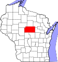
Location of Brokaw in Marathon County, Wisconsin.
Coordinates: 45°1′42″N89°39′23″W / 45.02833°N 89.65639°W / 45.02833; -89.65639
Country United States
State Flag of Wisconsin.svg  Wisconsin
County Marathon
Incorporated1903
Government
  TypeFormer Village
Area
[1]
  Total1.21 sq mi (3.13 km2)
  Land1.03 sq mi (2.68 km2)
  Water0.17 sq mi (0.45 km2)
Elevation
[2]
1,220 ft (372 m)
Population
 (2010) [3]
  Total251
  Estimate 
(2017) [4]
248
  Density239.85/sq mi (92.60/km2)
Time zone UTC-6 (Central (CST))
  Summer (DST) UTC-5 (CDT)
Area code(s) 715 & 534
FIPS code 55-09975 [5]
GNIS feature ID1562231 [2]

Brokaw is a former village in Marathon County, Wisconsin, United States. It is part of the Wausau, Wisconsin Metropolitan Statistical Area. The population was 251 at the 2010 census. [6] Brokaw merged with the village of Maine, Wisconsin on October 1, 2018. [7]

Contents

Geography

Brokaw is located at 45°1′42″N89°39′23″W / 45.02833°N 89.65639°W / 45.02833; -89.65639 (45.028457, -89.656366). [8]

According to the United States Census Bureau, the village has a total area of 1.23 square miles (3.19 km2), of which, 1.07 square miles (2.77 km2) of it is land and 0.16 square miles (0.41 km2) is water. [9]

Demographics

Historical population
CensusPop.Note
1910 458
1920 4937.6%
1930 5144.3%
1940 477−7.2%
1950 380−20.3%
1960 319−16.1%
1970 312−2.2%
1980 298−4.5%
1990 224−24.8%
2000 107−52.2%
2010 251134.6%
2018 (est.)245 [10] −2.4%
U.S. Decennial Census [11]

2010 census

As of the census [3] of 2010, there were 251 people, 123 households, and 66 families living in the village. The population density was 234.6 inhabitants per square mile (90.6/km2). There were 138 housing units at an average density of 129.0 per square mile (49.8/km2). The racial makeup of the village was 97.6% White, 1.6% Asian, 0.4% from other races, and 0.4% from two or more races. Hispanic or Latino of any race were 2.4% of the population.

There were 123 households, of which 19.5% had children under the age of 18 living with them, 35.0% were married couples living together, 13.0% had a female householder with no husband present, 5.7% had a male householder with no wife present, and 46.3% were non-families. 33.3% of all households were made up of individuals, and 5.7% had someone living alone who was 65 years of age or older. The average household size was 2.04 and the average family size was 2.59.

The median age in the village was 32.9 years. 13.9% of residents were under the age of 18; 12.9% were between the ages of 18 and 24; 32.3% were from 25 to 44; 25.2% were from 45 to 64; and 15.9% were 65 years of age or older. The gender makeup of the village was 45.8% male and 54.2% female.

2000 census

As of the census [5] of 2000, there were 107 people, 47 households, and 24 families living in the village. The population density was 108.6 people per square mile (41.7/km2). There were 49 housing units at an average density of 49.7 per square mile (19.1/km2). The racial makeup of the village was 98.13% White, 0.93% Native American, and 0.93% from two or more races. Hispanic or Latino of any race were 1.87% of the population.

There were 47 households, out of which 17.0% had children under the age of 18 living with them, 38.3% were married couples living together, 6.4% had a female householder with no husband present, and 48.9% were non-families. 38.3% of all households were made up of individuals, and 21.3% had someone living alone who was 65 years of age or older. The average household size was 2.28 and the average family size was 2.92.

In the village, the population was spread out, with 17.8% under the age of 18, 15.0% from 18 to 24, 30.8% from 25 to 44, 19.6% from 45 to 64, and 16.8% who were 65 years of age or older. The median age was 35 years. For every 100 females, there were 101.9 males. For every 100 females age 18 and over, there were 109.5 males.

The median income for a household in the village was $27,083, and the median income for a family was $54,167. Males had a median income of $26,458 versus $25,000 for females. The per capita income for the village was $28,290. There were 20.8% of families and 21.5% of the population living below the poverty line, including 50.0% of under eighteens and 17.6% of those over 64.

History

In the 1880s, the Wausau Boom Company built a dam on the Wisconsin River near the present location of the village, and in 1903 the Village of Brokaw was incorporated. [12] The community began to develop in the early 20th century around the Wausau Paper Mills. It was founded by paper company owner Norman Brokaw. [13]

Notable people

Related Research Articles

<span class="mw-page-title-main">Athens, Wisconsin</span> Village in Wisconsin, United States

Athens is a village in Marathon County, Wisconsin, United States. The population was 1,105 at the 2010 census. It is part of the Wausau, Wisconsin Metropolitan Statistical Area.

<span class="mw-page-title-main">Brighton, Marathon County, Wisconsin</span> Town in Wisconsin, United States

Brighton is a town in Marathon County, Wisconsin, United States. It is part of the Wausau, Wisconsin Metropolitan Statistical Area. The population was 620 at the 2020 census.

<span class="mw-page-title-main">Cleveland, Marathon County, Wisconsin</span> Town in Wisconsin, United States

Cleveland is a town in Marathon County, Wisconsin, United States. It is part of the Wausau, Wisconsin Metropolitan Statistical Area. The population was 1,488 at the 2010 census. The unincorporated community of Bradley is located in the town.

<span class="mw-page-title-main">Edgar, Wisconsin</span> Village in Wisconsin, United States

Edgar is a village in Marathon County, Wisconsin, United States. It is part of the Wausau, Wisconsin Metropolitan Statistical Area. The population was 1,479 at the 2010 census. Edgar has maintained Tree City USA standing since 1995.

<span class="mw-page-title-main">Frankfort, Marathon County, Wisconsin</span> Town in Wisconsin, United States

Frankfort is a town in Marathon County, Wisconsin, United States. It is part of the Wausau, Wisconsin Metropolitan Statistical Area. It is part of the Wausau, Wisconsin Metropolitan Statistical Area. The population was 670 at the 2010 census. The unincorporated community of Swan is located in the town.

<span class="mw-page-title-main">Johnson, Wisconsin</span> Town in Wisconsin, United States

The Town of Johnson is located in Marathon County, Wisconsin, United States. It is part of the Wausau, Wisconsin Metropolitan Statistical Area. The population was 985 at the 2010 census. The unincorporated communities of Corinth, Milan, and Wuertsburg are located in the town.

<span class="mw-page-title-main">Village of Maine, Wisconsin</span> Village in Wisconsin, United States

Maine is an incorporated village in Marathon County, Wisconsin, United States. It is part of the Wausau, Wisconsin Metropolitan Statistical Area. The population was 2,337 at the 2010 census. The unincorporated communities of Mount View and Taegesville are located partially in the town.

<span class="mw-page-title-main">Marathon City, Wisconsin</span> Village in Wisconsin, United States

Marathon City is a village in Marathon County, Wisconsin, United States. It is part of the Wausau, Wisconsin Metropolitan Statistical Area. The population was 1,524 at the 2010 census. The village was incorporated from a part of the original area of the town of Marathon. The village dates back to 1856. The name of the village commemorates the Battle of Marathon.

<span class="mw-page-title-main">McMillan, Wisconsin</span> Town in Wisconsin, United States

McMillan is a town in Marathon County, Wisconsin, United States. It is part of the Wausau, Wisconsin Metropolitan Statistical Area. The population was 1,968 at the 2010 census. The unincorporated community of McMillan is located in the town. A section of the Mead Wildlife Area is also located in the town.

<span class="mw-page-title-main">Norrie, Wisconsin</span> Town in Wisconsin, United States

The Town of Norrie is located in Marathon County, Wisconsin, United States. It is part of the Wausau, Wisconsin Metropolitan Statistical Area. The population was 976 at the 2010 census.

<span class="mw-page-title-main">Rothschild, Wisconsin</span> Village in Wisconsin, United States

Rothschild is a village in Marathon County, Wisconsin, United States. It is part of the Wausau, Wisconsin Metropolitan Statistical Area. The population was 5,567 at the 2020 census. Rothschild is the northern terminus of Interstate 39, which starts in Normal, Illinois.

<span class="mw-page-title-main">Schofield, Wisconsin</span> City in Wisconsin, United States

Schofield is a city in Marathon County, Wisconsin, United States. It is part of the Wausau, Wisconsin Metropolitan Statistical Area. The population was 2,157 at the 2020 census. The city was named for William Scholfield, who came to the area in the 1851 to open a sawmill. The city has since dropped the "L" from its name.

<span class="mw-page-title-main">Wien, Wisconsin</span> Town in Wisconsin, United States

Wien is a town in Marathon County, Wisconsin, United States. It is part of the Wausau, Wisconsin Metropolitan Statistical Area. The population was 825 at the 2010 census. The unincorporated community of Wien is located in the town.

<span class="mw-page-title-main">Dorchester, Wisconsin</span> Village in Wisconsin, United States

Dorchester is a village in Clark and Marathon counties in the U.S. state of Wisconsin, along the 45th parallel. It is part of the Wausau, Wisconsin Metropolitan Statistical Area. The population was 876 at the 2010 census. Of this, 871 were in Clark County, and only 5 were in Marathon County.

<span class="mw-page-title-main">Unity, Wisconsin</span> Village in Wisconsin, United States

Unity is a village in Clark and Marathon counties in the U.S. state of Wisconsin. It is part of the Wausau, Wisconsin Metropolitan Statistical Area. The population was 343 at the 2010 census. Of this, 204 were in Marathon County, and 139 were in Clark County. The village is located in northeastern town of Unity in Clark County and northwestern town of Brighton in Marathon County.

<span class="mw-page-title-main">Rib Mountain, Wisconsin</span> Village in Wisconsin, United States

Rib Mountain is a village located in Marathon County, Wisconsin, United States. The population was 7,313 at the 2020 census. A suburb of Wausau, it is part of the Wausau Metropolitan Statistical Area. The census-designated place of Rib Mountain is located in the village.

The Town of Spencer is located in Marathon County, Wisconsin, United States. It is part of the Wausau, WI Metropolitan Statistical Area. The population was 1,581 at the 2010 census. The village of Spencer is located in the northeastern part of the town.The unincorporated community of Mann also is located in the town.

<span class="mw-page-title-main">Wausau (town), Wisconsin</span> Town in Wisconsin, United States

Wausau is a town in Marathon County, Wisconsin, United States. It is part of the Wausau, Wisconsin Metropolitan Statistical Area. The population was 2,229 at the 2010 census. The city of Wausau is located adjacent to and partially within the town. The unincorporated community of Nutterville is located in the town and the unincorporated community of Sunset is partially in the town.

<span class="mw-page-title-main">Weston, Wisconsin</span> Village in Wisconsin, United States

Weston is a village in Marathon County, Wisconsin. It is part of the Wausau Metropolitan Statistical Area. The population was 14,868 at the time of the 2010 census.

<span class="mw-page-title-main">Aniwa, Wisconsin</span> Village in Wisconsin, United States

Aniwa is a village in Shawano County, Wisconsin, United States. The population was 260 at the 2010 census. The village is located within the Town of Aniwa. U.S. Route 45 runs north–south through the village.

References

  1. "2017 U.S. Gazetteer Files". United States Census Bureau. Retrieved March 28, 2019.
  2. 1 2 "US Board on Geographic Names". United States Geological Survey. October 25, 2007. Retrieved January 31, 2008.
  3. 1 2 "U.S. Census website". United States Census Bureau . Retrieved November 18, 2012.
  4. "Population and Housing Unit Estimates" . Retrieved March 24, 2018.
  5. 1 2 "U.S. Census website". United States Census Bureau . Retrieved January 31, 2008.
  6. "Profile of General Population and Housing Characteristics: 2010 Demographic Profile Data (DP-1): Brokaw village, Wisconsin". United States Census Bureau . Retrieved September 7, 2012.
  7. Terlecki, Courtney. "Wausau area communities merge--a first in state history". WAOW.com. Retrieved December 14, 2018.
  8. "US Gazetteer files: 2010, 2000, and 1990". United States Census Bureau. February 12, 2011. Retrieved April 23, 2011.
  9. "US Gazetteer files 2010". United States Census Bureau. Archived from the original on January 25, 2012. Retrieved November 18, 2012.
  10. "Population and Housing Unit Estimates" . Retrieved June 4, 2019.
  11. "Census of Population and Housing". Census.gov. Retrieved June 4, 2015.
  12. "Village of Brokaw, Centennial Celebration, Rising by the River" (PDF). 2003. Retrieved March 20, 2022.
  13. Callary, Edward (2016). Place Names of Wisconsin. Madison, WI: University of Wisconsin Press. p. 39. ISBN   978-0-299-30964-0.