Rib Mountain (CDP), Wisconsin

Last updated

Rib Mountain
CDP
WIMap-doton-Rib Mountain.png
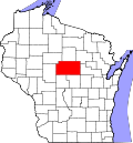
Location of Rib Mountain, Wisconsin
Coordinates: 44°55′44″N89°39′57″W / 44.92889°N 89.66583°W / 44.92889; -89.66583
Country United States
State Wisconsin
County Marathon
Named for Rib Mountain
Area
  Total13.1 sq mi (33.8 km2)
  Land12.1 sq mi (31.4 km2)
  Water0.9 sq mi (2.4 km2)
Population
 (2020)
  Total6,061
  Density460/sq mi (180/km2)
Time zone UTC-6 (Central (CST))
  Summer (DST) UTC-5 (CDT)
Area code(s) 715 & 534

Rib Mountain is a census-designated place (CDP) in the town of Rib Mountain in Marathon County, Wisconsin, United States. The population was 6,061 at the 2020 census. [1]

Contents

The community is named for Rib Mountain.

Geography

Rib Mountain is located at 44°55′43″N89°39′57″W / 44.92861°N 89.66583°W / 44.92861; -89.66583 (44.928768, -89.665872). [2]

According to the United States Census Bureau, the CDP has a total area of 33.8 km2 (13.1 sq mi). 31.4 km2 (12.1 sq mi) of it is land and 2.4 km2 (0.93 sq mi) of it (6.98%) is water.

Demographics

Historical population
CensusPop.Note
2010 5,651
2020 6,0617.3%
U.S. Decennial Census [3]

As of the census [4] of 2000, there were 6,059 people, 2,211 households, and 1,782 families residing in the CDP. The population density was 193.0 people/km2 (500 people/sq mi). There were 2,278 housing units at an average density of 72.6 units/km2 (188 units/sq mi). The racial makeup of the CDP was 96.06% White, 0.17% Black or African American, 0.23% Native American, 2.79% Asian, 0.23% from other races, and 0.53% from two or more races. Hispanic or Latino of any race were 0.61% of the population.

There were 2,211 households, out of which 36.9% had children under the age of 18 living with them, 74.0% were married couples living together, 4.5% had a female householder with no husband present, and 19.4% were non-families. 15.4% of all households were made up of individuals, and 6.4% had someone living alone who was 65 years of age or older. The average household size was 2.71 and the average family size was 3.03.

In the CDP, the population was spread out, with 26.5% under the age of 18, 5.9% from 18 to 24, 29.1% from 25 to 44, 27.4% from 45 to 64, and 11.0% who were 65 years of age or older. The median age was 39 years. For every 100 females, there were 102.8 males. For every 100 females age 18 and over, there were 98.9 males.

The median income for a household in the CDP was $58,866, and the median income for a family was $63,881. Males had a median income of $42,432 versus $26,947 for females. The per capita income for the CDP was $28,066. About 0.5% of families and 2.0% of the population were below the poverty line, including none of those under age 18 and 2.8% of those age 65 or over.

Related Research Articles

<span class="mw-page-title-main">East Fork, Arizona</span> CDP in Navajo County, Arizona

East Fork is a census-designated place (CDP) in Navajo County, Arizona, United States, on the Fort Apache Indian Reservation. The population was 699 at the 2010 census.

<span class="mw-page-title-main">Picture Rocks, Arizona</span> CDP in Pima County, Arizona

Picture Rocks is a census-designated place (CDP) in Pima County, Arizona, United States, home of the Tucson artifacts. The population was 9,551 at the 2020 United States census.

<span class="mw-page-title-main">Havre North, Montana</span> Census-designated place in Montana, United States

Havre North is a census-designated place (CDP) in Hill County, Montana, United States. The population was 716 at the 2010 census, down from 973 in 2000.

<span class="mw-page-title-main">Greenville, Rhode Island</span> Census-designated place in Rhode Island, United States

Greenville is a village and census-designated place (CDP) in the town of Smithfield in Providence County, Rhode Island, United States. The population was 8,658 at the 2010 census. The CDP is centered on the village of Greenville but also encompasses the nearby villages of West Greenville and Spragueville, as well as the Mountaindale Reservoir and beach.

<span class="mw-page-title-main">Narragansett Pier, Rhode Island</span> CDP in Rhode Island, United States

Narragansett Pier is an unincorporated village and a census-designated place (CDP) in the town of Narragansett in Washington County, Rhode Island, United States. The population was 3,409 at the 2010 census.

<span class="mw-page-title-main">Potosi, Texas</span> CDP in Texas, United States

Potosi is a census-designated place (CDP) in Taylor County, Texas, United States. Its population was 2,991 at the 2010 census. It is part of the Abilene, Texas metropolitan statistical area.

<span class="mw-page-title-main">Vansant, Virginia</span> Census-designated place in Virginia, United States

Vansant is a census-designated place (CDP) in Buchanan County, Virginia, United States. The population was 470 at the 2010 census. Vansant is located just south of the town of Grundy.

Fairlawn is a census-designated place (CDP) in Pulaski County, Virginia, United States. The population was 2,419 at the 2020 census up from 2,367 at the 2010 census. It is served by the Radford, Virginia post office and is located on the opposite side of the New River from Radford.

<span class="mw-page-title-main">Lake Wazeecha, Wisconsin</span> CDP in Wisconsin, United States

Lake Wazeecha is a census-designated place (CDP) in the town of Grand Rapids, Wood County, Wisconsin, United States. The population was 2,651 at the 2010 census.

<span class="mw-page-title-main">Etna, Wyoming</span> Census-designated place in Wyoming, United States

Etna is a census-designated place (CDP) in Lincoln County, Wyoming, United States. The population was 185 at the 2020 census.

<span class="mw-page-title-main">Lake Wisconsin, Wisconsin</span> CDP in Wisconsin, United States

Lake Wisconsin is a census-designated place (CDP) in Columbia and Sauk counties, in the towns of Lodi and Merrimac, in Wisconsin, United States. The population was 4,189 at the 2010 census.

<span class="mw-page-title-main">Palmer (CDP), Massachusetts</span> Former CDP in Massachusetts, United States

Palmer is former census-designated place (CDP) in Hampden County, Massachusetts, United States. The population was 3,900 at the 2000 census. It is part of the Springfield, Massachusetts Metropolitan Statistical Area. The area is more commonly known as Depot Village, named for the ornate train depot built there by famed architect H.H. Richardson

<span class="mw-page-title-main">Kingston (CDP), Massachusetts</span> Census-designated place in Massachusetts, United States

Kingston is a census-designated place (CDP) in the town of Kingston in Plymouth County, Massachusetts, United States. The population was 5,591 at the 2010 census.

<span class="mw-page-title-main">Athol (CDP), Massachusetts</span> CDP in Massachusetts, United States

Athol is a census-designated place (CDP) in the town of Athol in Worcester County, Massachusetts, United States. The population was 8,265 at the 2010 census.

<span class="mw-page-title-main">Clinton (CDP), Massachusetts</span> CDP in Massachusetts, United States

Clinton is a census-designated place (CDP) in the town of Clinton in Worcester County, Massachusetts, United States. The population was 7,389 at the 2010 census.

<span class="mw-page-title-main">Milford (CDP), Massachusetts</span> CDP in Massachusetts, United States

Milford is a census-designated place (CDP) in the town of Milford in Worcester County, Massachusetts, United States. The population was 25,055 at the 2010 census.

<span class="mw-page-title-main">Westborough (CDP), Massachusetts</span> Census-designated place in Massachusetts, United States

Westborough is a census-designated place (CDP) in the town of Westborough in Worcester County, Massachusetts, United States. The population was 4,045 at the 2010 census.

Wallingford is a census-designated place (CDP) in Rutland County, Vermont, United States. The population was 830 at the 2010 census.

<span class="mw-page-title-main">Brattleboro (CDP), Vermont</span> CDP in Vermont, United States

Brattleboro is a census-designated place (CDP) corresponding to the densely populated core of the town of Brattleboro in Windham County, Vermont, United States. The population was 8,289 at the 2000 census.

Seymour is a census-designated place (CDP) in Eau Claire County, Wisconsin, United States. The population was 1,418 at the 2010 census. It is located within the town of Seymour and is part of the Eau Claire urban area.

References

  1. "United States Census 2020". United States Census Bureau . Retrieved March 3, 2023.
  2. "US Gazetteer files: 2010, 2000, and 1990". United States Census Bureau. February 12, 2011. Retrieved April 23, 2011.
  3. "Census of Population and Housing". Census.gov. Retrieved March 3, 2023.
  4. "U.S. Census website". United States Census Bureau . Retrieved January 31, 2008.