Price County was created on March 3, 1879, when Wisconsin Governor William E. Smith signed legislation creating the county. The county was later organized in 1882.[3]William T. Price (1824–1886), for whom Price County was named,[4] was President of the Wisconsin Senate and an early logger in Price County; he later was elected to the U.S. Congress.[5] The county was formed from portions of Chippewa and Lincoln counties.
The first white settler in what is now Price County was Major Isaac Stone, who located on the Spirit River in 1860 to engage in lumbering.[6] Price County continues today to be a large producer of raw timber.[7]
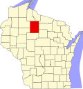
Geography
According to the U.S. Census Bureau, the county has a total area of 1,278 square miles (3,310km2), of which 1,254 square miles (3,250km2) is land and 24 square miles (62km2) (1.9%) is water.[8] The highest natural point in Wisconsin, Timms Hill at 1,951 feet (595m), is located in Price County.
As of the census of 2020,[1] the population was 14,054. The population density was 11.2 peopleper square mile (4.3 people/km2). There were 10,735 housing units at an average density of 8.6 unitsper square mile (3.3 units/km2). The racial makeup of the county was 94.2% White, 0.9% Pacific Islander, 0.6% Native American, 0.5% Asian, 0.2% Black or African American, 0.5% from other races, and 3.1% from two or more races. Ethnically, the population was 1.3% Hispanic or Latino of any race.
2000 census
2000 Census age pyramid for Price County
As of the census[14]of 2000, there were 15,822 people, 6,564 households, and 4,417 families residing in the county. The population density was 13 peopleper square mile (5.0 people/km2). There were 9,574 housing units at an average density of 8 unitsper square mile (3.1 units/km2). The racial makeup of the county was 98.22% White, 0.1% Black or African American, 0.6% Native American, 0.3% Asian, 0.03% Pacific Islander, 0.15% from other races, and 0.6% from two or more races. 0.73% of the population were Hispanic or Latino of any race. 44.4% were of German, 6.5% Norwegian, 5.9% Swedish, 5.4% Polish, 5.2% Irish and 5% Czech ancestry.
There were 6,564 households, out of which 28.9% had children under the age of 18 living with them, 56.5% were married couples living together, 6.6% had a female householder with no husband present, and 32.7% were non-families. 28.5% of all households were made up of individuals, and 14.5% had someone living alone who was 65 years of age or older. The average household size was 2.37 and the average family size was 2.91.
In the county, the population was spread out, with 23.8% under the age of 18, 5.8% from 18 to 24, 25.8% from 25 to 44, 25.7% from 45 to 64, and 18.8% who were 65 years of age or older. The median age was 42 years. For every 100 females, there were 101.00 males. For every 100 females age 18 and over, there were 99 males.
In 2017, there were 127 births, giving a general fertility rate of 71.4 births per 1000 women aged 15–44, the 13th highest rate out of all 72 Wisconsin counties.[15]
Price County was originally a Republican stronghold which became a swing county and bellwether beginning in the Depression years, voting for the nationwide winner in every election from 1928 to 1984 except for the very closely contested 1960 election. Recently, starting in 1988 it saw a Democratic trend through 2012 (with the exception of 2000). Several of these elections were particularly close; in 2004, Democrat John Kerry won the county by a narrow plurality of 37 votes. While the county swung strongly Democratic in 2008 to support Barack Obama, the best such performance since 1964, in 2012 Obama lost ground and only carried the county by 3 votes. In 2016 the county swung hard to the right in support of Donald Trump, who became the first Republican to carry it by over 60% since Warren G. Harding in 1920. Trump improved his margins in both 2020 and 2024.[16]
United States presidential election results for Price County, Wisconsin[17][18]
This page is based on this Wikipedia article Text is available under the CC BY-SA 4.0 license; additional terms may apply. Images, videos and audio are available under their respective licenses.