Sheboygan County, Wisconsin

Last updated

Sheboygan County, Wisconsin
Sheboygan County Courthouse 2018.jpg
Flag of Sheboygan County, Wisconsin.png
Sheboygan County Seal.png
Map of Wisconsin highlighting Sheboygan County.svg
Map of Wisconsin showing Sheboygan County
Map of USA WI.svg
Wisconsin's location in the contiguous United States
CountryFlag of the United States (23px).png  United States
State Flag of Wisconsin.svg  Wisconsin
Incorporated 1846
Named for Sheboygan River
County seat Sheboygan
Largest city Sheboygan
Incorporated municipalities
28 (total)
  • 3 cities
  • 19 towns
  • 11 villages
Government
  Type County
  Body Board of Supervisors
  Board PresidentRoger L. Te Stroete
  County Board25 commissioners
Area
  Total1,271 sq mi (3,290 km2)
  Land511 sq mi (1,320 km2)
  Water760 sq mi (2,000 km2)
  Rank 56th largest county in Wisconsin
Population
 (2020)
  Total118,034
  Rank 13th largest county in Wisconsin
  Density93/sq mi (36/km2)
Time zone UTC−6 (Central)
  Summer (DST) UTC−5 (Central)
ZIP Code
53081, 53083, 53073, 53085, 53070, 53044, 53093, 53001, 53031, 53026, 53082
Area codes 920
Congressional districts 6th
Interstates I-43.svg
State Routes WIS 23.svg WIS 28.svg WIS 32.svg WIS 42.svg WIS 57.svg WIS 67.svg WIS 144.svg
Airports Sheboygan County Memorial Airport
Waterways Lake MichiganSheboygan RiverNorth Branch Milwaukee River
Public transit Shoreline Metro
Website sheboygancountywi.gov

Sheboygan County is a county in the U.S. state of Wisconsin. It is named after the Sheboygan River. [1] As of the 2020 census, the population was 118,034. [2] Its county seat is Sheboygan. [3] The county was created in 1836 and organized in 1846. [4] At the time, it was located in the Wisconsin Territory. Sheboygan County comprises the Sheboygan, WI Metropolitan Statistical Area. Part of the Holyland region is located in northwestern Sheboygan County.

Contents

Geography

According to the U.S. Census Bureau, the county has a total area of 1,271 square miles (3,290 km2), of which 511 square miles (1,320 km2) is land and 760 square miles (2,000 km2) (60%) is water. [5]

Major highways

Railroads

Buses

Airport

Sheboygan County Memorial Airport (KSBM), serves the county and surrounding communities.

Adjacent counties

National marine sanctuary

The Wisconsin Shipwreck Coast National Marine Sanctuary was established in 2021 in the waters of Lake Michigan, with its south-central portion lying off Sheboygan County′s coast. The national marine sanctuary is the site of a large number of historically significant shipwrecks. [6] [7] [8]

Climate

Sheboygan County
Climate chart (explanation)
J
F
M
A
M
J
J
A
S
O
N
D
 
 
66
 
 
−4
−9
 
 
61
 
 
−3
−9
 
 
82
 
 
1
−5
 
 
160
 
 
13
−1
 
 
123
 
 
16
6
 
 
133
 
 
18
12
 
 
106
 
 
24
15
 
 
96
 
 
25
13
 
 
77
 
 
21
12
 
 
133
 
 
12
5
 
 
71
 
 
6
−2
 
 
78
 
 
−4
−7
Average max. and min. temperatures in °C
Precipitation totals in mm
Source: [9]
Imperial conversion
JFMAMJJASOND
 
 
2.6
 
 
25
16
 
 
2.4
 
 
27
16
 
 
3.2
 
 
34
23
 
 
6.3
 
 
55
30
 
 
4.8
 
 
61
43
 
 
5.2
 
 
64
54
 
 
4.2
 
 
75
59
 
 
3.8
 
 
77
55
 
 
3
 
 
70
54
 
 
5.2
 
 
54
41
 
 
2.8
 
 
43
28
 
 
3.1
 
 
25
19
Average max. and min. temperatures in °F
Precipitation totals in inches

Demographics

Historical population
CensusPop.Note
1840 133
1850 8,3796,200.0%
1860 26,875220.7%
1870 31,74918.1%
1880 34,2067.7%
1890 42,48924.2%
1900 50,34518.5%
1910 54,8889.0%
1920 59,9139.2%
1930 71,23518.9%
1940 76,2217.0%
1950 80,6315.8%
1960 86,4847.3%
1970 96,66011.8%
1980 100,9354.4%
1990 103,8772.9%
2000 112,6468.4%
2010 115,5072.5%
2020 118,0342.2%
U.S. Decennial Census [10]
1790–1960 [11] 1900–1990 [12]
1990–2000 [13] 2010–2020 [2] [14]

As of the census of 2020, [15] the population was 118,034. The population density was 230.7 people per square mile (89.1 people/km2). There were 52,303 housing units at an average density of 102.2 units per square mile (39.5 units/km2). The racial makeup of the county was 83.2% White, 5.9% Asian, 2.2% Black or African American, 0.5% Native American, 2.9% from other races, and 5.4% from two or more races. Ethnically, the population was 7.3% Hispanic or Latino of any race.

2000 Census Age Pyramid for Sheboygan County USA Sheboygan County, Wisconsin age pyramid.svg
2000 Census Age Pyramid for Sheboygan County

As of the census [16] of 2000, there were 112,646 people, 43,545 households, and 29,915 families residing in the county. The population density was 219 people per square mile (85 people/km2). There were 45,947 housing units at an average density of 90 units per square mile (35 units/km2). The racial makeup of the county was 92.71% White, 1.09% Black or African American, 0.36% Native American, 3.28% Asian, 0.02% Pacific Islander, 1.46% from other races, and 1.07% from two or more races.

3.36% of the population were Hispanic or Latino of any race. 54.9% were of German, 7.8% Dutch and 5.4% American ancestry. 91.9% spoke English, 3.0% Spanish, 2.5% Hmong and 1.7% German as their first language.

There were 43,545 households, out of which 32.30% had children under the age of 18 living with them, 58.00% were married couples living together, 7.30% had a female householder with no husband present, and 31.30% were non-families. 26.10% of all households were made up of individuals, and 10.40% had someone living alone who was 65 years of age or older. The average household size was 2.50 and the average family size was 3.05.

In the county, the population was spread out, with 25.50% under the age of 18, 8.40% from 18 to 24, 29.80% from 25 to 44, 22.30% from 45 to 64, and 14.00% who were 65 years of age or older. The median age was 37 years. For every 100 females there were 100.60 males. For every 100 females age 18 and over, there were 99.90 males.

In 2017, there were 1,204 births, giving a general fertility rate of 61.3 births per 1000 women aged 15–44, the 31st lowest rate out of all 72 Wisconsin counties. [17] Additionally, there were 81 reported induced abortions performed on women of Sheboygan County residence in 2017. [18]

Communities

Sheboygan County Historical Museum SheboyganCountyHistoricalMuseum.jpg
Sheboygan County Historical Museum
Grandstand at the Sheboygan County fairgrounds SheboyganCountyWisconsinFairgrounds.jpg
Grandstand at the Sheboygan County fairgrounds

Cities

RankCommunityPopulationYearZip Code
1 Sheboygan 49,929184653081
2 Plymouth 8,932188053073
3 Sheboygan Falls 8,210183553085

Villages

Towns

Census-designated places

Unincorporated communities

Ghost towns

Public High Schools

Law enforcement

Sheboygan County Sheriff's Office
Agency overview
Formed1846
Employees180
Annual budget$17 million
Jurisdictional structure
General nature
Operational structure
Headquarters525 North 6th Street
Sheboygan, Wisconsin 53081
Flag of the United States.svg  United States
Sworn members73
Sheriff responsible
  • Cory Roeseler
Facilities
Stations1
Patrol Boats2
Patrol Dogs3
Website
www.sheboygansheriff.com

The Sheboygan County Sheriff's Office was established in 1846, with T.C. Horner the first sheriff elected. The Sheriff's Office was once located inside the David Taylor House, [19] which still stands today in the same location as a part of the Sheboygan County Historical Museum. The jail was located in the basement of the David Taylor House from 1915 to 1936 while the Sheriff's Office was located on the first floor and the sheriff's residence on the second floor. In 1936, the Sheriff's Office and county jail moved to the top floor of the Sheboygan County Courthouse.[ citation needed ]

In 1981, the Sheboygan County Sheriff's Office relocated to its present location inside the Law Enforcement Center at 525 North 6th Street in Sheboygan. At the time, it was a very contemporary linear facility with modern security systems. The second floor of the Sheriff's Office served as the county jail until 1998 when a 95,000 square foot, 295 bed Detention Center was constructed on the city's south side. It was envisioned the Sheriff's Office and the Sheboygan Police Department would be housed inside the Law Enforcement Center but that never occurred.[ citation needed ]

In 2012, after years of discussion, the Sheboygan County and City of Sheboygan approved an agreement to combine emergency dispatch at the Law Enforcement Center. [20] Under the proposal, the city will fund remodeling of the new center by providing $2.5 million for the project. [21] The Joint Dispatch Center began operation in 2016.

The current sheriff is Cory Roeseler, who was elected to his first term in office in 2018. [22]

Politics

United States presidential election results for Sheboygan County, Wisconsin [23]
Year Republican Democratic Third party
No.%No.%No.%
2020 37,60956.97%27,10141.06%1,3011.97%
2016 32,51454.40%23,00038.48%4,2527.11%
2012 34,07254.38%27,91844.56%6611.06%
2008 30,80149.59%30,39548.94%9111.47%
2004 34,45855.02%27,60844.08%5590.89%
2000 29,64853.71%23,56942.70%1,9843.59%
1996 20,06742.69%22,02246.85%4,91410.45%
1992 22,52641.29%20,56837.70%11,46521.01%
1988 23,47149.75%23,42949.66%2770.59%
1984 26,34555.05%21,11244.12%3960.83%
1980 23,03647.42%20,97443.18%4,5659.40%
1976 22,33247.13%24,22651.13%8251.74%
1972 21,50049.40%21,11448.52%9052.08%
1968 17,76444.86%20,17050.93%1,6684.21%
1964 12,96832.88%26,41066.95%670.17%
1960 21,67653.89%18,42545.81%1200.30%
1956 22,07759.91%14,54039.46%2350.64%
1952 22,08459.00%15,13640.44%2120.57%
1948 12,45943.05%15,33953.00%1,1443.95%
1944 15,29149.42%15,06248.68%5851.89%
1940 15,30548.21%15,80049.77%6422.02%
1936 8,86531.59%17,41562.06%1,7836.35%
1932 7,45427.96%18,02967.62%1,1784.42%
1928 12,64051.17%11,43946.31%6222.52%
1924 6,97434.56%1,3506.69%11,85758.75%
1920 11,99468.95%1,89510.89%3,50720.16%
1916 5,56252.92%3,88536.96%1,06310.11%
1912 2,69227.97%3,96841.23%2,96530.81%
1908 5,94852.40%4,40538.81%9988.79%
1904 6,12157.18%3,43032.04%1,15310.77%
1900 5,92753.77%4,04936.73%1,0479.50%
1896 6,64462.50%3,32731.30%6606.21%
1892 3,63840.27%5,12656.74%2702.99%

See also

Related Research Articles

<span class="mw-page-title-main">Washington County, Wisconsin</span> County in Wisconsin, United States

Washington County is a county in the U.S. state of Wisconsin. As of the 2020 census, the population was 136,761. Its county seat is West Bend. The county was created from Wisconsin Territory in 1836 and organized in 1845. It was named after President George Washington.

<span class="mw-page-title-main">Washburn County, Wisconsin</span> County in Wisconsin, United States

Washburn County is a county in the U.S. state of Wisconsin. It is named after Governor Cadwallader C. Washburn. As of the 2020 census, the population was 16,623. Its county seat is Shell Lake. The county was created in 1883.

<span class="mw-page-title-main">Ozaukee County, Wisconsin</span> County in Wisconsin, United States

Ozaukee County is a county in the U.S. state of Wisconsin. As of the 2020 census, the population was 91,503. Its county seat is Port Washington. Ozaukee County is included in the Milwaukee–Waukesha–West Allis, WI Metropolitan Statistical Area.

<span class="mw-page-title-main">Manitowoc County, Wisconsin</span> County in Wisconsin, United States

Manitowoc County is a county in the U.S. state of Wisconsin. As of the 2020 census, the population was 81,359. Its county seat is Manitowoc. The county was created in 1836 prior to Wisconsin's statehood and organized in 1848. Manitowoc County comprises the Manitowoc, WI Micropolitan Statistical Area.

<span class="mw-page-title-main">Fond du Lac County, Wisconsin</span> County in Wisconsin, United States

Fond du Lac County is a county in the U.S. state of Wisconsin. As of the 2020 census, the population was 104,154. Its county seat is Fond du Lac. The county was created in the Wisconsin Territory in 1836 and later organized in 1844. Fond du Lac is French for "bottom of the lake", given so because of the county's location at the southern shore of Lake Winnebago. Fond du Lac County comprises the Fond du Lac, Wisconsin Metropolitan Statistical Area. The Holyland region is in northeastern Fond du Lac County.

<span class="mw-page-title-main">Calumet County, Wisconsin</span> County in Wisconsin, United States

Calumet County is a county located in the U.S. state of Wisconsin. As of the 2020 census, the population was 52,442. The county seat is Chilton. The county was created in 1836 and organized in 1850.

<span class="mw-page-title-main">Newton, Manitowoc County, Wisconsin</span> Town in Wisconsin, United States

Newton is a town in Manitowoc County, Wisconsin, United States. The population was 2,241 at the 2000 census.

<span class="mw-page-title-main">Two Creeks, Wisconsin</span> Town in Wisconsin, United States

Two Creeks is a town in Manitowoc County, Wisconsin, United States. The population was 551 at the 2000 census.

<span class="mw-page-title-main">Cedar Grove, Wisconsin</span> Village in Wisconsin, United States

Cedar Grove is a village in Sheboygan County, Wisconsin, United States, within the Town of Holland. The population was 2,101 at the 2020 census. It is included in the Sheboygan, Wisconsin Metropolitan Statistical Area.

<span class="mw-page-title-main">Elkhart Lake, Wisconsin</span> Village in Wisconsin, United States

Elkhart Lake is a village in Sheboygan County, Wisconsin, United States, located within the northwestern part of the county within the Town of Rhine. The population was 967 at the 2010 census. It is included in the Sheboygan, Wisconsin Metropolitan Statistical Area. Elkhart Lake may be best known for hosting road races on public county roads during the 1950s, later moving to a dedicated race track called Road America, which is located a few miles south of the village.

<span class="mw-page-title-main">Glenbeulah, Wisconsin</span> Village in Wisconsin, United States

Glenbeulah is a village in Sheboygan County, Wisconsin, United States. The population was 463 at the 2010 census. It is included in the Sheboygan, Wisconsin Metropolitan Statistical Area. Glenbeulah is situated on the Mullet River.

<span class="mw-page-title-main">Oostburg, Wisconsin</span> Village in Wisconsin, United States

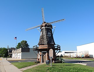
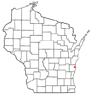
Oostburg is a village in Sheboygan County, Wisconsin, United States. The population was 3,056 at the 2020 census. It is included in the Sheboygan, Wisconsin Metropolitan Statistical Area.

<span class="mw-page-title-main">Manitowoc, Wisconsin</span> City in Wisconsin, United States

Manitowoc is a city in and the county seat of Manitowoc County, Wisconsin, United States. The city is located on Lake Michigan at the mouth of the Manitowoc River. According to the 2020 census, Manitowoc had a population of 34,626, with over 50,000 residents in the surrounding communities.

<span class="mw-page-title-main">Two Rivers, Wisconsin</span> City in Wisconsin, United States

Two Rivers is a city in Manitowoc County, Wisconsin, United States. The population was 11,271 at the 2020 census. It is the birthplace of the ice cream sundae. The city's advertising slogan is "Catch our friendly waves" as it is located along Lake Michigan.

<span class="mw-page-title-main">Belgium, Wisconsin</span> Village in Ozaukee County, Wisconsin

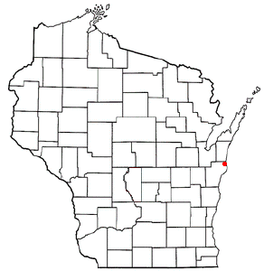
Belgium is a village in Ozaukee County, Wisconsin, United States. Located along Interstate 43, the village is one of the northernmost communities in the Milwaukee metropolitan area. The population was 2,245 at the 2010 census.

<span class="mw-page-title-main">Plymouth, Wisconsin</span> City in Wisconsin, United States

Plymouth is a city in Sheboygan County, Wisconsin, along the Mullet River. It is included in the Sheboygan, Wisconsin Metropolitan Statistical Area. The city is located in the Town of Plymouth, but is politically independent. Plymouth is known as "Hub City" for its former role as a center of wooden wheelwrighting. The population was 8,932 at the 2020 census. Mayor Don Pohlman was last re-elected in April 2018.

<span class="mw-page-title-main">Sheboygan, Wisconsin</span> City and county seat in Wisconsin, United States

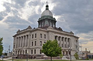
Sheboygan is a city in and the county seat of Sheboygan County, Wisconsin, United States. The population was 49,929 at the 2020 census. It is the principal city of the Sheboygan, Wisconsin Metropolitan Statistical Area, which has a population of 118,034. The city is located on the western shore of Lake Michigan at the mouth of the Sheboygan River, about 50 miles north of Milwaukee and 64 mi (103 km) south of Green Bay.

<span class="mw-page-title-main">Sheboygan Falls, Wisconsin</span> Place in United States, Town of Rochester

Sheboygan Falls is a city in Sheboygan County, Wisconsin, United States. Its population was 8,210 at the 2020 census. The city's downtown is listed on the National Register of Historic Places and is the first Main Street Community in Wisconsin. The city is part of the Sheboygan, Wisconsin Metropolitan Statistical Area.

<span class="mw-page-title-main">Sheboygan County Sheriff's Office</span>

Sheboygan County Sheriff's Office is the principal law enforcement agency that serves Sheboygan County, Wisconsin. The current sheriff is Cory Roeseler, who was elected to his first term in office in 2018.

<span class="mw-page-title-main">Wisconsin Shipwreck Coast National Marine Sanctuary</span> Protected marine area in Lake Michigan off Wisconsin, United States

The Wisconsin Shipwreck Coast National Marine Sanctuary is one of 15 United States National Marine Sanctuaries administered by the National Oceanic and Atmospheric Administration (NOAA), an agency of the United States Department of Commerce; NOAA co-manages the sanctuary jointly with the State of Wisconsin. It is located in Lake Michigan along the coast of Wisconsin. It was created in 2021 to protect shipwrecks considered nationally important archaeological resources.

References

  1. "Winnebago Took Its Name from an Indian Tribe". The Post-Crescent. December 28, 1963. p. 14. Retrieved August 25, 2014 via Newspapers.com. Open Access logo PLoS transparent.svg
  2. 1 2 "State & County QuickFacts". United States Census Bureau. Archived from the original on August 19, 2011. Retrieved January 23, 2014.
  3. "Find a County". National Association of Counties. Retrieved June 7, 2011.
  4. "Wisconsin: Individual County Chronologies". Wisconsin Atlas of Historical County Boundaries. The Newberry Library. 2007. Archived from the original on April 14, 2017. Retrieved August 15, 2015.
  5. "2010 Census Gazetteer Files". United States Census Bureau. August 22, 2012. Retrieved August 9, 2015.
  6. "Wisconsin Shipwreck Coast National Marine Sanctuary Designation; Final Regulations". NOAA via Federal Register. June 23, 2021. Retrieved June 29, 2021.
  7. National Marine Sanctuaries media document: Wisconsin Shipwreck Coast National Marine Sanctuary Accessed 29 June 2021
  8. NOAA News "NOAA designates new national marine sanctuary in Wisconsin’s Lake Michigan," June 22, 2021 Accessed 29 June 2021
  9. "NASA Earth Observations Data Set Index". NASA. Retrieved January 30, 2016.
  10. "U.S. Decennial Census". United States Census Bureau. Retrieved August 9, 2015.
  11. "Historical Census Browser". University of Virginia Library. Retrieved August 9, 2015.
  12. Forstall, Richard L., ed. (March 27, 1995). "Population of Counties by Decennial Census: 1900 to 1990". United States Census Bureau. Retrieved August 9, 2015.
  13. "Census 2000 PHC-T-4. Ranking Tables for Counties: 1990 and 2000" (PDF). United States Census Bureau. April 2, 2001. Archived (PDF) from the original on October 9, 2022. Retrieved August 9, 2015.
  14. "U.S. Census Bureau QuickFacts: Sheboygan County, Wisconsin". Archived from the original on January 17, 2021. Retrieved August 19, 2021.
  15. "2020 Decennial Census: Sheboygan County, Wisconsin". data.census.gov. U.S. Census Bureau. Retrieved July 4, 2022.
  16. "U.S. Census website". United States Census Bureau . Retrieved May 14, 2011.
  17. "Annual Wisconsin Birth and Infant Mortality Report, 2017 P-01161-19 (June 2019): Detailed Tables". Archived from the original on June 19, 2019. Retrieved June 19, 2019.
  18. Reported Induced Abortions in Wisconsin, Office of Health Informatics, Division of Public Health, Wisconsin Department of Health Services. Section: Trend Information, 2013–2017, Table 18, pages 17-18
  19. "'Crime and Punishment' follows the history of law enforcement in Sheboygan County". The Sheboygan Press. August 19, 2010.
  20. "Preliminary Approval for Joint Dispatch". WHBL 1330 AM. October 30, 2012. Retrieved March 18, 2015.
  21. "Combined dispatch gets green light". The Plymouth Review. January 24, 2013. Retrieved March 18, 2015.
  22. "Sheboygan County Sheriff Cory Roeseler running for reelection". WKTS. April 20, 2022. Retrieved April 20, 2022.
  23. Leip, David. "Dave Leip's Atlas of U.S. Presidential Elections". uselectionatlas.org. Retrieved November 11, 2020.

Further reading

43°43′N87°40′W / 43.72°N 87.66°W / 43.72; -87.66