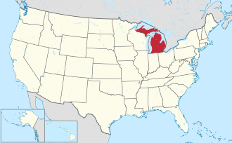
Mason County | |
---|---|
Coordinates: 44°01′N86°30′W / 44.02°N 86.5°W | |
Country | United States |
State | Michigan |
Founded | 1840 (founded as Notipekago) 1855 (organized) [1] |
Named for | Stevens T. Mason |
Seat | Ludington |
Largest city | Ludington |
Area | |
• Total | 1,242 sq mi (3,220 km2) |
• Land | 495 sq mi (1,280 km2) |
• Water | 747 sq mi (1,930 km2) 60% |
Population (2020) | |
• Total | 29,052 |
• Density | 58/sq mi (22/km2) |
Time zone | UTC−5 (Eastern) |
• Summer (DST) | UTC−4 (EDT) |
Congressional district | 2nd |
Website | www |
Mason County is a county located in the U.S. state of Michigan. As of the 2020 Census, the population was 29,052. [2] The county seat is Ludington. [3]
Mason County comprises the Ludington, MI Micropolitan Statistical Area.
The county is named for Stevens T. Mason, Governor of Michigan from 1835 to 1840. [5] It was created by the Michigan Legislature in 1840 as Notipekago County, [6] then renamed Mason County in 1843. The county was administered by Ottawa County prior to the organization of county government in 1855. [4] [1]
According to the US Census Bureau, the county has a total area of 1,242 square miles (3,220 km2), of which 495 square miles (1,280 km2) is land and 747 square miles (1,930 km2) (60%) is water. [7]
By land
By water
Census | Pop. | Note | %± |
---|---|---|---|
1850 | 93 | — | |
1860 | 831 | 793.5% | |
1870 | 3,263 | 292.7% | |
1880 | 10,065 | 208.5% | |
1890 | 16,385 | 62.8% | |
1900 | 18,885 | 15.3% | |
1910 | 21,832 | 15.6% | |
1920 | 19,831 | −9.2% | |
1930 | 18,756 | −5.4% | |
1940 | 19,378 | 3.3% | |
1950 | 20,474 | 5.7% | |
1960 | 21,929 | 7.1% | |
1970 | 22,612 | 3.1% | |
1980 | 26,365 | 16.6% | |
1990 | 25,537 | −3.1% | |
2000 | 28,274 | 10.7% | |
2010 | 28,705 | 1.5% | |
2020 | 29,052 | 1.2% | |
2023 (est.) | 29,159 | [9] | 0.4% |
US Decennial Census [10] 1790–1960 [11] 1900–1990 [12] 1990–2000 [13] 2010–2018 [2] |
As of the 2000 United States Census, [14] of 2000, there were 28,274 people, 11,406 households, and 7,881 families in the county. The population density was 57 people per square mile (22 people/km2). There were 16,063 housing units at an average density of 32 per square mile (12/km2). The racial makeup of the county was 95.84% White, 0.73% Black or African American, 0.78% Native American, 0.28% Asian, 0.02% Pacific Islander, 0.82% from other races, and 1.53% from two or more races. 3.01% of the population were Hispanic or Latino of any race. 24.5% were of German, 10.4% Polish, 8.8% English, 8.5% Irish, 7.7% American and 5.0% Swedish ancestry. 96.0% spoke only English, while 2.2% spoke Spanish at home.
There were 11,406 households, out of which 29.70% had children under the age of 18 living with them, 56.40% were married couples living together, 9.20% had a female householder with no husband present, and 30.90% were non-families. 26.50% of all households were made up of individuals, and 11.70% had someone living alone who was 65 years of age or older. The average household size was 2.43 and the average family size was 2.92.
The county population contained 24.20% under the age of 18, 7.10% from 18 to 24, 26.20% from 25 to 44, 25.80% from 45 to 64, and 16.80% who were 65 years of age or older. The median age was 40 years. For every 100 females there were 97.50 males. For every 100 females age 18 and over, there were 94.40 males.
The median income for a household in the county was $34,704, and the median income for a family was $41,654. Males had a median income of $33,873 versus $22,616 for females. The per capita income for the county was $17,713. About 8.20% of families and 11.00% of the population were below the poverty line, including 16.50% of those under age 18 and 7.00% of those age 65 or over.
Mason County has usually voted Republican in national elections. Since 1884, the county's voters have selected the Republican Party nominee in 83% (30 of 36) of the national elections through 2024.
Year | Republican | Democratic | Third party(ies) | |||
---|---|---|---|---|---|---|
No. | % | No. | % | No. | % | |
2024 | 10,830 | 59.86% | 6,973 | 38.54% | 288 | 1.59% |
2020 | 10,207 | 59.06% | 6,802 | 39.36% | 274 | 1.59% |
2016 | 8,505 | 57.50% | 5,281 | 35.70% | 1,006 | 6.80% |
2012 | 7,580 | 51.69% | 6,856 | 46.75% | 229 | 1.56% |
2008 | 7,147 | 46.89% | 7,817 | 51.29% | 277 | 1.82% |
2004 | 8,124 | 55.60% | 6,333 | 43.34% | 154 | 1.05% |
2000 | 7,066 | 54.29% | 5,579 | 42.86% | 371 | 2.85% |
1996 | 5,066 | 41.35% | 5,597 | 45.69% | 1,588 | 12.96% |
1992 | 5,102 | 39.00% | 4,829 | 36.91% | 3,151 | 24.09% |
1988 | 6,800 | 59.58% | 4,531 | 39.70% | 82 | 0.72% |
1984 | 8,202 | 67.83% | 3,803 | 31.45% | 87 | 0.72% |
1980 | 7,137 | 58.14% | 4,134 | 33.68% | 1,005 | 8.19% |
1976 | 6,812 | 59.15% | 4,541 | 39.43% | 163 | 1.42% |
1972 | 6,811 | 63.57% | 3,697 | 34.50% | 207 | 1.93% |
1968 | 5,311 | 54.02% | 3,660 | 37.23% | 860 | 8.75% |
1964 | 3,842 | 39.02% | 5,993 | 60.87% | 11 | 0.11% |
1960 | 6,011 | 58.21% | 4,305 | 41.69% | 10 | 0.10% |
1956 | 6,142 | 65.15% | 3,274 | 34.73% | 12 | 0.13% |
1952 | 6,179 | 64.65% | 3,298 | 34.51% | 81 | 0.85% |
1948 | 4,147 | 55.99% | 2,988 | 40.34% | 272 | 3.67% |
1944 | 4,446 | 58.27% | 3,137 | 41.11% | 47 | 0.62% |
1940 | 4,874 | 55.62% | 3,836 | 43.77% | 53 | 0.60% |
1936 | 3,224 | 39.37% | 4,598 | 56.14% | 368 | 4.49% |
1932 | 3,098 | 42.48% | 3,854 | 52.85% | 340 | 4.66% |
1928 | 4,318 | 72.74% | 1,567 | 26.40% | 51 | 0.86% |
1924 | 3,567 | 67.18% | 815 | 15.35% | 928 | 17.48% |
1920 | 3,652 | 69.39% | 1,338 | 25.42% | 273 | 5.19% |
1916 | 2,198 | 53.17% | 1,689 | 40.86% | 247 | 5.97% |
1912 | 844 | 21.51% | 1,073 | 27.34% | 2,007 | 51.15% |
1908 | 2,577 | 65.71% | 1,132 | 28.86% | 213 | 5.43% |
1904 | 2,394 | 72.13% | 764 | 23.02% | 161 | 4.85% |
1900 | 2,185 | 61.31% | 1,251 | 35.10% | 128 | 3.59% |
1896 | 2,177 | 56.27% | 1,580 | 40.84% | 112 | 2.89% |
1892 | 1,426 | 45.85% | 1,383 | 44.47% | 301 | 9.68% |
1888 | 1,697 | 50.79% | 1,573 | 47.08% | 71 | 2.13% |
1884 | 1,299 | 50.49% | 1,217 | 47.30% | 57 | 2.22% |
Mason County operates the county jail, maintains rural roads, operates the major local courts, records deeds, mortgages, and vital records, administers public health regulations, and participates with the state in the provision of social services. The county board of commissioners controls the budget and has limited authority to make laws or ordinances. In Michigan, most local government functions – police and fire, building and zoning, tax assessment, street maintenance etc. – are the responsibility of individual cities and townships.
(information as of Jan 2021)
The West Shore Educational Service District, based in Ludington, services the districts in the county along with those of Lake and Oceana. The intermediate school district offers regional special education and general education services, as well as technical career programs for its students. [18]
Mason County is served by the following regular public school districts: [19]
The county also has one charter school, the Gateway to Success Academy.
Mason County has the following private schools: [20]
Oceana County is a county located in the U.S. state of Michigan. As of the 2020 Census, the population was 26,659. Its county seat and largest incorporated community is Hart. Oceana County is located in the West Michigan region of the state's Lower Peninsula. The county has a shoreline along Lake Michigan, which has allowed for agriculture and tourism to flourish within the county. The county is also known as the "Asparagus Capital of the World", and is home to the National Asparagus Festival, in Hart.
Newaygo County is a county in the U.S. state of Michigan. As of the 2020 United States Census, the population was 49,978. The county seat is White Cloud. The county was created in 1840, and was organized in 1851. It was either named for an Ojibwe leader who signed the Treaty of Saginaw in 1819 or for an Algonquian word meaning "much water".
Manistee County is a county located in the U.S. state of Michigan. As of the 2020 census, the population was 25,032. The county seat is Manistee. The county is named for the Manistee River. Manistee County is part of Northern Michigan and has a shoreline on Lake Michigan.
Lake County is a county located in the U.S. state of Michigan. As of the 2020 Census, the population was 12,096. The county seat is Baldwin.
Excelsior Township is a civil township of Kalkaska County in the U.S. state of Michigan. The population was 991 at the 2020 census.
Filer Charter Township is a charter township of Manistee County in the U.S. state of Michigan. The population was 2,318 at the 2020 census.
Manistee is a city in the U.S. state of Michigan. Located in southwestern Manistee County, it is part of the northwestern Lower Peninsula. Manistee is the county seat of Manistee County, and its population was 6,259 at the 2020 census. This makes Manistee the fifth-largest city in Northern Michigan.
Norman Township is a civil township of Manistee County in the U.S. state of Michigan. The population was 1,567 at the 2020 census.
Stronach Township is a civil township of Manistee County in the U.S. state of Michigan. The population was 834 at the 2020 census.
Amber Township is a civil township of Mason County in the U.S. state of Michigan. As of the 2020 census, the township population was 2,529.
Custer is a village in Mason County in the U.S. state of Michigan. The population was 272 at the 2020 census. The village is located within Custer Township.
Custer Township is a civil township of Mason County in the U.S. state of Michigan. The population was 1,321 at the 2020 census. The village of Custer is located within the township.
Free Soil is a village in Mason County in the U.S. state of Michigan. The population was 158 at the 2020 census. The village is located within Free Soil Township.
Free Soil Township is a civil township of Mason County in the U.S. state of Michigan. The population was 842 at the 2020 census. The village of Free Soil is located within the township.
Grant Township is a civil township of Mason County in the U.S. state of Michigan. As of the 2020 census, the township population was 925.
Ludington is a city in the U.S. state of Michigan. It is the county seat and the largest city in Mason County. The population was 7,655 at the 2020 census.
Meade Township is a civil township of Mason County in the U.S. state of Michigan. The population was 179 at the 2020 census.
Riverton Township is a civil township of Mason County in the U.S. state of Michigan. The population was 1,232 at the 2020 census.
Scottville is a city in Mason County in the U.S. state of Michigan. The population was 1,356 at the 2020 census.
Summit Township is a civil township of Mason County in the U.S. state of Michigan. The population was 995 at the 2020 census.