List of Michigan state parks

Last updated

This is a list of Michigan state parks and related protected areas under the jurisdiction or owned by the Michigan Department of Natural Resources (DNR) Parks and Recreation Division. A total of 103 state parks, state recreation areas and trail state parks currently exist along with eight other sites as well as 16 state harbors on the Great Lakes. While the Parks and Recreation Division directly manages the large majority of the parks in the system, a few are either jointly-managed with other agencies or are leased to other governmental entities, either temporarily or on an ongoing basis. Michigan's 103 state parks and recreation areas cover 306,000 acres (124,000 ha) with 14,100 campsites in 142 campgrounds and over 900 miles (1,400 km) of trails. [1] The state parks and recreation areas statewide collectively saw more than 26 million visits in 2016. [2]

Contents

History

Michigan's state parks system was started in 1919. Three Michigan state parks pre-date the creation of the park system in 1919: Mackinac Island State Park (1895), Michilimackinac State Park (1909) and Interlochen State Park (1917).

Mackinac Island State Park was created in 1895. It had served as the nation's second national park for two decades beginning in 1875. In 1909, Michilimackinac State Park was created in nearby Mackinaw City. Both of these parks, along with Historic Mill Creek State Park are under the jurisdiction of the Mackinac Island State Park Commission.

Interlochen State Park was purchased by the Michigan Legislature in 1917 and was the first public park to be transferred to the Michigan State Park Commission in 1920. Because Mackinac Island State Park was a federal gift with its own commission and jurisdiction, for those reasons some choose to not consider it the first state park even though it predates Interlochen State Park by nearly 25 years. [3]

Since 1919, 33 additional state park units have been decommissioned for varied reasons. The majority of these former state park units, 16, were transferred to counties or cities and are still local parks today. Four of the former units were incorporated into Michigan's two National Lakeshores when were created in the 1960s and 70s, while five others were removed and reverted into surrounding state lands (state game areas, state forests, state fish hatcheries, etc.). Four of the units were incorporated into larger state recreation areas in the 1940s in the Greater Detroit area, although one of those recreation areas is now a local park. Two of the former state park units are now state forest campgrounds and another two units existed on state lands which were sold to private interests and closed. (The Former state park units section lists each of these former units.)

Additional DNR facilities

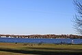
DNR operates 746 boat launches on 57,000 acres (230 km2) of designated public water access sites. It also operates 16 "harbors of refuge" as well as providing support for the other 61 harbors in the system. The harbors of refuge are approximately 30 miles (50 km) apart along the Great Lakes shoreline to provide shelter from storms and often provide boat launches and supplies. There are 13 state underwater preserves covering 2,450 square miles (6,300 km2) of Great Lakes bottomland and ten of them have a maritime museum or interpretive center in a nearby coastal community. [4]

The DNR Parks and Recreation Division also manages 138 state forest campgrounds (including a dozen equestrian campgrounds). The Michigan state game and wildlife areas encompass more than 340,000 acres (1,400 km2). DNR also oversees the trail systems in the state. This includes 880 miles (1,400 km) of non-motorized trails, 1,145 miles (1,800 km) of rail-trails, 3,193 miles (5,100 km) of off-road vehicle (ORV) routes and 6,216 miles (10,000 km) of snowmobile trails. [5]

For a discussion of all protected areas in Michigan under all jurisdictions, see Protected areas of Michigan.

Michigan state parks

Name [6] CountySizeEstab-
lished [7]
Lake / riverImageRemarks
acresha
Algonac State Park St. Clair 1,450 acres590 ha1937 St. Clair River Rare savanna lands
Aloha State Park Cheboygan 107 acres43 ha1923 Mullett Lake On the Michigan Inland Waterway
Baraga State Park Baraga 56 acres23 ha1922 Lake Superior On Keweenaw Bay
Bay City State Park Bay 2,389 acres967 ha1923 Lake Huron Tobico Marsh.jpg On Saginaw Bay
Belle Isle Park Wayne 982 acres397 ha2014 [lower-alpha 1] Detroit River JSMFFULL.jpg
Bewabic State Park Iron 315 acres127 ha1966 [lower-alpha 2] Fortune Lake Bewabic Park c 1940.jpg
Brimley State Park Chippewa 151 acres61 ha1922 Lake Superior On Whitefish Bay
Burt Lake State Park Cheboygan 406 acres164 ha1920 Burt Lake Burtlakesp.jpg
Cambridge Junction Historic State Park Lenawee 80 acres32 ha1965noneHistoric Walker Tavern
Cheboygan State Park Cheboygan 1,250 acres510 ha1962 Lake Huron Cheboygan State Park.jpg
Clear Lake State Park Montmorency 290 acres120 ha1966Clear Lake
Coldwater Lake State Park Branch 400 acres160 ha1987 Coldwater Lake
Craig Lake State Park Baraga 8,459 acres3,423 ha1967Craig Lake
Dodge #4 State Park Oakland 139 acres56 ha1922 Cass Lake Cass Lake (Michigan) boats Wednesdays (514873849).jpg
Duck Lake State Park Muskegon 728 acres295 ha1974Duck Lake
Fayette Historic State Park Delta 711 acres288 ha1959 Big Bay de Noc, Lake Michigan
Fisherman's Island State Park Charlevoix 2,678 acres1,084 ha1975 Lake Michigan Fisherman'sIslandStatePark.jpg
Fort Wilkins Historic State Park Keweenaw 711 acres288 ha1923 Lake Superior Site of Copper Harbor Light
Grand Haven State Park Ottawa 48 acres19 ha1920 Lake Michigan Grand Haven Beach.jpg
Grand Mere State Park Berrien 985 acres399 ha1973 Lake Michigan Grand Mere Beach.jpg
Harrisville State Park Alcona 107 acres43 ha1920 Lake Huron Harrisville state park beach 06.jpg
Hartwick Pines State Park Crawford 9,672 acres3,914 ha1927East Branch Au Sable River Hartwick Pines State Park.jpg Old-growth white and red pine forest
Hayes State Park Lenawee,
Jackson, Washtenaw
654 acres265 ha1920Wamplers Lake,
Round Lake
Walter J Hayes State Park Michigan pinic area on Wamplers Lake.JPG
Historic Mill Creek State Park [8] Cheboygan 625 acres253 ha1978Near Lake Huron Historic Mill Creek Michigan.jpg Contains Historic Mill Creek Discovery Park
Hoeft State Park Presque Isle 301 acres122 ha1920 Lake Huron Hoeft St Park - BeachLifeBoat.jpg
Hoffmaster State Park Muskegon,
Ottawa
1,100 acres450 ha1963 Lake Michigan Sand dunes at P.J. Hoffmaster State Park (8741881328).jpg
Holland State Park Ottawa 617 acres250 ha1926 Lake Macatawa,
Lake Michigan
Holland State Park.jpg
Indian Lake State Park Schoolcraft 847 acres343 ha1932 Indian Lake
Interlochen State Park Grand Traverse 187 acres76 ha1917 Green Lake,
Duck Lake
First state park created under Michigan state parks system
Keith J. Charters Traverse City State Park Grand Traverse 47 acres19 ha1920 Lake Michigan Traverse City State Park beach (Oct 2020).jpg On Grand Traverse Bay
Lake Gogebic State Park Gogebic 1,329 acres538 ha1926 Lake Gogebic Boardwalk at Lake Gogebic State Park (29940616062).jpg
Lakeport State Park St. Clair 565 acres229 ha1938 Lake Huron
Laughing Whitefish Falls State Park Alger 960 acres390 ha1946 Laughing Whitefish River
Leelanau State Park Leelanau 1,350 acres550 ha1964 [lower-alpha 3] Lake Michigan Sunset frm Grand Traverse Lighthouse.jpg
Ludington State Park Mason 5,300 acres2,100 ha1927 Lake Michigan Ludington State Park Fall 2005 032.jpg
Mackinac Island State Park [8] Mackinac 1,800 acres730 ha1895 [lower-alpha 4] Lake Huron South Parapet, the Fort, Mackinac Isl., Mich (NYPL b12647398-69756).tiff Home to historic Fort Mackinac.
Maybury State Park Wayne 944 acres382 ha1971none Maybury State Park Michigan park office.JPG
McLain State Park Houghton 443 acres179 ha1930 Lake Superior Gfp-michigan-mclain-state-park-full-view-of-the-lighthouse.jpg
Mears State Park Oceana 610 acres250 ha1920 Lake Michigan
Meridian-Baseline State Park Ingham,
Jackson
188 acres76 ha1967Shaw Branch
Michilimackinac State Park [8] Emmet, Cheboygan 37 acres15 ha1904 Straits of Mackinac Fort Michilimackinac 2.jpg Includes Colonial Michilimackinac and Old Mackinac Point Lighthouse
Mitchell State Park Wexford 1,289 acres522 ha1920 Lake Mitchell,
Lake Cadillac
Muskallonge Lake State Park Luce 217 acres88 ha1956 Lake Superior
Muskegon State Park Muskegon 1,233 acres499 ha1923 Lake Michigan,
Muskegon Lake
LakeMichiganMuskegonShoreline.jpg
Negwegon State Park Alcona, Alpena 591 acres239 ha1962 Lake Huron Negwegon State Park.jpg
Newaygo State Park Newaygo 257 acres104 ha1966 Hardy Dam Pond
North Higgins Lake State Park Crawford 429 acres174 ha1965 Higgins Lake
Old Mission State Park Grand Traverse 520 acres210 ha1989 [lower-alpha 5] Lake Michigan OldMission-MI-lighthouse.jpg Leased to Peninsula Township and operated as Lighthouse Park
Onaway State Park Presque Isle 158 acres64 ha1920 Black Lake Onaway State Park c1930.jpg
Orchard Beach State Park Manistee 201 acres81 ha1921 Lake Michigan Orchard Beach State Park.jpg
Otsego Lake State Park Otsego 1,293 acres523 ha1920 Otsego Lake
Palms Book State Park Schoolcraft 388 acres157 ha1929 Kitch-iti-kipi,
Indian Lake
Kitch raft.jpg
Petoskey State Park Emmet 203 acres82 ha1961 Little Traverse Bay
Porcupine Mountains Wilderness State Park Gogebic,
Ontonagon
59,020 acres23,880 ha1944 Lake Superior FullLakeOfTheClouds.JPG
Port Crescent State Park Huron 600 acres240 ha1955 Lake Huron
Sanilac Petroglyphs Historic State Park Sanilac 240 acres97 ha1971Little Cass River Sanilac Petroglyphs - Archer.jpg
Saugatuck Dunes State Park Allegan 1,000 acres400 ha1977 Lake Michigan Water and Covered Dune, Looking North, Saugatuck Dunes State Park, Michigan.jpg
Seven Lakes State Park Oakland 1,434 acres580 ha1971Big Seven Lake
Silver Lake State Park Oceana 2,936 acres1,188 ha1920 Lake Michigan, Silver Lake Silver Lake Dunes Michigan 2.jpg Includes Little Sable Point Light
Sleeper State Park Huron 723 acres293 ha1924 Lake Huron
Sleepy Hollow State Park Clinton 2,678 acres1,084 ha1965 Lake Ovid
South Higgins Lake State Park Roscommon 1,000 acres400 ha1924 Higgins Lake Michigan's Higgins Lake.jpg
Sterling State Park Monroe 1,300 acres530 ha1935 Lake Erie Sterling State Park Michigan pedestrian bridge over lagoon.JPG
Straits State Park Mackinac 181 acres73 ha1924 Straits of Mackinac Includes Father Marquette National Memorial
Sturgeon Point State Park Alcona 76 acres31 ha1960 Lake Michigan Sturgeon Point Lighthouse.jpg
Tahquamenon Falls State Park Chippewa,
Luce
46,179 acres18,688 ha1947Tahquamenon River Tahquamenon falls lower.jpg
Tawas Point State Park Iosco 183 acres74 ha1960 Lake Huron P7050019 Tawas Point SP (E Tawas Mich).jpg
Thompson's Harbor State Park Presque Isle 5,109 acres2,068 ha1988 Lake Huron
Twin Lakes State Park Houghton 175 acres71 ha1964Lake Roland Gfp-michigan-twin-lakes-state-park-michigan.jpg
Van Buren State Park Van Buren 400 acres160 ha1966 Lake Michigan Lake Michigan shore in January.JPG
Van Riper State Park Marquette 1,055 acres427 ha1956 Lake Michigamme
Warren Dunes State Park Berrien 1,952 acres790 ha1930 Lake Michigan Warren Dunes.JPG
Warren Woods State Park Berrien 311 acres126 ha1949 Galien River Warrenwoods.jpg
Watkins Lake State Park and County Preserve Washtenaw 1,122 acres454 ha2016Watkins Lake
Wells State Park Menominee 678 acres274 ha1925 Lake Michigan Sunset at J.W. Wells State Park.jpg On Green Bay
Wilderness State Park Emmet 10,512 acres4,254 ha1927 Lake Michigan Wilderness State Park Michigan.jpg
William G. Milliken State Park and Harbor Wayne 31 acres13 ha2004 Detroit River Police Boats at Milliken State Park.jpg
Wilson State Park Clare 36 acres15 ha1920 Budd Lake
Young State Park Charlevoix 563 acres228 ha1920 Lake Charlevoix Beach Young State Park (9462588806).jpg
  1. Established in 1845 as a Detroit City Park, established as a Michigan State Park in 2014 under a 30-year lease.
  2. Established in 1923 as an Iron County Park, purchased by the State of Michigan in 1966.
  3. The park was originally deeded to the State in 1932, however.
  4. Established in 1875 as Mackinac Island National Park, deeded to the State of Michigan in 1875.
  5. The park was originally deeded to the State in 1932, however.

Michigan state recreation areas

Name [6] CountySizeEstab-
lished [7]
Lake / riverImageRemarks
acresha
Bald Mountain State Recreation Area Oakland 4,637 acres1,877 ha1944Lower Trout Lake, othersWater Warrior Island waterpark
Bass River State Recreation Area Ottawa 1,665 acres674 ha1994 Grand River
Brighton State Recreation Area Livingston 4,947 acres2,002 ha1944Bishop Lake, others
Fort Custer State Recreation Area Kalamazoo 3,033 acres1,227 ha1971Eagle, Jackson Hole and Whitford-Lawler Lakes
Highland State Recreation Area Oakland 5,900 acres2,400 ha1944Haven Hill, Temple, Moore Lakes and others
Holly State Recreation Area Oakland 7,817 acres3,163 ha1944Heron, Valley, and McGinnis Lakes
Ionia State Recreation Area Ionia 4,500 acres1,800 ha1965 Grand River
Island Lake State Recreation Area Livingston 4,000 acres1,600 ha1944 Huron River, Island LakeHot-air balloon launch area
Lake Hudson State Recreation Area Lenawee 2,796 acres1,132 ha1979Lake HudsonFirst-ever Dark-Sky Preserve designated, 1993
Lime Island State Recreation Area Chippewa 980 acres400 ha2011 St. Marys River Visitors provide own transportation to remote island; six rental cabins; Victorian House/Museum
Menominee River State Recreation Area Dickinson, Menominee 2,879 acres1,165 ha2012 Menominee River Co-managed with Wisconsin's Menominee River State Park and Recreation Area
Metamora-Hadley State Recreation Area Lapeer 723 acres293 ha1944Minnewanna Lake
Ortonville State Recreation Area Lapeer, Oakland 5,400 acres2,200 ha1944Big Fish and Davison Lakes
Pinckney State Recreation Area Livingston, Washtenaw 11,000 acres4,500 ha1944Numerous inland lakes
Pontiac Lake State Recreation Area Oakland 3,745 acres1,516 ha1944 Huron River, Pontiac Lake
Proud Lake State Recreation Area Oakland 3,030 acres1,230 ha1944 Huron River, Proud Lake
Rifle River State Recreation Area Ogemaw 4,449 acres1,800 ha1963 Rifle River
Rockport State Recreation Area Alpena, Presque Isle 4,237 acres1,715 ha2012 Lake Huron Contains old limestone quarry and Besser Natural Area
Tippy Dam State Recreation Area Manistee 117 acres47 ha2007 Manistee River Managed under a lease agreement with Consumers Energy.
Waterloo State Recreation Area Jackson, Washtenaw 20,125 acres8,144 ha1943Numerous inland lakes
W.C. Wetzel State Recreation Area Macomb 913 acres369 ha1969Coon Creek
Yankee Springs State Recreation Area Barry 5,200 acres2,100 ha1943 Gun Lake
USA Michigan location map.svg
Green pog.svg
Green pog.svg
Green pog.svg
Green pog.svg
Green pog.svg
Green pog.svg
Green pog.svg
Green pog.svg
Green pog.svg
Green pog.svg
Green pog.svg
Green pog.svg
Green pog.svg
Green pog.svg
Green pog.svg
Green pog.svg
Green pog.svg
Green pog.svg
Green pog.svg
Green pog.svg
Green pog.svg
Michigan state recreation areas (clickable map)

Michigan trail state parks

The following state trails are units of the State Park System. Several other state trails fall under Department of Natural Resources jurisdiction and/or maintenance, but are not state park units and are not included here.

NameOfficial nameCountiesLengthEstab- lishedImageRemarks
mikm
Hart-Montague Trail State Park William Field Memorial Hart-Montague Trail State Park Muskegon, Oceana 22351988Converted rail-trail
Kal-Haven Trail Kal-Haven Bicycle Trail Sesquicentennial State Park Kalamazoo, Van Buren 34.555.51988
Kal-Haven Trail.jpg
Converted rail-trail
Lakelands Trail State Park Mike Levine Lakelands Trail State Park Ingham, Livingston, Washtenaw 26421991
Lakelands Trail State Park (Pinckney).jpg
Converted rail-trail
Van Buren Trail State Park Van Buren 14231994Converted rail-trail
White Pine Trail State Park Fred Meijer White Pine Trail State Park Kent, Mecosta, Montcalm, Osceola, Wexford 921481996
Little Muskegon River Morley Michigan.jpg
Converted rail-trail

Other sites

Name [6] CountySizeEstab-
lished [7]
Hydrologic Feature(s)ImageRemarks
acresha
Agate Falls Scenic Site Ontonagon 213 acres86 ha1992Agate FallsAdjacent to Agate Falls MDOT State Roadside Park.
Bond Falls Scenic Site Ontonagon 90 acres36 ha1992 Bond Falls DNR-managed facility on Upper Peninsula Power Company (UPPCO)-owned land.
DNR Pocket Park Delta 1 acre0.40 ha1998noneWithin the Upper Peninsula State Fairgrounds in Escanaba featuring a fishing pond, archery and pellet gun ranges, a fire tower, a waterfall and a dozen specialty gardens. Open seasonally May through September.
Father Marquette National Memorial Mackinac 58 acres23 ha1973 Straits of Mackinac (views)Within the western portion of Straits State Park.
Holly Oaks ORV Park Oakland 235 acres95 ha2021noneJointly-managed with Oakland County Parks.
Outdoor Adventure Center Wayne 0.94 acres0.38 ha2015 Detroit River In historic Globe Building, adjacent to William G. Milliken State Park and Harbor.
Ralph A. MacMullan Conference Center Crawford 32 acres13 ha1941 Higgins Lake Within North Higgins Lake State Park
Wagner Falls Scenic Site Alger 23 acres9.3 ha1956 Wagner Falls
Wagner Falls Wagner Falls.jpg
Wagner Falls

Former state park units

Michigan state forests

The Au Sable River runs through the Au Sable State Forest Canoes AuSableRiverMI.jpg
The Au Sable River runs through the Au Sable State Forest

Michigan's state forest system is administered by the Forest Resources Division (FRD) within the Michigan Department of Natural Resources, not the Parks and Recreation Division (PRD) which manages the state park system, however the Parks and Recreation Division took over the recreation responsibilities of the Forest Resources Division (e.g. the state forest campgrounds and the trails and pathways within the state forests) in January 2012.

Related Research Articles

<span class="mw-page-title-main">Hiawatha National Forest</span> National forest in Michigan, United States

Hiawatha National Forest is a 894,836-acre (362,127 ha) National Forest in the Upper Peninsula of the state of Michigan in the United States. Commercial logging is conducted in some areas. The United States Forest Service administers this National Forest; it is physically divided into two subunits, commonly called the Eastside 46°14′N84°50′W and Westside 46°08′N86°40′W.

<span class="mw-page-title-main">Indiana Dunes National Park</span> United States National Park in Indiana

Indiana Dunes National Park is a United States national park located in northwestern Indiana managed by the National Park Service. It was authorized by Congress in 1966 as the Indiana Dunes National Lakeshore and was redesignated as the nation's 61st national park on February 15, 2019. The park runs for about 20 miles (32 km) along the southern shore of Lake Michigan and covers 15,349 acres (6,212 ha). Along the lakefront, the eastern area is roughly the lake shore south to U.S. 12 or U.S. 20 between Michigan City, Indiana, on the east and the Cleveland-Cliffs steel plant on the west. To the west of the steel plant lies West Beach and a small extension south of the steel mill continues west along Salt Creek to Indiana 249. The western area is roughly the shoreline south to U.S. 12 between the Burns Ditch west to Broadway in downtown Gary, Indiana. The area conservation scheme is enhanced by the older Indiana Dunes State Park. In addition, there are several outlying areas, including Pinhook Bog, in LaPorte County to the east; the Heron Rookery in Porter County, the center of the park; and the Calumet Prairie State Nature Preserve and the Hobart Prairie Grove, both in Lake County, the western end of the park.

<span class="mw-page-title-main">Sleeping Bear Dunes National Lakeshore</span> Protected area

Sleeping Bear Dunes National Lakeshore is a United States National Lakeshore located along the northwest coast of the Lower Peninsula of Michigan in Leelanau and Benzie counties near Empire, Michigan. The park covers a 35-mile-long (56 km) stretch of Lake Michigan's eastern coastline, as well as North and South Manitou islands. This Northern Michigan park was established primarily because of its outstanding natural features, including forests, beaches, dune formations, and ancient glacial phenomena. The lakeshore also contains many cultural features including the 1871 South Manitou Island Lighthouse, three former stations of the Coast Guard and an extensive rural historic farm district. In 2011, the area won the title of "The Most Beautiful Place in America" from Good Morning America. In 2014, a section of the park was named the Sleeping Bear Dunes Wilderness by the United States Congress.

<span class="mw-page-title-main">Northern Michigan</span> Northern region of Michigans lower peninsula

Northern Michigan, also known as Northern Lower Michigan, is a region of the U.S. state of Michigan. A popular tourist destination, it is home to several small- to medium-sized cities, extensive state and national forests, lakes and rivers, and a large portion of Great Lakes shoreline. The region has a significant seasonal population much like other regions that depend on tourism as their main industry. Northern Lower Michigan is distinct from the more northerly Upper Peninsula and Isle Royale, which are also located in "northern" Michigan. In the northernmost 21 counties in the Lower Peninsula of Michigan, the total population of the region is 506,658 people.

The protected areas of Michigan come in an array of different types and levels of protection. Michigan has five units of the National Park Service system. There are 14 federal wilderness areas; the majority of these are also tribal-designated wildernesses. It has one of the largest state forest systems as well having four national forests. The state maintains a large state park system and there are also regional parks, and county, township and city parks. Still other parks on land and in the Great Lakes are maintained by other governmental bodies. Private protected areas also exist in the state, mainly lands owned by land conservancies.

Indiana Dunes State Park is an Indiana State Park located in Porter County, Indiana, United States, 47 miles (75.6 km) east of Chicago. The park is bounded by Lake Michigan to the northwest and is surrounded by as well as within the authorized boundaries of Indiana Dunes National Park, a unit of the National Park Service; the NPS owns the water from the ordinary high water mark to 300 feet (91 m) offshore. The 1,530-acre (619.2 ha) Dunes Nature Preserve makes up the bulk of eastern part of the park, and includes most of the park's hiking trails and dune landscape. This was one of the first places Richard Lieber considered when establishing the Indiana State Park system. Like all Indiana state parks, there is a fee for entrance. Indiana Dunes State Park was established in 1925 and designated a National Natural Landmark in 1974.

<span class="mw-page-title-main">Holland State Park</span> Park in Michigan, USA

Holland State Park is a public recreation area covering 142 acres (57 ha) in Park Township, Ottawa County, four miles (6 km) west of the city of Holland, Michigan. The state park consists of separate Lake Macatawa and Lake Michigan units on the northern side of the channel connecting Lake Macatawa with Lake Michigan. It is often the most visited state park in Michigan, receiving between 1.5 and 2 million visitors annually.

<span class="mw-page-title-main">Wilderness State Park</span> Park in Michigan, USA

Wilderness State Park is a public recreation area bordering Lake Michigan, five miles southwest of Mackinaw City in Emmet County in Northern Michigan. The state park's 10,512 acres (4,254 ha) include 26 miles (42 km) of shoreline, diverse forested dune and swale complexes, wetlands, camping areas, and many miles of hiking trails. The state park is operated by the Michigan Department of Natural Resources, which has, as of 2006, approved a proposal that 4,492 acres (1,818 ha) be officially dedicated as a wilderness area. Wilderness State Park was designated a Michigan "dark sky preserve" in 2012.

<span class="mw-page-title-main">Aloha State Park</span> Park in Michigan, USA

Aloha State Park is a public recreation area located six miles (9.7 km) south of Cheboygan in Cheboygan County, Michigan. The state park covers 107 acres (43 ha) on the northeast side of Mullett Lake at the center of the Inland Lakes Waterways.

<span class="mw-page-title-main">Cheboygan State Park</span> State park in Cheboygan County, Michigan, United States

Cheboygan State Park is a public recreation area covering 1,250 acres (510 ha) on the shores of Lake Huron in Cheboygan County, Michigan, United States. The state park offers views of the Fourteen Foot Shoal Light and the remains of the 1859 Cheboygan Point Light plus a distant view of the Poe Reef Light, some six miles to the northeast.

<span class="mw-page-title-main">Fisherman's Island State Park</span> Park in Michigan, USA

Fisherman's Island State Park is a public recreation area of 2,678 acres (1,084 ha) sitting on six miles (9.7 km) of Lake Michigan shoreline southwest of Charlevoix, Michigan. It is named for a small piece of land, Fisherman Island, located some 900 feet (270 m) from the mainland. For most of the period from 1998 to 2016, historically low lake levels resulted in the island becoming attached to the mainland via a tombolo. The park's interior terrain consists largely of rolling dunes covered with maple, birch and aspen broken up by bogs of cedar and black spruce. The park is operated by the Michigan Department of Natural Resources.

<span class="mw-page-title-main">Ludington State Park</span> Park in Michigan, USA

Ludington State Park is a public recreation area located two miles north of Ludington, Michigan, occupying 5,300 acres (2,100 ha) between the shores of Lake Michigan and Hamlin Lake. The state park is crossed by a one-mile stretch of the Big Sable River and is home to the 112-foot-high (34 m) Big Sable Point Lighthouse, which dates from 1876.

<span class="mw-page-title-main">South Higgins Lake State Park</span> State park in Michigan, United States

South Higgins Lake State Park is a public recreation area covering 1,000 acres (400 ha) on the southern shore of Higgins Lake five miles southwest of Roscommon in Roscommon County, Michigan. The state park occupies one mile of shoreline on Higgins Lake and entirely surrounds Marl Lake and portions of the Cut River.

<span class="mw-page-title-main">Michigan Department of Natural Resources</span> Government agency of Michigan

The Michigan Department of Natural Resources (DNR) is the agency of the state of Michigan charged with maintaining natural resources such as state parks, state forests, and recreation areas. It is governed by a director appointed by the Governor and accepted by the Natural Resources Commission. Currently the Director is Daniel Eichinger. The DNR has about 1,400 permanent employees, and over 1,600 seasonal employees.

<span class="mw-page-title-main">Pinckney State Recreation Area</span>

Pinckney State Recreation Area is a Michigan state recreation area in Dexter, Sylvan and Lyndon Townships, Washtenaw County and Putnam and Unadilla Townships, Livingston County in the U.S. state of Michigan. The park is 11,000 acres (4,500 ha) and sits at an elevation of 922 feet (281 m). The park is connected to the nearby Waterloo State Recreation Area by the 35-mile (56 km) Waterloo–Pinckney Trail. Pinckney State Recreation Area is open for year-round recreation including hiking, fishing, swimming, hunting and a variety of winter sports.

<span class="mw-page-title-main">Garnet, Michigan</span> Unincorporated community in Michigan, United States

Garnet is an unincorporated community in Mackinac County in the U.S. state of Michigan. The community is located within Hudson Township. As an unincorporated community, Garnet has no legally defined boundaries or population statistics of its own.

French Farm Lake is a lake in Wawatam Township in Emmet County in the U.S. state of Michigan. 802 acres (325 ha) in size, it is located approximately 2.7 miles (4.3 km) southwest of Mackinaw City, Michigan. It is the northernmost lake of Michigan's Lower Peninsula. It is served by the North Country Trail from Mackinaw City and by local dirt roads.

<span class="mw-page-title-main">Hobart Nature District</span>

The Hobart Nature District is located in the City of Hobart, Indiana and includes over 1,000 acres (400 ha) of scenic parks, wetlands and floodplains, winding rivers, peaceful lakes, open prairies, oak savannas, old-growth forests, and undulating ravines.

References

  1. "Michigan Statewide Comprehensive Outdoor Recreation Plan 2018–2022: Public Comment Draft" (PDF). Michigan Department of Natural Resources. August 31, 2017. Retrieved June 28, 2018.
  2. "A snapshot of 2016 accomplishments" (PDF). Michigan Department of Natural Resources. Retrieved June 28, 2018.
  3. "MICHIGAN'S FIRST STATE PARK?". Michigan Department of Natural Resources. April 8, 2019. Retrieved April 8, 2019.
  4. "Michigan's Public Land Base and Outdoor Recreation" (PDF). 2008–2012 Statewide Comprehensive Outdoor Recreation Plan. Michigan Department of Natural Resources. Retrieved February 19, 2010.
  5. "Executive Summary" (PDF). 2008–12 Michigan State Comprehensive Outdoor Recreation Plan. Michigan Department of Natural Resources. October 1, 2007. p. 2. Retrieved February 19, 2010.
  6. 1 2 3 As listed by Michigan Department of Natural Resources, 2018, except where noted. "Recreation Search". Michigan Department of Natural Resources. Retrieved June 27, 2018.
  7. 1 2 3 "When were Michigan state parks and recreation areas established?" (PDF). Michigan Department of Natural Resources. Retrieved March 24, 2020.
  8. 1 2 3 "Department of Natural Resources: FY 2021 Capital Outlay Five-Year Plan" (PDF). Michigan Department of Natural Resources. October 31, 2019. Retrieved October 12, 2021.
  9. 1 2 3 Karamanski, Theodore (1996). A Nationalized Lakeshore: The Creation and Administration of Sleeping Bear Dunes National Lakeshore. Omaha, Nebraska: National Park Service. ISBN   979-8645156039.
  10. "Fund Diversion for Forest Fire Fighting Opposed". The News-Palladium. Vol. 63, no. 263. Associated Press. November 6, 1947. p. 22.
  11. "Former State Park Turned Over To County". Port Huron Times-Herald. No. Vol. XL, No. 76. March 17, 1949. p. 1.