National military park

Last updated

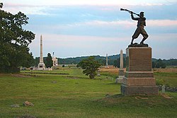
Vicksburg National Military Park, Illinois Memorial Vicksburg-illinois-memorial.jpg
Vicksburg National Military Park, Illinois Memorial
Kennesaw Mountain National Battlefield Park Kennesaw mountain cannon01.jpg
Kennesaw Mountain National Battlefield Park

National Military Park, National Battlefield, National Battlefield Park, and National Battlefield Site are four designations for 25 battle sites preserved by the United States federal government because of their national importance. The designation applies to "sites where historic battles were fought on American soil during the armed conflicts that shaped the growth and development of the United States...." [1]

Contents

There are eleven National Battlefields (NB), nine National Military Parks (NMP), four National Battlefield Parks (NBP), and one National Battlefield Site (NBS). The National Park Service does not distinguish among the four designations in terms of their preservation or management policies.

Seventeen sites are from the American Civil War, four from the American Revolutionary War, one from the War of 1812, one from the French and Indian War, and two were attacks on Native Americans. Big Hole is the only site in the Western United States.

In 1890, Chickamauga and Chattanooga National Military Park was the first such site created by Congress. Originally these sites were maintained by the War Department, but were transferred to the National Park Service on August 10, 1933. The different designations appear to represent Congressional attitudes at the time of authorization of each individual site, although "park" appears to be reserved for the larger sites. Only Brices Cross Roads National Battlefield Site, which is small, still bears that designation; others have since been redesignated. Some battlefields are designated as National Monuments, such as Little Bighorn Battlefield National Monument, Mill Springs Battlefield National Monument, and ten forts, several of which saw battle; National Historical Parks, such as Harpers Ferry National Historical Park and Cedar Creek and Belle Grove National Historical Park; or National Historic Sites, such as Sand Creek Massacre National Historic Site.

As with all historic areas in the National Park System, these battle sites are automatically listed on the National Register of Historic Places.

List of areas

NameImageLocationTypeEstablished [2] Area [3] ConflictBattle(s)Website
Antietam Antietam Bloody Lane.JPG Maryland
39°28′13″N77°44′17″W / 39.47028°N 77.73806°W / 39.47028; -77.73806
NBAugust 30, 18903,228.89 acres
(13.1 km2; 5.0 sq mi)
Civil War Antietam
Big Hole Big Hole Battlefield.jpg Montana
45°38′15″N113°38′37″W / 45.63750°N 113.64361°W / 45.63750; -113.64361
NBJune 23, 1910975.61 acres
(3.9 km2; 1.5 sq mi)
Nez Perce War
of the
Indian Wars
The Big Hole
Brices Cross Roads BricesCrossroads2010.jpg Mississippi
34°30′22.0″N88°43′44.0″W / 34.506111°N 88.728889°W / 34.506111; -88.728889
NBSFebruary 21, 19291.00 acre
(0.0040 km2; 0.00156 sq mi)
Civil War Brice's Cross Roads
Chickamauga and Chattanooga Cannon Row.jpg Georgia, Tennessee
34°56′24″N85°15′36″W / 34.94000°N 85.26000°W / 34.94000; -85.26000
NMPAugust 19, 18909,523.48 acres
(38.5 km2; 14.9 sq mi)
Civil War Chickamauga

Chattanooga
Cowpens Cowpens National Battlefield - wilderness road and fence.jpg South Carolina
35°08′12″N81°49′05″W / 35.13667°N 81.81806°W / 35.13667; -81.81806
NBMarch 4, 1929841.56 acres
(3.4 km2; 1.3 sq mi)
Revolutionary War Cowpens
Fort Donelson Fort Donelson river battery (1).jpg Tennessee, Kentucky
36°29′14″N87°51′39″W / 36.48722°N 87.86083°W / 36.48722; -87.86083
NBAugust 10, 19331,319.00 acres
(5.3 km2; 2.1 sq mi)
Civil War Fort Donelson

Fort Henry
Fort Necessity Fort Necessity 101114.jpg Pennsylvania
39°48′55″N79°35′22″W / 39.81528°N 79.58944°W / 39.81528; -79.58944
NBMarch 4, 1931902.80 acres
(3.7 km2; 1.4 sq mi)
French and Indian War Fort Necessity
Fredericksburg and Spotsylvania Sunken Road Restored 2004 Section in Fredericksburg and Spotsylvania National Military Park.jpg Virginia
38°17′35″N77°28′09″W / 38.29306°N 77.46917°W / 38.29306; -77.46917
NMPFebruary 14, 19278,405.46 acres
(34.0 km2; 13.1 sq mi)
Civil War Fredericksburg

Chancellorsville

The Wilderness

Spotsylvania Court House
Gettysburg High Water Mark - Cemetery Ridge, Gettysburg Battlefield.jpg Pennsylvania
39°48′31″N77°14′12″W / 39.80861°N 77.23667°W / 39.80861; -77.23667
NMPFebruary 11, 18956,032.07 acres
(24.4 km2; 9.4 sq mi)
Civil War Gettysburg
Guilford Courthouse Signers Monument Guilford Courthouse National Military Park.JPG North Carolina
36°7′53″N79°50′47″W / 36.13139°N 79.84639°W / 36.13139; -79.84639
NMPMarch 2, 1917253.54 acres
(1.0 km2; 0.4 sq mi)
Revolutionary War Guilford Court House
Horseshoe Bend Battlefield overview, Horseshoe Bend NMP.jpg Alabama
32°58′15″N85°44′18″W / 32.97083°N 85.73833°W / 32.97083; -85.73833
NMPJuly 25, 19562,040.00 acres
(8.3 km2; 3.2 sq mi)
Creek War
of the
Indian Wars
Horseshoe Bend
Kennesaw Mountain Kennesaw Mountain National Battlefield Park, Cobb County, GA, US (24).jpg Georgia
33°58′59″N84°34′41″W / 33.98306°N 84.57806°W / 33.98306; -84.57806
NBPFebruary 18, 19172,913.63 acres
(11.8 km2; 4.6 sq mi)
Civil War Kennesaw Mountain
Kings Mountain Kings Mountain National Military Park, April 2015 - path and obelisk in trees.JPG South Carolina
35°8′16″N81°23′22″W / 35.13778°N 81.38944°W / 35.13778; -81.38944
NMPAugust 10, 19333,945.29 acres
(16.0 km2; 6.2 sq mi)
Revolutionary War Kings Mountain
Manassas Fence at Manassas Battlefield, VA IMG 4330.JPG Virginia
38°48′46″N77°31′18″W / 38.81278°N 77.52167°W / 38.81278; -77.52167
NBPNovember 14, 19365,073.44 acres
(20.5 km2; 7.9 sq mi)
Civil War First Manassas

Second Manassas
Monocacy BestFarmMonocacy.jpg Maryland
39°22′16″N77°23′31″W / 39.37115°N 77.39208°W / 39.37115; -77.39208
NBJune 21, 19341,646.88 acres
(6.7 km2; 2.6 sq mi)
Civil War Monocacy
Moores Creek MOCR earthworks 0948.jpg North Carolina
34°27′29.6″N78°06′37.1″W / 34.458222°N 78.110306°W / 34.458222; -78.110306
NBJune 2, 192687.75 acres
(0.4 km2; 0.1 sq mi)
Revolutionary War Moore's Creek Bridge
Pea Ridge Pea Ridge Battleground.jpg Arkansas
36°27′15.″N94°02′04.9″W / 36.45417°N 94.034694°W / 36.45417; -94.034694
NMPJuly 20, 19564,300.35 acres
(17.4 km2; 6.7 sq mi)
Civil War Pea Ridge
Petersburg Restored entrance to mine, Petersburg VA.jpg Virginia
37°13′10″N77°21′41″W / 37.21944°N 77.36139°W / 37.21944; -77.36139
NBJuly 3, 19269,368.34 acres
(37.9 km2; 14.6 sq mi)
Civil War Petersburg campaign
Richmond Malvern Hill, Civil War Battlefield, RIchmond National Battlefield - Stierch.jpg Virginia
37°25′45″N77°22′25″W / 37.42917°N 77.37361°W / 37.42917; -77.37361
NBPMarch 2, 19368,168.87 acres
(33.1 km2; 12.8 sq mi)
Civil War Peninsula campaign
and the
Seven Days Battles

Overland campaign

Petersburg campaign
River Raisin River Raisin National Battlefield Park.jpg Michigan
41°54′49″N83°22′42″W / 41.91361°N 83.37833°W / 41.91361; -83.37833
NBPOctober 22, 201042.18 acres
(0.2 km2; 0.1 sq mi)
War of 1812 Frenchtown
Shiloh Sunken Road, Shiloh National Military Park.JPG Tennessee, Mississippi
35°08′12″N88°20′26″W / 35.13667°N 88.34056°W / 35.13667; -88.34056
NMPDecember 27, 18949,323.70 acres
(37.7 km2; 14.6 sq mi)
Civil War Shiloh
Stones River 6-pounder Wiard cannon at Stones River National Battlefield.jpg Tennessee
35°52′34″N86°25′51″W / 35.87611°N 86.43083°W / 35.87611; -86.43083
NBMarch 3, 1927709.49 acres
(2.9 km2; 1.1 sq mi)
Civil War Stones River
Tupelo Tupelo NBS Monument.jpg Mississippi
34°15′20.4″N88°44′13.2″W / 34.255667°N 88.737000°W / 34.255667; -88.737000
NBAugust 11, 19331.00 acre
(0.0040 km2; 0.00156 sq mi)
Civil War Tupelo
Vicksburg Monument to U.S. Grant at Vicksburg National Military Park.jpg Mississippi, Louisiana
32°21′55″N90°50′32″W / 32.36528°N 90.84222°W / 32.36528; -90.84222
NMPFebruary 21, 18992,524.11 acres
(10.2 km2; 3.9 sq mi)
Civil War Vicksburg campaign
Wilson's Creek Wilson's Creek National Battlefield.jpg Missouri
37°6′56″N93°25′12″W / 37.11556°N 93.42000°W / 37.11556; -93.42000
NBApril 22, 19602,407.79 acres
(9.7 km2; 3.8 sq mi)
Civil War Wilson's Creek

Other battlefields in the National Park System

National Memorials

National Monuments

National Historical Parks

National Historic Sites

Affiliated areas

The following are affiliated areas of the National Park Services that are battlegrounds

See also

Notes

  1. American Battlefield Protection Act of 1996
  2. "Park Anniversaries" . Retrieved August 13, 2021.
  3. "National Park Service Acreage Reports" . Retrieved August 13, 2021.

Related Research Articles

<span class="mw-page-title-main">Battle of Oriskany</span> 1777 engagement of the American Revolutionary War

The Battle of Oriskany was a major engagement of the Saratoga campaign during the American Revolutionary War. On August 6, 1777, an American column of Tryon County militia and Oneidas marching to relieve the siege of Fort Stanwix was ambushed by a contingent of Britain's Indigenous allies and Loyalists. It was one of the few battles of the war in which most non-Indigenous participants were settlers born in the Thirteen Colonies. The Americans suffered heavy casualties during the battle.

<span class="mw-page-title-main">Fort Stanwix</span> United States historic place

Fort Stanwix was a colonial fort whose construction commenced on August 26, 1758, under the direction of British General John Stanwix, at the location of present-day Rome, New York, but was not completed until about 1762. The bastion fort was built to guard a portage known as the Oneida Carry during the French and Indian War. Fort Stanwix National Monument, a reconstructed structure built by the National Park Service, now occupies the site.

<span class="mw-page-title-main">Battle of South Mountain</span> Battle of the American Civil War

The Battle of South Mountain, known in several early Southern accounts as the Battle of Boonsboro Gap, was fought on September 14, 1862, as part of the Maryland campaign of the American Civil War. Three pitched battles were fought for possession of three South Mountain passes: Crampton's, Turner's, and Fox's Gaps.

<span class="mw-page-title-main">Little Bighorn Battlefield National Monument</span> Historical battlefield in Montana, United States

Little Bighorn Battlefield National Monument preserves the site of the June 25 and 26, 1876, Battle of the Little Bighorn, near Crow Agency, Montana, in the United States. It also serves as a memorial to those who fought in the battle: George Armstrong Custer's 7th Cavalry and a combined Lakota-Northern Cheyenne and Arapaho force. Custer National Cemetery, on the battlefield, is part of the national monument. The site of the connected military action led by Marcus Reno and Frederick Benteen is also part of the National Monument, but is about 3 miles (4.83 km) southeast of the main site.

Fort Motte was developed first as Mt. Joseph Plantation; it was commandeered in 1780 by the British and fortified as a temporary military outpost in what is now South Carolina during the American Revolutionary War. It was significant for its military use as a depot for their convoys between Camden and Charleston, which they occupied. Located along the Congaree River, it is roughly 90–95 miles from Charleston by 21st-century roadways. The British had fortified the big house and surrounds, and it became known as Fort Motte, after Rebecca Brewton Motte, who had been occupying it with her family. During the Patriot Siege of Fort Motte, the plantation mansion was set on fire. The British surrendered at this site.

<span class="mw-page-title-main">American Battlefield Trust</span> Nonprofit preserving battlefields

The American Battlefield Trust is a charitable organization whose primary focus is in the preservation of battlefields of the Revolutionary War, the War of 1812, and the American Civil War, through the acquisition of battlefield land. The American Battlefield Trust was formerly known as the Civil War Trust. On May 8, 2018, the organization announced the creation of the American Battlefield Trust as the umbrella organization for two divisions, the Civil War Trust and the Revolutionary War Trust, which was formerly known as "Campaign 1776".

<span class="mw-page-title-main">Harpers Ferry National Historical Park</span> Park at confluence of Virginia, West Virginia and Maryland in the United States

Harpers Ferry National Historical Park, originally Harpers Ferry National Monument, is located at the confluence of the Potomac and Shenandoah rivers in and around Harpers Ferry, West Virginia. The park includes the historic center of Harpers Ferry, notable as a key 19th-century industrial area and as the scene of John Brown's failed abolitionist uprising. It contains the most visited historic site in the state of West Virginia, John Brown's Fort.

<span class="mw-page-title-main">Antietam National Battlefield</span> Historical area from the American Civil War

Antietam National Battlefield is a National Park Service-protected area along Antietam Creek in Sharpsburg, Washington County, northwestern Maryland. It commemorates the American Civil War Battle of Antietam that occurred on September 17, 1862.

<span class="mw-page-title-main">Dade Battlefield Historic State Park</span> United States historic place

Dade Battlefield Historic State Park is a state park located on County Road 603 between Interstate 75 and U.S. Route 301 in Sumter County, Florida. The 80-acre (32 ha) park includes 40 acres (160,000 m2) of pine flatwoods and a live oak hammock. Also called the Dade Massacre site, it preserves the Second Seminole War battlefield where tribal Seminole warriors and Black Seminole allies fought soldiers under the command of Major Francis L. Dade on December 28, 1835. Each year, on the weekend after Christmas, the Dade Battlefield Society sponsors a reenactment of the battle that started the Second Seminole War.

<span class="mw-page-title-main">Pennsylvania in the American Revolution</span>

Pennsylvania was the site of many key events associated with the American Revolution and American Revolutionary War. The city of Philadelphia, then capital of the Thirteen Colonies and the largest city in the colonies, was a gathering place for the Founding Fathers who discussed, debated, developed, and ultimately implemented many of the acts, including signing the Declaration of Independence, that inspired and launched the revolution and the quest for independence from the British Empire.

<span class="mw-page-title-main">Cedar Creek and Belle Grove National Historical Park</span> National Historical Park of the United States

Cedar Creek and Belle Grove National Historical Park became the 388th unit of the United States National Park Service when it was authorized on December 19, 2002. The National Historical Park was created to protect several historically significant locations in the Shenandoah Valley of Northern Virginia, notably the site of the American Civil War Battle of Cedar Creek and the Belle Grove Plantation.

<span class="mw-page-title-main">Camden Expedition Sites National Historic Landmark</span> Historic district in Arkansas, United States

The Camden Expedition Sites is a national historic landmark consisting of nine nationally significant historic places in southwest Arkansas where events of the Union army's disastrous Camden Expedition of 1864 occurred during the American Civil War. The Union was attempting to take over Shreveport, Louisiana. Each of the sites are individually listed on the National Register of Historic Places. It was designated a national historic landmark on April 19, 1994.
Douglas D. Scott is an American archaeologist most notable for his work at the Little Bighorn in the mid-1980s. Working with Richard Fox, Melissa Connor, Dick Harmon, and staff and volunteers from the National Park Service, Scott worked to sketch out a field methodology that has enabled archaeologists to systematically investigate battlefields. This work is internationally recognized as constituting a great step forward in our ability to interpret battlefields archaeologically, regardless of the extent of the historical record. At the Little Bighorn, the fieldwork produced an interpretation of the battle that for the first time gave a clear understanding of the way the battle developed and pointed out some of the glaring inaccuracies of the historiography of the event. The fieldwork also helped determine which of the 242 headstones to the 210 U.S. soldiers lost at the Little Bighorn were erroneous, and recovered skeletal elements allowed one of the soldiers to be positively identified. It was not as successful in recovering the remains of 24 men lost in Deep Ravine and whose whereabouts are unknown to this day.

The Port Hudson State Historic Site is located on the Mississippi River north of Baton Rouge in East Feliciana Parish, Louisiana, just outside the limits of Port Hudson and in the vicinity of Jackson. The site preserves a portion of the fortifications and battle area of the longest siege in American history, during the American Civil War from May 23 through July 9, 1863. The state of Louisiana maintains the site, which includes a museum about the siege, artillery displays, redoubts, and interpretive plaques. Historical reenactments are held each year. It was designated a National Historic Landmark in 1974, significant as the first place where African-American military units fought for the Union Army under African-American field leadership.

<span class="mw-page-title-main">Siege of Fort Stanwix</span> Part of the American Revolutionary War

The siege of Fort Stanwix began on August 2, 1777, and ended on August 22, 1777. Fort Stanwix, at the western end of the Mohawk River Valley, was a primary defense point for the Continental Army against the British and indigenous forces aligned against them during the American Revolutionary War. The fort was occupied by Continental Army forces from New York and Massachusetts under the command of Colonel Peter Gansevoort. The besieging force was composed of British regulars, Loyalist soldiers, Hessians, and indigenous warriors, under the command of Brigadier General Barry St. Leger. St. Leger's expedition was a diversion in support of Lieutenant General John Burgoyne's campaign to take control of the Hudson River Valley to the east.

The Civil War Trust's Civil War Discovery Trail is a heritage tourism program that links more than 600 U.S. Civil War sites in more than 30 states. The program is one of the White House Millennium Council's sixteen flagship National Millennium Trails. Sites on the trail include battlefields, museums, historic sites, forts and cemeteries.

<span class="mw-page-title-main">Mill Springs Battlefield National Monument</span> United States historic place

The Mill Springs Battlefield National Monument was the location of the Battle of Mill Springs in January 1862. It was declared to be a U.S. National Historic Landmark in 1993 and authorized as a national monument in 2019. After acquisition of property by the National Park Service it was established as a unit on September 22, 2020.

<span class="mw-page-title-main">American Civil War battlefield preservation</span> Public and private preservation efforts

The practice of preserving the battlefields of the American Civil War for historical and memorial reasons has been developed over more than 150 years in the United States. Even during the American Civil War active duty soldiers on both sides of the conflict began erecting impromptu battlefield monuments to their recently fallen comrades. Since these initial attempts at preservation and commemoration, important Civil War battle sites have been preserved by various groups and many are now in the care of the National Park Service and overseen by the American Battlefield Protection Program (ABPP). Of approximately 10,500 acts of aggression that occurred between the United States and the Confederacy 384 have been identified in a 1993 federal report as being principal to the conflict. From these, a select few have been chosen based on their historical significance, accessibility, and preservability to be federally curated. Beyond sites run by the U.S. Federal government, many secondary battle sites across the United States are maintained and operated by state governments and private historical groups.

<span class="mw-page-title-main">Barbara Sutteer</span> American National Park Service employee

Barbara Ann Sutteer (Booher) is an American retired National Park Service (NPS) employee. Sutteer worked for the Federal Aviation Administration and the Bureau of Indian Affairs in Alaska for 17 years before being appointed the superintendent of Little Bighorn Battlefield National Monument, the first female and first Native American to serve in that position. Sutteer's work at Little Bighorn contributed to a more balanced presentation of the events that took place there, as well as increasing Indian representation in park employees, museum exhibits, and the stories told by park interpreters.