Battle of Bloody Marsh

Last updated
Battle of Bloody Marsh
Part of the Invasion of Georgia, War of Jenkins' Ear
BloodyMarshMap.jpg
A Map of the Bloody Marsh area as it was in 1742
(north is down)
Date7 July 1742 (new style)
Location 31°9′24″N81°22′47″W / 31.15667°N 81.37972°W / 31.15667; -81.37972
Result British victory
Belligerents

Union flag 1606 (Kings Colors).svg  Great Britain

Bandera de Espana 1701-1748.svg Spain
Commanders and leaders
Union flag 1606 (Kings Colors).svg James Oglethorpe Bandera de Espana 1701-1748.svg Antonio Barba
Strength
650 regulars, militia & Native Americans [1] 150-200+ regulars [2]
Casualties and losses
light casualties 200 killed

The Battle of Bloody Marsh took place on 7 July 1742 between Spanish and British forces on St. Simons Island, part of the Province of Georgia, resulting in a victory for the British. Part of the War of Jenkins' Ear, the battle was for the British fortifications of Fort Frederica and Fort St. Simons, with the strategic goal the sea routes and inland waters they controlled. With the victory, the Province of Georgia established undisputed claim to the island. The British also won the Battle of Gully Hole Creek, which took place on the island the same day.

Contents

Background

James Oglethorpe led the colonization of Georgia for Great Britain and had chosen Savannah as the principal port for the new colony. In the 1730s, Spain and Great Britain were disputing control of the border between Georgia and La Florida, where the Spanish had several settlements and forts. Given a heightened threat of Spanish invasion, Oglethorpe sought to increase his southern defenses. Accompanied by rangers and two Native American guides, Oglethorpe picked St. Simons Island as the site for a new town and fort. In 1734, Oglethorpe convinced the Parliament and the colonial trustees to pay for a military garrison at the fort.

The trustees also recruited a large group of colonists to settle St. Simons Island. The ships bearing the settlers and supplies arrived at Tybee Island early in 1736. From there, some went to the mainland while others traveled via periaguas (also known as pirogues) to St. Simons Island to found Frederica. The town and its fort were built on the elbow of the Frederica River to control approaches from both directions.

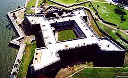
In 1737, Oglethorpe returned to England to acquire more funding and permission to raise a regiment of soldiers; he gained Parliamentary approval for both. He was appointed commander-in-chief of all British forces (limited as they were) in the colonies of South Carolina and Georgia. Oglethorpe subsequently recruited a company of Scots from Inverness, to migrate with their families to settle at Darien (briefly named "New Inverness") on the mainland, at the mouth of the Altamaha River. [3] The men formed a military unit known locally as the Highland Independent Company. Official British records list it as Oglethorpe's Regiment of Foot. It was ranked as 42nd Regiment of Foot (old) in 1747 and disbanded 29 May 1749. [4] Two forts had been constructed about five miles apart on St. Simons Island. Between the two ran a road the width of one wagon, named Military Road. This served to supply the garrison at Fort Frederica and settlers in the nearby village from Fort St. Simons.

The battles took place after a Spanish invasion of the island. They were part of the larger conflict known as the War of Jenkins' Ear (1739 to 1748). It derived its name from an incident in 1731. A Spanish boarding party had gone aboard a British brig Rebecca, off the Florida coast, and found that its captain Robert Jenkins was smuggling. The Spanish officer cut off one of Jenkins' ears for piracy. Parliament used the nearly forgotten incident to rally public opinion to their side in 1739, but the war was over trade and territorial competition between Britain and Spain. On October 30, 1739, Great Britain declared war on Spain.

Invasion, battle, and aftermath

Castillo de San Marcos - St. Augustine. Stronghold of Manuel de Montiano Castillo de San Marcos.jpg
Castillo de San Marcos - St. Augustine. Stronghold of Manuel de Montiano

Spanish governor Don Manuel de Montiano commanded the invasion force, which by some estimates totaled between 4,500 and 5,000 men. Of that number, roughly 1,900 to 2,000 were ground assault troops. Oglethorpe's forces, consisting of regulars, militia, and native Indians, numbered fewer than 1,000. The garrison at Fort St. Simons resisted the invasion with cannonade but could not prevent the landing.

On the 5 July 1742, Montiano landed nearly 1,900 men from 36 ships near Gascoigne Bluff, close to the Frederica River. Faced with a superior force, Oglethorpe decided to withdraw from Fort St. Simons before the Spanish could mount an assault. He ordered the small garrison to spike the guns and slight the fort (doing what damage they could), to deny the Spanish full use of the military asset. The Spanish took over the remains of the fort the following day, establishing it as their base on the island.

Battle of Gully Hole Creek

After landing troops and supplies, and consolidating their position at Fort St. Simons, the Spanish began to reconnoiter beyond their perimeter. They found the road between Fort St. Simons and Fort Frederica but assumed the narrow track was just a farm road. On 7 July the Spanish undertook a reconnaissance in force along the road with approximately 115 men under the command of Captain Sebastian Sanchez. Near Fort Frederica, Sanchez' column made contact with Oglethorpe's soldiers, under command of Noble Jones. The British routed the Spanish, killing or capturing nearly a third of their soldiers. Oglethorpe's forces advanced along Military Road toward Fort St. Simons in pursuit of the retreating Spanish. When Spanish prisoners revealed that a larger Spanish force was advancing from the opposite direction toward Frederica, Oglethorpe left to gather reinforcements.

Battle of Bloody Marsh

Glynn County, GA Glynn County Georgia.png
Glynn County, GA

The British advance party, in pursuit of the defeated Spanish force, engaged in a skirmish, then fell back in face of advancing Spanish reinforcements. When the British reached a bend in the road, Lieutenants Southerland and Macoy ordered the column to stop. They took cover in a semi-circle-shaped area around a clearing behind trees and palmettos, waiting for the advancing Spanish having to take cover in the dense forest. They watched as the Spanish came into view through the Marshy area. Once the they were within range, the British fired multiple volleys from behind the protection of the dense forest. Fortunately for both sides at this point it was later in the afternoon and it started to rain causing the smoke from the muskets to hang in the air. Half of the British broke rank and from not knowing where the Spanish muskets were firing from. General Oglethorpe left the battlefield to get more reinforcements, leaving his men without their commander. The Spanish did not take advantage of their numerical advantage and kept of their rate of fire until they ran out of ammunition after an hour. Once out of ammo, they retreaded back towards Fort St. Simons.

The attack killed seven Spaniards and a few British soldiers. [5] [6] [7] The fighting at Bloody Marsh was filled with confusion on both sides. Neither side had a clear view of the strength or position of the other side. Since the Spanish left the field of battle before the British, it was declared a victory for Oglethorpe and his men. The battle took its name from the British tradition that the marsh ran red with the blood of dead Spanish soldiers. However, the Spanish reports write they only lost seven men during the hour-long engagement.The battle blunted the Spanish advance and ultimately proved decisive. Oglethorpe was credited with the victory, though he arrived at the scene after the fighting had ceased. [8]

Oglethorpe continued to press the Spanish, trying to dislodge them from the island. A few days later, approaching a Spanish settlement on the south side, he learned of a French man who had deserted the British and gone to the Spanish. Worried that the deserter might report how small the British force was, Oglethorpe spread out his drummers, to make them sound as if they were accompanying a larger force. He wrote to the deserter, addressing him as if he were a spy for the British, saying that the man just needed to continue his stories until Britain could send more men. The prisoner who was carrying the letter took it to the Spanish officers, as Oglethorpe had hoped, and the Spanish promptly executed the Frenchman. The timely arrival of British ships reinforced a misconception among the Spanish that British reinforcements were arriving. The Spanish left St. Simons on 25 July, ending their last invasion of colonial Georgia. [9] [10] [11] [12]

Aftermath

In the ensuing months, Oglethorpe considered counter-attacks against Florida, but circumstances were not favourable. The focus of the war had shifted from the Americas to Europe; arms, supplies and troops were not readily available. The region settled into an uneasy peace, occasionally punctuated by minor skirmishes. Oglethorpe was later appointed brigadier general. About 1744 he left Georgia for Britain, where he married an heiress; he lived in Britain the rest of his life. The Treaty of Aix-la-Chapelle ended the war in 1748 and recognised the status of Georgia as a British colony, formally ratified by Spain in the subsequent Treaty of Madrid. Its position was further secured in 1763 when Spain ceded Florida to Britain in an exchange of territory under the Treaty of Paris ending the Seven Years' War.

Wormsloe Plantation in Savannah annually commemorates the War of Jenkins' Ear. [13]

See also

Notes

  1. Marley p. 261
  2. Marley p.262
  3. "History of Darien, Georgia". Cityofdarienga.com. Archived from the original on 2011-07-28. Retrieved 2012-10-16.
  4. Swinson (1972), p.137
  5. Colonial America by Bonnie L. Lukes (Cengage Gale, Jan 4, 1999) page 105
  6. Colonial America, 1607-1763 by Harry M. Ward (Prentice Hall, 1991)
  7. The American Colonial Wars: a concise history, 1607-1775 Nathaniel Claiborne Hale, General Society of Colonial Wars (U.S.) Hale House, 1967 page 54
  8. A history of Georgia: from its first discovery by Europeans to the adoption of the present constitution by William Bacon Stevens page 189
  9. 1943. Minutes of the Proceedings Held on St. Simons Island, Georgia, in Commemoration of the Two Hundredth Anniversary of the Battle of Bloody Marsh, on July 7, 1942. The Georgia Historical Quarterly. 27, no. 2: 182-207.
  10. Hicky, Daniel Whitehead. 1937. Fort Frederica. The North American Review. 243, no. 2: 249.
  11. Cotter, John L. 1963. The Fort at Frederica. American Antiquity. 28, no. 3: 404.
  12. Murphy, Jordan, and Ronald C Meyer. 2008. Fort Frederica National Monument (Georgia). New York, NY: Ambrose Video Pub.
  13. "Wormsloe Historic Site | Georgia State Parks". Gastateparks.org. Archived from the original on 2010-11-27. Retrieved 2012-12-18.

Related Research Articles

<span class="mw-page-title-main">War of Jenkins' Ear</span> 1739–1748 conflict between Britain and Spain

The War of Jenkins' Ear was a conflict lasting from 1739 to 1748 between Britain and Spain. The majority of the fighting took place in New Granada and the Caribbean Sea, with major operations largely ended by 1742. It was related to the 1740 to 1748 War of the Austrian Succession. The name was coined in 1858 by British historian Thomas Carlyle, and refers to Robert Jenkins, captain of the British brig Rebecca, whose ear was allegedly severed by Spanish coast guards while searching his ship for contraband in April 1731.

<span class="mw-page-title-main">St. Simons, Georgia</span> Place in Georgia, United States

St. Simons Island is a barrier island and census-designated place (CDP) located on St. Simons Island in Glynn County, Georgia, United States. The names of the community and the island are interchangeable, known simply as "St. Simons Island" or "SSI", or locally as "The Island". St. Simons is part of the Brunswick metropolitan statistical area, and according to the 2020 U.S. census, the CDP had a population of 14,982. Located on the southeast Georgia coast, midway between Savannah and Jacksonville, St. Simons Island is both a seaside resort and residential community. It is the largest of Georgia's renowned Golden Isles. Visitors are drawn to the Island for its warm climate, beaches, variety of outdoor activities, shops and restaurants, historical sites, and natural environment.

<span class="mw-page-title-main">Darien, Georgia</span> City in Georgia, United States

Darien is a city in and the county seat of McIntosh County, Georgia, United States. It lies on Georgia's coast at the mouth of the Altamaha River, approximately 50 miles south of Savannah, and is part of the Brunswick, Georgia metropolitan statistical area. It is the second-oldest planned city in Georgia and was originally called New Inverness. The population of Darien was 1,460 at the 2020 census, down from 1,975 in 2010.

The Battle of Alligator Bridge took place on June 30, 1778, and was the only major engagement in an unsuccessful campaign to conquer British East Florida during the American Revolutionary War. A detachment of Georgia militiamen under the command of General James Screven chased Thomas Brown's Loyalist company into a large position of British regulars established by British Major Mark Prevost and were turned back.

<span class="mw-page-title-main">Fort Frederica National Monument</span>

Fort Frederica National Monument, on St. Simons Island, Georgia, preserves the archaeological remnants of a fort and town built by James Oglethorpe between 1736 and 1748 to protect the southern boundary of the British colony of Georgia from Spanish raids. About 630 British troops were stationed at the fort.

<span class="mw-page-title-main">Amelia Island</span> Island in the U.S. state of Florida

Amelia Island is a part of the Sea Islands chain that stretches along the East Coast of the United States from South Carolina to Florida; it is the southernmost of the Sea Islands, and the northernmost of the barrier islands on Florida's Atlantic coast. Lying in Nassau County, Florida, it is 13 miles (21 km) long and approximately 4 miles (6.4 km) wide at its widest point. The communities of Fernandina Beach, Amelia City, and American Beach are located on the island.

<span class="mw-page-title-main">Golden Isles of Georgia</span> Place in Georgia, United States

The Golden Isles of Georgia consist of barrier islands, and the mainland port cities of Brunswick and Darien, on the 100-mile-long coast of the U.S. state of Georgia on the Atlantic Ocean. They include St. Simons Island, Sea Island, Jekyll Island, Little St. Simons Island, Sapelo Island, Blackbeard Island, Historic Darien and Historic Brunswick. The islands are part of a long chain of barrier islands known as the "Sea Islands", located along the coasts of South Carolina, Georgia and northern Florida.

<span class="mw-page-title-main">Battle of Gully Hole Creek</span> Battle during the War of Jenkins Ear

The Battle of Gully Hole Creek was a battle that took place on July 18, 1742 between Spanish and British forces in the Province of Georgia, resulting in a victory for the British. Part of a much larger conflict, known as the War of Jenkins' Ear, the battle was for control of St. Simons Island, the British fortifications of Fort Frederica and Fort St. Simons, and the strategic sea routes and inland waters they controlled. After the victory, the Province of Georgia established undisputed claim to the island, which is now part of the U.S. state of Georgia. The better-known Battle of Bloody Marsh, a skirmish also won by the British, took place on the island the same day.

<span class="mw-page-title-main">Fort King George</span> United States historic place

Fort King George State Historic Site is a fort located in the U.S. state of Georgia in McIntosh County, adjacent to Darien. The fort was built in 1721 along what is now known as the Darien River and served as the southernmost outpost of the British Empire in the Americas until 1727. The fort was constructed in what was then considered part of the colony of South Carolina, but was territory later settled as Georgia. It was part of a defensive line intended to encourage settlement along the colony's southern frontier, from the Savannah River to the Altamaha River. Great Britain, France, and Spain were competing to control the American Southeast, especially the Savannah-Altamaha River region.

<span class="mw-page-title-main">Siege of St. Augustine (1740)</span> Battle during the War of Jenkins Ear

The siege of St. Augustine was a military engagement that took place during June–July 1740. It involved a British attack on the city of St Augustine in Spanish Florida and was a part of the much larger conflict known as the War of Jenkins' Ear.

<span class="mw-page-title-main">Wormsloe Historic Site</span> United States historic place

The Wormsloe Historic Site, originally known as Wormsloe Plantation, is a state historic site near Savannah, Georgia, in the southeastern United States. The site consists of 822 acres (3.33 km2) protecting part of what was once the Wormsloe Plantation, a large estate established by one of Georgia's colonial founders, Noble Jones. The site includes a picturesque 1.5 miles (2.4 km) oak avenue, the ruins of Jones' fortified house built of tabby, a museum, and a demonstration area interpreting colonial daily life.

Manuel Joaquín de Montiano y Sopelana was a Spanish General and colonial administrator who served as Royal Governor of La Florida during Florida's First Spanish Period and as Royal Governor of Panama. He defended Florida from an attack by British forces in 1740 and launched his own unsuccessful Invasion of Georgia during the War of Jenkins' Ear.

<span class="mw-page-title-main">Invasion of Georgia (1742)</span> Campaign during the War of Jenkins Ear

In the 1742 Invasion of Georgia, Spanish forces based in Florida attempted to seize and occupy disputed territory held by the British colony of Georgia. The campaign was part of a larger conflict which became known as the War of Jenkins' Ear. Local British forces under the command of the Governor James Oglethorpe rallied and defeated the Spaniards at the Battle of Bloody Marsh and the Battle of Gully Hole Creek, forcing them to withdraw. Britain's ownership of Georgia was formally recognized by Spain in the subsequent Treaty of Madrid.

<span class="mw-page-title-main">Siege of Fort Mose</span> 26 June 1740 action of the War of Jenkins Ear

The Battle of Fort Mose was a significant action of the War of Jenkins' Ear that took place on June 14, 1740 in Spanish Florida. Captain Antonio Salgado commanded a Spanish column of 300 regular troops, backed by the free black militia under Francisco Menéndez and allied Seminole warriors consisting of Indian auxiliaries. They stormed Fort Mose, a strategically crucial position newly held by 170 British soldiers under Colonel John Palmer. Palmer and his garrison had taken the fort from the Spanish as part of James Oglethorpe's offensive to capture St. Augustine.

<span class="mw-page-title-main">Lachlan McIntosh</span> American general (1725–1806)

Lachlan McIntosh was a Scottish American military and political leader during the American Revolution and the early United States. In a 1777 duel, he fatally shot Button Gwinnett, a signer of the Declaration of Independence.

<span class="mw-page-title-main">Oglethorpe's Regiment</span> Military unit

Oglethorpe's Regiment of Foot was an infantry regiment of the British Army formed for service in North America during the War of Jenkins' Ear. It was commanded by James Oglethorpe, first Governor of Georgia.

<span class="mw-page-title-main">James Oglethorpe</span> British Army general, founder of the Georgia colony (1696–1785)

James Edward Oglethorpe was a British soldier, Member of Parliament, and philanthropist, and the founder of the Province of Georgia in what was then colonial-era British America. As a social reformer, he hoped to resettle Britain's "worthy poor" in the New World, initially focusing on those in debtors' prisons.

<span class="mw-page-title-main">Fort St. Andrews</span> British fort in Georgia, United States

Fort St. Andrews was a British colonial coastal fortification built on Cumberland Island, Georgia, in 1736. The fort was built by the British as part of a buffer against Spanish Florida and the colonies to the north. The fort was abandoned and later destroyed by the Spanish in mid-1742.

<span class="mw-page-title-main">Lebanon Plantation</span> United States historic place

Lebanon Plantation is a state historic site located at 5745 Ogeechee Road in Savannah, Georgia. The site is over 500 acres (2.0 km2) consisting of a large estate granted to James Deveaux in 1756, and was named for the many cedar trees on the property. An additional 500 acres were granted to Phillip Delegal in 1758 and eventually became part of the plantation. The site was purchased by Joseph Habersham in 1802. Habersham sold it in 1804 to George W. Anderson who built the main house that was rebuilt and added on to after the American Civil War. Anderson's son, George Wayne Anderson, JR Commanded Fort McAllister in the Civil War, and after the fort fell, Lebanon became his prison and the headquarters of the Fifteenth Army Corps of the US Army.

<span class="mw-page-title-main">Fort San Francisco de Pupo</span> 18th-century Spanish fort in Florida, United States

Fort San Francisco de Pupo was an 18th-century Spanish fort on the west bank of the St. Johns River in Florida, about eighteen miles from St. Augustine, the capital of Spanish Florida. Lying on the old trail to the Spanish province of Apalachee in western Florida, Fort Pupo and its sister outpost, Fort Picolata on the opposite shore of the river, controlled all traffic on the ferry crossing. The remains of Fort Pupo are situated about three miles south of Green Cove Springs in Clay County, near the end of Bayard Point opposite Picolata. The surrounding area is a hammock of southern live oak, southern magnolia, pignut hickory and other typical trees native to the region.

References