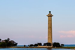
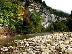
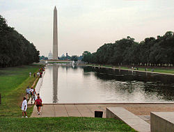
The National Park System of the United States is the collection of physical properties owned or administered by the National Park Service. The collection includes all national parks and most national monuments, as well as several other types of protected areas of the United States.
As of December 2024, there are 433 units of the National Park System. [1] However, this number is somewhat misleading. For example, Denali National Park and Preserve is counted as two units, since the same name applies to a national park and an adjacent national preserve. Yet Jean Lafitte National Historical Park and Preserve is counted as one unit, despite its double designation. Counting methodology is typically based on the language of a park's authorizing legislation.
Although the designations generally reflect sites' features, all units of the system are considered administratively equal and with few exceptions the designations themselves do not define their level of protection. Each site has a management plan consistent with its ecological, historic, and recreational resources and its enabling legislation.
In addition to areas of the National Park System, the National Park Service also provides technical and financial assistance to several affiliated areas authorized by Congress. Affiliated areas are marked on the lists below.
National Park System units are found in all 50 states, the District of Columbia, and the U.S. territories of Guam, American Samoa, the U.S. Virgin Islands, and Puerto Rico. The territory of the Northern Mariana Islands has an affiliated area but not an official NPS unit.
Nearly all units managed by the National Park Service participate in the National Park Passport Stamps program.
There are 63 officially designated national parks in the United States and its dependent areas, as of 2021. [2] The national parks are considered the "crown jewels" of the system and are typically larger than other areas, including a variety of significant ecological and geological resources.
Name | Established | Disbanded | Result |
---|---|---|---|
Abraham Lincoln National Park | July 17, 1916 | August 11, 1939 | Redesignated as Abraham Lincoln Birthplace National Historical Park |
Fort McHenry National Park | March 3, 1925 | August 11, 1939 | Redesignated under the unique designation of Fort McHenry National Monument and Historic Shrine |
General Grant National Park | October 1, 1890 | March 4, 1940 | Incorporated into Kings Canyon National Park |
Hawaii National Park | August 1, 1916 | September 13, 1960 | Divided into Hawaii Volcanoes National Park and Haleakala National Park |
Mackinac National Park | April 15, 1875 | March 2, 1895 | Transferred to Michigan; now operated as Mackinac Island State Park |
Platt National Park | June 29, 1906 | March 17, 1976 | Incorporated with Arbuckle Recreation Area and redesignated Chickasaw National Recreation Area |
Rock Creek Park [5] | September 27, 1890 | August 10, 1933 | Incorporated into National Capital Parks |
Sullys Hill National Park | April 27, 1904 | March 3, 1931 | Transferred to the U.S. Fish and Wildlife Service; now operated as White Horse Hill National Game Preserve |
There are 136 national monuments, 89 of which are administered by the NPS and are listed below. Of these, 87 (all except Grand Canyon-Parashant and Avi Kwa Ame) are NPS official units. The remaining 47 monuments are administered by five other federal agencies. Three, Grand Canyon–Parashant, Craters of the Moon, and Avi Kwa Ame National Monuments, are jointly administered by the NPS and the Bureau of Land Management, and Tule Lake National Monument is joint with the Fish and Wildlife Service. National monuments are typically smaller and protect just one or few major resources. They include both natural and historical sites and can be established by the president under the Antiquities Act. 34 former national monuments have been redesignated or incorporated into national parks.
Name | Established | Disbanded | Result |
---|---|---|---|
Carlsbad Cave National Monument | October 5, 1923 | May 14, 1930 | Redesignated as Carlsbad Caverns National Park |
Denali National Monument | December 1, 1978 | December 2, 1980 | Incorporated with Mount McKinley National Park and renamed Denali National Park and Preserve |
Grand Canyon National Monument | January 11, 1908 | February 26, 1919 | Redesignated as Grand Canyon National Park |
Grand Canyon National Monument | December 22, 1932 | January 3, 1975 | Abolished; lands transferred with Marble Canyon National Monument into an expansion of Grand Canyon National Park. [6] [7] [8] [9] |
Marble Canyon National Monument | January 20, 1969 | January 3, 1975 | Abolished; lands transferred with Grand Canyon National Monument into an expansion of Grand Canyon National Park. |
Kobuk Valley National Monument | December 1, 1978 | December 2, 1980 | Redesignated as Kobuk Valley National Park |
Papago Saguaro National Monument | January 31, 1914 | April 7, 1930 | Transferred to Arizona; now jointly operated by the cities of Phoenix and Tempe |
Pullman National Monument | February 19, 2015 | December 29, 2022 | Redesignated as Pullman National Historical Park |
Lewis and Clark Cavern National Monument | May 11, 1908 | August 24, 1937 | Transferred to Montana; now operated as a state park |
Kenai Fjords National Monument | December 1, 1978 | December 2, 1980 | Redesignated as Kenai Fjords National Park |
Channel Islands National Monument | April 26, 1938 | March 5, 1980 | Redesignated as Channel Islands National Park |
Father Millet Cross National Monument | August 10, 1933 | September 7, 1949 | Transferred to New York upon the closing of the adjacent military base; now operated part of Fort Niagara State Park |
First State National Monument | March 25, 2013 | December 19, 2014 | Incorporated into First State National Historical Park |
Lake Clark National Monument | December 1, 1978 | December 2, 1980 | Renamed Lake Clark National Park and Preserve |
Black Canyon of the Gunnison National Monument | March 2, 1933 | October 21, 1999 | Redesignated as Black Canyon of the Gunnison National Park |
Harriet Tubman Underground Railroad National Monument | March 25, 2013 | December 19, 2014 | The National Park Service areas of this monument were incorporated into Harriet Tubman Underground Railroad National Historical Park, and the National Park Service no longer recognizes their portions of the national monument as distinct from the national historical park. The remaining portions of Harriet Tubman Underground Railroad National Monument continue to be operated by the U.S. Fish and Wildlife Service. |
Mukuntuweap National Monument (renamed Zion National Monument in 1918) | July 31, 1909 | November 19, 1919 | Redesignated as Zion National Park |
Zion National Monument ("the Kolob Canyons area") | January 22, 1937 | July 11, 1956 | Incorporated into Zion National Park |
Capitol Reef National Monument | August 2, 1937 | December 18, 1971 | Redesignated as Capitol Reef National Park |
Arches National Monument | April 12, 1929 | November 12, 1971 | Redesignated as Arches National Park |
Bryce Canyon National Monument | June 8, 1923 | February 25, 1928 | Redesignated as Bryce Canyon National Park |
Wheeler National Monument | December 7, 1908 | August 3, 1950 | Returned to United States Forest Service |
Holy Cross National Monument | May 11, 1929 | August 3, 1950 | Returned to United States Forest Service |
White Sands National Monument | January 18, 1933 | December 20, 2019 | Redesignated as White Sands National Park |
Jackson Hole National Monument | 1943 | September 14, 1950 | Merged into Grand Teton National Park |
Shoshone Cavern National Monument | September 21, 1909 | May 17, 1954 | Transferred to Cody, Wyoming as a municipal attraction, and later returned to the Bureau of Land Management |
Old Kasaan National Monument | October 25, 1916 | July 26, 1955 | Transferred to United States Forest Service |
Castle Pinckney National Monument | August 10, 1933 | March 29, 1956 | Transferred to South Carolina, and later sold to the Sons of Confederate Veterans; site currently inaccessible and unmaintained |
Saguaro National Monument | March 1, 1933 | October 4, 1994 | Redesignated as Saguaro National Park |
Verendrye National Monument | June 29, 1917 | July 30, 1956 | Transferred to North Dakota after the construction of the Garrison Dam; site currently flooded by the reservoir Lake Sakakawea |
Gates of the Arctic National Monument | December 1, 1978 | December 2, 1980 | Renamed Gates of the Arctic National Park and Preserve |
Fossil Cycad National Monument | October 21, 1922 | August 1, 1956 | Transferred to Bureau of Land Management because of severe vandalism to the site |
Death Valley National Monument | February 11, 1933 | October 31, 1994 | Redesignated as Death Valley National Park |
Joshua Tree National Monument | August 10, 1936 | October 31, 1994 | Redesignated as Joshua Tree National Park |
Ackia Battlefield National Monument | August 27, 1935 | August 10, 1961 | Incorporated into Natchez Trace Parkway |
Meriwether Lewis National Monument | February 6, 1925 | August 10, 1961 | Incorporated into Natchez Trace Parkway |
Katmai National Monument | September 24, 1918 | December 2, 1980 | Renamed Katmai National Park and Preserve |
Mount Olympus National Monument | March 2, 1909 | June 29, 1938 | Redesignated as Olympic National Park |
Petrified Forest National Monument | December 8, 1906 | December 9, 1962 | Redesignated as Petrified Forest National Park |
Lehman Caves National Monument | June 10, 1933 | October 27, 1986 | Abolished; incorporated into Great Basin National Park [10] |
Congaree Swamp National Monument | October 18, 1976 | November 10, 2003 | Redesignated as Congaree National Park |
Glacier Bay National Monument | February 25, 1925 | December 2, 1980 | Renamed Glacier Bay National Park and Preserve |
Mound City Group National Monument | January 1, 1918 | January 2, 1992 | Incorporated into Hopewell Culture National Historical Park |
Minidoka Internment National Monument | January 17, 2001 | May 8, 2008 | Redesignated as Minidoka National Historic Site |
Pinnacles National Monument | January 16, 1908 | January 10, 2013 | Redesignated as Pinnacles National Park [11] |
Andrew Johnson National Monument | April 27, 1942 | December 11, 1963 | Redesignated as Andrew Johnson National Historic Site [12] |
Sieur de Monts National Monument | July 8, 1916 | February 26, 1919 | Redesignated as Lafayette National Park (renamed Acadia National Park on January 19, 1929) |
Edison Laboratory National Monument | July 14, 1956 | September 5, 1962 | Combined with Edison Home National Historic Site into Edison National Historic Site, later redesignated Thomas Edison National Historical Park |
Wrangell–St. Elias National Monument | December 1, 1978 | December 2, 1980 | Renamed Wrangell–St. Elias National Park and Preserve |
Badlands National Monument | January 29, 1939 | November 10, 1978 | Redesignated as Badlands National Park |
Great Sand Dunes National Monument | March 17, 1932 | September 14, 2004 | Renamed Great Sand Dunes National Park and Preserve |
Biscayne National Monument | October 18, 1968 | June 28, 1980 | Redesignated as Biscayne National Park |
Fort Jefferson National Monument | January 4, 1935 | October 26, 1992 | Redesignated as Dry Tortugas National Park |
Cinder Cone National Monument | May 6, 1907 | August 9, 1916 | Merged with Lassen Peak National Monument and redesignated as Lassen Volcanic National Park |
Lassen Peak National Monument | May 6, 1907 | August 9, 1916 | Merged with Cinder Cone National Monument and redesignated as Lassen Volcanic National Park |
Homestead National Monument of America | March 19, 1936 | January 13, 2021 | Redesignated as Homestead National Historical Park |
There are 21 national preserves in the United States, 19 of which are counted by the National Park System as official units. Ten are stand-alone official units, while eleven others are designated areas where hunting or grazing is permitted as part of a larger "national park and preserve" or "national monument and preserve". Nine of those are counted as separate units, while Oregon Caves National Monument and Preserve and New River Gorge National Park and Preserve are single units (there is no functional difference). Jean Lafitte National Historical Park and Preserve is not officially a national preserve but has similar management policies, while Salt River Bay National Historical Park and Ecological Preserve is unrelated.
There are 63 national historical parks.
Name | Status |
---|---|
Coltsville National Historical Park | Connecticut (pending acquisition of property) |
There are 86 national historic sites, of which 76 are NPS units, 9 are affiliated areas, and one, Grey Towers National Historic Site, is managed by the U.S. Forest Service (not listed here).
Name | Established | Disbanded | Result |
---|---|---|---|
Federal Hall Memorial National Historic Site | May 26, 1939 | August 11, 1955 | Redesignated Federal Hall National Memorial |
Atlanta Campaign National Historic Site | October 13, 1944 | September 21, 1950 | Transferred to state of Georgia; park never developed beyond a set of six roadside interpretive markers along the Dixie Highway |
Mar-a-Lago National Historic Site | October 21, 1972 | December 23, 1980 | Returned to a nonprofit foundation operated by the Post family, the original owners of the site |
McLoughlin House National Historic Site (affiliated unit) | June 27, 1941 | July 29, 2003 | Merged into Fort Vancouver National Historic Site |
St. Thomas National Historic Site | December 24, 1960 | February 5, 1975 | Transferred to U.S. Virgin Islands; currently operated as a Virgin Islands territorial park |
Sewall-Belmont House National Historic Site | April 12, 2016 | Redesignated Belmont-Paul Women's Equality National Monument and changed from affiliated unit to an NPS unit | |
Edison Home National Historic Site | December 6, 1955 | September 5, 1962 | Combined with Edison Laboratory National Monument into Edison National Historic Site, later redesignated Thomas Edison National Historical Park |
Edison National Historic Site | September 5, 1962 | March 30, 2009 | Redesignated Thomas Edison National Historical Park |
Name | Location | Status |
---|---|---|
Ronald Reagan Boyhood Home National Historic Site [14] | Illinois | Pending acquisition of property |
Name [2] | Location | Area (2024) [3] [4] |
---|---|---|
Saint Croix Island International Historic Site | Maine / New Brunswick | 6.50 acres (0.0263 km2) |
Name [2] | Location | Area (2024) [4] [15] |
---|---|---|
Kennesaw Mountain National Battlefield Park | Georgia | 2,913.63 acres (11.7910 km2) |
Manassas National Battlefield Park | Virginia | 5,073.76 acres (20.5328 km2) |
Richmond National Battlefield Park | Virginia | 8,144.28 acres (32.9587 km2) |
River Raisin National Battlefield Park | Michigan | 42.18 acres (0.1707 km2) |
Name [2] | Location | Area (2024) [4] [15] |
---|---|---|
Chickamauga and Chattanooga National Military Park | Georgia, Tennessee | 9,523.48 acres (38.5402 km2) |
Fredericksburg and Spotsylvania County Battlefields Memorial National Military Park | Virginia | 8,405.46 acres (34.0157 km2) |
Gettysburg National Military Park | Pennsylvania | 6,037.06 acres (24.4311 km2) |
Guilford Courthouse National Military Park | North Carolina | 254.90 acres (1.0315 km2) |
Horseshoe Bend National Military Park | Alabama | 2,040.00 acres (8.2556 km2) |
Kings Mountain National Military Park | South Carolina | 3,945.29 acres (15.9660 km2) |
Pea Ridge National Military Park | Arkansas | 4,440.82 acres (17.9714 km2) |
Shiloh National Military Park | Tennessee, Mississippi | 9,318.64 acres (37.7112 km2) |
Vicksburg National Military Park | Mississippi, Louisiana | 3,049.15 acres (12.3395 km2) |
Name | Established | Disbanded | Result |
---|---|---|---|
Moore's Creek National Military Park | June 2, 1926 | September 8, 1980 | Redesignated as Moores Creek National Battlefield |
Monocacy National Military Park | June 21, 1934 | October 21, 1976 | Redesignated Monocacy National Battlefield; previously Monocacy National Battlefield Site (1929 to 1934) |
Name [2] | Location | Area (2024) [4] [15] |
---|---|---|
Antietam National Battlefield | Maryland | 3,287.63 acres (13.3046 km2) |
Big Hole National Battlefield | Montana | 969.61 acres (3.9239 km2) |
Cowpens National Battlefield | South Carolina | 841.56 acres (3.4057 km2) |
Fort Donelson National Battlefield | Tennessee, Kentucky | 1,319.25 acres (5.3388 km2) |
Fort Necessity National Battlefield | Pennsylvania | 902.80 acres (3.6535 km2) |
Monocacy National Battlefield | Maryland | 1,646.88 acres (6.6647 km2) |
Moores Creek National Battlefield | North Carolina | 87.75 acres (0.3551 km2) |
Petersburg National Battlefield | Virginia | 9,598.68 acres (38.8445 km2) |
Stones River National Battlefield | Tennessee | 709.49 acres (2.8712 km2) |
Tupelo National Battlefield | Mississippi | 1.00 acre (0.0040 km2) |
Wilson's Creek National Battlefield | Missouri | 2,446.75 acres (9.9016 km2) |
Name [2] | Location | Area (2024) [4] [15] |
---|---|---|
Brices Cross Roads National Battlefield Site | Mississippi | 1.00 acre (0.0040 km2) |
Name | Established | Disbanded | Result |
---|---|---|---|
Antietam National Battlefield Site | August 30, 1890 | 1978 | Redesignated Antietam National Battlefield |
New Orleans Battlefield Site (Chalmette Monument and Grounds) | March 4, 1907 | 1939 | Redesignated Chalmette National Historical Park; incorporated into Jean Lafitte National Historical Park and Preserve, Nov. 10, 1978 |
Kennesaw Mountain National Battlefield Site | February 8, 1917 | 1935 | Redesignated Kennesaw Mountain National Battlefield Park |
White Plains National Battlefield Site | May 18, 1926 | 1956 | Assumed by Battle of White Plains Monument Committee, 1958 |
Tupelo National Battlefield Site | February 21, 1929 | 1961 | Redesignated Tupelo National Battlefield |
Monocacy National Battlefield Site | March 1, 1929 | June 21, 1934 | Reauthorized as a national military park; redesignated Monocacy National Battlefield, Oct. 21, 1976 |
Cowpens National Battlefield Site | March 4, 1929 | 1972 | Redesignated Cowpens National Battlefield |
Appomattox Battlefield Site | June 18, 1930 | 1935 | Designated Appomattox Court House National Historical Monument; redesignated Appomattox Court House National Historical Park, 1954 |
Fort Necessity National Battlefield Site | March 4, 1931 | 1961 | Redesignated Fort Necessity National Battlefield |
There are 31 national memorials that are NPS units and five affiliated national memorials. [2]
Name | Established | Disbanded | Result |
---|---|---|---|
Camp Blount Tablets National Memorial | 1930 | 1944 | Transferred to NPS in 1933 from War Dept., it was never developed; only a stone marker remains off U.S. Route 231 near Fayetteville, Tennessee |
Fort Clatsop National Memorial | May 29, 1958 | October 30, 2004 | Incorporated into Lewis and Clark National and State Historical Parks |
Jefferson National Expansion Memorial | December 21, 1935 | February 22, 2018 | Redesignated as Gateway Arch National Park |
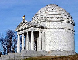
New Echota Marker National Memorial | August 10, 1933 | September 21, 1950 | Transferred to state of Georgia; currently operated as a Georgia state park. |
Oklahoma City National Memorial | October 9, 1997 | January 23, 2004 | Transferred to the nonprofit Oklahoma City National Memorial Foundation; NPS interpretation continues at this affiliated unit |
Name | Law |
---|---|
Adams Memorial | Authorized by Public Law 107-62 |
National Desert Storm/Desert Shield Memorial | Authorized by National Defense Authorization Act 2015 [16] |
National Global War on Terrorism Memorial | Authorized by Public Law 115-51 |
There are 18 national recreation areas administered by the National Park Service. [2] Another 22 national recreation areas are administered by the Forest Service and Bureau of Land Management.
Name | Established | Disbanded | Result |
---|---|---|---|
Arbuckle Recreation Area | February 1, 1965 | March 17, 1976 | Incorporated with Platt National Park and redesignated Chickasaw National Recreation Area |
Cuyahoga Valley National Recreation Area | December 27, 1974 | October 11, 2000 | Redesignated as Cuyahoga Valley National Park |
Flaming Gorge National Recreation Area | July 22, 1963 | October 1, 1968 | Transferred to U.S. Forest Service |
Lake Texoma Recreation Area | April 18, 1946 | June 30, 1949 | Returned to U.S. Army Corps of Engineers |
Millerton Lake Recreation Area | May 22, 1945 | November 1, 1957 | Transferred to state of California; currently operated by the California Department of Water Resources |
Shadow Mountain National Recreation Area | June 27, 1952 | March 1, 1979 | Transferred to U.S. Forest Service |
Shasta Lake Recreation Area | May 22, 1945 | July 1, 1948 | Transferred to U.S. Forest Service |
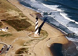
There are 10 national seashores. [2]
Name | Location | Area (2024) [3] [4] |
---|---|---|
Assateague Island National Seashore | Maryland, Virginia | 41,311.27 acres (167.1808 km2) |
Canaveral National Seashore | Florida | 57,661.69 acres (233.3486 km2) |
Cape Cod National Seashore | Massachusetts | 43,623.22 acres (176.5369 km2) |
Cape Hatteras National Seashore | North Carolina | 30,350.65 acres (122.8247 km2) |
Cape Lookout National Seashore | North Carolina | 28,243.36 acres (114.2968 km2) |
Cumberland Island National Seashore | Georgia | 36,346.83 acres (147.0904 km2) |
Fire Island National Seashore | New York | 19,580.65 acres (79.2401 km2) |
Gulf Islands National Seashore | Florida, Mississippi | 138,306.64 acres (559.7071 km2) |
Padre Island National Seashore | Texas | 130,434.27 acres (527.8488 km2) |
Point Reyes National Seashore | California | 71,053.38 acres (287.5428 km2) |
There are three national lakeshores, located in Michigan and Wisconsin.
Name | Location | Area (2024) [3] [4] |
---|---|---|
Apostle Islands National Lakeshore | Wisconsin | 69,377.43 acres (280.7605 km2) |
Pictured Rocks National Lakeshore | Michigan | 73,235.97 acres (296.3755 km2) |
Sleeping Bear Dunes National Lakeshore | Michigan | 71,318.57 acres (288.6160 km2) |
Name | Established | Disbanded | Result |
---|---|---|---|
Indiana Dunes National Lakeshore | November 5, 1966 | February 15, 2019 | Redesignated Indiana Dunes National Park |
There are four national rivers (marked with an asterisk) and ten national wild and scenic rivers administered as distinct units of the National Park System. [2] There are many more national wild and scenic rivers that run through other units.
Name | Established | Disbanded | Result |
---|---|---|---|
New River Gorge National River | November 10, 1978 | December 27, 2020 | Redesignated New River Gorge National Park and Preserve |
National reserves are partnerships between federal, state, and local authorities. Within the boundaries of the three national reserves are combinations of federal land (Park Service or National Wildlife Refuges), state parks and forests, local public lands, and private properties. Two national reserves are currently managed as official units.
Name [2] | Location | Area (2024) [3] [4] |
---|---|---|
City of Rocks National Reserve | Idaho | 14,512.27 acres (58.7291 km2) |
Ebey's Landing National Historical Reserve | Washington | 19,333.51 acres (78.2399 km2) |
Pinelands National Reserve (affiliated area) | New Jersey | 1,164,025 acres (4,710.64 km2) |
Ten roadways and surrounding scenic areas are managed by the NPS as parkways, four of which as official units and five as part of other units.
Name [2] | Location | Area (2024) [3] [4] |
---|---|---|
Baltimore-Washington Parkway (part of National Capital Parks East) | Maryland, Washington, D.C. | |
Blue Ridge Parkway | Virginia, North Carolina | 101,128.20 acres (409.2513 km2) |
Colonial Parkway (part of Colonial National Historical Park) | Virginia | |
Foothills Parkway (part of Great Smoky Mountains National Park) | Tennessee | |
George Washington Memorial Parkway (In 1989, the Maryland and DC portions of the parkway were renamed Clara Barton Parkway to overcome motorist confusion). | Virginia, Maryland, Washington, D.C. | 6,719.21 acres (27.1917 km2) |
John D. Rockefeller, Jr. Memorial Parkway | Wyoming | 23,777.22 acres (96.2230 km2) |
Natchez Trace Parkway | Mississippi, Alabama, Tennessee | 52,380.46 acres (211.9762 km2) |
Oxon Run Parkway (part of National Capital Parks East) | Washington, D.C. | |
Rock Creek and Potomac Parkway (part of Rock Creek Park) | Washington, D.C. | |
Suitland Parkway (part of National Capital Parks East) | Maryland |
These National Park Service trails are part of the larger National Trails System. Only six of the trails are considered official units of the park system. [2]
Most national cemeteries are administered by the Department of Veterans Affairs, although a few are managed by the National Park Service and the U.S. Army. None of the cemeteries are considered official units of the system; they are all affiliated with other parks.
Name | Established | Disbanded | Result |
---|---|---|---|
Chattanooga National Cemetery | August 10, 1933 | December 7, 1944 | returned to War Department |
The National Park Service provides limited assistance to national heritage areas, but does not administer them.
There are 11 NPS units of other designations, as well as other affiliated areas. The National Mall and National Capital Parks have many sites, some of which are also units of other designations.
In addition, there are sites where the NPS is authorized to provide financial and technical assistance to local authorities for interpretive or educational purposes, but do not have the right to acquire land or have a say in land use or zoning. These include the 55 National Heritage Areas, as well as National Commemorative Sites such as Quindaro Townsite or the Kennedy-King National Commemorative Site. There are also various administrative groups of listed parks, such as Manhattan Sites, National Parks of New York Harbor, and Western Arctic National Parklands. The NPS also owns conservation easements (but not the land itself) for part of the area called the Green Springs National Historic Landmark District.
Name | Established | Disbanded | Result |
---|---|---|---|
Appomattox Court House National Historical Monument | 1935 | 1954 | Redesignated Appomattox Court House National Historical Park; previously Appomattox National Battlefield Site (1930–1935) |
National Visitor Center, Washington, D.C. | March 12, 1968 | December 29, 1981 | Transferred to Department of Transportation |
John F. Kennedy Center for the Performing Arts | June 16, 1972 | July 21, 1994 | Transferred to Kennedy Center Trustees |
New Jersey Coastal Heritage Trail Route (affiliated area) | 1988 | September 30, 2011 | Multiple site agencies continue managing the route without NPS partnership [20] |
In the 1930s and 1940s, the NPS developed dozens of recreational demonstration areas, most of which eventually became national or state parks.
The National Park Service (NPS) is an agency of the United States federal government, within the US Department of the Interior. The service manages all national parks; most national monuments; and other natural, historical, and recreational properties, with various title designations. The United States Congress created the agency on August 25, 1916, through the National Park Service Organic Act. Its headquarters is in Washington, D.C., within the main headquarters of the Department of the Interior.
In the United States, a national monument is a protected area that can be created from any land owned or controlled by the federal government by proclamation of the president of the United States or an act of Congress. National monuments protect a wide variety of natural and historic resources, including sites of geologic, marine, archaeological, and cultural importance. The Antiquities Act of 1906 gives presidents the power to proclaim national monuments by executive action. In contrast, national parks in the U.S. must be created by Congressional legislation. Some national monuments were first created by presidential action and later designated as national parks by congressional approval.
There are 21 protected areas of the United States designated as national preserves. They were established by an act of Congress to protect areas that have resources often associated with national parks but where certain natural resource-extractive activities such as hunting and mining may be permitted, provided their natural values are preserved. The activities permitted in each national preserve vary depending on the enabling legislation of the unit. All national preserves are managed by the National Park Service (NPS) as part of the National Park System.
The Antiquities Act of 1906 is an act that was passed by the United States Congress and signed into law by Theodore Roosevelt on June 8, 1906. This law gives the president of the United States the authority to, by presidential proclamation, create national monuments from federal lands to protect significant natural, historic, or scientific features. The Act has been used more than a hundred times since its enactment to create a wide variety of protected areas.
Glen Canyon National Recreation Area is a national recreation area and conservation unit of the United States National Park Service that encompasses the area around Lake Powell and lower Cataract Canyon in Utah and Arizona, covering 1,254,429 acres (5,076.49 km2) of mostly rugged high desert terrain. The recreation area is named for Glen Canyon, which was flooded by the Glen Canyon Dam, completed in 1966, and is now mostly submerged beneath the waters of Lake Powell.
Petroglyph National Monument stretches 17 miles (27 km) along Albuquerque, New Mexico's West Mesa, a volcanic basalt escarpment that dominates the city's western horizon. Authorized June 27, 1990, the 7,236 acres (2,928 ha) monument is cooperatively managed by the National Park Service and the City of Albuquerque. The western boundary of the monument features a chain of dormant fissure volcanoes. Beginning in the northwest corner, Butte volcano is followed to its south by Bond, Vulcan, Black and JA volcanoes.
A national recreation area (NRA) is a protected area in the United States established by an Act of Congress to preserve enhanced recreational opportunities in places with significant natural and scenic resources. There are 40 NRAs, which emphasize a variety of activities for visitors, including hiking, camping, boating, fishing, swimming, biking, horseback riding, and wildlife viewing, in areas that include multiple-use management for both conservation and limited utilization of natural resources. They have diverse features and contexts, being established around reservoirs, in urban areas, and within forests. Due to their size, diversity of activities, and proximity to population centers, NRAs are among the most visited units of the National Park System, with six among the thirty most visited sites.
Fort Frederica National Monument, on St. Simons Island, Georgia, preserves the archaeological remnants of a fort and town built by James Oglethorpe between 1736 and 1748 to protect the southern boundary of the British colony of Georgia from Spanish raids. About 630 British troops were stationed at the fort.
National Military Park, National Battlefield, National Battlefield Park, and National Battlefield Site are four designations for 25 battle sites preserved by the United States federal government because of their national importance. The designation applies to "sites where historic battles were fought on American soil during the armed conflicts that shaped the growth and development of the United States...."
Grand Canyon–Parashant National Monument is located on the northern edge of the Grand Canyon in northwest Arizona, on the Arizona Strip. The monument was established by Presidential Proclamation 7265 on January 11, 2000.
The National Capital Parks was a unit of the National Park System of the United States, now divided into multiple administrative units. It encompasses a variety of federally owned properties in and around the District of Columbia including memorials, monuments, parks, interiors of traffic circles and squares, triangles formed by irregular intersections, and other open spaces.
National Conservation Lands, formally known as the National Landscape Conservation System, is a 35-million-acre (140,000 km2) collection of lands in 873 federally recognized areas considered to be the crown jewels of the American West. These lands represent 10% of the 258 million acres (1,040,000 km2) managed by the Bureau of Land Management (BLM). The BLM is the largest federal public land manager and is responsible for over 40% of all the federal public land in the nation. The other major federal public land managers include the US Forest Service (USFS), National Park Service (NPS), and the US Fish and Wildlife Service (USFWS).
Cedar Creek and Belle Grove National Historical Park became the 388th unit of the United States National Park Service when it was authorized on December 19, 2002. The National Historical Park was created to protect several historically significant locations in the Shenandoah Valley of Northern Virginia, notably the site of the American Civil War Battle of Cedar Creek and the Belle Grove Plantation.
According to the California Protected Areas Database (CPAD), in the state of California, United States, there are over 14,000 inventoried protected areas administered by public agencies and non-profits. In addition, there are private conservation areas and other easements. They include almost one-third of California's scenic coastline, including coastal wetlands, estuaries, beaches, and dune systems. The California State Parks system alone has 270 units and covers 1.3 million acres (5,300 km2), with over 280 miles (450 km) of coastline, 625 miles (1,006 km) of lake and river frontage, nearly 18,000 campsites, and 3,000 miles (5,000 km) of hiking, biking, and equestrian trails.
Since 1872 the United States National Park System has grown from a single, public reservation called Yellowstone National Park to include 430 natural, historical, recreational, and cultural areas throughout the United States, its territories, and island possessions. These areas include National Parks, National Monuments, National Memorials, National Military Parks, National Historic Sites, National Parkways, National Recreation Areas, National Seashores, National Scenic Riverways, and National Scenic Trails.
The protected areas of the Sierra Nevada, a major mountain range located in the U.S. states of California and Nevada, are numerous and highly diverse. Like the mountain range itself, these areas span hundreds of miles along the length of the range, and over 14,000 feet of elevation from the lowest foothills to the summit of Mount Whitney.
Click on Park Acreage Reports (1997 – Last Calendar/Fiscal Year), then select By Park, Calendar Year, <choose year>, and then click the View PDF Report button – the areas used here are the Gross Area Acres which are in the final column of the report