This article may require copy editing for grammar, style, cohesion, tone, or spelling.(August 2025) |
Mid-Atlantic | |
|---|---|
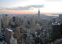
     Left to right from top: The Lower Manhattan skyline in New York City, Independence Hall in Philadelphia, Assateague Island, the Philadelphia skyline, and the Catskills seen from the Hudson River | |
 | |
| Coordinates: 41°N77°W / 41°N 77°W | |
| Composition | |
| Metropolitan areas |
|
| Largest city | New York City |
| Area | |
• Total | 191,299.86 sq mi (495,464.4 km2) |
| • Land | 174,468.45 sq mi (451,871.2 km2) |
| • Water | 16,831.41 sq mi (43,593.2 km2) 8.80% |
| Population | |
• Total | 60,783,913 |
| • Density | 348.39487/sq mi (134.51601/km2) |
| GDP (nominal) | |
| • Q3 2022 | $5.233 trillion |
The Mid-Atlantic is a region of the United States located in the eastern part of the country. Traditional definitions include seven U.S. states: New York, New Jersey, Pennsylvania, Delaware, Maryland, Virginia, West Virginia, and the national capital of Washington, D.C. [3]
Contents
- Composition
- History
- Major states, cities, and urban areas
- Metropolitan areas
- States and federal district
- State capitals and federal district
- In presidential elections
- Culture
- Cuisine
- Film and Television
- Literature
- Music
- Sports
- Economy
- See also
- References
- Bibliography
Depending on various factors, different regional divisions exist however: the U.S. Bureau of Labor Statistics in its newest regional division excludes New York from the region; [4] the U.S. Census Bureau excludes Delaware, Maryland, Virginia and West Virginia from the region; [5] USGS defines the region by watersheds thus additionally including North Carolina; [6] the EPA excludes both New York and New Jersey; [7] the U.S. Maritime Administration excludes upper New Jersey and New York; [8] the Office of Small Business Programs of the U.S. Department of Defense excludes New York. [9] When discussing climate, Connecticut is sometimes included, since its climate is closer to the Mid-Atlantic than the rest of the New England region.[ citation needed ]
The region was known in the 17th century as the "Middle Colonies" during the colonial era, initially including four colonial provinces, the Delaware Colony and the provinces of New Jersey, New York, and Pennsylvania, each of which were among the Thirteen Colonies in pre-revolutionary British America. Afterwards, the area was recognized geographically as the "Middle States", with Maryland, Virginia and in some instances North Carolina included, as well as the Ohio Territory.
As of the 2020 census, the region had a population of 60,783,913, representing slightly over 18% of the nation's population. The Mid-Atlantic is a relatively affluent region of the nation; nearly half of the nation's 100 highest-income counties based on median household income are located in the Mid-Atlantic, and 33 of the nation's top 100 counties based on per capita income are in the region. Most of the Mid-Atlantic states rank among the 15 highest-income states in the nation by both median household income and per capita income.
The Mid-Atlantic region played an instrumental and historic role in the nation's founding and the development of the nation. Six of the seven states were members of the Thirteen Colonies that sent delegates to the Second Continental Congress, which assembled in Philadelphia and unanimously adopted the Declaration of Independence, and formalized the Continental Army under George Washington's command during the American Revolutionary War. Following independence, the states again gathered in Philadelphia at the Constitutional Convention, in 1788, where they ratified the United States Constitution, which remains the oldest and longest-standing written and codified national constitution in force in the world. [10]
The Mid-Atlantic region was settled during the colonial era between the early 17th century and the conclusion of the American Revolutionary War in 1783 by European Americans of primarily Dutch, German, Swedish, English, and other Western European ethnicities. Religious pluralism and freedoms existed in the original Thirteen Colonies and were particularly prevalent in Province of Pennsylvania and the geographic region that ultimately broke from Pennsylvania to form the Delaware Colony. Among the 13 colonies, the Province of Maryland was the only colony with a substantial Catholic population.
Following the American Revolutionary War, the Mid-Atlantic region hosted each of the historic capitals of the United States. The nation's capital was constructed in Washington, D.C. in the late 18th century, and relocated there from Philadelphia in 1800.
In the early part of the 19th century, New York and Pennsylvania overtook Virginia as the nation's two most populous states, and the Mid-Atlantic region overtook New England as the most important trading and industrial center in the nation. During this period, large numbers of German, Irish, Italian, Jewish, Polish, and other immigrants arrived in the region's coastal cities, including Baltimore, Newark, New York City, Philadelphia, and interior cities such as Pittsburgh, and Rochester, Albany, and Buffalo, the latter of which is also included in the Great Lakes region, with their skyscrapers and subways, which emerged as icons of modernity and American economic and cultural power in the 20th century.
In the late 19th century, the region played a vital and historic role in the development of American culture, commerce, trade, and industry sectors. [11]
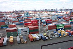
The Northeast Corridor and Interstate 95 in the region link an almost contiguous urban region, which includes large and small cities and their respective suburbs and forms the Northeast megalopolis, one of the world's most important concentrations of finance, media, communications, education, medicine, and technology.
The region is home to eight of the top 25 ranked universities in the nation: Cornell University in Ithaca, New York; Columbia University in New York City; Princeton University in Princeton, New Jersey; the University of Pennsylvania in Philadelphia; Carnegie Mellon University in Pittsburgh; Johns Hopkins University in Baltimore, Georgetown University in Washington, D.C.; and the University of Virginia in Charlottesville, Virginia according to U.S. News & World Report Best Colleges Ranking. [12] [13] [14]