Amazon Basin (sedimentary basin)

Last updated

Amazon Basin
Bacia do Amazonas
Relief Map of Brazil.jpg
Red pog.svg
Amazon Basin2.jpg
The basin is located in the center and center-right of the picture.
Coordinates 2°29′47″S57°3′25″W / 2.49639°S 57.05694°W / -2.49639; -57.05694
Etymology Amazon River
Location South America
Region North
CountryFlag of Brazil.svg  Brazil
State(s) Amazonas, Pará
Cities Manaus
Characteristics
On/OffshoreOnshore
Boundaries Guiana Shield, Gurupá Arch; Marajó Basin, Brazilian Shield, Púrus Arch; Solimões Basin
Part ofAmazon basins
Area620,000 km2 (240,000 sq mi)
Hydrology
River(s) Amazon River
Geology
Basin type Continental rift basin
Plate South America
Age Cambrian-recent
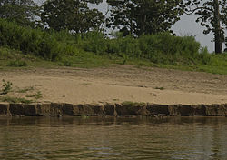
Amazon alluvium deposit Amazon alluvium deposit - autazes.jpg
Amazon alluvium deposit

The Amazon Basin is a large sedimentary basin (620,000 square kilometres (240,000 sq mi)) located near the middle and lower course of the Amazon River, south the Guiana Shield and north of the Central Brazilian Shield. The basin developed on a rift that originated about 550 million years ago during the Cambrian.

Contents

Location

The Amazon Basin is located south of the Guiana Shield, north of the Central Brazilian Shield, east of the Solimões Basin, and west of the Marajó Basin. It is bound to the west by the Púrus Arch and in the east by the Gurupá Arch. The basin has an elongated shape with a WSW-ENE orientation. Its long axis runs from the vicinity of Manaus to the area near the confluence of Xingu River with the Amazon River.

Evolution of the basin

The Amazon Basin was developed on a rift, called the Sub-Amazonal Rift, that originated about 550 million years ago during continental collision of the West African Craton. [1] Parts of the rift were reactivated during the opening of the South Atlantic. [1] The Amazon Basin evolved through tectonic activity including continental collision, subduction, and distortion of parts of the Andes Mountain Range. [2]

Bauxite deposits

The Amazon basin hosts large deposits of the aluminum-rich sedimentary rock bauxite. [3] The discovery of bauxite deposits approximately 70 years ago [3] made Brazil one of the most important countries in terms of both production and possession of bauxite deposits.

Related Research Articles

<span class="mw-page-title-main">Geology of the Appalachians</span> Geologic description of the Appalachian Mountains

The geology of the Appalachians dates back more than 1.2 billion years to the Mesoproterozoic era when two continental cratons collided to form the supercontinent Rodinia, 500 million years prior to the development of the range during the formation of Pangea. The rocks exposed in today's Appalachian Mountains reveal elongate belts of folded and thrust faulted marine sedimentary rocks, volcanic rocks, and slivers of ancient ocean floor—strong evidences that these rocks were deformed during plate collision. The birth of the Appalachian ranges marks the first of several mountain building plate collisions that culminated in the construction of Pangea with the Appalachians and neighboring Anti-Atlas mountains near the center. These mountain ranges likely once reached elevations similar to those of the Alps and the Rocky Mountains before they were eroded.

The Campos Basin is one of 12 coastal sedimentary basins of Brazil. It spans both onshore and offshore parts of the South Atlantic with the onshore part located near Rio de Janeiro. The basin originated in Neocomian stage of the Cretaceous period 145–130 million years ago during the breakup of Gondwana. It has a total area of about 115,000 square kilometres (44,000 sq mi), with the onshore portion small at only 500 square kilometres (190 sq mi).

<span class="mw-page-title-main">Rift</span> Geological linear zone where the lithosphere is being pulled apart

In geology, a rift is a linear zone where the lithosphere is being pulled apart and is an example of extensional tectonics. Typical rift features are a central linear downfaulted depression, called a graben, or more commonly a half-graben with normal faulting and rift-flank uplifts mainly on one side. Where rifts remain above sea level they form a rift valley, which may be filled by water forming a rift lake. The axis of the rift area may contain volcanic rocks, and active volcanism is a part of many, but not all, active rift systems.

<span class="mw-page-title-main">Geology of the United States</span>

The richly textured landscape of the United States is a product of the dueling forces of plate tectonics, weathering and erosion. Over the 4.5 billion-year history of the Earth, tectonic upheavals and colliding plates have raised great mountain ranges while the forces of erosion and weathering worked to tear them down. Even after many millions of years, records of Earth's great upheavals remain imprinted as textural variations and surface patterns that define distinctive landscapes or provinces.

<span class="mw-page-title-main">Geology of Colombia</span>

Geology of Colombia refers to the geological composition of the Republic of Colombia that determines its geography. Most of the emerged territory of Colombia covers vast areas within the South American Plate, whereas much submerged territory lies within the Caribbean Plate and the Nazca Plate.

<span class="mw-page-title-main">Laurentia</span> Craton forming the geological core of North America

Laurentia or the North American Craton is a large continental craton that forms the ancient geological core of North America. Many times in its past, Laurentia has been a separate continent, as it is now in the form of North America, although originally it also included the cratonic areas of Greenland and the Hebridean Terrane in northwest Scotland. During other times in its past, Laurentia has been part of larger continents and supercontinents and consists of many smaller terranes assembled on a network of early Proterozoic orogenic belts. Small microcontinents and oceanic islands collided with and sutured onto the ever-growing Laurentia, and together formed the stable Precambrian craton seen today.

<span class="mw-page-title-main">Geology of Russia</span>

The geology of Russia, the world's largest country, which extends over much of northern Eurasia, consists of several stable cratons and sedimentary platforms bounded by orogenic (mountain) belts.

<span class="mw-page-title-main">Geology of Massachusetts</span>

The geology of Massachusetts includes numerous units of volcanic, intrusive igneous, metamorphic and sedimentary rocks formed within the last 1.2 billion years. The oldest formations are gneiss rocks in the Berkshires, which were metamorphosed from older rocks during the Proterozoic Grenville orogeny as the proto-North American continent Laurentia collided against proto-South America. Throughout the Paleozoic, overlapping the rapid diversification of multi-cellular life, a series of six island arcs collided with the Laurentian continental margin. Also termed continental terranes, these sections of continental rock typically formed offshore or onshore of the proto-African continent Gondwana and in many cases had experienced volcanic events and faulting before joining the Laurentian continent. These sequential collisions metamorphosed new rocks from sediments, created uplands and faults and resulted in widespread volcanic activity. Simultaneously, the collisions raised the Appalachian Mountains to the height of the current day Himalayas.

<span class="mw-page-title-main">Geology of North America</span>

The geology of North America is a subject of regional geology and covers the North American continent, the third-largest in the world. Geologic units and processes are investigated on a large scale to reach a synthesized picture of the geological development of the continent.

<span class="mw-page-title-main">Himalayan foreland basin</span> Active collisional foreland basin in South Asia

The Himalayan foreland basin is an active collisional foreland basin system in South Asia. Uplift and loading of the Eurasian Plate on to the Indian Plate resulted in the flexure (bending) of the Indian Plate, and the creation of a depression adjacent to the Himalayan mountain belt. This depression was filled with sediment eroded from the Himalaya, that lithified and produced a sedimentary basin ~3 to >7 km deep. The foreland basin spans approximately 2,000 kilometres (1,200 mi) in length and 450 kilometres (280 mi) in width. From west to east the foreland basin stretches across five countries: Pakistan, India, Nepal, Bangladesh, and Bhutan.

<span class="mw-page-title-main">Owambo Basin</span>

The Owambo Basin is a sedimentary basin located on the Congo Craton in Southern Africa that extends from southern Angola into Namibia and includes the Etosha Pan. It is bound on the southern and western sides by the Damara Belt in Northern Namibia, and by the Cubango River to the East. The northern boundary is scientifically disputed, but is currently mapped by most stratigraphers to include southern Angola with the boundary set at the Kunene River. The Owambo Basin is host to two famous regions: Tsumeb, a major Namibian city and site of a formerly active copper mine with exceptional mineralogical variability producing museum quality rare specimens, and Etosha National Park, the largest protected wildlife sanctuary in Namibia centered around Etosha Pan.

Guyana occurs within the northern part of the Guiana Shield. The Guiana Shield forms the northern part of the Amazonian Craton, the core of the South American continent.

<span class="mw-page-title-main">Geology of Ivory Coast</span>

The geology of Ivory Coast is almost entirely extremely ancient metamorphic and igneous crystalline basement rock between 2.1 and more than 3.5 billion years old, comprising part of the stable continental crust of the West African Craton. Near the surface, these ancient rocks have weathered into sediments and soils 20 to 45 meters thick on average, which holds much of Ivory Coast's groundwater. More recent sedimentary rocks are found along the coast. The country has extensive mineral resources such as gold, diamonds, nickel and bauxite as well as offshore oil and gas.

The geology of Malawi formed on extremely ancient crystalline basement rock, which was metamorphosed and intruded by igneous rocks during several orogeny mountain building events in the past one billion years. The rocks of the Karoo Supergroup and newer sedimentary units deposited across much of Malawi in the last 251 million years, in connection with a large rift basin on the supercontinent Gondwana and the more recent rifting that has created the East African Rift, which holds Lake Malawi. The country has extensive mineral reserves, many of them poorly understood or not exploited, including coal, vermiculite, rare earth elements and bauxite.

<span class="mw-page-title-main">Geology of New York (state)</span>

The geology of the State of New York is made up of ancient Precambrian crystalline basement rock, forming the Adirondack Mountains and the bedrock of much of the state. These rocks experienced numerous deformations during mountain building events and much of the region was flooded by shallow seas depositing thick sequences of sedimentary rock during the Paleozoic. Fewer rocks have deposited since the Mesozoic as several kilometers of rock have eroded into the continental shelf and Atlantic coastal plain, although volcanic and sedimentary rocks in the Newark Basin are a prominent fossil-bearing feature near New York City from the Mesozoic rifting of the supercontinent Pangea.

The geology of Venezuela includes ancient Precambrian igneous and metamorphic basement rocks, layered with sedimentary rocks from the Paleozoic and Mesozoic and thick geologically recent Cenozoic sediments with extensive oil and gas.

The geology of Brazil includes very ancient craton basement rock from the Precambrian overlain by sedimentary rocks and intruded by igneous activity, as well as impacted by the rifting of the Atlantic Ocean.

The geology of Newfoundland and Labrador includes basement rocks formed as part of the Grenville Province in the west and Labrador and the Avalonian microcontinent in the east. Extensive tectonic changes, metamorphism and volcanic activity have formed the region throughout Earth history.

The Moscow Basin is a major sedimentary basin and tectonic structural feature in the stable East European Craton. It has been widely studied by Russian and Scandinavian geologists.

<span class="mw-page-title-main">Parnaíba Basin</span>

The Parnaíba Basin is a large cratonic sedimentary basin located in the North and Northeast portion of Brazil. About 50% of its areal distribution occurs in the state of Maranhão, and the other 50% occurring in the state of Pará, Piauí, Tocantins, and Ceará. It is one of the largest Paleozoic basins in the South American Platform. The basin has a roughly ellipsoidal shape, occupies over 600,000 km2, and is composed of ~3.4 km of mainly Paleozoic sedimentary rock that overlies localized rifts.

References

  1. 1 2 Burke, Kevin C.; Lytwyn, Jennifer (1993). "Origin of the Rift Under the Amazon Basin as a Result of Continental Collision During Pan-African Time". International Geology Review. 35 (10): 881–897. doi:10.1080/00206819309465563.
  2. Latrubesse, Edgardo M.; Cozzuol, Mario; da Silva-Caminha, Silane A. F.; Rigsby, Catherine A.; Absy, Maria Lucia; Jaramillo, Carlos (2010). "The Late Miocene paleogeography of the Amazon Basin and the evolution of the Amazon River system". Earth-Science Reviews. 99 (3): 99–124. doi:10.1016/j.earscirev.2010.02.005. ISSN   0012-8252. S2CID   129666624.
  3. 1 2 Grubb, P. L. C. (1979). "Genesis of bauxite deposits in the lower Amazon Basin and Guianas coastal plain". Economic Geology. 74 (4): 735–750. doi:10.2113/gsecongeo.74.4.735. ISSN   0361-0128.