West African Craton

Last updated

The West African Craton (WAC) is one of the five cratons of the Precambrian basement rock of Africa that make up the African Plate, the others being the Kalahari craton, Congo craton, Saharan Metacraton and Tanzania Craton. [1] Cratons themselves are tectonically inactive, but can occur near active margins, [2] with the WAC extending across 14 countries in Western Africa, coming together in the late Precambrian and early Palaeozoic eras to form the African continent. It consists of two Archean centers juxtaposed against multiple Paleoproterozoic domains made of greenstone belts, sedimentary basins, regional granitoid-tonalite-trondhjemite-granodiorite (TTG) plutons, and large shear zones. The craton is overlain by Neoproterozoic and younger sedimentary basins. The boundaries of the WAC are predominantly defined by a combination of geophysics and surface geology, with additional constraints by the geochemistry of the region. [1] At one time, volcanic action around the rim of the craton may have contributed to a major global warming event. [3]

Contents

Location and geology

West Africa West African Craton.svg
West Africa

The craton appears to have formed when three Archean cratons fused: Leo-Man-Ghana, Taoudeni and Reguibat.
The first two docked around 2.1 Ga (billion years ago), and the Reguibat Craton docked with the craton around 2 Ga. The roots of the combined craton extend to a depth of over 300 km (190 mi) in the sub-continental lithospheric mantle. [4] The WAC stretches from the Little Atlas mountains of Morocco to the Gulf of Guinea, and is bounded by mobile belts of much younger rocks to the north, east and west. The oldest rocks were metamorphosed 2.9 to 2.5 billion years ago. In the Sahara it is mostly covered by more recent sediments from the Phanerozoic Eon. Further south, younger volcanic and sedimentary rocks outcrop in Ghana, Ivory Coast, and Sierra Leone, surrounded by even younger sediments laid down in the Precambrian. [5]

The WAC is made of two distinct regions north and south of each other; the Reguibat shield and the Man shield respectively. Both of these regions are mainly made of rocks that are either Archean or Paleoproterozoic in age, [1] with western Archean nuclei, [2] and rock types are separated by major shear zones. [6] The fold belts surrounding the WAC were folded and metamorphosed during the Pan-African and/or the Variscan orogenies. [7]

The WAC underlies the modern countries of Morocco, Algeria, Mauritania, Senegal, The Gambia, Guinea Bissau, Guinea, Mali, Burkina Faso, Sierra Leone, Liberia, Ivory Coast, Ghana, Togo and Benin.

Metamorphism and evolution

The metamorphic record of the craton is characteristic of Paleoproterozoic plate tectonics. A definitive evolution of the area has not been determined as a result of conflicting interpretation of the relationship between low-grade greenstone belts and high-grade gneissic terranes dominated by TTG suites. [8] The three major, widely accepted tectonothermal events for the WAC; the 3.5 to 2.9 Ga Pre-Leonean and Leonean Orogeny, the 2.9 to 2.8 Ga Liberian Orogeny, and the 2.15-1.8 Ga Eburnean Orogeny. [6] A definitive answer has strong implications on the geodynamic processes controlling the craton stabilization and maturation after the Archean-Proterozoic transition. Limited geochronological data indicate a prolonged period of metamorphic overprint, lasting approximately 70-million-years, with the support of Sm-Nd garnet-whole-rock isochron age data and U-Pb and Pb-Pb crystallization ages of zircon, monazite, and titanite. [8]

Overprinting relationships in the area indicate copper mineralization is associated with the first deformation event in the WAC, with gold mineralization occurring during subsequent deformation events via reactivation of magmatic and hydrothermal fluids. [1]

Constraints

The metamorphic rock of the WAC include, but are not limited to, high-grade amphibolite facies amphibolite, gneiss, paragneiss schist, calc-silicate rock, and migmatites. Portions of the region have also been metamorphosed to the greenschist facies, [2] generally termed a greenstone belt in an Archean terrane. [9] The timing of the facies is constrained by the in-situ U-Pb dating, with garnet composition providing constraints for prograde evolution at the blueschist-amphibolite facies transition. [8] The tectonic environment is constrained by a combination of geophysics, surface geology, geochemistry, and metallogenesis. [10]

Wanderings

Approximate location of Mesoproterozoic (older than 1.3 Ga) cratons in South America and Africa (the Saharan Metacraton is not shown). Cratons West Gondwana.svg
Approximate location of Mesoproterozoic (older than 1.3 Ga) cratons in South America and Africa (the Saharan Metacraton is not shown).

The Earth formed about 4.54 billion years ago. [11] As it cooled, the lithosphere, consisting of the crust and the rigid uppermost part of the mantle, solidified. The lithosphere rides on the asthenosphere, which is also solid but can flow like a liquid on geological time scales. The lithosphere is broken up into tectonic plates, which slowly move in relation to one another at speeds of 50–100 mm annually, colliding, combining into continents, splitting and drifting apart to form new continental configurations. [12]

It is difficult to reconstruct the early wanderings of the West African Craton, but around 1.13–1.071 billion years ago it seems to have been one of the cratons that came together to form Rodinia, a supercontinent. At that time, the Congo Craton lay to the west of the Amazonian Craton, and the West African Craton lay to the south where both were rotated about 180° and retain this relative configuration. [13]

Around 750 million years ago Rodinia rifted apart into three continents: Proto-Laurasia, the Congo craton and Proto-Gondwana. [14] The West African Craton may then have combined with other cratons to form Pannotia, a hypothetical supercontinent that existed from the Pan-African orogeny about 600 million years ago to the end of the Precambrian about 539 million years ago. [15] Later it became part of Gondwana, [16] and later still part of Pangaea, the supercontinent that existed during the Paleozoic and Mesozoic eras about between 335 and 175 million years ago, before North and South America separated from Eurasia and Africa and the continents started to drift towards current configurations. [17]

Snowball Earth

Volcanoes may have had a role in ending the global ice age of Snowball Earth. Mahameru-volcano.jpeg
Volcanoes may have had a role in ending the global ice age of Snowball Earth.

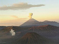
Proponents of the Snowball Earth theory claim that sometime before 650 million years ago the Earth was going through an extremely cold period. The oceans were frozen to great depths, and snow covering reflected the heat from the sun through cloudless skies. Only simple forms of life could survive in locations such as deep oceanic hydrothermal vents. [18] At the end of this period the edges of the West African craton became highly active, throwing up a ring of volcanoes. The thermal activity was caused by excessive mantle heat that had built up below the craton, insulated by the lithosphere. The volcanic eruptions created a greenhouse effect on massive scale, melting the ice and releasing CO2 into the atmosphere. The climate quickly switched to one much warmer than today, resulting in the Cambrian explosion of life forms. [3]

Features

During its wanderings, at different times covered by ice sheets, forests, marshes or arid desert, the surface of the West African Craton has been heavily eroded by ice, water and wind. In most places the original rocks are buried far below more recent volcanic and sedimentary deposits. The visible features are usually of comparatively recent origin.

Little Atlas Range and Atlas Mountains

Atlas Mountains in North Africa. Atlas-Mountains-Labeled-2.jpg
Atlas Mountains in North Africa.

The Little Atlas range formed about 300 million years ago when Euramerica and Gondwana ground against one another during the Alleghenian orogeny, a process that also formed the Appalachians in present-day North America. More recently, in the Cenozoic Era from 66 million to about 1.8 million year ago, the mountain chains that today compose the Atlas Mountains were lifted up as the European and African plates collided at the southern end of the Iberian peninsula. Erosion has reduced the Little Atlas range so that it is today lower than the High Atlas range to the north. [19] [20]

Saharan Basins

South of the mountains, the West African Craton is relatively flat, mostly desert or dry savanna apart from the areas near the Atlantic or Gulf of Guinea. However, below the surface there are ancient sedimentary basins such as the Taoudeni basin that may contain large reserves of oil and gas. [21]

Reguibat Shield

The northern Reguibat shield covers parts of Algeria, Western Sahara, [22] [23] Morocco and Mauritania. [1] It contains exposed Paleoproterozoic units to the east, and Archean to the west, including kimberlites [2] making it a primary diamond source with gold and copper deposits occurring in a sub-domain of the shield (Paleoproterozoic Yetti). [6] It experienced at least one major cooling event during the Mesozoic and three minor cooling events from the late Cretaceous to present day. Low temperature thermochronology data indicates that the western side of the shield has an igneous differentiation post-Triassic thermal history, largely controlled by vertical movements of the crust via burial and exhumation processes. [7]

Man Shield

The southern Man shield covers the countries Ivory Coast, Mali, Burkina Faso, Ghana, Sierra Leone, Liberia, and Guinea. [1] In this shield, a large portion of the WAC consists of Paleoproterozoic Birimian continent. [2] The Birimian units were initially produced in an immature volcanic arc setting, which was later metamorphosed during the Eburnean orogeny. The poor exposure of the greenstone belt in the area limits interpretations of a broad structural context. The limited greenstone belt exposure indicates a major deformation event associated with granitoid intrusions. [9]

The shield hosts world-class gold deposits, important iron ore concentrations, and the mineralization of aluminum ore, lead-zinc, manganese, phosphate, and uranium. A majority of the gold deposit formations occurred during the Eburnean orogeny, but a number of the remaining gold deposits formed before this orogeny during a period of oceanic arc-back-arc basin formation and erosion during the Neoproterozoic and Cretaceous. [6]

Mining activity

Within the West African Craton, there is a large amount of mining activity covering resources such as gold, copper, cobalt, silver, tin, and zinc. [24]

Artisanal mining activity in the craton dates back to the early 1960s which used quartz vein debris as a gold indicator. [25] Placer gold is primarily exploited by the artisanal miners, with other deposit types being mined by open-pit or by excavation mining (surface mining or sub-surface mining). [6] In 1985 the State of Burkina Faso created an official structure, known as Le Projet Orpaillage, for the management of gold mining and buying in the region. Metallurgical studies on the gold panning rejects were funded by the United Nations Development Programme (UNDP) and the Bureau de Recherches Géologiques et Minières (BUMIGEB). The treatment of mine tailings collected from artisanal working gold was the principle operation conducted by the Compagnie d'Exploitation des Mines d'Or du Burkina (CEMOB), operating a heap leach plant which processed approximately 500 tonnes of gold panning rejects per day. [25]

Mining in Sierra Leone

Following the Mineral Act, organized mining began in 1927 with significant mineral discovery in the 1930s and 40s resulting in medium to moderately sized mines; iron ore, two extensive alluvial gold field deposits, placer gold, alluvial diamonds, and chromite deposits. Quarrying and mining provides a livelihood for greater than 250 thousand people in Sierra Leone alone, employing approximately 15% of its population, producing a significant amount of material to qualify as a resource-rich country. The mining of the WAC can establish a strong economy and government development support, helping the alleviation of poverty. [26]

See also

Related Research Articles

<span class="mw-page-title-main">Proterozoic</span> Third eon of the geologic timescale, last eon of the Precambrian Supereon

The Proterozoic is a geological eon spanning the time interval from 2500 to 538.8 million years ago. It is the most recent part of the Precambrian "supereon". It is also the longest eon of the Earth's geologic time scale, and it is subdivided into three geologic eras : the Paleoproterozoic, Mesoproterozoic, and Neoproterozoic.

<span class="mw-page-title-main">Greenstone belt</span> Zone of variably metamorphosed rocks occurring in Archaean and Proterozoic cratons

Greenstone belts are zones of variably metamorphosed mafic to ultramafic volcanic sequences with associated sedimentary rocks that occur within Archaean and Proterozoic cratons between granite and gneiss bodies.

<span class="mw-page-title-main">North China Craton</span> Continental crustal block in northeast China, Inner Mongolia, the Yellow Sea, and North Korea

The North China Craton is a continental crustal block with one of Earth's most complete and complex records of igneous, sedimentary and metamorphic processes. It is located in northeast China, Inner Mongolia, the Yellow Sea, and North Korea. The term craton designates this as a piece of continent that is stable, buoyant and rigid. Basic properties of the cratonic crust include being thick, relatively cold when compared to other regions, and low density. The North China Craton is an ancient craton, which experienced a long period of stability and fitted the definition of a craton well. However, the North China Craton later experienced destruction of some of its deeper parts (decratonization), which means that this piece of continent is no longer as stable.

<span class="mw-page-title-main">Trans-Hudson orogeny</span> Mountain-building event in North America

The Trans-Hudson orogeny or Trans-Hudsonian orogeny was the major mountain building event (orogeny) that formed the Precambrian Canadian Shield and the North American Craton, forging the initial North American continent. It gave rise to the Trans-Hudson orogen (THO), or Trans-Hudson Orogen Transect (THOT), which is the largest Paleoproterozoic orogenic belt in the world. It consists of a network of belts that were formed by Proterozoic crustal accretion and the collision of pre-existing Archean continents. The event occurred 2.0–1.8 billion years ago.

<span class="mw-page-title-main">Geology of Saskatchewan</span> Geologic features of the Canadian province

The geology of Saskatchewan can be divided into two main geological regions, the Precambrian Canadian Shield and the Phanerozoic Western Canadian Sedimentary Basin. Within the Precambrian shield exists the Athabasca sedimentary basin. Meteorite impacts have altered the natural geological formation processes. The prairies were most recently affected by glacial events in the Quaternary period.

<span class="mw-page-title-main">Birimian</span>

The Birimian rocks are major sources of gold and diamonds that extend through Ghana, Côte d'Ivoire, Guinea, Mali and Burkina Faso. They are named after the Birim River, one of the main tributaries of the Pra River in Ghana and the country's most important diamond-producing area. Ghana and Mali are the second and third largest producers of gold in Africa, respectively.

<span class="mw-page-title-main">Man Shield</span>

The Man Shield is a geological shield or craton in the southeast portion of the West African Craton. The shield is in part overlaid by gold-bearing Birimian formations.

<span class="mw-page-title-main">Eburnean orogeny</span> Mountain building event in what is now West Africa

The Eburnean orogeny, or Eburnean cycle, was a series of tectonic, metamorphic and plutonic events in what is now West Africa during the Paleoproterozoic era about 2200–2000 million years ago. During this period the Birimian domain in West Africa was established and structured.

The geology of South Africa is highly varied including cratons, greenstone belts, large impact craters as well as orogenic belts. The geology of the country is the base for a large mining sector that extracts gold, diamonds, iron and coal from world-class deposits. The geomorphology of South Africa consists of a high plateau rimmed to west, south and southeast by the Great Escarpment, and the rugged mountains of the Cape Fold Belt. Beyond this there is strip of narrow coastal plain.

The geology of Central African Republic (CAR) is part of the broader geology of Africa. CAR occupies a swath of ancient rocks, dating back billions of years that record significant aspects of Earth history and yield minerals vital to the country's small economy.

The geology of Liberia is largely extremely ancient rock formed between 3.5 billion and 539 million years ago in the Archean and the Neoproterozoic, with some rocks from the past 145 million years near the coast. The country has rich iron resources as well as some diamonds, gold and other minerals in ancient sediment formations weathered to higher concentrations by tropical rainfall.

<span class="mw-page-title-main">Geology of Ghana</span>

The geology of Ghana is primarily very ancient crystalline basement rock, volcanic belts and sedimentary basins, affected by periods of igneous activity and two major orogeny mountain building events. Aside from modern sediments and some rocks formed within the past 541 million years of the Phanerozoic Eon, along the coast, many of the rocks in Ghana formed close to one billion years ago or older leading to five different types of gold deposit formation, which gave the region its former name Gold Coast.

<span class="mw-page-title-main">Geology of the Democratic Republic of the Congo</span>

The geology of the Democratic Republic of the Congo is extremely old, on the order of several billion years for many rocks. The country spans the Congo Craton: a stable section of ancient continental crust, deformed and influenced by several different mountain building orogeny events, sedimentation, volcanism and the geologically recent effects of the East Africa Rift System in the east. The country's complicated tectonic past have yielded large deposits of gold, diamonds, coltan and other valuable minerals.

<span class="mw-page-title-main">Geology of Ivory Coast</span>

The geology of Ivory Coast is almost entirely extremely ancient metamorphic and igneous crystalline basement rock between 2.1 and more than 3.5 billion years old, comprising part of the stable continental crust of the West African Craton. Near the surface, these ancient rocks have weathered into sediments and soils 20 to 45 meters thick on average, which holds much of Ivory Coast's groundwater. More recent sedimentary rocks are found along the coast. The country has extensive mineral resources such as gold, diamonds, nickel and bauxite as well as offshore oil and gas.

The geology of Mauritania is built on more than two billion year old Archean crystalline basement rock in the Reguibat Shield of the West African Craton, a section of ancient and stable continental crust. Mobile belts and the large Taoudeni Basin formed and filled with sediments in the connection with the Pan-African orogeny mountain building event 600 million years ago and a subsequent orogeny created the Mauritanide Belt. In the last 251 million years, Mauritania has accumulated additional sedimentary rocks during periods of marine transgression and sea level retreat. The arid country is 50% covered in sand dunes and has extensive mineral resources, although iron plays the most important role in the economy.

The geology of Mozambique is primarily extremely old Precambrian metamorphic and igneous crystalline basement rock, formed in the Archean and Proterozoic, in some cases more than two billion years ago. Mozambique contains greenstone belts and spans the Zimbabwe Craton, a section of ancient stable crust. The region was impacted by major tectonic events, such as the mountain building Irumide orogeny, Pan-African orogeny and the Snowball Earth glaciation. Large basins that formed in the last half-billion years have filled with extensive continental and marine sedimentary rocks, including rocks of the extensive Karoo Supergroup which exist across Southern Africa. In some cases these units are capped by volcanic rocks. As a result of its complex and ancient geology, Mozambique has deposits of iron, coal, gold, mineral sands, bauxite, copper and other natural resources.

<span class="mw-page-title-main">Geology of Sweden</span>

The geology of Sweden is the regional study of rocks, minerals, tectonics, natural resources and groundwater in the country. The oldest rocks in Sweden date to more than 2.5 billion years ago in the Precambrian. Complex orogeny mountain building events and other tectonic occurrences built up extensive metamorphic crystalline basement rock that often contains valuable metal deposits throughout much of the country. Metamorphism continued into the Paleozoic after the Snowball Earth glaciation as the continent Baltica collided with an island arc and then the continent Laurentia. Sedimentary rocks are most common in southern Sweden with thick sequences from the last 250 million years underlying Malmö and older marine sedimentary rocks forming the surface of Gotland.

The geology of Nunavut began to form nearly three billion years ago in the Archean and the territory preserves some of the world's oldest rock units.

The Superior Craton is a stable crustal block covering Quebec, Ontario, and southeast Manitoba in Canada, and northern Minnesota in the United States. It is the biggest craton among those formed during the Archean period. A craton is a large part of the Earth's crust that has been stable and subjected to very little geological changes over a long time. The size of Superior Craton is about 1,572,000 km2. The craton underwent a series of events from 4.3 to 2.57 Ga. These events included the growth, drifting and deformation of both oceanic and continental crusts.

References

  1. 1 2 3 4 5 6 Jessell M.W., Liégeois J-P. (2015). "100 years of research on the West African Craton". Journal of African Earth Sciences. 112(B): 377– 381. doi : 10.1016/j.jafrearsci.2015.10.008
  2. 1 2 3 4 5 Ennih N. & Liégeois J-P. (2008). The Boundaries of the West African Craton. Geological Society, London, Special Publications. 297: 1–17. doi : 10.1144/SP297.1
  3. 1 2 Doblas, Miguel; López-Ruiz, José; Cebriá, José-María; Youbi, Nasrrddine; Degroote, Eugenio (September 2002). "Mantle insulation beneath the West African craton during the Precambrian-Cambrian transition". Geology. 30 (9): 839. Bibcode:2002Geo....30..839D. doi:10.1130/0091-7613(2002)030<0839:MIBTWA>2.0.CO;2.
  4. G.C. Begg1, W.L. Griffin, L.M. Natapov, Suzanne Y. O'Reilly, S.P. Grand, C.J. O'Neill, J.M.A. Hronsky, Y. Poudjom Djomani, C.J. Swain, T. Deen and P. Bowden (2009). "The lithospheric architecture of Africa: Seismic tomography, mantle petrology, and tectonic evolution". Geosphere. 5 (1): 23–50. Bibcode:2009Geosp...5...23B. doi: 10.1130/GES00179.1 .{{cite journal}}: CS1 maint: multiple names: authors list (link)
  5. Peter Evans. "African geology". Fortune City. Archived from the original on February 6, 2009. Retrieved 2009-03-15.
  6. 1 2 3 4 5 Markwitz V., Hein K.A.A., Jessell M.W., Miller J. (2016). Metallogenic portfolio of the West African craton. Ore Geology Reviews. 78: 558-563. https://doi.org/10.1016/j.oregeorev.2015.10.024
  7. 1 2 Gouiza M., Bertotti G., Andriessen P.A.M. (2018). Mesozoic and Cenozoic thermal history of the Western Reguibat Shield (West African Craton). Terra Nova. 30(2): 135-145. https://doi.org/10.1111/ter.12318
  8. 1 2 3 Block S., Ganne J., Baratoux L., Zeh A., Parra-Avila L.A., Jessell M., Ailleres L., Siebenaller L. (2015). Petrological and geochronological constraints on lower crustexhumation during Paleoproterozoic (Eburnean) orogeny,NW Ghana, West African Craton. Journal of Metamorphic Geology. 33: 463-494. https://doi.org/10.1111/jmg.12129
  9. 1 2 Ganne J., De Andrade V., Weinberg R.F., Vidal O., Dubacq B., Kagambega N., Naba S., Baratoux L., Jessell M., Allibon J. (2011). Modern-style plate subduction preserved in the Palaeoproterozoic West African craton. Nature: Geoscience. 5: 60-65. https://doi.org/10.1038/ngeo1321
  10. Jessell M.W., Begg G.C., Miller M.S. (2016). The geophysical signatures of the West African Craton. Precambrian Research. 274: 3-24. https://doi.org/10.1016/j.precamres.2015.08.010
  11. "Age of the Earth". U.S. Geological Survey. 1997. Retrieved 2006-01-10.
  12. Read HH; Watson Janet (1975). Introduction to Geology. New York: Halsted. pp. 13–15.
  13. "Rodinia". Palaeos (Toby White). Archived from the original on 2009-02-18. Retrieved 2009-03-15.
  14. Torsvik, T.H.; 2003: The Rodinia Jigsaw Puzzle, Science 300, pp. 1379-1381.
  15. "Pannotia". Palaeos. Archived from the original on 2006-03-13. Retrieved 2006-03-12.
  16. "Geophysical computer model". University of Leeds. Retrieved 21 Oct 2008.
  17. Plate Tectonics and Crustal Evolution, Third Ed., 1989, by Kent C. Condie, Pergamon Press
  18. Kirschvink, J.L. (1992). "Late Proterozoic low-latitude global glaciation: The snowball Earth" (PDF). In Schopf, JW; Klein, C. (eds.). The Proterozoic Biosphere: A Multidisciplinary Study. Cambridge University Press, Cambridge. pp. 51–52.
  19. http://einstein.uab.cat/c_geotectonica/WebAtlas/AtlasLitho.htm%5B%5D Potential field modelling of the Atlas lithosphere
  20. http://einstein.uab.cat/c_geotectonica/WebAtlas/MaterialAtlas/Ayarzaetal2005.pdf%5B%5D Crustal structure under the central High Atlas Mountains (Morocco) from geological and gravity data, P. Ayarza, et al., 2005, Tectonophysics, 400, 67-84
  21. Wright, J.B. (1985). Geology and mineral resources of West Africa. London: Allen & Unwin. ISBN   978-0-04-556001-1.
  22. Petrology and Geochemistry of Magmatic Suites of Rocks in the Continental and Oceanic Crusts. ULB. 1996. p. 291. The Reguibat Shield is distributed between Mauritania , Western Sahara and Algeria
  23. Lauri J. Pesonen, Johanna Salminen, Sten-Ake Elming, David A.D. Evans, Toni Veikkolainen (2021). Ancient Supercontinents and the Paleogeography of Earth. Elsevier. p. 426. ISBN   978-0-12-818534-6.{{cite book}}: CS1 maint: multiple names: authors list (link)
  24. Yager et al. 2012, The Mineral Industries of Africa
  25. 1 2 Tshibubudze A., and Hein K. (2016). Gold mineralization in the Essakane goldfield in Burkina Faso, West African Craton. Ore Geology Reviews. 78: 652-659. https://doi.org/10.1016/j.oregeorev.2015.10.030
  26. Jalloh A.B., Sasaki K., Thomas M.O., Jalloh Y. (2013). The Geology, Mineral Resources of Sierra Leone and how the Resources can be Used to Develop the Nation. Procedia Earth and Planetary Science. 6: 131-138 https://doi.org/10.1016/j.proeps.2013.01.018

Further reading