
Sierra Leone is located on the west coast of Africa, between the 7th and 10th parallels north of the equator. Sierra Leone is bordered by Guinea to the north and northeast, Liberia to the south and southeast, and the Atlantic Ocean to the west.
The economy of Sierra Leone is that of a least developed country with a GDP of approximately 1.9 billion USD in 2009. Since the end of the civil war in 2002 the economy is gradually recovering with a GDP growth rate between 4 and 7%. In 2008 its GDP in PPP ranked between 147th and 153rd (CIA) largest in the world.

The Sierra Madre Oriental is a mountain range in northeastern Mexico. The Sierra Madre Oriental is part of the American Cordillera, a chain of mountain ranges (cordillera) that consists of an almost continuous sequence of mountain ranges that form the western "backbone" of North America, Central America, South America and Antarctica.

The Sierra Nevada de Santa Marta is an isolated mountain range separated from the Andes chain that runs through Colombia. Reaching an altitude of 5,700 m (18,700 ft) just 42 km (26 mi) from the Caribbean coast, the Sierra Nevada is one of the world's highest coastal ranges, being 250m shorter than the Saint Elias Mountains in Canada. The Sierra Nevada encompasses about 17,000 km2 (6,600 sq mi) and serves as the source of 36 rivers. The range is in the Departments of Magdalena, Cesar and La Guajira.

Tiwai Island is a wildlife sanctuary and tourist site in Sierra Leone. Run by the non-governmental organization Environmental Foundation for Africa, Tiwai is 12 square kilometers in area and located on the Moa River in the Southern Province. It is also one of the largest inland islands in the country.
Western Area Forest Reserve, also known as the Western Area Peninsula Forest Reserve, is a non-hunting forest reserve in Sierra Leone. The area became a forest reserve in 1916 and has an area of 17,688 hectares (68.29 sq mi). It was demarcated by Charles Lane Poole, Sierra Leone's first ever 'Conservator of Forests,' and founder of the Sierra Leonean Forestry Department. It is the westernmost semi-deciduous closed canopy forest in Sierra Leone. The forest is home to various endangered species, including a wide variety of endangered birds and Duiker.
Kangari Hills Forest Reserve is a non-hunting forest reserve in the centre of Sierra Leone. The area became a forest reserve in 1924. Lying between 200 and 500 metres above sea level, the reserve has an area of 8,573 hectares (85.73 km²), although parts of it area have been encroached upon by farming and mining. The Reserve is one of the few places in Sierra Leone where the endangered forest elephant survives.
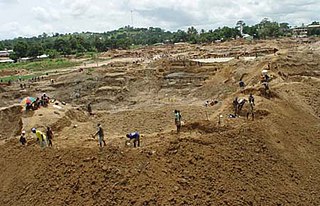
Farangbaia Forest Reserve is a forest reserve with a rainforest ecosystem in Sierra Leone. The Reserve covers an area of 1,260 hectares, is located approximately 10 km to the south-east of the town of Bumbuna and forms part of the catchment area for the Seli River. Since the outbreak of Sierra Leone civil war in 1991 much of the reserve has become farmland and bush forest and there a number sawmills operating there.
The Tingi Hills Forest Reserve is located in a mountain range in the east of Sierra Leone and occupies an area of 118.85 km2 (45.89 sq mi). It became a forest reserve in 1947 and a non-hunting forest reserve in 1973. The area reaches from an altitude of 400 to 1850 metres at the north peak of the dual peaked Sankan Biriwa massif. In the lower regions the area consists of forest interspersed with savannah then moves into shrub savannah and then mountain grassland at higher altitudes. Over 200 species of birds have been recorded in the area and the reserve is also home to western baboons and forest elephants.
Sankan Biriwa is a mountain massif in the east of Sierra Leone with two peaks, both over 1,800 metres, the northernmost is the second highest in Sierra Leone at 1,850 m. The mountain is part of the Tingi Hills Forest Reserve.
Kasewe Forest Reserve is an area of hills in the Moyamba District of Sierra Leone. It is designated as a forest reserve and contains moist semi-deciduous and evergreen forests that cover an area of 1.224 km². Made up of volcanic rock the hills stand about 500m above the interior plains of the country. The nearest town is Lunsar.

The Sierra de la Culebra, Portuguese: Serra da Coroa, is a mountain range in Castile and León, northwest Spain, and northeastern Portugal. It lies 7 km south of Puebla de Sanabria in the comarcas of Aliste, Sanabria and La Carballeda, as well as Vinhais and Bragança municipalities in the District of Bragança. Its highest point is 1,243 metres (4,078 ft) high Peña Mira, located near Flechas, within Figueruela de Arriba municipal term; other important peaks are Miño Cuevo 1,211 metres (3,973 ft) and Campanario 1,020 metres (3,350 ft).
The Sankan Biriwa No or Non - Hunting Forest Reserve is found in Sierra Leone. It was established in 1947. This site is 118km².

The Guinean montane forests are a tropical moist broadleaf forest ecoregion of West Africa

The Sierra Madre is the longest mountain range in the Philippines. Running in the north-south direction from the provinces of Cagayan to the north and Quezon to the south, the mountains form the eastern backbone of Luzon Island, the largest island of the archipelago. It is bordered by the Pacific Ocean to the east. The Pacific coast of Luzon along the Sierra Madre is less developed as the lofty and continuous mountains forms a bold and an almost inaccessible shore, exposed to the full force of the northeast monsoon and the waves of the Pacific Ocean. Some of communities east of the mountain range and along the coast are so remote they are only accessible by plane or boat.

The Tehuacán-Cuicatlán biosphere reserve is a protected natural area located in southeastern Mexico. Its name derives from its two main locations: Cuicatlán and Tehuacán, in the latter are their administrative offices, covers 490,186 hectares distributed among 21 municipalities in the state of Puebla and Oaxaca.
Sugar Loaf is a forested mountain in the Western Area of Sierra Leone in west Africa. The capital city of Freetown is built around its lower slopes. Parts of the mountain are protected as the Western Area Forest Reserve.

The Lion Mountains are a mountain range in Sierra Leone. The range stretches 30 kilometers on the Freetown Peninsula by the Atlantic Ocean, southeast of the capital Freetown. The mountains are part of the Western Area Forest Reserve, a nature reserve with a hunting ban, established in 1916. The highest point is Picket Hill at 888 meters.


