
Mali is a landlocked nation in West Africa, located southwest of Algeria, extending south-west from the southern Sahara Desert through the Sahel to the Sudanian savanna zone. Mali's size is 1,240,192 square kilometers.
Greenstone belts are zones of variably metamorphosed mafic to ultramafic volcanic sequences with associated sedimentary rocks that occur within Archaean and Proterozoic cratons between granite and gneiss bodies.

Bambouk is a traditional name for the territory in eastern Senegal and western Mali, encompassing the Bambouk Mountains on its eastern edge, the valley of the Faleme River and the hilly country to the east of the river valley. It was a formally described district in French Sudan, but in 1895, the border between French Sudan and Senegal was moved to the Faleme River, placing the western portion of the district within Senegal. The term is still used to designate the region, but there is no formal administrative area with that name.

The Yilgarn Craton is a large craton that constitutes a major part of the Western Australian land mass. It is bounded by a mixture of sedimentary basins and Proterozoic fold and thrust belts. Zircon grains in the Jack Hills, Narryer Terrane have been dated at ~4.27 Ga, with one detrital zircon dated as old as 4.4 Ga.
The Gawler Craton covers approximately 440,000 square kilometres of central South Australia. Its Precambrian crystalline basement crustal block was cratonised ca. 1550–1450 Ma. Prior to 1550 Ma the craton comprised a number of active Proterozoic orogenic belts extending back in time to at least 2450 Ma.
The West African Craton (WAC) is one of the five cratons of the Precambrian basement rock of Africa that make up the African Plate, the others being the Kalahari craton, Congo craton, Saharan Metacraton and Tanzania Craton. Cratons themselves are tectonically inactive, but can occur near active margins, with the WAC extending across 14 countries in Western Africa, coming together in the late Precambrian and early Palaeozoic eras to form the African continent. It consists of two Archean centers juxtaposed against multiple Paleoproterozoic domains made of greenstone belts, sedimentary basins, regional granitoid-tonalite-trondhjemite-granodiorite (TTG) plutons, and large shear zones. The craton is overlain by Neoproterozoic and younger sedimentary basins. The boundaries of the WAC are predominantly defined by a combination of geophysics and surface geology, with additional constraints by the geochemistry of the region. At one time, volcanic action around the rim of the craton may have contributed to a major global warming event.

The Birim River is one of the main tributaries of the Pra River in Ghana and the country's most important diamond-producing area, flowing through most of the width of the Eastern region. The river rises in the east of the Atewa Range, flows north through the gap between this range and the Kwahu Plateau, then runs roughly south-west until it joins the Pra. It gives its name to the Birimian rock formation, which yields most of the gold in the region. Ghana is the second largest producer of gold in Africa.

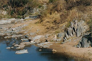
The Man Shield is a geological shield or craton in the southeast portion of the West African Craton. The shield is in part overlaid by gold-bearing Birimian formations.
Rift Valley Resources Limited is a mineral exploration company with tenements in highly prospective areas of Tanzania.
The Eburnean orogeny, or Eburnean cycle, was a series of tectonic, metamorphic and plutonic events in what is now West Africa during the Paleoproterozoic era about 2200–2000 million years ago. During this period the Birimian domain in West Africa was established and structured.
The geology of Burkina Faso is dominated by Precambrian rocks of the Guinea Rise, a dome of Archaean rocks, composed largely of migmatites, gneisses and amphibolites, over which lie the greenstone belts of the early Proterozoic age. The latter are metasediments and metavolcanics assigned largely to the Birimian Supergroup, a suite of rocks in which can also economically significant mineralization occurs. Pre-Birimian migmatites, gneisses, and amphibolites, located under the Birimian rocks, are the oldest rocks in the country. The Birimian deposits in the southwestern part of the country are typically divided between clastic and volcano-clastic formations.

The geology of Zimbabwe in southern Africa is centered on the Zimbabwe Craton, a core of Archean basement composed in the main of granitoids, schist and gneisses. It also incorporates greenstone belts comprising mafic, ultramafic and felsic volcanics which are associated with epiclastic sediments and iron formations. The craton is overlain in the north, northwest and east by Proterozoic and Phanerozoic sedimentary basins whilst to the northwest are the rocks of the Magondi Supergroup. Northwards is the Zambezi Belt and to the east the Mozambique Belt. South of the Zimbabwe Craton is the Kaapvaal Craton separated from it by the Limpopo Mobile Belt, a zone of deformation and metamorphism reflecting geological events from Archean to Mesoproterozoic times. The Zimbabwe Craton is intruded by an elongate ultramafic/mafic igneous complex known as the Great Dyke which runs for more than 500 km along a SSW/NNE oriented graben. It consists of peridotites, pyroxenites, norites and bands of chromitite.

Geologically, Guinea is covered by a crust of a very large Archean West African Craton with its northern and western regions having formations of younger Proterozoic rocks and its eastern region consists greenstone belts under the Birimian Supergroup which account for a major portion of West Africa's gold and iron ore reserves. Weathering of paleozoïcs schists has resulted in laterisiation leading to the formation of very large bauxite deposits.

The geology of Ghana is primarily very ancient crystalline basement rock, volcanic belts and sedimentary basins, affected by periods of igneous activity and two major orogeny mountain building events. Aside from modern sediments and some rocks formed within the past 541 million years of the Phanerozoic Eon, along the coast, many of the rocks in Ghana formed close to one billion years ago or older leading to five different types of gold deposit formation, which gave the region its former name Gold Coast.

The geology of Ivory Coast is almost entirely extremely ancient metamorphic and igneous crystalline basement rock between 2.1 and more than 3.5 billion years old, comprising part of the stable continental crust of the West African Craton. Near the surface, these ancient rocks have weathered into sediments and soils 20 to 45 meters thick on average, which holds much of Ivory Coast's groundwater. More recent sedimentary rocks are found along the coast. The country has extensive mineral resources such as gold, diamonds, nickel and bauxite as well as offshore oil and gas.
The geology of Mauritania is built on more than two billion year old Archean crystalline basement rock in the Reguibat Shield of the West African Craton, a section of ancient and stable continental crust. Mobile belts and the large Taoudeni Basin formed and filled with sediments in the connection with the Pan-African orogeny mountain building event 600 million years ago and a subsequent orogeny created the Mauritanide Belt. In the last 251 million years, Mauritania has accumulated additional sedimentary rocks during periods of marine transgression and sea level retreat. The arid country is 50% covered in sand dunes and has extensive mineral resources, although iron plays the most important role in the economy.
The geology of Niger comprises very ancient igneous and metamorphic crystalline basement rocks in the west, more than 2.2 billion years old formed in the late Archean and Proterozoic eons of the Precambrian. The Volta Basin, Air Massif and the Iullemeden Basin began to form in the Neoproterozoic and Paleozoic, along with numerous ring complexes, as the region experienced events such as glaciation and the Pan-African orogeny. Today, Niger has extensive mineral resources due to complex mineralization and laterite weathering including uranium, molybdenum, iron, coal, silver, nickel, cobalt and other resources.

The geology of Senegal formed beginning more than two billion years ago. The Archean greenschist Birimian rocks common throughout West Africa are the oldest in the country, intruded by Proterozoic granites. Basins formed in the interior during the Paleozoic and filled with sedimentary rocks, including tillite from a glaciation. With the rifting apart of the supercontinent Pangaea in the Mesozoic, the large Senegal Basin filled with thick sequences of marine and terrestrial sediments. Sea levels declined in the Eocene forming large phosphate deposits. Senegal is blanketed in thick layers of terrestrial sediments formed in the Quaternary. The country has extensive natural resources, including gold, diamonds, and iron.
An orogenic gold deposit is a type of hydrothermal mineral deposit. More than 75% of the gold recovered by humans through history belongs to the class of orogenic gold deposits. Rock structure is the primary control of orogenic gold mineralization at all scales, as it controls both the transport and deposition processes of the mineralized fluids, creating structural pathways of high permeability and focusing deposition to structurally controlled locations.

The Kubi gold mine is an abandoned open pit mine located 8 kilometres (5.0 mi) northeast of Dunkwa-on-Offin and 22 kilometres (14 mi) south of Obuasi, in Central Region, southern Ghana. It is 180 kilometres (110 mi) northwest of the national capital, Accra.

