Related Research Articles

Madagascar is a large island in the Indian Ocean located 400 kilometres (250 mi) off the eastern coast of Southern Africa, east of Mozambique. It has a total area of 587,040 square kilometres (226,660 sq mi) with 581,540 square kilometres (224,530 sq mi) of land and 6,900 square kilometres (2,700 sq mi) of water. Madagascar is the fourth-largest island in the world. The highest point is Maromokotro, in the Tsaratanana Massif region in the north of the island, at 2,876 metres (9,436 ft).

The African plate, also known as the Nubian plate, is a major tectonic plate that includes much of the continent of Africa and the adjacent oceanic crust to the west and south. It is bounded by the North American plate and South American plate to the west ; the Arabian plate and Somali plate to the east; the Eurasian plate, Aegean Sea plate and Anatolian plate to the north; and the Antarctic plate to the south.

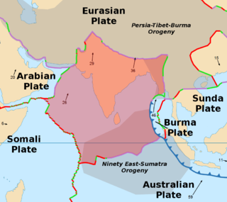
The Indian plate is a minor tectonic plate straddling the equator in the Eastern Hemisphere. Originally a part of the ancient continent of Gondwana, the Indian plate broke away from the other fragments of Gondwana 100 million years ago and began moving north, carrying Insular India with it. It was once fused with the adjacent Australian plate to form a single Indo-Australian plate; recent studies suggest that India and Australia have been separate plates for at least 3 million years. The Indian plate includes most of modern South Asia and a portion of the basin under the Indian Ocean, including parts of South China, western Indonesia, and extending up to but not including Ladakh, Kohistan, and Balochistan in Pakistan.

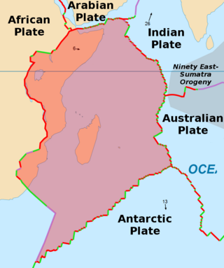
The Somali plate is a minor tectonic plate which straddles the Equator in the Eastern Hemisphere. It is currently in the process of separating from the African plate along the East African Rift Valley. It is approximately centered on the island of Madagascar and includes about half of the east coast of Africa, from the Gulf of Aden in the north through the East African Rift Valley. The southern boundary with the Nubian–African plate is a diffuse plate boundary consisting of the Lwandle plate.

The geology of India is diverse. Different regions of the Indian subcontinent contain rocks belonging to different geologic periods, dating as far back as the Eoarchean Era. Some of the rocks are very deformed and altered. Other deposits include recently deposited alluvium that has yet to undergo diagenesis. Mineral deposits of great variety are found in the subcontinent in huge quantities. Even India's fossil record is impressive in which stromatolites, invertebrates, vertebrates and plant fossils are included. India's geographical land area can be classified into the Deccan Traps, Gondwana and Vindhyan.

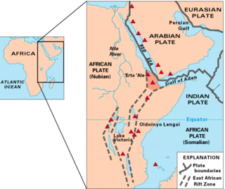
The East African Rift (EAR) or East African Rift System (EARS) is an active continental rift zone in East Africa. The EAR began developing around the onset of the Miocene, 22–25 million years ago. It was formerly considered to be part of a larger Great Rift Valley that extended north to Asia Minor.

The geology of Australia includes virtually all known rock types, spanning a geological time period of over 3.8 billion years, including some of the oldest rocks on earth. Australia is a continent situated on the Indo-Australian Plate.
The Pan-African orogeny was a series of major Neoproterozoic orogenic events which related to the formation of the supercontinents Gondwana and Pannotia about 600 million years ago. This orogeny is also known as the Pan-Gondwanan or Saldanian Orogeny. The Pan-African orogeny and the Grenville orogeny are the largest known systems of orogenies on Earth. The sum of the continental crust formed in the Pan-African orogeny and the Grenville orogeny makes the Neoproterozoic the period of Earth's history that has produced most continental crust.

The North China Craton is a continental crustal block with one of Earth's most complete and complex records of igneous, sedimentary and metamorphic processes. It is located in northeast China, Inner Mongolia, the Yellow Sea, and North Korea. The term craton designates this as a piece of continent that is stable, buoyant and rigid. Basic properties of the cratonic crust include being thick, relatively cold when compared to other regions, and low density. The North China Craton is an ancient craton, which experienced a long period of stability and fitted the definition of a craton well. However, the North China Craton later experienced destruction of some of its deeper parts (decratonization), which means that this piece of continent is no longer as stable.

The Afar Triple Junction is located along a divergent plate boundary dividing the Nubian, Somali, and Arabian plates. This area is considered a present-day example of continental rifting leading to seafloor spreading and producing an oceanic basin. Here, the Red Sea Rift meets the Aden Ridge and the East African Rift. The latter extends a total of 6,500 kilometers (4,000 mi) from the Afar Triangle to Mozambique.

Gondwana was a large landmass, sometimes referred to as a supercontinent. The remnants of Gondwana make up around two-thirds of today's continental area, including South America, Africa, Antarctica, Australia, Zealandia, Arabia, and the Indian Subcontinent.
This is a list of articles related to plate tectonics and tectonic plates.

The Seychelles Microcontinent is a microcontinent underlying Seychelles in the western Indian Ocean made of Late Precambrian rock.

The Mozambique Belt is a band in the Earth's crust that extends from East Antarctica through East Africa up to the Arabian-Nubian Shield. It formed as a suture between plates during the Pan-African orogeny, when Gondwana was formed.

The East Antarctic Shield or Craton is a cratonic rock body that covers 10.2 million square kilometers or roughly 73% of the continent of Antarctica. The shield is almost entirely buried by the East Antarctic Ice Sheet that has an average thickness of 2200 meters but reaches up to 4700 meters in some locations. East Antarctica is separated from West Antarctica by the 100–300 kilometer wide Transantarctic Mountains, which span nearly 3,500 kilometers from the Weddell Sea to the Ross Sea. The East Antarctic Shield is then divided into an extensive central craton that occupies most of the continental interior and various other marginal cratons that are exposed along the coast.

The geology of Madagascar comprises a variety of rocks of Precambrian age which make up the larger part of the east and centre of the island. They are intruded by basalts and rhyolites of Mesozoic to Cenozoic age. In contrast, the western part of the island is formed from sedimentary rocks of Carboniferous to Quaternary age. Archean rocks occur from the northeast portion of the island down to the south in the Ranotsara shear zone. Rocks in the northern portion of Madagascar are greenstone belts, from the Archean or Paleoproterozoic age.

The Aravalli Mountain Range is a northeast-southwest trending orogenic belt in the northwest part of India and is part of the Indian Shield that was formed from a series of cratonic collisions. The Aravalli Mountains consist of the Aravalli and Delhi fold belts, and are collectively known as the Aravalli-Delhi orogenic belt. The whole mountain range is about 700 km long. Unlike the much younger Himalayan section nearby, the Aravalli Mountains are believed much older and can be traced back to the Proterozoic Eon. They are arguably the oldest geological feature on Earth. The collision between the Bundelkhand craton and the Marwar craton is believed to be the primary mechanism for the development of the mountain range.

The geology of Somaliland is very closely related to the geology of Somalia. Somaliland is a de facto independent country within the boundaries that the international community recognizes as Somalia. Because it encompasses the former territory of British Somaliland, the region is historically better researched than former Italian Somaliland. Somaliland is built on more than 700 million year old igneous and metamorphic crystalline basement rock.. These ancient units are covered in thick layers of sedimentary rock formed in the last 200 million years and influenced by the rifting apart of the Somali Plate and the Arabian Plate.

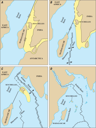
The Mascarene Basin is an oceanic basin in the western Indian Ocean. It was formed as the tectonic plate of the Indian subcontinent pulled away from the Madagascar Plate about 66–90 Mya, following the breaking up of the Gondwana supercontinent.
References
- ↑ Plummer, P. S., and E. R. Belle (1995), Mesozoic tectono–stratigraphic evolution of the Seychelles microcontinent, Sedimentary Geology , 96, 73–91.
- ↑ Timothy M. Kusky; Erkan Toraman & Tsilavo Raharimahefa (2006). "The Great Rift Valley of Madagascar: An extension of the Africa–Somali diffusive plate boundary?".
- ↑ Timothy M. Kusky; Erkan Toraman; Tsilavo Raharimahefa; Christine Rasoazanamparany (2010). "Active tectonics of the Alaotra–Ankay Graben System, Madagascar: Possible extension of Somalian–African diffusive plate boundary?". Gondwana Research. 18 (2–3): 274–294. doi:10.1016/j.gr.2010.02.003.
- 1 2 Collins, Alan S., and Brian F. Windley. "The tectonic evolution of central and northern Madagascar and its place in the final assembly of Gondwana." The Journal of Geology 110.3 (2002): 325–339.
- 1 2 3 Wit, Maarten J. de. "Madagascar: heads it's a continent, tails it's an island." Annual Review of Earth and Planetary Sciences 31.1 (2003): 213–248.
- 1 2 3 4 5 Kusky, Timothy M., Erkan Toraman, and Tsilavo Raharimahefa. "The Great Rift Valley of Madagascar: An extension of the Africa–Somali diffusive plate boundary?." Gondwana Research 11.4 (2007): 577–579.
- ↑ Grimison, Nina L., and Wang‐Ping Chen. "Earthquakes in the Davie Ridge‐Madagascar region and the southern Nubian‐Somalian plate boundary." Journal of Geophysical Research: Solid Earth (1978–2012) 93.B9 (1988): 10439-10450.
