Related Research Articles

The Paleogene Period is a geologic period and system that spans 43 million years from the end of the Cretaceous Period 66 Ma to the beginning of the Neogene Period 23.03 Ma. It is the first period of the Cenozoic Era and is divided into the Paleocene, Eocene, and Oligocene epochs. The earlier term Tertiary Period was used to define the time now covered by the Paleogene Period and subsequent Neogene Period; despite no longer being recognized as a formal stratigraphic term, "Tertiary" still sometimes remains in informal use. Paleogene is often abbreviated "Pg", although the United States Geological Survey uses the abbreviation "Pe" for the Paleogene on the Survey's geologic maps.

The Pacific-Antarctic Ridge is a divergent tectonic plate boundary located on the seafloor of the South Pacific Ocean, separating the Pacific Plate from the Antarctic Plate. It is regarded as the southern section of the East Pacific Rise in some usages, generally south of the Challenger Fracture Zone and stretching to the Macquarie Triple Junction south of New Zealand.

Faddey Faddeyevich Bellingshausen or Fabian Gottlieb Benjamin von Bellingshausen was a Russian cartographer, explorer, and naval officer of Baltic German descent, who attained the rank of admiral. He participated in the first Russian circumnavigation of the globe, and subsequently became a leader of another circumnavigation expedition that discovered the continent of Antarctica. Like Otto von Kotzebue and Adam Johann von Krusenstern, Bellingshausen belonged to the cohort of prominent Baltic German navigators who helped Russia launch its naval expeditions.

The Antarctic Peninsula, known as O'Higgins Land in Chile and Tierra de San Martín in Argentina, and originally as Graham Land in the United Kingdom and the Palmer Peninsula in the United States, is the northernmost part of mainland Antarctica.

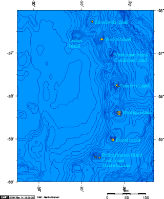
Bellingshausen Island is one of the most southerly islands of the South Sandwich Islands, close to Thule Island and Cook Island, and forming part of the Southern Thule group. It is named after its discoverer, Russian Antarctic explorer Fabian von Bellingshausen (1778–1852).

Cook Island is the central and largest island of the Southern Thule island group, part of the South Sandwich Islands in the far south Atlantic Ocean. Southern Thule was discovered by a British expedition under Captain James Cook in 1775. Cook Island was named for Cook by a Russian expedition under Fabian Gottlieb von Bellingshausen, which explored the South Sandwich islands in 1819–1820.

The Scotia Plate is a minor tectonic plate on the edge of the South Atlantic and Southern oceans. Thought to have formed during the early Eocene with the opening of the Drake Passage that separates Antarctica and South America, it is a minor plate whose movement is largely controlled by the two major plates that surround it: the Antarctic Plate and the South American Plate. The Scotia Plate takes its name from the steam yacht Scotia of the Scottish National Antarctic Expedition (1902–04), the expedition that made the first bathymetric study of the region.

The Fildes Peninsula is a 7 km (4.3 mi) long peninsula that forms the south-western end of King George Island in the South Shetland Islands of Antarctica. It was named from association with nearby Fildes Strait by the UK Antarctic Place-Names Committee in 1960; the strait was likely named for Robert Fildes, a British sealer of the 1800s.

The Kerguelen Plateau, also known as the Kerguelen–Heard Plateau, is an oceanic plateau and large igneous province (LIP) located on the Antarctic Plate, in the southern Indian Ocean. It is about 3,000 km (1,900 mi) to the southwest of Australia and is nearly three times the size of California. The plateau extends for more than 2,200 km (1,400 mi) in a northwest–southeast direction and lies in deep water.

The Bellingshausen Sea is an area along the west side of the Antarctic Peninsula between 57°18'W and 102°20'W, west of Alexander Island, east of Cape Flying Fish on Thurston Island, and south of Peter I Island. The Bellingshausen Sea borders the Eights Coast, the Bryan Coast, and the west part of the English Coast. To the west of Cape Flying Fish it joins the Amundsen Sea.

Adelaide Island is a large, mainly ice-covered island, 139 kilometres (75 nmi) long and 37 kilometres (20 nmi) wide, lying at the north side of Marguerite Bay off the west coast of the Antarctic Peninsula. The Ginger Islands lie off the southern end. Mount Bodys is the easternmost mountain on Adelaide Island, rising to over 1,220 m. The island lies within the Argentine, British and Chilean Antarctic claims.

The Phoenix Plate was a tectonic plate that existed during the early Paleozoic through late Cenozoic time. It formed a triple junction with the Izanagi and Farallon plates in the Panthalassa Ocean as early as 410 million years ago, during which time the Phoenix Plate was subducting under eastern Gondwana.
The Charcot Plate was a fragment of the Phoenix Plate. The subduction of the Charcot Plate, beneath West Antarctica, stopped before 83 Ma, and became fused onto the Antarctic Peninsula. Researchers have suggested that there are remnants of the western part of the Charcot Plate in the Bellingshausen Sea.

The Antarctic-Phoenix Ridge, also called the Phoenix Ridge, is an extinct mid-ocean ridge that consisted of three spreading ridge segments between the Antarctic Peninsula and the Scotia Sea. It initiated during the Late Cretaceous-Early Tertiary when the Phoenix Plate had divergent boundaries with the Bellingshausen and Pacific plates. Spreading along the Antarctic-Phoenix Ridge had ceased entirely by 3.3 million years ago when the small remnant of the Phoenix Plate was incorporated into the Antarctic Plate.

The Sikorski Glacier is a small glacier in the north-eastern part of the Noville Peninsula, Thurston Island, Ellsworth Land, Antarctica. It flows north-east to the Bellingshausen Sea between Mount Palmer and Mount Feury. It was first roughly delineated from aerial photos taken by the USN's Operation Highjump in 1946–47. It was named by the Advisory Committee on Antarctic Names (US-ACAN) for Stephen Sikorski, electronics technician on USS Glacier, who assisted in setting up an automatic weather station on Thurston Island during the USN's Bellingshausen Sea Expedition in February 1960.

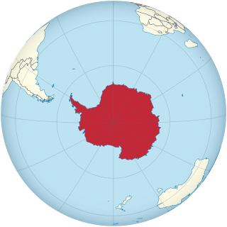
Antarctica is Earth's southernmost and least-populated continent. Situated almost entirely south of the Antarctic Circle and surrounded by the Southern Ocean, it contains the geographic South Pole. Antarctica is the fifth-largest continent, being about 40% larger than Europe, and has an area of 14,200,000 km2 (5,500,000 sq mi). Most of Antarctica is covered by the Antarctic ice sheet, with an average thickness of 1.9 km (1.2 mi).
Ferrigno Ice Stream is an ice Stream more than 15 nautical miles (28 km) long flowing into Eltanin Bay southwest of Wirth Peninsula, Antarctica. It was named by the Advisory Committee on Antarctic Names after Jane G. Ferrigno of the United States Geological Survey (USGS). Ferrigno has been a specialist for some decades from the 1970s in the use of satellite imagery for glacier studies and map compilation, co-leader of the USGS team that compiled the 1:5,000,000-scale radiometer maps of Antarctica, and task leader of the team that is compiling 25 glaciological and coastal-change maps of Antarctica.
The Antarctic Peninsula, roughly 1,000 kilometres (650 mi) south of South America, is the northernmost portion of the continent of Antarctica. Like the associated Andes, the Antarctic Peninsula is an excellent example of ocean-continent collision resulting in subduction. The peninsula has experienced continuous subduction for over 200 million years, but changes in continental configurations during the amalgamation and breakup of continents have changed the orientation of the peninsula itself, as well as the underlying volcanic rocks associated with the subduction zone.

This is an alphabetical index of all articles related to the continent of Antarctica.

The East Antarctic Shield or Craton is a cratonic rock body that covers 10.2 million square kilometers or roughly 73% of the continent of Antarctica. The shield is almost entirely buried by the East Antarctic Ice Sheet that has an average thickness of 2200 meters but reaches up to 4700 meters in some locations. East Antarctica is separated from West Antarctica by the 100–300 kilometer wide Transantarctic Mountains, which span nearly 3,500 kilometers from the Weddell Sea to the Ross Sea. The East Antarctic Shield is then divided into an extensive central craton that occupies most of the continental interior and various other marginal cratons that are exposed along the coast.
References
- Eagles, G., K. Gohl and R. D. Larter (2004) Life of the Bellingshausen plate, Geophysical Research Letters, 31, L07603 Abstract
- McCarron, Joe J. and Robert D. Larter, Late Cretaceous to early Tertiary subduction history of the Antarctic Peninsula, Journal of the Geological Society, March 1998
