Cordillera Blanca Fault Zone

Last updated

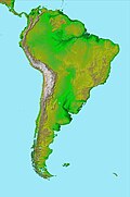
The Cordillera Blanca Fault Zone (Spanish : Falla Cordillera Blanca) is a system of geological faults located next to Cordillera Blanca in the northern Peruvian Andes. The fault is considered the most active one in northern Peru. The last time the fault ruptured was in the 1500s or before. [1] The fault zone forms the western boundary of Cordillera Blanca Batholith. [2]

Related Research Articles

<span class="mw-page-title-main">Cordillera Blanca</span> Mountain range in Peru; part of the Andes

The Cordillera Blanca is a mountain range in Peru that is part of the larger Andes range and extends for 200 kilometres (124 mi) between 8°08' and 9°58'S and 77°00' and 77°52'W, in a northwesterly direction. It includes several peaks over 6,000 metres (19,690 ft) high and 722 individual glaciers. The highest mountain in Peru, Huascarán, at 6,768 metres (22,205 ft) high, is located there.

A cordillera is an extensive chain and/or network system of mountain ranges, such as those in the west coast of the Americas. The term is borrowed from Spanish, where the word comes from cordilla, a diminutive of cuerda ('rope').

<span class="mw-page-title-main">Los Ríos Region</span> Region of Chile

The Los Ríos Region is one of Chile's 16 regions, the country's first-order administrative divisions. Its capital is Valdivia. It began to operate as a region on October 2, 2007, having been created by subdividing the Los Lagos Region in southern Chile. It consists of two provinces: Valdivia and the newly created Ranco Province, which was formerly part of Valdivia Province.

<span class="mw-page-title-main">Cordillera Oriental (Bolivia)</span> Mountain range in Bolivia

The Cordillera Oriental or Eastern Cordillera is a set of parallel mountain ranges of the Bolivian Andes, emplaced on the eastern and north eastern margin of the Andes. Large parts of Cordillera Oriental are forested and humid areas rich in agricultural and livestock products. Geologically, the Cordillera Oriental is formed by the Central Andean fold and thrust belt.

<span class="mw-page-title-main">Andean Volcanic Belt</span> Volcanic belt in South America

The Andean Volcanic Belt is a major volcanic belt along the Andean cordillera in Argentina, Bolivia, Chile, Colombia, Ecuador, and Peru. It is formed as a result of subduction of the Nazca Plate and Antarctic Plate underneath the South American Plate. The belt is subdivided into four main volcanic zones which are separated by volcanic gaps. The volcanoes of the belt are diverse in terms of activity style, products, and morphology. While some differences can be explained by which volcanic zone a volcano belongs to, there are significant differences within volcanic zones and even between neighboring volcanoes. Despite being a type location for calc-alkalic and subduction volcanism, the Andean Volcanic Belt has a broad range of volcano-tectonic settings, as it has rift systems and extensional zones, transpressional faults, subduction of mid-ocean ridges and seamount chains as well as a large range of crustal thicknesses and magma ascent paths and different amounts of crustal assimilations.

<span class="mw-page-title-main">Andean orogeny</span> Ongoing mountain-forming process in South America

The Andean orogeny is an ongoing process of orogeny that began in the Early Jurassic and is responsible for the rise of the Andes mountains. The orogeny is driven by a reactivation of a long-lived subduction system along the western margin of South America. On a continental scale the Cretaceous and Oligocene were periods of re-arrangements in the orogeny. The details of the orogeny vary depending on the segment and the geological period considered.

<span class="mw-page-title-main">Geology of Bolivia</span>

The geology of Bolivia comprises a variety of different lithologies as well as tectonic and sedimentary environments. On a synoptic scale, geological units coincide with topographical units. The country is divided into a mountainous western area affected by the subduction processes in the Pacific and an eastern lowlands of stable platforms and shields. The Bolivian Andes is divided into three main ranges; these are from west to east: the Cordillera Occidental that makes up the border to Chile and host several active volcanoes and geothermal areas, Cordillera Central once extensively mined for silver and tin and the relatively low Cordillera Oriental that rather than being a range by its own is the eastern continuation of the Central Cordillera as a fold and thrust belt. Between the Occidental and Central Cordillera the approximately 3,750-meter-high Altiplano high plateau extends. This basin hosts several freshwater lakes, including Lake Titicaca as well as salt-covered dry lakes that bring testimony of past climate changes and lake cycles. The eastern lowlands and sub-Andean zone in Santa Cruz, Chuquisaca, and Tarija Departments was once an old Paleozoic sedimentary basin that hosts valuable hydrocarbon reserves. Further east close to the border with Brazil lies the Guaporé Shield, made up of stable Precambrian crystalline rock.

<span class="mw-page-title-main">Famatinian orogeny</span> Paleozoic geological event in South America

The Famatinian orogeny is an orogeny that predates the rise of the Andes and that took place in what is now western South America during the Paleozoic, leading to the formation of the Famatinian orogen also known as the Famatinian belt. The Famatinian orogeny lasted from the Late Cambrian to at least the Late Devonian and possibly the Early Carboniferous, with orogenic activity peaking about 490 to 460 million years ago. The orogeny involved metamorphism and deformation in the crust and the eruption and intrusion of magma along a Famatinian magmatic arc that formed a chain of volcanoes. The igneous rocks of the Famatinian magmatic arc are of calc-alkaline character and include gabbros, tonalites, granodiorites and trondhjemites. The youngest igneous rocks of the arc are granites.

<span class="mw-page-title-main">Altiplano Basin</span> Sedimentary basin within the Andes in Bolivia and Peru

The Altiplano Basin is a sedimentary basin within the Andes in Bolivia and Peru. The basin is located on the Altiplano plateau between the Cordillera Occidental and the Cordillera Oriental. Over-all the basin has evolved through time in a context of horizontal shortening of Earth's crust. The great thickness of the sediments accumulated in the basin is mostly the result of the erosion of Cordillera Oriental.

The Boconó Fault is a complex of geological faults located in the Eastern Ranges of northeastern Colombia and the Mérida Andes of northwestern Venezuela. The fault has a NE-SW orientation; it is a strike-slip fault and has a dextral relative movement. It extends over a length of 500 kilometres (310 mi). The fault, with a slip rate ranging from 4.3 to 6.1 millimetres per year, has been active since the Early Holocene and earthquakes of 1610 and 1894 are associated with it.

<span class="mw-page-title-main">Choiyoi Group</span>

Choiyoi Group is a Permian and Triassic-aged group of volcano-sedimentary formations in Argentina and Chile. The group bears evidence of bimodal-style volcanism related to an ancient subduction zone that existed along the western margin of the supercontinent Gondwana.

The Vicuña Mackenna Batholith is a group of plutons in the Chilean Coast Range of northern Chile. The plutons of the batholith formed between the Early Jurassic and the Late Cretaceous. The magmas that formed the batholith originated in Earth's mantle and have not suffered any significant crustal contamination. A group of Early Cretaceous plutons were intruded syn-tectonically on the Atacama Fault.

The Coastal Batholith of Peru is a group of hundreds, if not thousands, of individual plutons that crop out near or at the coast of Peru. The batholith runs a length of ca. 1600 km. Most of the plutons of the batholith were intruded in an elongated coast-parallel extensional basin. The magma that formed the batholith's plutons is thought to have originated from the partial melting of hydrated basaltic rocks at the base of the crust during rifting (extension). Subsequently, the rift basin was inverted. During the ascent the magma followed vertical pathways but emplacement was mostly in the form of tabular bodies.

The Cordillera Blanca Batholith is an extensive group of individual plutons that crop out near or at Cordillera Blanca, Peru. The batholith intrudes the Jurassic Chicama Formation. To the west the Cordillera Blanca Fault makes up the border of the batholith. It has been suggested that the magma that originated the batholith was the product of partial melting of underplated basaltic crust.

The Colangüil Batholith is a group of plutons in western Argentina between the latitudes of 29 and 31° S. The plutons of the batholith were emplaced and cooled in the Late Paleozoic and the Triassic. Runs in a north–south direction. The plutons of the batholith are intruded into volcanic rocks produced by the same plutons plus some earlier deformed basement. The most common rocks in the batholith are granodiorite, granite and leucogranite. The batholith contains also a dyke swarm of north–south trending dykes. Compared to other subduction-related batholiths around the Pacific Ocean Colangüil Batholith is more felsic.

Farellones Formation is a geological formation of Miocene age in the Andes of Central Chile made up almost entirely of volcanic and volcaniclastic rocks. At some location reaches thicknesses in excess of 3,000 metres (9,800 ft). It overlies the Oligo–Miocene Abanico Formation across a diachronous unconformity. The best exposure of the formation is said to be at the ski resort of Farellones east of Santiago.

<span class="mw-page-title-main">Huincul Fault</span> Fault that extends from the Neuquén Basin eastwards into the Argentine Shelf

The Huincul Fault or Huincul Fault Zone is an east-to-west-oriented, continental-scale fault that extends from the Neuquén Basin eastwards into the Argentine Shelf. To the west, it has been proposed to extend across the Andes to the Chilean Coast Range.

Tocomar is a Pleistocene volcano in the Jujuy Province, Argentina. It is part of the Andean Volcanic Belt, more specifically to its sub-belt the Central Volcanic Zone. The Central Volcanic Zone consists of about 44 active volcanoes and large calderas of the Altiplano-Puna volcanic complex. Volcanism there is caused by the subduction of the Nazca Plate beneath the South America Plate in the Peru-Chile Trench. At Tocomar, volcanism is further influenced by a large fault zone, the Calama-Olacapato-El Toro fault, which runs diagonally across the volcanic arc.

The Ibagué Fault is a major dextral slightly oblique strike-slip fault in the department of Tolima in central Colombia. The fault has a total length of 123.9 kilometres (77.0 mi) and runs along an average east-northeast to west-southwest strike of 067.9 ± 11 cross-cutting the Central Ranges of the Colombian Andes.

<span class="mw-page-title-main">Geology of Peru</span>

The geology of Peru includes ancient Proterozoic rocks, Paleozoic and Mesozoic volcanic and sedimentary rocks, and numerous basins and the Andes Mountains formed in the Cenozoic.

References

  1. Siame, L.L.; Sébrier, M.; Bellier, O.; Bourles, D. (2006). "Can cosmic ray exposure dating reveal the normal faulting activity of the Cordillera Blanca Fault, Peru?". Revista de la Asociación Geológica Argentina . Asociación Geológica Argentina. 61 (4): 536–544. Retrieved 24 November 2015.
  2. Petford, Nick; Atherton, Michael (1996). "Na-rich Partial Melts from Newly Underplated Basaltic Crust: the Cordillera Blanca Batholith, Peru". Journal of Petrology . 37 (6): 1491–1521.