Chilean Iron Belt

Last updated
Chilean Iron Belt
Stratigraphic range: Cretaceous
~132–84  Ma
Type Mining district
Location
Coordinates 27°21′59″S70°25′59″W / 27.366389°S 70.433056°W / -27.366389; -70.433056
Region Atacama Region, Coquimbo Region
Country Chile
Extent Atacama Fault System
Chilean Iron Belt (Chile)

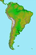
The Chilean Iron Belt is a geological province rich in iron ore deposits in northern Chile. It extends as a north-south beld along the western part of the Chilean regions of Coquimbo and Atacama, chiefly between the cities of La Serena and Taltal. [1] [2] The belt follows much of the Atacama Fault System and is about 600 km long and 25 km broad. [2] [3]

Iron oxide-apatite, iron oxide copper gold ore deposits (IOCG) and manto-type copper and silver are the main types of deposits. [1] [2] Iron-apatite and IOCG are considered to have different origins. [4] Manto-type deposits are concentrated in the northern part of the belt and are chiefly emplaced on rocks of La Negra Formation. [1]

The ores of the Chilean Iron Belt formed in separate pulses in the Cretaceous period as result of magmatic and hydrothermal processes. [1] At least part of the iron oxide-apatite rock originated from molten iron in the form of lava, tephra. [3] and intrusions. [4] Thus iron oxide apatite magma cooled into rock variously from surface volcanoes to depths of 10 km over even more. [4]

Some geologists have speculated that a large meteorite impact in the Pacific during the Cretaceous period may have set in motion a series of tectonic changes that led to the formation the ores. [5]

Iron mines along the Chilean Iron Belt

Related Research Articles

<span class="mw-page-title-main">Ore</span> Rock with valuable metals, minerals and elements

Ore is natural rock or sediment that contains one or more valuable minerals concentrated above background levels, typically containing metals, that can be mined, treated and sold at a profit. The grade of ore refers to the concentration of the desired material it contains. The value of the metals or minerals a rock contains must be weighed against the cost of extraction to determine whether it is of sufficiently high grade to be worth mining and is therefore considered an ore. A complex ore is one containing more than one valuable mineral.

<span class="mw-page-title-main">Antofagasta Region</span> Region of Chile

The Antofagasta Region is one of Chile's sixteen first-order administrative divisions. The second-largest region of Chile in area, it comprises three provinces, Antofagasta, El Loa and Tocopilla. It is bordered to the north by Tarapacá, by Atacama to the south, and to the east by Bolivia and Argentina. The region's capital is the port city of Antofagasta; another one of its important cities is Calama. The region's main economic activity is copper mining in its giant inland porphyry copper systems.

<span class="mw-page-title-main">Iron ore</span> Ore rich in iron or the element Fe

Iron ores are rocks and minerals from which metallic iron can be economically extracted. The ores are usually rich in iron oxides and vary in color from dark grey, bright yellow, or deep purple to rusty red. The iron is usually found in the form of magnetite (Fe
3
O
4
, 72.4% Fe), hematite (Fe
2
O
3
, 69.9% Fe), goethite (FeO(OH), 62.9% Fe), limonite (FeO(OH)·n(H2O), 55% Fe), or siderite (FeCO3, 48.2% Fe).

<span class="mw-page-title-main">Skarn</span> Hard, coarse-grained, hydrothermally altered metamorphic rocks

Skarns or tactites are coarse-grained metamorphic rocks that form by replacement of carbonate-bearing rocks during regional or contact metamorphism and metasomatism. Skarns may form by metamorphic recrystallization of impure carbonate protoliths, bimetasomatic reaction of different lithologies, and infiltration metasomatism by magmatic-hydrothermal fluids. Skarns tend to be rich in calcium-magnesium-iron-manganese-aluminium silicate minerals, which are also referred to as calc-silicate minerals. These minerals form as a result of alteration which occurs when hydrothermal fluids interact with a protolith of either igneous or sedimentary origin. In many cases, skarns are associated with the intrusion of a granitic pluton found in and around faults or shear zones that commonly intrude into a carbonate layer composed of either dolomite or limestone. Skarns can form by regional or contact metamorphism and therefore form in relatively high temperature environments. The hydrothermal fluids associated with the metasomatic processes can originate from a variety of sources; magmatic, metamorphic, meteoric, marine, or even a mix of these. The resulting skarn may consist of a variety of different minerals which are highly dependent on both the original composition of the hydrothermal fluid and the original composition of the protolith.

<span class="mw-page-title-main">Carbonatite</span> Igneous rock with more than 50% carbonate minerals

Carbonatite is a type of intrusive or extrusive igneous rock defined by mineralogic composition consisting of greater than 50% carbonate minerals. Carbonatites may be confused with marble and may require geochemical verification.

<span class="mw-page-title-main">Volcanogenic massive sulfide ore deposit</span> Metal sulfide ore deposit

Volcanogenic massive sulfide ore deposits, also known as VMS ore deposits, are a type of metal sulfide ore deposit, mainly copper-zinc which are associated with and produced by volcanic-associated hydrothermal events in submarine environments.

<span class="mw-page-title-main">Porphyry copper deposit</span> Type of copper ore body

Porphyry copper deposits are copper ore bodies that are formed from hydrothermal fluids that originate from a voluminous magma chamber several kilometers below the deposit itself. Predating or associated with those fluids are vertical dikes of porphyritic intrusive rocks from which this deposit type derives its name. In later stages, circulating meteoric fluids may interact with the magmatic fluids. Successive envelopes of hydrothermal alteration typically enclose a core of disseminated ore minerals in often stockwork-forming hairline fractures and veins. Because of their large volume, porphyry orebodies can be economic from copper concentrations as low as 0.15% copper and can have economic amounts of by-products such as molybdenum, silver, and gold. In some mines, those metals are the main product.

<span class="mw-page-title-main">Ore genesis</span> How the various types of mineral deposits form within the Earths crust

Various theories of ore genesis explain how the various types of mineral deposits form within Earth's crust. Ore-genesis theories vary depending on the mineral or commodity examined.

<span class="mw-page-title-main">Layered intrusion</span>

A layered intrusion is a large sill-like body of igneous rock which exhibits vertical layering or differences in composition and texture. These intrusions can be many kilometres in area covering from around 100 km2 (39 sq mi) to over 50,000 km2 (19,000 sq mi) and several hundred metres to over one kilometre (3,300 ft) in thickness. While most layered intrusions are Archean to Proterozoic in age, they may be any age such as the Cenozoic Skaergaard intrusion of east Greenland or the Rum layered intrusion in Scotland. Although most are ultramafic to mafic in composition, the Ilimaussaq intrusive complex of Greenland is an alkalic intrusion.

<span class="mw-page-title-main">Chilean Coast Range</span> Mountain range in South America

The Chilean Coastal Range is a mountain range that runs from north to south along the Pacific coast of South America parallel to the Andean Mountains, extending from Morro de Arica in the north to Taitao Peninsula, where it ends at the Chile Triple Junction, in the south. The range has a strong influence on the climate of Chile since it produces a rain shadow to the east. Because of this the vegetation growing on the seaward slopes is much more exuberant than in the interior. Compared to the coastal lowlands and the Intermediate Depression, it is sparsely populated with land use varying from protected areas to grazing and silviculture. The range is present in all Chilean regions, except for Coquimbo Region and Magallanes Region.

Iron oxide copper gold ore deposits (IOCG) are important and highly valuable concentrations of copper, gold and uranium ores hosted within iron oxide dominant gangue assemblages which share a common genetic origin.

<span class="mw-page-title-main">Kiruna mine</span> Underground iron ore mine in Sweden

The Kiruna mine is the largest and most modern underground iron ore mine in the world. The mine is located in Kiruna in Norrbotten County, Lapland, Sweden. The mine is owned by Luossavaara-Kiirunavaara AB (LKAB), a large Swedish mining company. In 2018 the mine produced 26.9 million tonnes of iron ore. The Kiruna mine has an ore body which is 4 km (2.5 mi) long, 80 metres (260 ft) to 120 metres (390 ft) thick and reaching a depth of up to 2 km (1.2 mi). Since mining began at the site in 1898, the mine has produced over 950 million tonnes of ore. As of 2020, the main haulage level is 1,365 m below the ore outcrop at Kiirunavaara that existed prior to mining.

<span class="mw-page-title-main">Atacama Fault</span> System of geological faults in northern Chile

The Atacama Fault Zone (AFZ) is an extensive system of faults cutting across the Chilean Coastal Cordillera in Northern Chile between the Andean Mountain range and the Pacific Ocean. The fault system is North-South striking and runs for more than 1100 km North and up to 50 km in width through the Andean forearc region. The zone is a direct result of the ongoing subduction of the Eastward moving Nazca Plate beneath the South American Plate and is believed to have formed in the Early Jurassic during the beginnings of the Andean orogeny. The zone can be split into 3 regions: the North, Central and South.

<span class="mw-page-title-main">El Laco</span> Volcanic complex in the Antofagasta Region, Chile

El Laco is a volcanic complex in the Antofagasta Region of Chile. It is directly south of the Cordón de Puntas Negras volcanic chain. Part of the Central Volcanic Zone of the Andes, it is a group of seven stratovolcanoes and a caldera. It is about two million years old. The main summit of the volcano is a lava dome called Pico Laco, which is variously reported to be 5,325 metres (17,470 ft) or 5,472 metres (17,953 ft) high. The edifice has been affected by glaciation, and some reports indicate that it is still fumarolically active.

<span class="mw-page-title-main">La Negra Formation</span> Geologic formation in Chile

La Negra Formation is a geologic formation of Jurassic age, composed chiefly of volcanic and volcaniclastic rocks, located in the Coast Range of northern Chile. The formation originated in marine and continental (terrestrial) conditions, and bears evidence of submarine volcanism as well as large explosive eruptions. The volcanism of La Negra Formation is thought to have lasted for about five million years.

El Tofo is an iron ore mine in the Chilean Norte Chico region. The mine lies in northern Coquimbo Region within a larger mining district known as the Chilean Iron Belt. Geologically El Tofo is an iron oxide-apatite deposit.

El Romeral is an iron mine in north-central Chile. The mine benefits from being located only 22 km NNE of the city of La Serena and being next to Guayacán, a port with conditions for high-tonnage cargo ships. The mine emerged as a replacement for the nearby mine of El Tofo that was close to depletion in the early 1950s. El Romeral was Bethehem Chile Iron Mines last major investment as Compañía de Acero del Pacífico obtained the ownership of El Tofo and El Romeral in the early 1971 when they were nationalized during the Presidency of Salvador Allende. Despite being initially an expensive mine in terms of infrastructure investment and having a troublesome geology El Romeral proved with time to host more iron than initially thought. Following an ownership restructuring Compañía Minera del Pacífico, now holds control of the mine. During the 1970s El Romeral would produce enough iron to fully supply the steel mill of Huachipato. From the 1970s onward El Romeral came to overshadow El Algarrobo mine in iron production.

La Liga Formation is a geologic formation Late Jurassic and Early Cretaceous age cropping out in Coquimbo Region, Chile. Rocks of the formation are andesites. Locally the rocks of the formation present epidote alteration. The iron ores of El Romeral mine are emplaced on La Liga Formation.

El Algarrobo is an iron mine in north-central Chile. Geologically it is an iron oxide-apatite (IOA) type of deposit. El Algarrobo is part of a wider province of iron ores known as the Chilean Iron Belt. From the 1970s onward El Romeral have come to overshadow El Algarrobo in iron ore production.

Punta del Cobre Formation is a geologic formation of Early Cretaceous age cropping out in the interior of Atacama Region, Chile. The formation is of Early Cretaceous age. It is made of massive volcanic rocks, chiefly andesite, dacite, and volcaniclastic rocks representing "flows" and Volcanic breccia of basaltic andesitic and basaltic composition. The rocks of the formation belong to the calc-alkaline magma series. Rocks show intense hydrothermal alteration and hosts significant copper and gold deposits and lesser amounts of zinc and silver. The formation lies in a zone of small-scale mining that supplies the nearby Fundición de Paipote copper smelter. The copper and iron ores of the Dominga prospect are in part emplaced in Punta del Cobre Formation.

References

  1. 1 2 3 4 Barra, Fernando; Reich, M.; Selby, D.; Rojas, P.; Simon, A.; Salazar, E.; Palma, G. (2017). "Unraveling the origin of the Andean IOCG clan: a Re-Os isotope approach" (PDF). Ore Geology Reviews. 81 (1): 62–78. Bibcode:2017OGRv...81...62B. doi:10.1016/j.oregeorev.2016.10.016.
  2. 1 2 3 Simon, Adam C.; Knipping, Jaayne; Reich, Martin; Barra, Fernando; Deditius, Artur P.; Bilenker, Laura; Childress, Tristan (2018). "Kiruna-Type Iron Oxide-Apatite (IOA) and Iron Oxide Copper-Gold (IOCG) Deposits Form by a Combination of Igneous and Magmatic-Hydrothermal Processes: Evidence from the Chilean Iron Belt". In Arribas R., Antonio M.; Mauk, Jeffrey L. (eds.). Metals, Minerals, and Society. Society of Economic Geologists Special Publication. Vol. 21. pp. 89–114. doi:10.5382/SP.21. ISBN   9781629493084.
  3. 1 2 Travisany, Vinicio; Henríquez, Fernando; Nyström, Jan Olov (1995). "Magnetite lava flows in the Pleito-Melon District of the Chilean iron belt". Economic Geology . 90 (2): 438–444. Bibcode:1995EcGeo..90..438T. doi:10.2113/gsecongeo.90.2.438.
  4. 1 2 3 Tornos, Fernando; Hanchar, John M.; Munizaga, Rodrigo; Velasco, Francisco; Galindo, Carmen (2020). "The role of the subducting slab and melt crystallization in the formation of magnetite-(apatite) systems, Coastal Cordillera of Chile". Mineralium Deposita . 56 (2): 253–278. doi:10.1007/s00126-020-00959-9. S2CID   212629723.
  5. Oyarzún, J.; Oyarzun, R.; Lillo, J.; Ménard, J.J. (2012). "May a large asteroid impact in the Pacific have triggered a cascade of tectonomagmatic events leading to formation of the Mid-Cretaceous Chilean Iron Belt?". Geotemas. 13: 1915–1918.