Cuyo Basin

Last updated
Cuyo Basin
Cuenca Cuyana
Relief Map of Argentina.jpg
Red pog.svg
Location of the basin in Argentina
Coordinates 34°15′S68°34′W / 34.250°S 68.567°W / -34.250; -68.567
Etymology Cuyo River
CountryFlag of Argentina.svg  Argentina
State(s) Mendoza, San Juan
Cities Mendoza
Characteristics
On/OffshoreOnshore
Boundaries Andes
Part of Andean foreland basins
Area~30,000 km2 (12,000 sq mi)
Hydrology
River(s) Cuyo River
Geology
Basin type Foreland basin
Plate South American
Orogeny Andean
Age Triassic-Pliocene
Stratigraphy Stratigraphy
Field(s) Tupungato

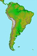
Cuyo Basin (Spanish : Cuenca Cuyana) is a sedimentary basin in Mendoza Province, western Argentina. The Cuyo Basin has a NNW-SSE elongated shape and is limited to the west by the Sierra Pintada System and to the east by the Pampean pericraton. To the north the basin reaches the area around the city of Mendoza. [1]

Contents

Description

The Cuyo Basin has an approximate area of 30,000 square kilometres (12,000 sq mi). [2] It has two major sub-basins: Cacheuta (Spanish: Subcuenca Cacheuta) in the north and Alvear (Spanish: Subcuenca Alvear) in the south. The northern fringes of Cacheuta sub-basin reaches into San Juan Province. The basin existed already during the Triassic but its current shape is derivative of the Andean orogeny. [1]

The basin originated as a rift basin in the context of extensional tectonics and crustal thinning that followed the Paleozoic Gondwanide orogeny. [note 1]

Stratigraphy

The stratigraphy of the Cuyo Basin comprises the following formations:

Age
bold is SALMA type
GroupFormationLithologies Depositional environment Notes
Pleistocene Tunuyán [4]
Mio-Pliocene
Huayquerian
Huayquerías Mudstones, sandstones, tuff Fluvial [5]
Miocene Mogotes Alluvial [6]
Miocene La Pilona Shales and sandstonesAlluvial [6]
Middle Miocene
Laventan
Mariño SandstonesAlluvial and eolian [6]
Late Oligocene
Deseadan
Early Oligocene Hiatus [6]
Priabonian
Bartonian
Divisaderan
Divisadero Largo Fluvial [6]
Lutetian Papagayos Fluvial [6]
Early Eocene Hiatus [6]
Paleocene
Late Cretaceous
Early Cretaceous Punta de las Bardas Basalts Volcanic [6]
Late Jurassic
Barrancas Sandstones and conglomeratesAlluvial to fluvial [6]
Rhaetian Uspallata Río Blanco Fluvial-deltaic [6] [3]
Norian
Carnian Cacheuta Black shalesLacustrine [6] [7]
Potrerillos Tuffs, conglomerates, sandstones, shalesAlluvial to fluvial [6] [7] [8]
Ladinian Cerro de las Cabras Mudstones and conglomerates [6] [7]
Anisian
Olenekian Río Mendoza Volcaniclastic conglomerates [6] [7]
Induan
Late Permian Choiyoi Group [3]
Carboniferous Hiatus [9] [10]
Devonian
Early Paleozoic Cuyania [9] [10]

See also

Notes and references

Notes

  1. These tectonics are not related to the break-up of Gondwana later in the Mesozoic. [3]

Related Research Articles

The Magallanes Basin or Austral Basin is a major sedimentary basin in southern Patagonia. The basin covers a surface of about 170,000 to 200,000 square kilometres and has a NNW-SSE oriented shape. The basin is bounded to the west by the Andes mountains and is separated from the Malvinas Basin to the east by the Río Chico-Dungeness High. The basin evolved from being an extensional back-arc basin in the Mesozoic to being a compressional foreland basin in the Cenozoic. Rocks within the basin are Jurassic in age and include the Cerro Toro Formation. Three ages of the SALMA classification are defined in the basin; the Early Miocene Santacrucian from the Santa Cruz Formation and Friasian from the Río Frías Formation and the Pleistocene Ensenadan from the La Ensenada Formation.

The Precordillera Terrane or Cuyania was an ancient microcontinent or terrane whose history affected many of the older rocks of Cuyo in Argentina. It was separated by oceanic crust from the Chilenia terrane which accreted into it at ~420-390 Ma when Cuyania was already amalgamated with Gondwana. The hypothesized Mejillonia Terrane in the coast of northern Chile is considered by some geologists to be a single block with Cuyania.

The Divisaderan age is a South American land mammal age, covering a period of geologic time within the Middle and Late Eocene epochs of the Paleogene. It follows the Mustersan age and is followed by the Tinguirirican age.

The Deseadan age is a period of geologic time within the Oligocene epoch of the Paleogene to the Early Miocene epoch of the Neogene, used more specifically within the SALMA classification of South America. It follows the Tinguirirican and precedes the Colhuehuapian age.

The Santacrucian age is a period of geologic time within the Early Miocene epoch of the Neogene, used more specifically with SALMA classification in South America. It follows the Colhuehuapian and precedes the Friasian age.

The Lotena Formation is a geologic formation dated from the Late Callovian to Early Oxfordian in the Neuquén Basin in Mendoza Province, Argentina. The formation, first defined by Weaver in 1931 and named after Cerro Lotena, consists of fluvial conglomerates, calcareous sandstones and marine limestones and shales. The Lotena Formation is overlain by the La Manga Formation and overlies the Lajas Formation of the Cuyo Group. Initially, the fossil find of the pterosaur Herbstosaurus pigmaeus was reported from the formation, but this fossil was found in the younger Vaca Muerta. The formation is a reservoir rock in the Neuquén Basin.

<span class="mw-page-title-main">Neuquén Basin</span> Sedimentary basin covering most of Neuquén Province in Argentina

Neuquén Basin is a sedimentary basin covering most of Neuquén Province in Argentina. The basin originated in the Jurassic and developed through alternating continental and marine conditions well into the Tertiary. The basin bounds to the west with the Andean Volcanic Belt, to the southeast with the North Patagonian Massif and to the northeast with the San Rafael Block and to the east with the Sierra Pintada System. The basin covers an area of approximately 120,000 square kilometres (46,000 sq mi). One age of the SALMA classification, the Colloncuran, is defined in the basin, based on the Collón Curá Formation, named after the Collón Curá River, a tributary of the Limay River.

<span class="mw-page-title-main">Andean orogeny</span> Ongoing mountain-forming process in South America

The Andean orogeny is an ongoing process of orogeny that began in the Early Jurassic and is responsible for the rise of the Andes mountains. The orogeny is driven by a reactivation of a long-lived subduction system along the western margin of South America. On a continental scale the Cretaceous and Oligocene were periods of re-arrangements in the orogeny. The details of the orogeny vary depending on the segment and the geological period considered.

<span class="mw-page-title-main">Malargüe Group</span> Group of geologic formations in Argentina

The Malargüe Group is a group of geologic formations of the Neuquén Basin of the Mendoza, Neuquén, Río Negro and La Pampa Provinces in northern Patagonia, Argentina. The formations of the Malargüe Group range in age between the middle Campanian to Deseadan, an Oligocene age of the SALMA classification, straddling the Cretaceous–Paleogene boundary, about 79 million to 30 million years in age. The group overlies the older Neuquén Group, separated by an unconformity dated to 79 Ma. The rocks of the Malargüe Group comprise both marine and continental deposits which are over 400 m (1312 ft) thick in total.

Salta Basin or Salta Rift Basin is a sedimentary basin located in the Argentine Northwest. The basin started to accumulate sediments in the Early Cretaceous (Neocomian) and at present it has sedimentary deposits reaching thicknesses of 5,000 metres (16,000 ft). The basin contains seven sub-basins: Tres Cruces, Lomas de Olmedo, Metán, Alemanía, Salfity, El Rey, Sey and Brealito. The basin environment has variously been described as a "foreland rift" and an "intra-continental rift". The basin developed under conditions of extensional tectonics and rift-associated volcanism.

Abanico Formation is a 3 kilometres (9,800 ft) thick sedimentary formation exposed in the Andes of Central Chile. The formation has been deposited in a timespan from the Eocene to the Miocene. Abanico Formation's contact with the overlying Miocene Farellones Formation has been the subject of differing interpretations since the 1960s. A small part of the formation crops out in the Mendoza Province of western Argentina.

<span class="mw-page-title-main">Gondwanide orogeny</span> Permian mountain forming tectonic event

The Gondwanide orogeny was an orogeny active in the Permian that affected parts of Gondwana that are by current geography now located in southern South America, South Africa, Antarctica, Australia and New Guinea. The zone of deformation in Argentina extends as a belt south and west of the cratonic nucleus of Río de la Plata–Pampia. The deformation of the orogeny is visible in the Sierra de la Ventana mountains in Argentina and the Cape Fold Belt in South Africa. The Gondwanide orogeny might have been linked with the roughly contemporary San Rafael orogeny of western Argentina.

<span class="mw-page-title-main">Choiyoi Group</span>

Choiyoi Group is a Permian and Triassic-aged group of volcano-sedimentary formations in Argentina and Chile. The group bears evidence of bimodal-style volcanism related to an ancient subduction zone that existed along the western margin of the supercontinent Gondwana.

<span class="mw-page-title-main">Tectonic evolution of Patagonia</span>

Patagonia comprises the southernmost region of South America, portions of which lie on either side of the Argentina-Chile border. It has traditionally been described as the region south of the Rio, Colorado, although the physiographic border has more recently been moved southward to the Huincul fault. The region's geologic border to the north is composed of the Rio de la Plata craton and several accreted terranes comprising the La Pampa province. The underlying basement rocks of the Patagonian region can be subdivided into two large massifs: the North Patagonian Massif and the Deseado Massif. These massifs are surrounded by sedimentary basins formed in the Mesozoic that underwent subsequent deformation during the Andean orogeny. Patagonia is known for its vast earthquakes and the damage they cause.

The geology of Argentina includes ancient Precambrian basement rock affected by the Grenville orogeny, sediment filled basins from the Mesozoic and Cenozoic as well as newly uplifted areas in the Andes.

The Colorado Basin is a sedimentary basin located in northeastern Patagonia. The basin stretches across an area of approximately 180,000 square kilometres (69,000 sq mi), of which 37,000 square kilometres (14,000 sq mi) onshore in the southern Buenos Aires Province and the easternmost Río Negro Province extending offshore in the South Atlantic Ocean.

<span class="mw-page-title-main">Agrio Formation</span>

The Agrio Formation is an Early Cretaceous geologic formation that is up to 1,500 metres (4,900 ft) thick and is located in the southern Mendoza Province and northern-central Neuquén Province, in the Neuquén Basin of northwestern Patagonia, Argentina. This formation is the youngest one of the Mendoza Group, overlying the Mulichinco and Bajada Colorada Formations and overlain by the Huitrín and La Amarga Formations. It is dated to the Late Valanginian to Early Hauterivian, Late Valanginian to Early Barremian, or Hauterivian to earliest Aptian.

<span class="mw-page-title-main">Ischigualasto-Villa Unión Basin</span>

The Ischigualasto-Villa Unión Basin is a small sedimentary basin located in the Argentine Northwest, Argentina. It is located in the southwestern part of La Rioja Province and the northeastern part of San Juan Province. The basin borders the Sierras Pampeanas in the east, the western boundary of the basin is formed by the Valle Fértil Fault, bordering the Precordillera, and it is bound in the southeast by the El Alto Fault, separating the basin from the Marayes-El Carrizal Basin.

The Río Seco de la Quebrada Formation is a Triassic geological formation in Mendoza Province, Argentina. Fossils of cynodonts such as Cynognathus, Diademodon, and Pascualgnathus have been found in this formation, along with dicynodonts such as Vinceria and Acratophorus. Based on biostratigraphy, the Río Seco de la Quebrada Formation is considered to have formed during the Anisian stage, as it shares fauna with the upper subzones of the Cynognathus Assemblage Zone in South Africa. However, radiometric dating controversially argues that it was deposited during the early Carnian stage, 10 million years younger than expected otherwise.

The Agua de la Piedra Formation is a Late Oligocene geologic formation of the Malargüe Group that crops out in the southernmost Precordillera and northernmost Neuquén Basin in southern Mendoza Province, Argentina.

References

  1. 1 2 "Cuenca Cuyana". Secretaría de Energía (in Spanish). Government of Argentina. Retrieved 30 November 2015.
  2. Zencich et al., 2008, p.110
  3. 1 2 3 Spalletti et al., 2008, p.270
  4. Yrigoyen, 1993
  5. Garrido et al, 2017, p.51
  6. 1 2 3 4 5 6 7 8 9 10 11 12 13 14 Zencich et al., 2008, p.112
  7. 1 2 3 4 Spalletti et al., 2008, p.269
  8. Spalletti et al., 2005
  9. 1 2 Finney, 2007
  10. 1 2 Keller et al., 1998

Bibliography

General
Divisadero Largo Formation
Huayquerías Formation
Mariño Formation

Further reading