Chamorro Time Zone

Last updated
UTC+10 highlighted on a world map. Timezones2008 UTC+10.png
UTC+10 highlighted on a world map.

The Chamorro Time Zone, [1] formerly the Guam Time Zone, is a United States time zone which observes standard time ten hours ahead of Coordinated Universal Time (UTC+10:00). The clock time in this zone is based on the mean solar time of the 150th meridian east of the Greenwich Observatory.

Contents

The zone includes the U.S. territories of Guam and the Northern Mariana Islands, where the Chamorro people are the original inhabitants. Since Daylight Saving Time (DST) is not observed anywhere in this zone, the time is always known as Chamorro Standard Time (ChST).

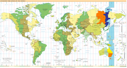
The zone is two hours behind Wake Island Time Zone and 15 hours ahead of North American Eastern Time Zone. As of March 19, 2024 it is the easternmost (farthest ahead) time zone shown on the U.S. government's time.gov webpage. Although Wake, Howland and Baker Islands are U.S. territories in more easterly time zones (that are not shown), they are uninhabited.

Chamorro Standard Time shares the same time as Australian Eastern Standard Time. The State of Queensland also does not observe DST, so the Commonwealth of the Northern Mariana Islands (CNMI), Guam and Queensland are on the same time year round.

Populated areas and major cities

History

The U.S. Congress formally created Chamorro Standard Time by federal Public Law 106-564 on December 23, 2000. Previously, Guam Standard Time existed per territorial Public Law 5-25 (1959). [2] This statute is still on the territorial law books, although it is preempted by the federal law.[ citation needed ]

The Northern Mariana Islands, as part of the Trust Territory of the Pacific Islands, were not part of any American time zone prior to becoming a U.S. Commonwealth on January 1, 1978. Being directly north of Guam, however, they observed the same time.[ citation needed ]

See also

Related Research Articles

<span class="mw-page-title-main">Guam</span> Unincorporated US territory in the Pacific Ocean

Guam is an organized, unincorporated territory of the United States in the Micronesia subregion of the western Pacific Ocean. Guam's capital is Hagåtña, and the most populous village is Dededo. It is the westernmost point and territory of the United States, reckoned from the geographic center of the U.S. In Oceania, Guam is the largest and southernmost of the Mariana Islands and the largest island in Micronesia.

The history of Guam starts with the early arrival around 2000 BC of Austronesian people known today as the Chamorro Peoples. The Chamorus then developed a "pre-contact" society, that was colonized by the Spanish in the 17th century. The present American rule of the island began with the 1898 Spanish–American War. Guam's history of colonialism is the longest among the Pacific islands.

<span class="mw-page-title-main">Micronesia</span> Subregion of Oceania

Micronesia is a subregion of Oceania, consisting of about 2,000 small islands in the Northwestern Pacific Ocean. It has a close shared cultural history with three other island regions: Maritime Southeast Asia to the west, Polynesia to the east, and Melanesia to the south—as well as with the wider community of Austronesian peoples.

<span class="mw-page-title-main">Northern Mariana Islands</span> Unincorporated territory of the United States

The Northern Mariana Islands, officially the Commonwealth of the Northern Mariana Islands, is an unincorporated territory and commonwealth of the United States consisting of 14 islands in the northwestern Pacific Ocean. The CNMI includes the 14 northernmost islands in the Mariana Archipelago; the southernmost island, Guam, is a separate U.S. territory. The Northern Mariana Islands were listed by the United Nations as a non-self governing territory until 1990.

<span class="mw-page-title-main">Mariana Islands</span> Archipelago in the Pacific Ocean

The Mariana Islands, also simply the Marianas, are a crescent-shaped archipelago comprising the summits of fourteen longitudinally oriented, mostly dormant volcanic mountains in the northwestern Pacific Ocean, between the 12th and 21st parallels north and along the 145th meridian east. They lie south-southeast of Japan, west-southwest of Hawaii, north of New Guinea and east of the Philippines, demarcating the Philippine Sea's eastern limit. They are found in the northern part of the western Oceanic sub-region of Micronesia, and are politically divided into two jurisdictions of the United States: the Commonwealth of the Northern Mariana Islands and, at the southern end of the chain, the territory of Guam. The islands were named after the influential Spanish queen Mariana of Austria following their colonization in the 17th century.

<span class="mw-page-title-main">Eastern Time Zone</span> North American time zone (UTC−5 and UTC−4)

The Eastern Time Zone (ET) is a time zone encompassing part or all of 23 states in the eastern part of the United States, parts of eastern Canada, and the state of Quintana Roo in Mexico.

<span class="mw-page-title-main">Mountain Time Zone</span> Time zone of North America

The Mountain Time Zone of North America keeps time by subtracting seven hours from Coordinated Universal Time (UTC) when standard time (UTC−07:00) is in effect, and by subtracting six hours during daylight saving time (UTC−06:00). The clock time in this zone is based on the mean solar time at the 105th meridian west of the Greenwich Observatory. In the United States, the exact specification for the location of time zones and the dividing lines between zones is set forth in the Code of Federal Regulations at 49 CFR 71.

<span class="mw-page-title-main">Territories of the United States</span>

Territories of the United States are sub-national administrative divisions overseen by the federal government of the United States. The various American territories differ from the U.S. states and Indian reservations as they are not sovereign entities. In contrast, each state has a sovereignty separate from that of the federal government and each federally recognized Native American tribe possesses limited tribal sovereignty as a "dependent sovereign nation." Territories are classified by incorporation and whether they have an "organized" government through an organic act passed by the Congress. American territories are under American sovereignty and, consequently, may be treated as part of the United States proper in some ways and not others. Unincorporated territories in particular are not considered to be integral parts of the United States, and the Constitution of the United States applies only partially in those territories.

<span class="mw-page-title-main">Time in the United States</span> U.S. time zones

In the United States, time is divided into nine standard time zones covering the states, territories and other US possessions, with most of the country observing daylight saving time (DST) for approximately the spring, summer, and fall months. The time zone boundaries and DST observance are regulated by the Department of Transportation, but no single map of those existed until the agency announced intentions to make one in September 2022. Official and highly precise timekeeping services (clocks) are provided by two federal agencies: the National Institute of Standards and Technology (NIST) ; and the United States Naval Observatory (USNO). The clocks run by these services are kept synchronized with each other as well as with those of other international timekeeping organizations.

<span class="mw-page-title-main">Uniform Time Act</span> United States timekeeping and daylight saving time law

The Uniform Time Act of 1966, Pub. L.Tooltip Public Law  89–387, 80 Stat. 107, enacted April 13, 1966, was a Law of the United States to "promote the adoption and observance of uniform time within the standard time zones" prescribed by the Standard Time Act of 1918. Its intended effect was to simplify the official pattern of where and when daylight saving time (DST) is applied within the U.S. Prior to this law, each state had its own scheme for when DST would begin and end, and in some cases, which parts of the state should use it.

<span class="mw-page-title-main">Chamorro people</span> Indigenous people of the Mariana Islands

The Chamorro people are the Indigenous people of the Mariana Islands, politically divided between the United States territory of Guam and the encompassing Commonwealth of the Northern Mariana Islands in Micronesia, a commonwealth of the US. Today, significant Chamorro populations also exist in several U.S. states, including Hawaii, California, Washington, Texas, Tennessee, Oregon, and Nevada, all of which together are designated as Pacific Islander Americans according to the U.S. Census. According to the 2000 Census, about 64,590 people of Chamorro ancestry live in Guam and another 19,000 live in the Northern Marianas.

<span class="mw-page-title-main">UTC+10:00</span> Identifier for a time offset from UTC of +10

UTC+10:00 is an identifier for a time offset from UTC of +10:00. This time is used in:

<span class="mw-page-title-main">Time in Australia</span> Time zones in Australia

Australia uses three main time zones: Australian Eastern Standard Time, Australian Central Standard Time and Australian Western Standard Time.

<span class="mw-page-title-main">Samoa Time Zone</span> Time zone

The Samoa Time Zone or Samoa Standard Time (SST) observes standard time by subtracting eleven hours from Coordinated Universal Time (UTC-11:00). The clock time in this zone is based on the mean solar time of the 165th meridian west of the Greenwich Observatory.

<span class="mw-page-title-main">Wake Island Time Zone</span> Time zone

The Wake Island Time Zone observes standard time by adding twelve hours to Coordinated Universal Time (UTC+12:00). The clock time in this zone is based on the mean solar time of the 180th degree meridian east of the Greenwich Observatory.

<span class="mw-page-title-main">Daylight saving time in the United States</span> Practice of setting the clock forward by one hour in the United states

Most of the United States observes daylight saving time, the practice of setting the clock forward by one hour when there is longer daylight during the day, so that evenings have more daylight and mornings have less. Exceptions include Arizona, Hawaii, and the territories of American Samoa, Guam, the Northern Mariana Islands, Puerto Rico, and the United States Virgin Islands. The Uniform Time Act of 1966 established the system of uniform daylight saving time throughout the US.

<span class="mw-page-title-main">LGBT rights in the Northern Mariana Islands</span>

Lesbian, gay, bisexual, and transgender (LGBT) rights in the Northern Mariana Islands have evolved substantially in recent years. Same-sex marriage and adoption became legal with the Supreme Court's ruling in the case of Obergefell v. Hodges in June 2015. However, the U.S. territory does not ban discrimination based on sexual orientation and gender identity, except in relation to government employees. Gender changes are legal in the Northern Mariana Islands, provided the applicant has undergone sex reassignment surgery.

Voting rights of citizens in Guam differ from those of United States citizens in each of the fifty states. In the U.S. House of Representatives, Guam is entitled to a delegate, who is not allowed to vote on the floor of the House, but can vote on procedural matters and in House committees. Citizens of Guam may not vote in general elections for President.

The Marianas archipelago of the Northern Pacific contains fourteen islands located between Japan and New Guinea on a north–south axis and Hawaii and the Philippines on an east–west axis. Inhabitants were Spanish nationals from the 16th century until the Spanish–American War of 1898. As Guam became a territory of the United States the Northern Marianas were sold to Germany in 1899. The Northern Mariana Islands were a German protectorate until 1919, when they became part of the South Seas Mandate, administered by Japan. At the close of World War II, the Marianas became part of the Trust Territory of the Pacific Islands. In 1975, the Commonwealth of the Northern Mariana Islands became a self-governing territory. In 1986, the Marianas came under the sovereignty of the United States when the trusteeship ended and US nationality and citizenship was conferred on the inhabitants of the territory.

References

  1. "Chamorro" per 15 U.S.C.   § 263 as amended and 49 CFR 71.14 (text, PDF).
  2. Guam Code Annotated, Title 1, Section 1010.(text, PDF).

Sources