Islands and coastal region surrounded by the Caribbean Sea
This article is about the group of islands. For the body of water surrounding them, see Caribbean Sea. For the Indigenous inhabitants of the Caribbean or people of Caribbean descent, see Caribbean people. For other uses, see Caribbean (disambiguation).
Geopolitically, the islands of the Caribbean are often regarded as a subregion of North America, though sometimes they are included in Middle America, or regarded as its own subregion as the Caribbean.[11][12] The Caribbean is sometimes considered alongside Central America as a region.[13]
Political map of Caribbean
Generally, the Caribbean region is organized into 33 political entities, including 13 sovereign states, 12 dependencies, 7 overseas territories, and various disputed territories. From 15 December 1954 to 10 October 2010, there was a territory known as the Netherlands Antilles composed of five islands, all of which were Dutch dependencies.[14] From 3 January 1958 to 31 May 1962, there was also a short-lived political union called the British West Indies Federation composed of ten English-speaking Caribbean territories, all of which were then British dependencies.
The two most prevalent pronunciations of "Caribbean" outside the Caribbean are /ˌkærɪˈbiːən/ (KARR-ə-BEE-ən), with the primary stress on the third syllable, and /kəˈrɪbiən/ (kə-RIB-ee-ən), with the stress on the second. Most authorities of the last century preferred the stress on the third syllable.[17] This is the older of the two pronunciations, but the stressed-second-syllable variant has been established for over 75 years.[18][when?] It has been suggested that speakers of British English prefer /ˌkærɪˈbiːən/ (KARR-ə-BEE-ən) while North American speakers more typically use /kəˈrɪbiən/ (kə-RIB-ee-ən),[19] but major American dictionaries and other sources list the stress on the third syllable as more common in American English too.[20][21][22][23] According to the American version of Oxford Online Dictionaries, the stress on the second syllable is becoming more common in UK English and is increasingly considered "by some" to be more up to date and more "correct".[24]
The word Caribbean has multiple uses. Its principal ones are geographical and political. The Caribbean can also be expanded to include territories with strong cultural and historical connections to Africa, slavery, European colonisation and the plantation system.
Physiographically, the Caribbean region is mainly a chain of islands surrounding the Caribbean Sea. To the north, the region is bordered by the Gulf of Mexico, the Straits of Florida and the Northern Atlantic Ocean, which lies to the east and northeast. To the south lies the coastline of the continent of South America.
The oldest evidence of humans in the Caribbean is in southern Trinidad at Banwari Trace, where remains have been found from 7,000 years ago. These pre-ceramic sites, which belong to the Archaic (pre-ceramic) age, have been termed Ortoiroid. The earliest archaeological evidence of human settlement in Hispaniola dates to about 3600 BC, but the reliability of these finds is questioned. Consistent dates of 3100 BC appear in Cuba. The earliest dates in the Lesser Antilles are from 2000 BC in Antigua. A lack of pre-ceramic sites in the Windward Islands and differences in technology suggest that these Archaic settlers may have Central American origins. Whether an Ortoiroid colonization of the islands took place is uncertain, but there is little evidence of one.
DNA studies changed some of the traditional beliefs about pre-Columbian indigenous history. According to National Geographic, "studies confirm that a wave of pottery-making farmers—known as Ceramic Age people—set out in canoes from the northeastern coast of South America starting some 2,500 years ago and island-hopped across the Caribbean. They were not, however, the first colonizers. On many islands they encountered a foraging people who arrived some 6,000 or 7,000 years ago... The ceramicists, who are related to today's Arawak-speaking peoples, supplanted the earlier foraging inhabitants—presumably through disease or violence—as they settled new islands."[25]
Between 400 BC and 200 BC, the first ceramic-using agriculturalists, the Saladoid culture, entered Trinidad from South America. They expanded up the Orinoco River to Trinidad, and then spread rapidly up the islands of the Caribbean. Some time after 250 AD another group, the Barancoid, entered Trinidad. The Barancoid society collapsed along the Orinoco around 650 AD and another group, the Arauquinoid, expanded into these areas and up the Caribbean chain. Around 1300 AD a new group, the Mayoid, entered Trinidad and remained the dominant culture until Spanish settlement.
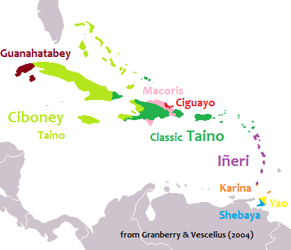
At the time of the European discovery of most of the islands of the Caribbean, three major Amerindian indigenous peoples lived on the islands: the Taíno in the Greater Antilles, The Bahamas and the Leeward Islands; the Island Caribs and Galibi in the Windward Islands; and the Ciboney in western Cuba. The Taínos are subdivided into Classic Taínos, who occupied Puerto Rico and part of Hispaniola; Western Taínos, who occupied the Bahamian archipelago, Cuba, Jamaica, and part of Hispaniola; and the Eastern Taínos, who occupied the northern Lesser Antilles. The southern Lesser Antilles, including Martinique and Trinidad, were inhabited by both Carib-speaking and Arawak-speaking groups.
Soon after Christopher Columbus came to the Caribbean including Hispaniola and Martinica, both Portuguese and Spanish explorers began claiming territories in Central and South America. These early colonies brought gold to Europe; most specifically England, the Netherlands, and France. These nations hoped to establish profitable colonies in the Caribbean. Colonial rivalries made the Caribbean a cockpit for European wars for centuries.
Columbus, and the early colonists of Hispaniola, treated the indigenous peoples brutally, even enslaving children.[26] In 1512, after pressure from Dominican friars, the Laws of Burgos were introduced by the Spanish Crown to better protect the rights of the New World natives. The Spanish used a form of slavery called the Encomienda, where slaves would be awarded to the conquistadors, who were charged with protecting and converting their slaves. This had a devastating impact on the population,[27] so starting in 1503, slaves from Africa were imported to the colony. Jamaica was ceded to England by Spain while both Martinica and the western third of Hispaniola were ceded to France.
While early slave traders were Portuguese and Spanish, known as the First Atlantic System, by the 17th century the trade became dominated by British, French, and Dutch merchants. This was known as the Second Atlantic System. 5 million African slaves would be taken to the Caribbean, and around half would be traded to the British Caribbean islands. Slavery was abolished first in the Dutch Empire in 1814. Spain abolished slavery in its empire in 1811, with the exceptions of Cuba, Puerto Rico, and Santo Domingo. Slavery was not abolished in Cuba until 1886.[28] Britain abolished the slave trade in 1807, and slavery proper in 1833. France abolished slavery in its colonies in 1848.
The Caribbean was known for pirates, especially between 1640 and 1680. The term "buccaneer" is often used to describe a pirate operating in this region. The Caribbean region was war-torn throughout much of its colonial history, but the wars were often based in Europe, with only minor battles fought in the Caribbean. Some wars, however, were born of political turmoil in the Caribbean itself.
In 1791, a slave rebellion in the French colony of Saint-Domingue led to the establishment in 1804 of Haiti, the first republic in the Caribbean. Neighboring Santo Domingo (now Dominican Republic) would attain its independence on three separate occasions in 1821, 1844 and 1865. Cuba became independent in 1898 following American intervention in the War of Independence during the Spanish-American war. Following the war, Spain's last colony in the Americas, Puerto Rico, became an unincorporated territory of the United States.
Decolonisation and modern period
Between the 1960s and '80s, most of the British holdings in the Caribbean achieved political independence, starting with Jamaica in 1962, then Trinidad and Tobago (1962), British Guiana (1966), Barbados (1966), The Bahamas (1973), Grenada (1974), Dominica (1978), St. Lucia (1979), St. Vincent (1979), Antigua and Barbuda (1981), and St. Kitts and Nevis (1983). In case of the Netherlands, the Netherlands Antilles received autonomy status within the Kingdom in 1954, with Aruba receiving its own in 1986 and Curacao and St. Maarten in 2010. Presently, the United States, Britain, France and the Netherlands still have some Caribbean possessions.
The decline of the export industries meant a need to diversify the economies of the Caribbean territories. The tourism industry started developing in the early 20th century, rapidly developing in the 1960s when regular international flights made vacations affordable and is now a $50 billion industry. Another industry that developed in the early 20th century was offshore banking and financial services, particularly in The Bahamas and the Cayman Islands, as the proximity of the Caribbean islands to North America made them an attractive location for branches of foreign banks seeking to avail themselves of less complicated regulations and lower tax rates.
Since the Monroe Doctrine, the United States gained a major influence on most Caribbean nations. In the early part of the 20th century this influence was extended by participation in the Banana Wars. Victory in the Spanish–American War and the signing of the Platt Amendment in 1901 ensured that the United States would have the right to interfere in Cuban political and economic affairs, militarily if necessary. After the Cuban Revolution of 1959, relations deteriorated rapidly leading to the Bay of Pigs Invasion, the Cuban Missile Crisis, and successive US attempts to destabilize the island, based upon Cold War fears of the Soviet threat. The US invaded and occupied Hispaniola for 19 years (1915–34), subsequently dominating the Haitian economy through aid and loan repayments. The US invaded Haiti again in 1994. After the 2004 Haitian coup d'état, the US were accused by CARICOM of arranging it to remove elected Haitian leader Jean-Bertrand Aristide. In 1965, 23,000 US troops were sent to the Dominican Republic to quash a local uprising against military rule (see Dominican Civil War). President Lyndon Johnson had ordered the invasion to stem what he deemed to be a "Communist threat". However, the mission appeared ambiguous and was roundly condemned throughout the hemisphere as a return to gunboat diplomacy. In 1983, the US invaded Grenada to remove populist left-wing leader Maurice Bishop. The US maintains a naval military base in Cuba at Guantanamo Bay. The base is one of five unified commands whose "area of responsibility" is Central and South Americas and the Caribbean. The command is headquartered in Miami, Florida.
Definitions of the terms Greater Antilles and Lesser Antilles often vary. As part of the Puerto Rico Bank and the Puerto Rico-Virgin Islands microplate, the Virgin Islands are sometimes included with the Greater Antilles. The term Lesser Antilles is often used to define an island arc that includes Grenada but excludes Trinidad and Tobago and the Leeward Antilles.
The waters of the Caribbean Sea host large, migratory schools of fish, turtles, and coral reef formations. The Puerto Rico Trench, located on the fringe of the Atlantic Ocean and Caribbean Sea just to the north of the island of Puerto Rico, is the deepest point in all of the Atlantic Ocean.[32]
The region sits in the line of several major shipping routes with the Panama Canal connecting the western Caribbean Sea with the Pacific Ocean.
Rainfall varies with elevation, size and water currents, such as the cool upwellings that keep the ABC islands arid. Warm, moist trade winds blow consistently from the east, creating both rain forest and semi arid climates across the region. The tropical rainforest climates include lowland areas near the Caribbean Sea from Costa Rica north to Belize, as well as the Dominican Republic and Puerto Rico, while the more seasonal dry tropical savanna climates are found in Cuba, northern Colombia and Venezuela, and southern Yucatán, Mexico. Arid climates are found along the extreme northern coast of Venezuela out to the islands including Aruba and Curaçao, as well as the northwestern tip of Yucatán.
While the region generally is sunny much of the year, the wet season from May through November sees more frequent cloud cover (both broken and overcast), while the dry season from December through April is more often clear to mostly sunny. Seasonal rainfall is divided into 'dry' and 'wet' seasons, with the latter six months of the year being wetter than the first half. The air temperature is hot much of the year, varying from 25 to 33 C (77 F to 90 F) between the wet and dry seasons. Seasonally, monthly mean temperatures vary from only about 5 C (7 F) in the northern most regions, to less than 3 C in the southernmost areas of the Caribbean.
Hurricane season is from June to November, but they occur more frequently in August and September and more common in the northern islands of the Caribbean. Hurricanes that sometimes batter the region usually strike northwards of Grenada and to the west of Barbados. The principal hurricane belt arcs to northwest of the island of Barbados in the Eastern Caribbean. A great example being recent events of Hurricane Irma devastating the island of Saint Martin during the 2017 hurricane season.
Sea surface temperatures change little annually, normally running from 30°C (87°F) in the warmest months to 26°C (76°F) in the coolest months. The air temperature is warm year round, in the 70s, 80s and 90s, and only varies from winter to summer about 2–5 degrees on the southern islands and about a 10–20 degrees difference on the northern islands of the Caribbean. The northern islands, like The Bahamas, Cuba, Puerto Rico and the Dominican Republic, may be influenced by continental masses during winter months, such as cold fronts.
Aruba: Latitude 12°N
Climate data for Oranjestad, Aruba (1981–2010, extremes 1951–2010)
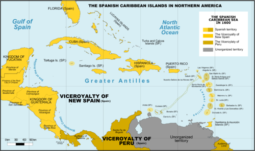
Spanish Caribbean Islands in the American Viceroyalties 1600Political evolution of Central America and the Caribbean from 1700 to presentThe mostly Spanish-controlled Caribbean in the 18th centuryThe mostly Spanish-controlled Caribbean in the 16th century
Portuguese West Indies – present-day Barbados, known as Os Barbados in the 16th century when the Portuguese claimed the island en route to Brazil. The Portuguese left Barbados abandoned years before the British arrived.
In addition, these countries share the University of the West Indies as a regional entity. The university consists of three main campuses in Jamaica, Barbados and Trinidad and Tobago, a smaller campus in The Bahamas and Resident Tutors in other contributing territories such as Trinidad.
Continental countries with Caribbean coastlines and islands
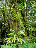
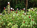
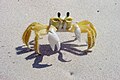
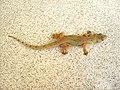
The Caribbean islands have one of the most diverse eco systems in the world. The animals, fungi and plants, and have been classified as one of Conservation International's biodiversity hotspots because of their exceptionally diverse terrestrial and marine ecosystems, ranging from montane cloud forests, to tropical rainforest, to cactusscrublands. The region also contains about 8% (by surface area) of the world's coral reefs[38] along with extensive seagrass meadows,[39] both of which are frequently found in the shallow marine waters bordering the island and continental coasts of the region.
For the fungi, there is a modern checklist based on nearly 90,000 records derived from specimens in reference collections, published accounts and field observations.[40] That checklist includes more than 11,250 species of fungi recorded from the region. As its authors note, the work is far from exhaustive, and it is likely that the true total number of fungal species already known from the Caribbean is higher. The true total number of fungal species occurring in the Caribbean, including species not yet recorded, is likely far higher given the generally accepted estimate that only about 7% of all fungi worldwide have been discovered.[41] Though the amount of available information is still small, a first effort has been made to estimate the number of fungal species endemic to some Caribbean islands. For Cuba, 2200 species of fungi have been tentatively identified as possible endemics of the island;[42] for Puerto Rico, the number is 789 species;[43] for the Dominican Republic, the number is 699 species;[44] for Trinidad and Tobago, the number is 407 species.[45]
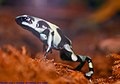
Many of the ecosystems of the Caribbean islands have been devastated by deforestation, pollution, and human encroachment. The arrival of the first humans is correlated with extinction of giantowls and dwarf ground sloths.[46] The hotspot contains dozens of highly threatened animals (ranging from birds, to mammals and reptiles), fungi and plants. Examples of threatened animals include the Puerto Rican amazon, two species of solenodon (giant shrews) in Cuba and the Hispaniola island, and the Cuban crocodile.
The region's coral reefs, which contain about 70 species of hard corals and from 500 to 700 species of reef-associated fishes[47] have undergone rapid decline in ecosystem integrity in recent years, and are considered particularly vulnerable to global warming and ocean acidification.[48] According to a UNEP report, the Caribbean coral reefs might go extinct in next 20 years due to human population explosion along the coast lines, overfishing, the pollution of coastal areas and global warming.[49]
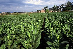
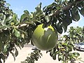
Some Caribbean islands have terrain that Europeans found suitable for cultivation for agriculture. Tobacco was an important early crop during the colonial era, but was eventually overtaken by sugarcane production as the region's staple crop. Sugar was produced from sugarcane for export to Europe. Cuba and Barbados were historically the largest producers of sugar. The tropical plantation system thus came to dominate Caribbean settlement. Other islands were found to have terrain unsuited for agriculture, for example Dominica, which remains heavily forested. The islands in the southern Lesser Antilles, Aruba, Bonaire and Curaçao, are extremely arid, making them unsuitable for agriculture. However, they have salt pans that were exploited by the Dutch. Sea water was pumped into shallow ponds, producing coarse salt when the water evaporated.[50]
The natural environmental diversity of the Caribbean islands has led to recent growth in eco-tourism. This type of tourism is growing on islands lacking sandy beaches and dense human populations.[51]
Caribbean societies are very different from other Western societies in terms of size, culture, and degree of mobility of their citizens.[52] The current economic and political problems the states face individually are common to all Caribbean states.[citation needed] Regional development has contributed to attempts to subdue current problems and avoid projected problems. From a political and economic perspective, regionalism serves to make Caribbean states active participants in current international affairs through collective coalitions. In 1973, the first political regionalism in the Caribbean Basin was created by advances of the English-speaking Caribbean nations through the institution known as the Caribbean Common Market and Community (CARICOM)[53] which is located in Guyana.
Certain scholars have argued both for and against generalizing the political structures of the Caribbean. On the one hand the Caribbean states are politically diverse, ranging from socialist systems towards more capitalist Westminster-style parliamentary systems. Other scholars argue that these differences are superficial, and that they tend to undermine commonalities in the various Caribbean states. Contemporary Caribbean systems seem to reflect a "blending of traditional and modern patterns, yielding hybrid systems that exhibit significant structural variations and divergent constitutional traditions yet ultimately appear to function in similar ways".[54] The political systems of the Caribbean states share similar practices.
The influence of regionalism in the Caribbean is often marginalized.[citation needed] Some scholars believe that regionalism cannot exist in the Caribbean because each small state is unique. On the other hand, scholars also suggest that there are commonalities amongst the Caribbean nations that suggest regionalism exists. "Proximity as well as historical ties among the Caribbean nations has led to cooperation as well as a desire for collective action".[55] These attempts at regionalization reflect the nations' desires to compete in the international economic system.[55]
Furthermore, a lack of interest from other major states promoted regionalism in the region. In recent years, the Caribbean has suffered from a lack of U.S. interest. "With the end of the Cold War, U.S. security and economic interests have been focused on other areas. As a result there has been a significant reduction in U.S. aid and investment to the Caribbean."[56] The lack of international support for these small, relatively poor states, helped regionalism prosper.
Following the Cold War another issue of importance in the Caribbean has been the reduced economic growth of some Caribbean States due to the United States and European Union's allegations of special treatment toward the region by each other. [clarification needed]
The Lomé Convention, which allowed banana exports from the former colonies of the Group of African, Caribbean and Pacific states (ACP) to enter Europe cheaply, came into effect in 1976.[57] In 1999, the United States under President Bill Clinton launched a challenge in the World Trade Organization against the European Union over Europe's preferential program, known as The World Trade Organization sided in the United States' favour and the beneficial elements of the convention to African, Caribbean and Pacific states have been partially dismantled and replaced by the Cotonou Agreement.[58]
During the US/EU dispute, the United States threatened to impose large tariffs on European Union goods (up to 100%) to pressure Europe to change the agreement with the Caribbean nations in favour of the Cotonou Agreement.[59]
Farmers in the Caribbean have complained of falling profits and rising costs as the Lomé Convention weakens.[60] Some farmers have faced increased pressure to turn towards the cultivation of illegal drugs, which has a higher profit margin and fills the sizable demand for these illegal drugs in North America and Europe.[61][62]
African Union relations
Many Caribbean nations have sought to deepen ties with the continent of Africa. The African Union-bloc has referred to the Caribbean as the potential "Sixth Region" of the African Union.[63] Some Caribbean states have already moved to join Africa institutions including Barbados, Grenada, Guyana, and The Bahamas which have all become members of the African Export Import Bank.[64] And the Caribbean Development Bank signing a cooperation strategic partnership agreement with the African Development Bank (AfDB)[65] At present Antigua and Barbuda, Barbados, Jamaica, Guyana, and Suriname are at various stages of establishing direct air flights with Africa to boost person-to-person links and boost trade between both regions.
Caribbean Financial Action Task Force and Association of Caribbean States
Caribbean nations have also started to more closely cooperate in the Caribbean Financial Action Task Force and other instruments to add oversight of the offshore industry. One of the most important associations that deal with regionalism amongst the nations of the Caribbean Basin has been the Association of Caribbean States (ACS). Proposed by CARICOM in 1992, the ACS soon won the support of the other countries of the region. It was founded in July 1994. The ACS maintains regionalism within the Caribbean on issues unique to the Caribbean Basin. Through coalition building, like the ACS and CARICOM, regionalism has become an undeniable part of the politics and economics of the Caribbean. The successes of region-building initiatives are still debated by scholars, yet regionalism remains prevalent throughout the Caribbean.
A linen market in Dominica in the 1770sAgostino Brunias. Free Women of Color with Their Children and Servants in a Landscape, Brooklyn MuseumAsian Indians in the late nineteenth century singing and dancing in Trinidad and TobagoStreet scene, Matanzas, Cuba
At the time of European contact, the dominant ethnic groups in the Caribbean included the Taíno of the Greater Antilles and northern Lesser Antilles, the Island Caribs of the southern Lesser Antilles, and smaller distinct groups such as the Guanajatabey of western Cuba and the Ciguayo of eastern Hispaniola. The population of the Caribbean is estimated to have been around 750,000 immediately before European contact, although lower and higher figures are given. After contact, social disruption and epidemic diseases such as smallpox and measles (to which they had no natural immunity)[77] led to a decline in the Amerindian population.[78][79] such as the Kongo, Igbo, Akan, Fon and Yoruba as well as military prisoners from Ireland, who were deported during the Cromwellian reign in England.[citation needed] Immigrants from Britain, Italy, France, Spain, the Netherlands, Portugal and Denmark also arrived, although the mortality rate was high for both groups.[80]
The population is estimated to have reached 2.2 million by 1800.[81] Immigrants from India, China, Indonesia, and other countries arrived in the mid-19th century as indentured servants.[82] After the ending of the Atlantic slave trade, the population increased naturally.[83] The total regional population was estimated at 37.5 million by 2000.[84]
The Spanish-speaking Caribbean populations are primarily of European, African, or racially mixed origins. Cuba has a European majority, along with a significant population of African ancestry. Puerto Rico has a mixed race majority with a mixture of European-African-Native American (tri-racial), and a large White and West African (black) minority. The Dominican Republic has the largest mixed-race population, primarily descended from Europeans, West Africans, and Amerindians.
Plaquita, a Dominican street version of cricket. The Dominican Republic was first introduced to cricket through mid-18th century British contact, but switched to baseball after the 1916 American occupation.
The regional football governing body is the Caribbean Football Union. National teams have competed in the CFU Championship from 1978 to 1988 and the Caribbean Cup since 1989. The top 4 teams in the tournament qualify for the CONCACAF Gold Cup. Cuba qualified to the FIFA World Cup in 1938, Haiti in 1974, Jamaica in 1998 and Trinidad and Tobago in 2006.
University of the West Indies, Jamaica, Trinidad and Tobago, Barbados, and Antigua & Barbuda.[98] In addition, the fourth campus, the Open Campus was formed in June 2008 as a result of an amalgamation of the Board for Non-Campus Countries and Distance Education, Schools of Continuing Studies, the UWI Distance Education Centres and Tertiary Level Units. The Open Campus has 42 physical sites in 16 Anglophone Caribbean countries.
↑The Lucayan Archipelago is excluded from some definitions of "Caribbean" and instead classified as Atlantic; this is primarily a geological rather than cultural or environmental distinction.
↑Bermuda is an associate member of the Caribbean Community.
↑Engerman, Stanley L. (2000). "A Population History of the Caribbean". In Haines, Michael R.; Steckel, Richard Hall (eds.). A Population History of North America. Cambridge University Press. pp.483–528. ISBN978-0-521-49666-7. OCLC41118518.
↑Hillman, Richard S.; D'Agostino, Thomas J., eds. (2003). Understanding the contemporary Caribbean. London, UK: Lynne Rienner. ISBN978-1588266637. OCLC300280211.
↑Higman, B. W. (2011). A Concise History of the Caribbean. Cambridge: Cambridge University Press. p.xi. ISBN978-0521043489.
↑"North America"Archived 3 May 2015 at the Wayback Machine . Britannica Concise Encyclopedia; "associated with the continent is Greenland, the largest island in the world, and such offshore groups as the Arctic Archipelago, the Bahamas, the Greater and Lesser Antilles, the Queen Charlotte Islands, and the Aleutian Islands", but also "North America is bounded... on the south by the Caribbean Sea", and "according to some authorities, North America begins not at the Isthmus of Panama but at the narrows of Tehuantepec".
↑The World: Geographic Overview, The World Factbook, Central Intelligence Agency; "North America is commonly understood to include the island of Greenland, the isles of the Caribbean, and to extend south all the way to the Isthmus of Panama"
↑"Carib". Encyclopædia Britannica. Archived from the original on 30 April 2008. Retrieved 20 February 2008. inhabited the Lesser Antilles and parts of the neighbouring South American coast at the time of the Spanish conquest.
↑In the early 20th century, only the pronunciation with the primary stress on the third syllable was considered correct, according to Frank Horace Vizetelly, A Desk-Book of Twenty-five Thousand Words Frequently Mispronounced (Funk and Wagnalls, 1917), p. 233.
↑Littler, D. and Littler, M. (2000) Caribbean Reef Plants. OffShore Graphics, Inc., ISBN0967890101.
↑Minter, D.W., Rodríguez Hernández, M. and Mena Portales, J. (2001) Fungi of the Caribbean. An annotated checklist. PDMS Publishing, ISBN0-9540169-0-4.
12Serbin, Andres (1994). "Towards an Association of Caribbean States: Raising Some Awkward Questions". Journal of Interamerican Studies and World Affairs. 36 (4): 61–90. doi:10.2307/166319. JSTOR166319. S2CID158660832.
↑"SPP Background". CommerceConnect.gov. Security and Prosperity Partnership of North America. Archived from the original on 18 June 2008. Retrieved 14 November 2010.
↑Since the Lucayan Archipelago is located in the Atlantic Ocean rather than Caribbean Sea, the Bahamas are part of the West Indies but are not technically part of the Caribbean, although the United Nations groups them with the Caribbean.
123Population estimates are taken from the Central Bureau of Statistics Netherlands Antilles. "Statistical information: Population". Government of the Netherlands Antilles. Archived from the original on 1 May 2010. Retrieved 14 October 2010.
↑Because of ongoing activity of the Soufriere Hills volcano beginning in July 1995, much of Plymouth was destroyed and government offices were relocated to Brades. Plymouth remains the de jure capital.
↑Table A.2, Database documentation, Latin America and the Caribbean (LAC) Population Database, version 3, International Center for Tropical Agriculture, 2005. Accessed on line 20 February 2008.
Engerman, Stanley L. "A Population History of the Caribbean", pp.483–528 in A Population History of North America Michael R. Haines and Richard Hall Steckel (Eds.), Cambridge University Press, 2000, ISBN0-521-49666-7.
Hillman, Richard S., and Thomas J. D'agostino, eds. Understanding the Contemporary Caribbean, London: Lynne Rienner, 2003 ISBN1-58826-663-X.
Further reading
Develtere, Patrick R. 1994. "Co-operation and development: With special reference to the experience of the Commonwealth Caribbean" ACCO, ISBN90-334-3181-5
Gowricharn, Ruben, ed. Caribbean Transnationalism: Migration, Pluralization, and Social Cohesion. Lanham, Maryland: Lexington Books, 2006. ISBN978-0-7391-1167-3
Maingot, Anthony P. The United States and the Caribbean: Challenges of an Asymmetrical Relationship. Westview Press, 1994. ISBN0-8133-2242-1
Palmié, Stephan, and Francisco A. Scarano, eds. The Caribbean: A History of the Region and Its Peoples (University of Chicago Press; 2011); 660 pp.; writings on the region since the pre-Columbian era. ISBN978-0-226-64506-3
Ramnarine, Tina K. Beautiful Cosmos: Performance and Belonging in the Caribbean Diaspora. London: Pluto Press, 2007. ISBN978-0-7453-1767-0
Rowntree, Lester, Martin Lewis, Marie Price, William Wyckoff. Diversity Amid Globalization: World Regions, Environment, Development, Upper Saddle River, New Jersey: Pearson Prentice Hall, 4th edition, 2009. ISBN978-0-13-600554-4
†Physiographically, these continental islands are not part of the volcanic Windward Islands arc, although sometimes grouped with them culturally and politically.
#Bermuda is an isolated North Atlanticoceanic island, physiographically not part of the Lucayan Archipelago, Antilles, Caribbean Sea nor North American continental nor South American continental islands. It is grouped with the Northern American region, but occasionally also with the Caribbean region culturally.
This page is based on this Wikipedia article Text is available under the CC BY-SA 4.0 license; additional terms may apply. Images, videos and audio are available under their respective licenses.