Belize City is the largest city in Belize. It was once the capital of the former British Honduras. According to the 2022 census, Belize City has a population of 63,999 people.[4] It is at the mouth of the Haulover Creek, which is a distributary of the Belize River. The Belize River empties into the Caribbean Sea eight kilometres (five miles) from Belize City on the Philip Goldson Highway on the coast of the Caribbean. The city is the country's principal port and its financial and industrial hub. Cruise ships drop anchor outside the port and are tendered by local citizens. The city was almost entirely destroyed in October 1961 when Hurricane Hattie swept ashore. It was the capital of British Honduras (as Belize was then named) until the government was moved to the new capital of Belmopan in 1970.[5]
Belize City was founded as "Belize Town" in 1638[2] by English lumber harvesters. It had been a small Maya settlement called Holzuz.[a][6] Belize Town was ideal for the English as a central post because it was on the sea and a natural outlet for local rivers and creeks down which the British shipped logwood and mahogany. Belize Town also became the home of the thousands of African slaves brought in by the English (later the British, beginning in 1707) to toil in the forestry industry. It was the coordination site for the 1798 Battle of St. George's Caye, won by the British against would-be invaders, and the home of the local courts and government officials up to the 1970s. For this reason, historians often say that "the capital was the colony", because the center of British control was here.[7][8]
This sentiment remains true today. Even though people like Antonio Soberanis Gómez, George Price and Evan X Hyde all lobbied to take their movements outside, and other ethnic groups such as the Garifuna and Mestizos sprang up elsewhere in the country, people looked to Belize Town for guidance.[7][8]
Natural disasters
Belize City has been directly struck by two hurricanes since 1900, the 1931 hurricane and the 1961 Hurricane Hattie, and at various times areas of the city have burnt down, the most recent being fires in 1999 and 2004. The city was also hit hard by Hurricane Richard in 2010 and by the 2016 Hurricane Earl. Fires on the Northside and Southside have burnt out great stretches of housing, but the fire department was able to quench most of these. The city is also susceptible to flooding in the rainy season.
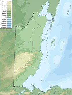
Belize population density and low elevation coastal zones. Belize City is especially vulnerable to sea level rise.
Belize City spreads out Mile 6 on the Western Highway and Mile 5 on the Northern Highway, at the Haulover Bridge. The city proper is usually divided into two areas: Northside, bounded by Haulover Creek and ending in the east at the Fort George area, and Southside, extending to the outskirts of the city and the port area including downtown. Politically, it is divided into ten constituencies.
Cityscape
Belize City, c.1914
Freetown, the westernmost constituency on Northside, is home to the Belama, Coral Grove, Buttonwood Bay and Vista Del Mar suburbs. Within the city proper it extends up to around the former Belize Technical College area.
Caribbean Shores includes Kings' Park, a small suburb north and west of Freetown Road, West Landivar, home to two of the University of Belize's three city campuses, and residential University Heights.
Pickstock inhabits the banks of the Haulover Creek extending to Barrack Road. St. John's Cathedral stands on the southern end of Albert Street. St. John's is the oldest Anglican Church in Central America, and one of the oldest buildings in Belize. The orange bricks came to Belize aboard British ships as ballast. Construction began in 1812, and the church was completed in 1820. St. John's is the only Anglican cathedral in the world outside England where the crowning of kings took place.
Fort George is perhaps the most colonial area in the city and contains Memorial Park, the Baron Bliss Grave and Baron Bliss Lighthouse and the Museum of Belize.
On the Southside, Lake Independence, Collet and Port Loyola are home to some of the city's poorest residents. "London bridges", rickety wooden pallets linking dwellings, and low-strung poles are not uncommon here. On the east side of Central American Boulevard are Mesopotamia, Queen's Square and Albert, which are slightly better. Albert contains the downtown streets of Albert and Regent Streets.
Bridges and other infrastructure
The Swing Bridge in Belize City is the only functioning, manually operated swing bridge in the world.
The divisions of the city are linked by four bridges: the Swing Bridge, at Market Square and North Front Street; the Belchina Bascule Bridge at the Douglas Jones Street and Youth for the Future Drive junction; the Belcan Bridge linking Central American Boulevard and the roundabout leading to the Northern Highway and Caribbean Shores, and a recently built fourth bridge linking Fabers' Road and the southern Lake Independence/Port Loyola area to the Belama and northwest suburbs of the city. Numerous smaller bridges link individual streets.
The three main canals running in Belize City, are Haulover Creek, Burdon Canal and Collet Canal. All of them run through Southside.
Climate
Belize City features a tropical monsoon climate, with very warm to hot and humid conditions throughout the course of the year. The city has a lengthy wet season that runs from May through February and a short dry season covering the remaining two months. However, as is the characteristic of several cities with tropical monsoon climates, Belize City sees some precipitation during its dry season. March is Belize City's driest month with only 48 millimetres or 1.9 inches of rainfall observed, a somewhat unusual month for a city with this climate type. Typically the driest month for a city with a tropical monsoon climate is the month after the winter solstice, which in Belize City would be January. Average monthly temperatures remain relatively constant throughout the course of the year, ranging from 24 to 28°C (75.2 to 82.4°F).
Belize City has more educational institutions at every level than any other city in Belize. Most city children in Belize attend high school. The only three schools that are not coed are on the Northside: Saint John's College (boys), Saint Catherine's Academy (girls) and Pallotti High School (girls). One Southside school that was previously all girls, Sadie Vernon Technical (Belize Continuation), became coed in 2005.[13]
There are three other private schools in Belize City: Belize Elementary School and its continuation Belize High School behind it, both on Princess Margret Drive, and the Hummingbird Elementary School.
Belize City's culture is considered similar to that of Caribbean capital cities such as St. George's, Grenada, or Georgetown, Guyana. Always busy in the daytime, the city has the hustle and bustle one would associate with a city of 70,800. Notable cultural events include Garifuna Settlement Day (November 19), Belize City Carnival (September), Baron Bliss Day (March 9).
The majority of working Belizeans travel to work in downtown offices or else ply their trade on the street sides. Belize City is home to branches of all the major banks of Belize and the Central Bank, as well as nearly all insurance centers, marketplaces and the like. Belize City is the hub for both national and international air, sea and road travel.
Belize Litoral.
Port of Belize
The city is home to the Port of Belize, the country's main port facility.
↑ "Klimatafel von Belize City (Int. Flugh.) / Belize"(PDF). Baseline climate means (1961-1990) from stations all over the world (in German). Deutscher Wetterdienst. Archived(PDF) from the original on 24 February 2020. Retrieved 24 January 2016.
This page is based on this Wikipedia article Text is available under the CC BY-SA 4.0 license; additional terms may apply. Images, videos and audio are available under their respective licenses.